Ticker for July 11, 2022
MESONET TICKER ... MESONET TICKER ... MESONET TICKER ... MESONET TICKER ...
July 11, 2022 July 11, 2022 July 11, 2022 July 11, 2022
Maniac
Mother Nature...she's a maniac, maaaaaaniac on the floor, and she's heat waving
like she's never heat waved before. Well, at least since the brutal summers of
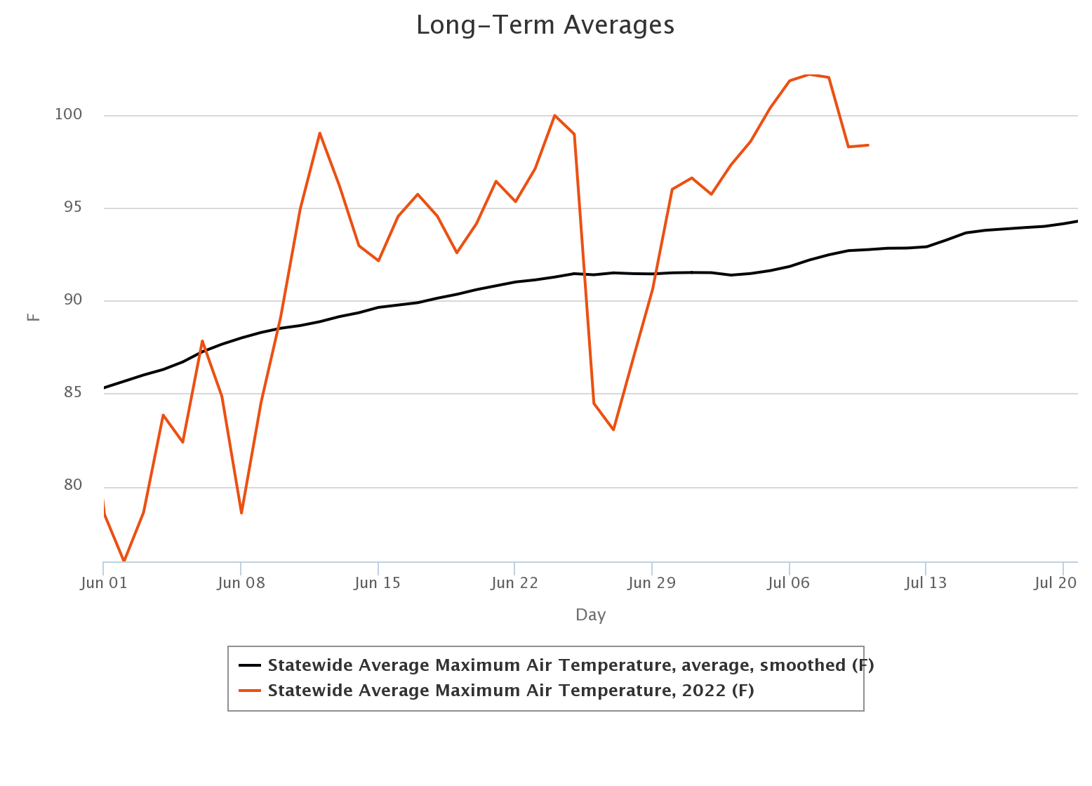
2011 and 2012 (although 2011 sneers at 2012 behind closed doors). We've had hot
weather after that, of course...there was a July day in 2018 that saw the
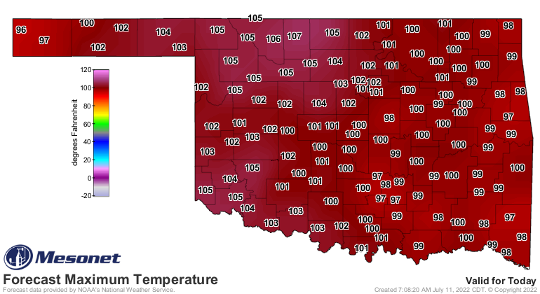
statewide average high temperature reach 107 degrees on the Mesonet (this year's
tops is 102 back on July 7), but this type of unending sunshine and consistent
heat is really a throwback to a decade ago.
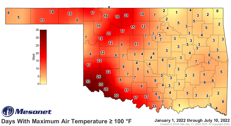
We can count the current iteration of this longer-term heat wave up to 13 days
if we add on today.
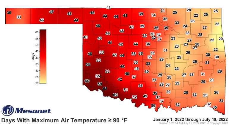
At least that's the length of time since we've seen a decent cooldown in the
state, but in reality the heat goes back further than that. In fact (why would
I lie???), 26 of the last 30 days have been above the long-term average across
the state.
So it's odd when I keep seeing folks remark that "this is a normal summer in
Oklahoma." Well, sure, since it's hot. That's typically how you would describe
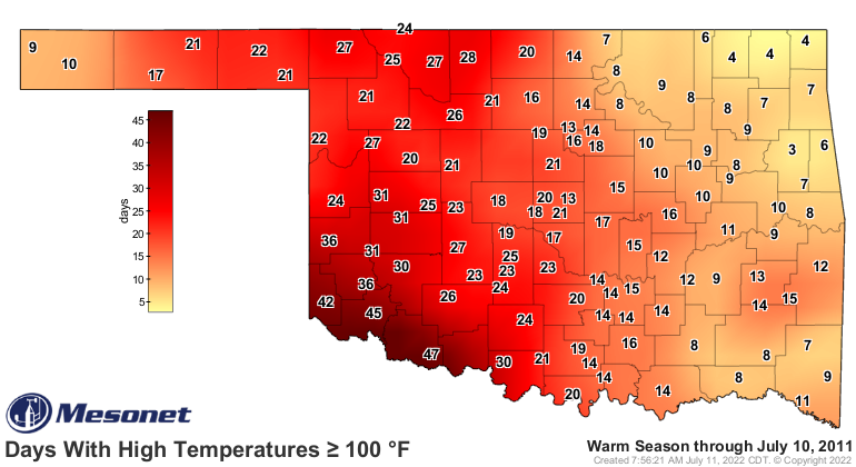
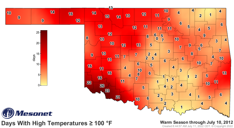
an Oklahoma summer. But this heat is somewhat uncommon since those summers of
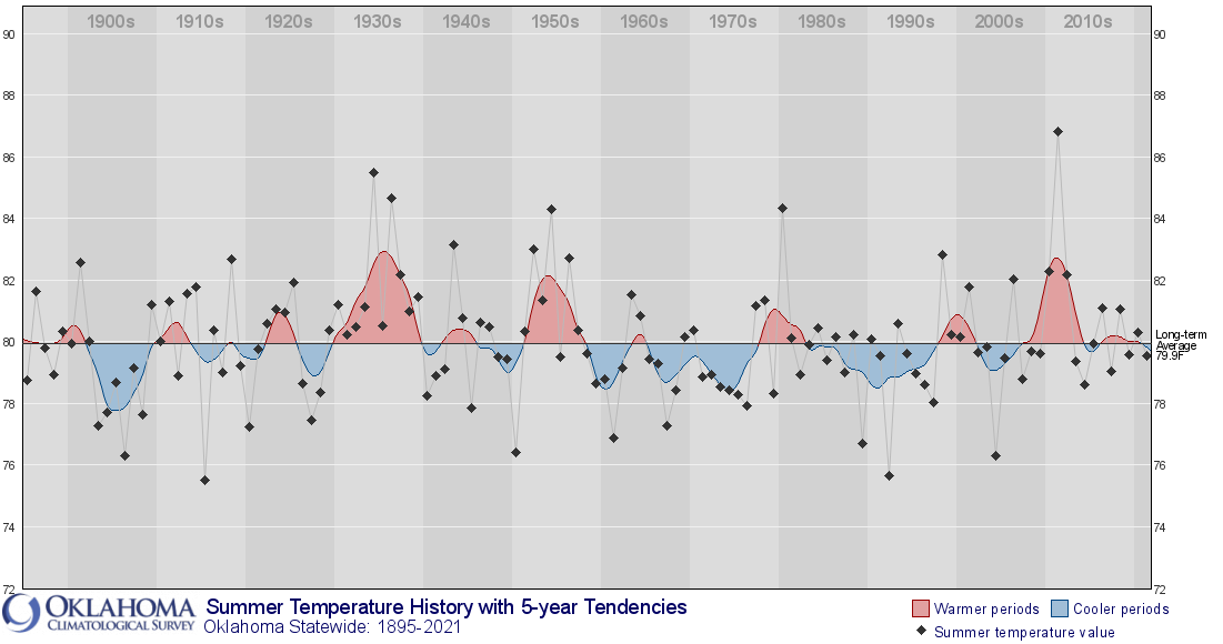
a decade ago when the summers of 2010-12 represented a 3-year string that we
hadn't seen since maybe the 1950s. And it is NOT just coincidental that the
drought through 2010-12 was arguably the worst we had seen since the 1950s.
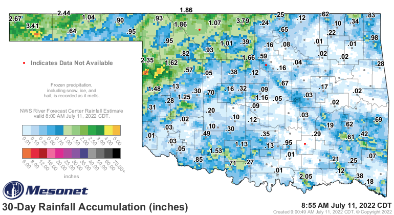
Ah yes, drought. So the sudden ending of moisture across much of the state
since early June along with those brutal temps and all that sunshine has led
to a rapid drying out across Oklahoma. After so much progress against the
drought, we are starting to backslide into increasing drought conditions once
again. Oklahoma's soil moisture, which I had now-infamously pegged as a reason
we would NOT have a hot summer this year, has all but disappeared in the face
of the heat wave (and lack of further rainfall).

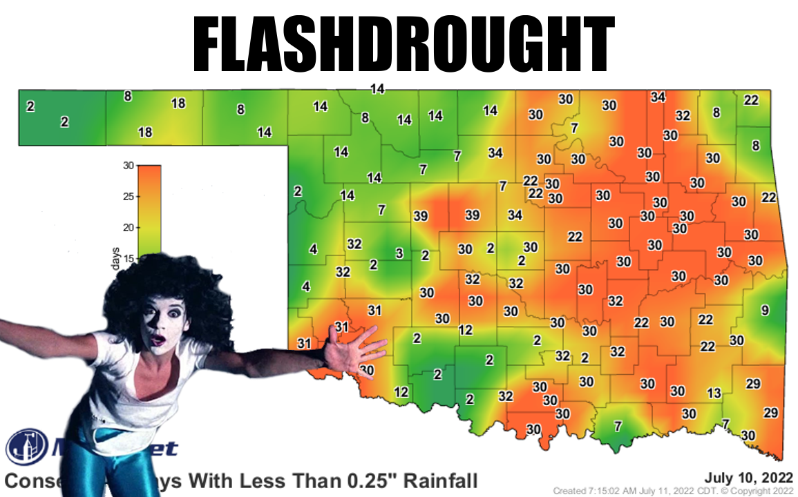
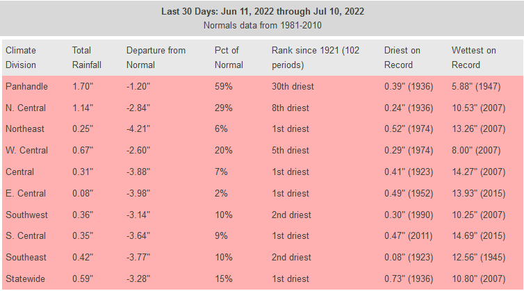
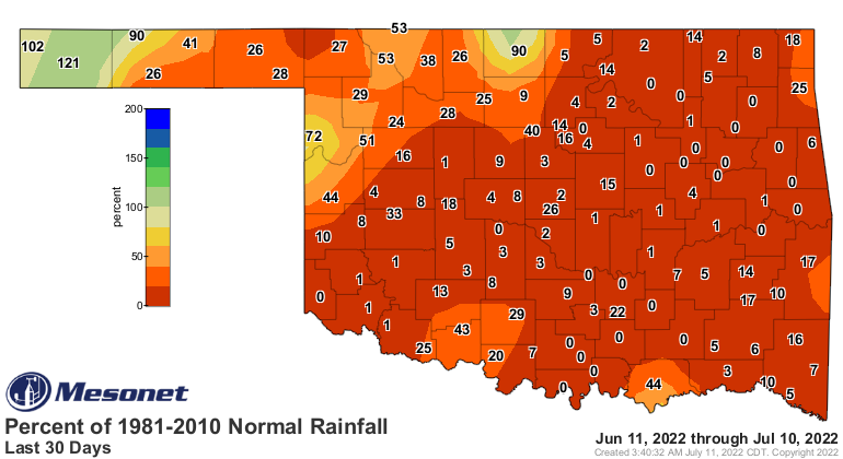
While the dry weather across parts of the state extends back 60-90 days in
some parts of the state, the "flashy" part of this dry spell goes back to
the 30-day period. That period is marked now as the driest on record across
the state over at least the last 100 years.

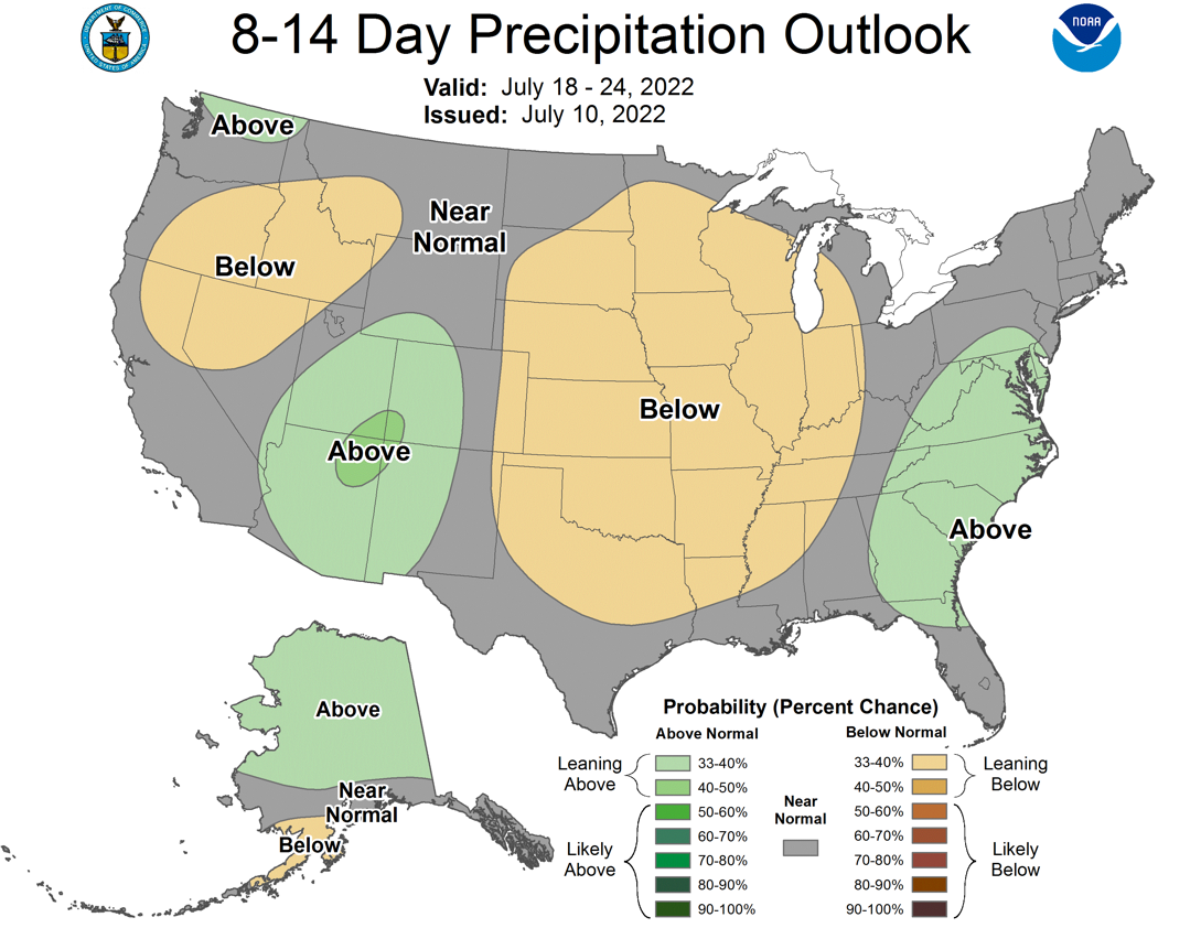
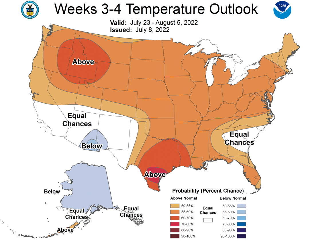
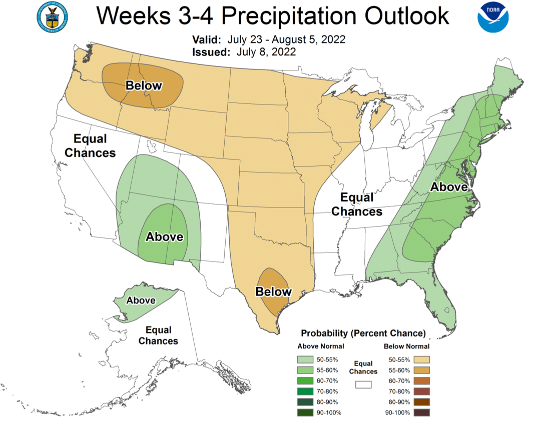
And there's not really much hope for bigtime rains coming up over at least
through the next 7 days, and possibly as we look all the way out to early
August as the heat and dry weather look further entrenched.
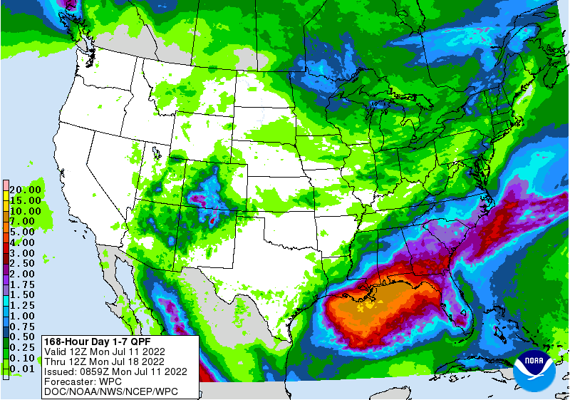
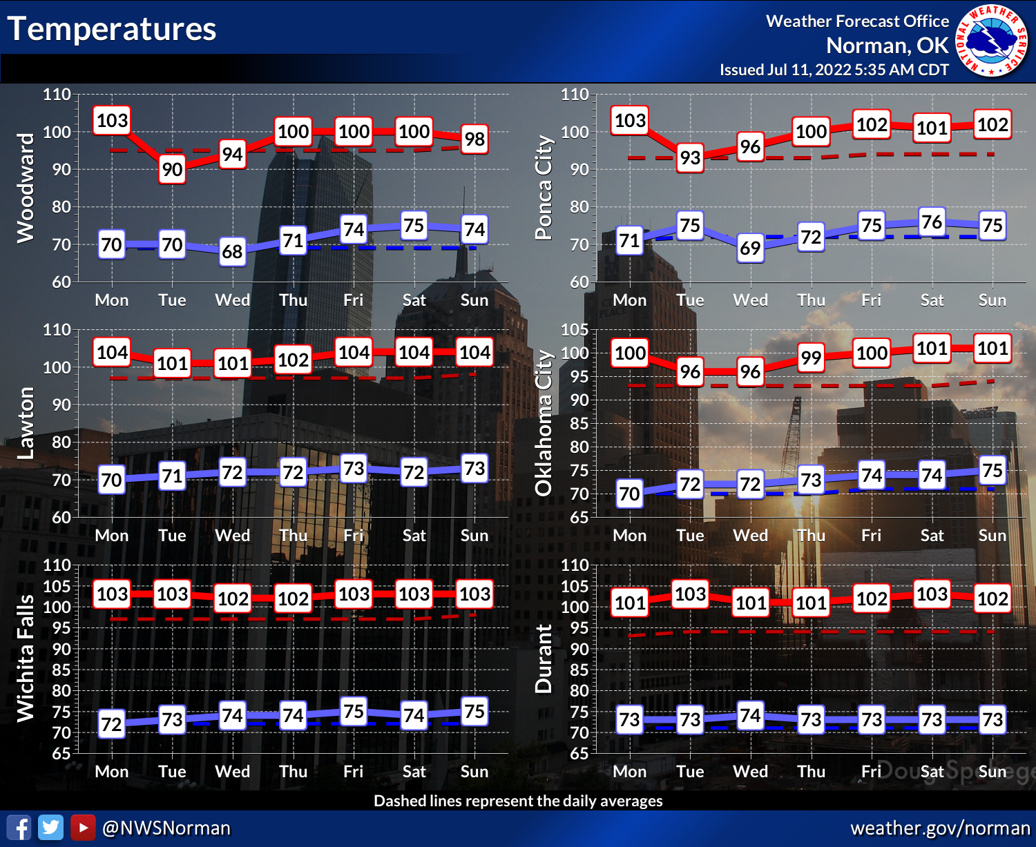
We will have some momentary relief, relatively speaking, coming up on Wednesday
and Thursday, as another cold front approaches. However, keep in mind while the
northern half of the state seems somewhat cooler temperatures, the southern half
of the state still bakes under the edge of that heat dome that has become
entrenched over the state. And then it's right back to the frying pan for all
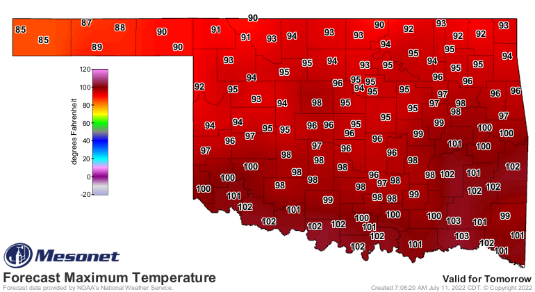
of the state for another extended period. And today might just rival July 7
for the hottest day of the year thus far.
Hopefully we're surprised by some more hefty rains than we're seeing in the
forecast totals. The saving grace of the coming week is that the humidity
should be a bit less than what we've seen with some of those heat index values
heading up above 110 degrees.
It's a dry heat...it's all we got!
Gary McManus
State Climatologist
Oklahoma Mesonet
Oklahoma Climatological Survey
gmcmanus@mesonet.org
July 11 in Mesonet History
| Record | Value | Station | Year |
|---|---|---|---|
| Maximum Temperature | 111°F | KIN2 | 2009 |
| Minimum Temperature | 52°F | GOOD | 1999 |
| Maximum Rainfall | 4.62 inches | SULP | 2023 |
Mesonet records begin in 1994.
Search by Date
If you're a bit off, don't worry, because just like horseshoes, “almost” counts on the Ticker website!