Ticker for May 24, 2022
MESONET TICKER ... MESONET TICKER ... MESONET TICKER ... MESONET TICKER ...
May 24, 2022 May 24, 2022 May 24, 2022 May 24, 2022
Top May
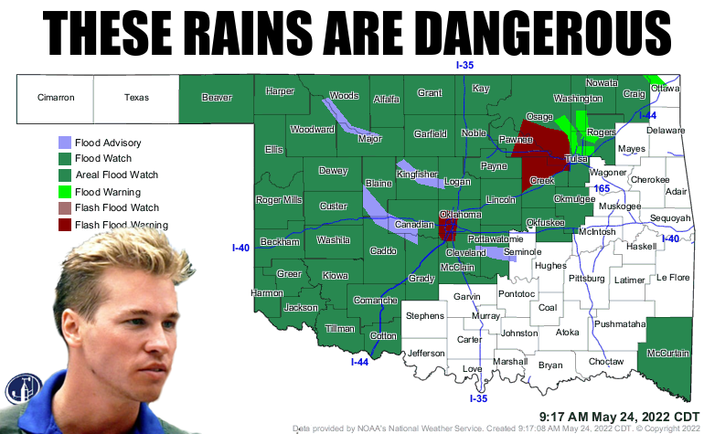
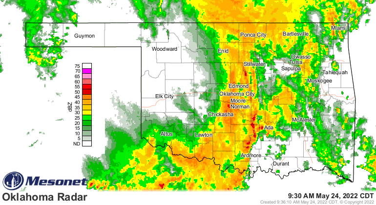
Whoa! When Beaver County has a flash flood watch, you know that May has gotten
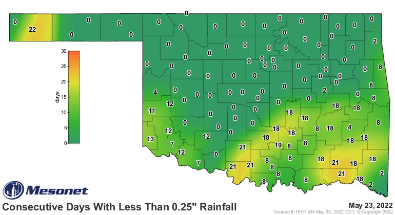
serious. Rains that have fallen thus far have completely wiped out the ugly
consecutive days without at least a quarter-inch in a single day map. It still
shows a few places up over 20 days, but I can look at the rainfall already today
and see those numbers are goners.
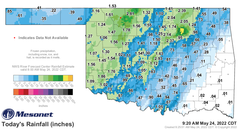
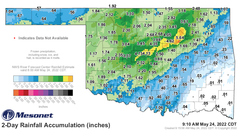
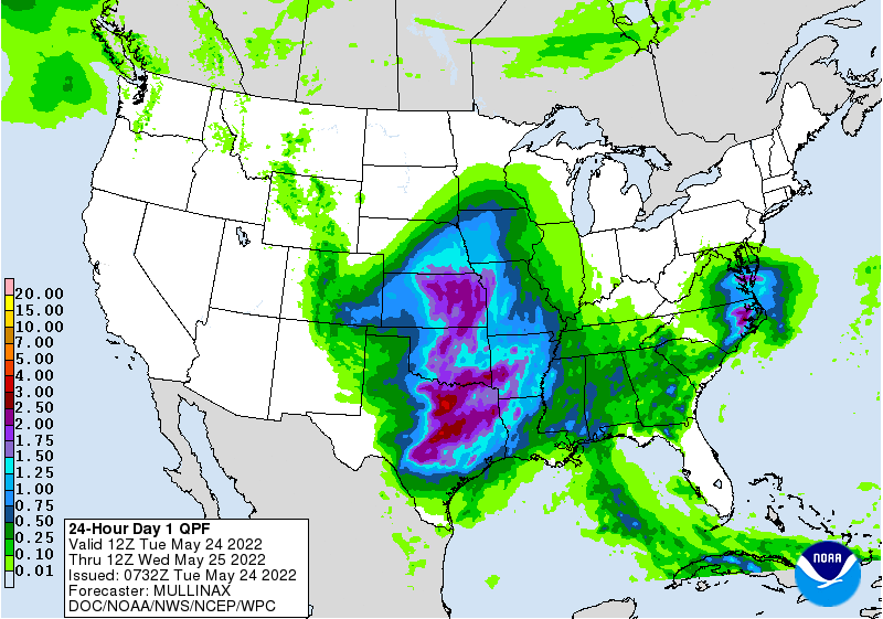
And the overall rainfall from this storm, while troubling with its flooding, is
finally hitting the correct spots over in western Oklahoma. 5-6 inches from
Canadian County up through Osage County was not necessarily needed, however.
Southeast Oklahoma will get theirs later on today. McCurtain County is also in a
flood watch, gauging from the top map. The mess is probably coming to an end
just a little bit from west to east, at least the heavy rains.
That's not the end of the rain, however. We still have the upper-low to swing
through, and not only that, we might see some big storms down South today.
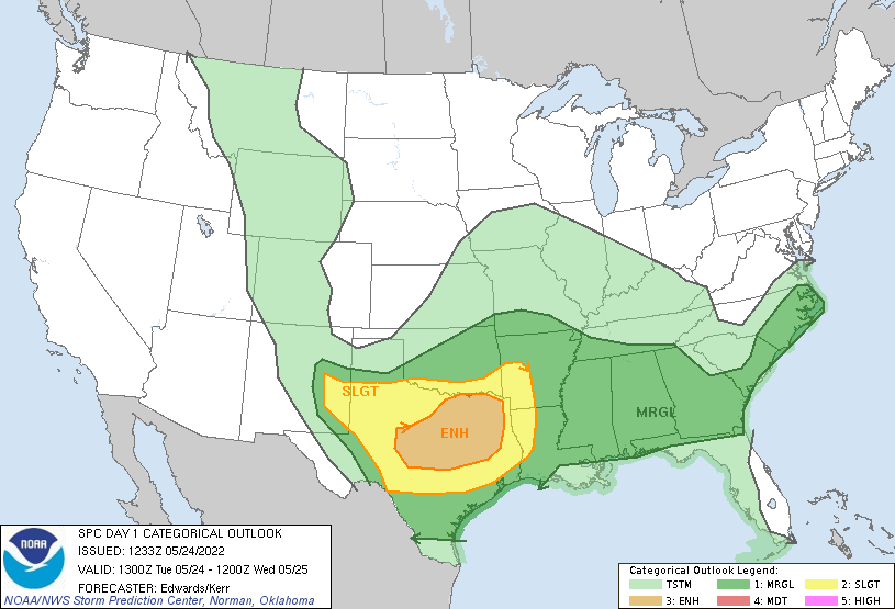
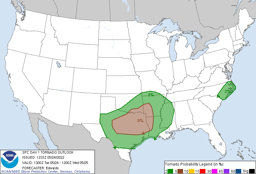
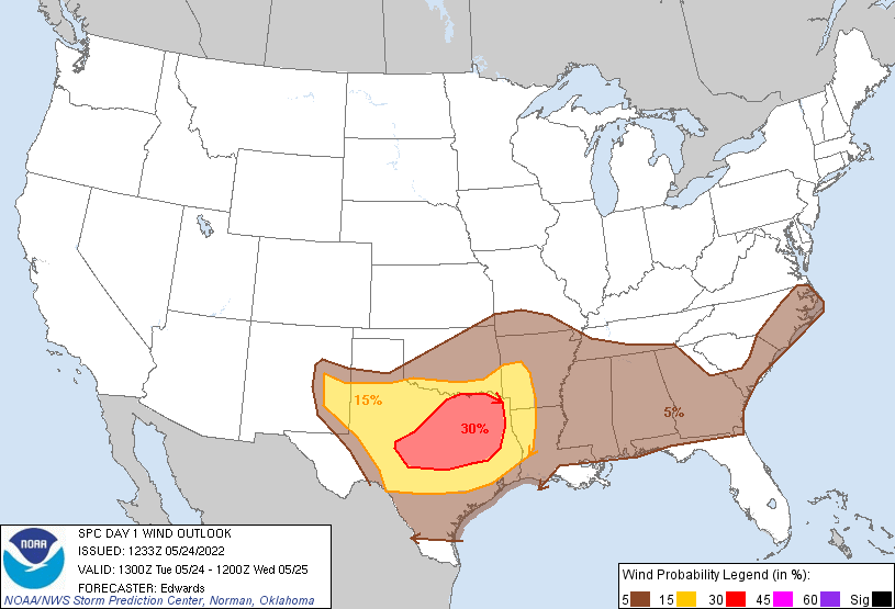
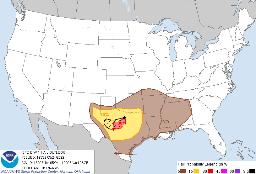
A lot of that is conditional (ain't it always?), but folks down in southern
OK need to be weather aware today. Heck, everybody needs to be drowning aware
with all this flash flooding and the further rains expected today. Now a lot
of this has already fallen, but down in the Southeast, your time is coming.
Other than that, it's way too cold out there. Did you know the wind chills are
down into the 30s across the western Panhandle?
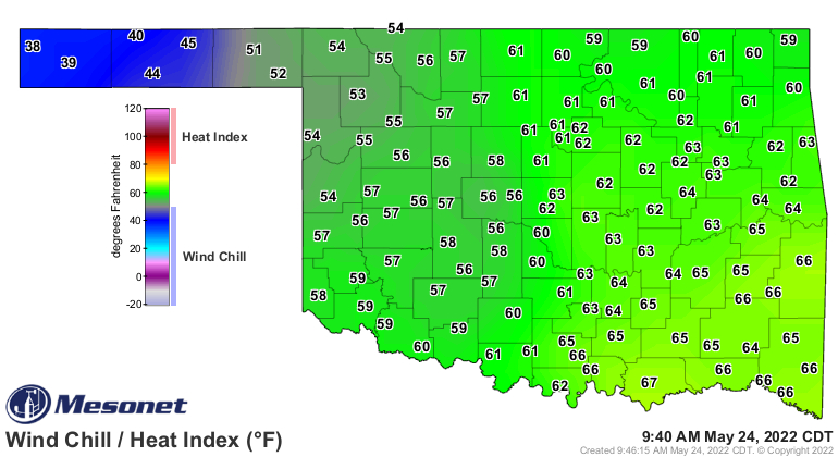
Cool, just like the Ice Man himself!
Gary McManus
State Climatologist
Oklahoma Mesonet
Oklahoma Climatological Survey
gmcmanus@mesonet.org
May 24 in Mesonet History
| Record | Value | Station | Year |
|---|---|---|---|
| Maximum Temperature | 111°F | TIPT | 2000 |
| Minimum Temperature | 36°F | EVAX | 2017 |
| Maximum Rainfall | 6.54 inches | MCAL | 2015 |
Mesonet records begin in 1994.
Search by Date
If you're a bit off, don't worry, because just like horseshoes, “almost” counts on the Ticker website!