Ticker for May 19, 2022
MESONET TICKER ... MESONET TICKER ... MESONET TICKER ... MESONET TICKER ...
May 19, 2022 May 19, 2022 May 19, 2022 May 19, 2022
Call me sir
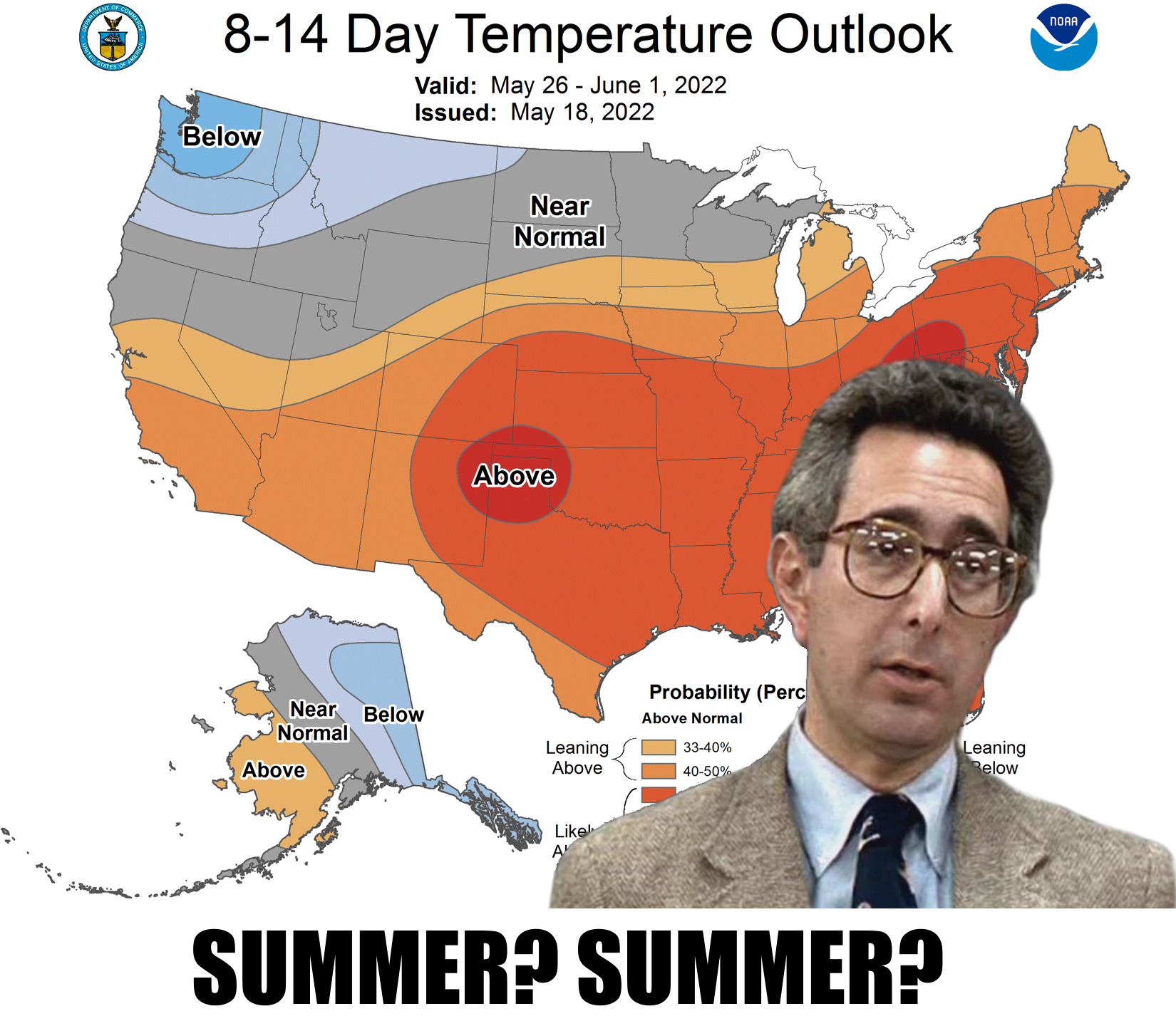
We stand on the precipice, my friends (and the rest of you); the dawning of a new
age in Oklahoma's weather. Gone will be the 90s and 100s, the hazy dust blowing
off the arid areas of the West. Not in a generation...wait wait wait! Okay, let's
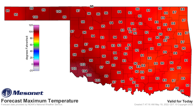
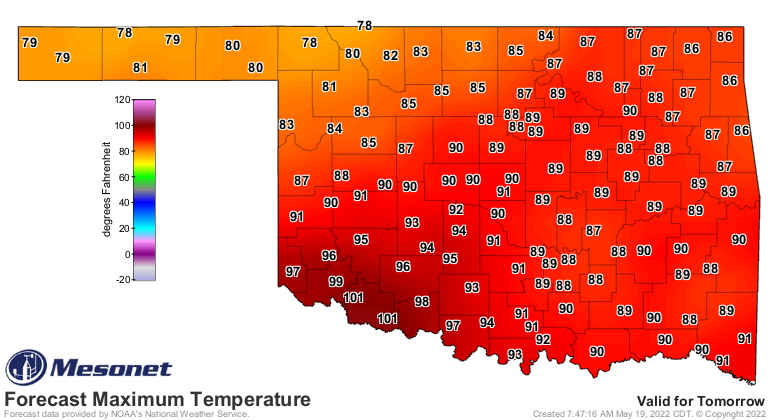
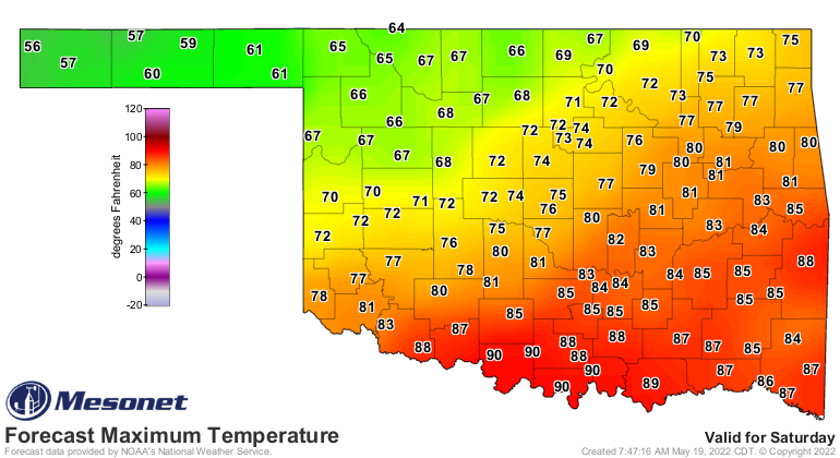
tone it down. Friday we'll see a pretty strong cold front that should drop us
into the 60s and 70s for highs and 40s and 50s for lows (30s for you folks in the
western Panhandle, possibly). Then a somewhat cooler next week before we make the
abrupt return to summer-like weather we've been seeing.

The rain we've been getting (like last night) is wonderful, of course. Just not
widespread enough.
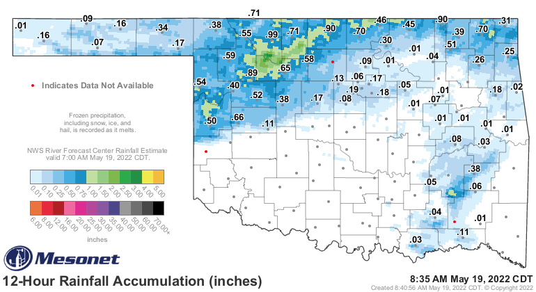
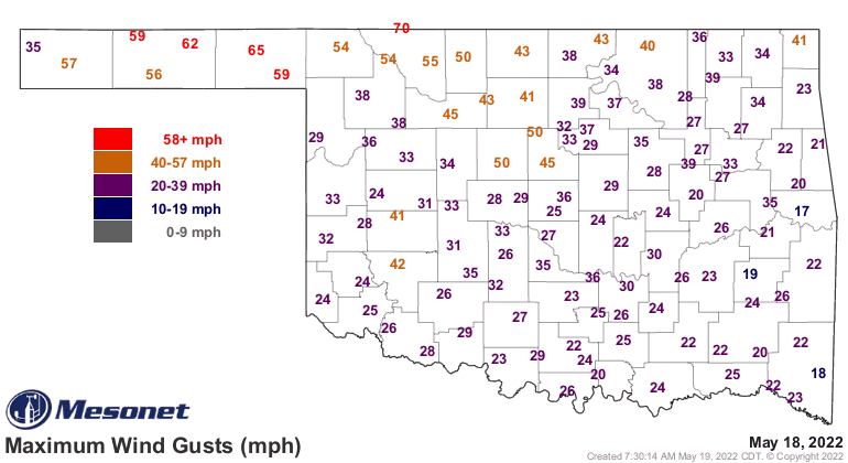
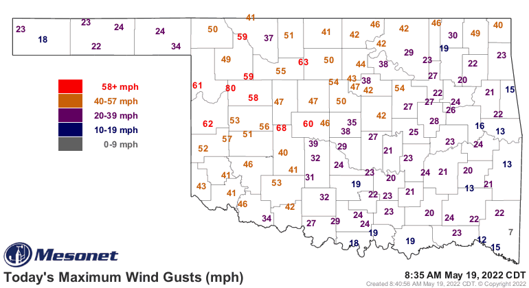
And it has been coming with lots of damaging wind, like last night, and the big
hail we saw last week. Thankfully, no tornado threat.
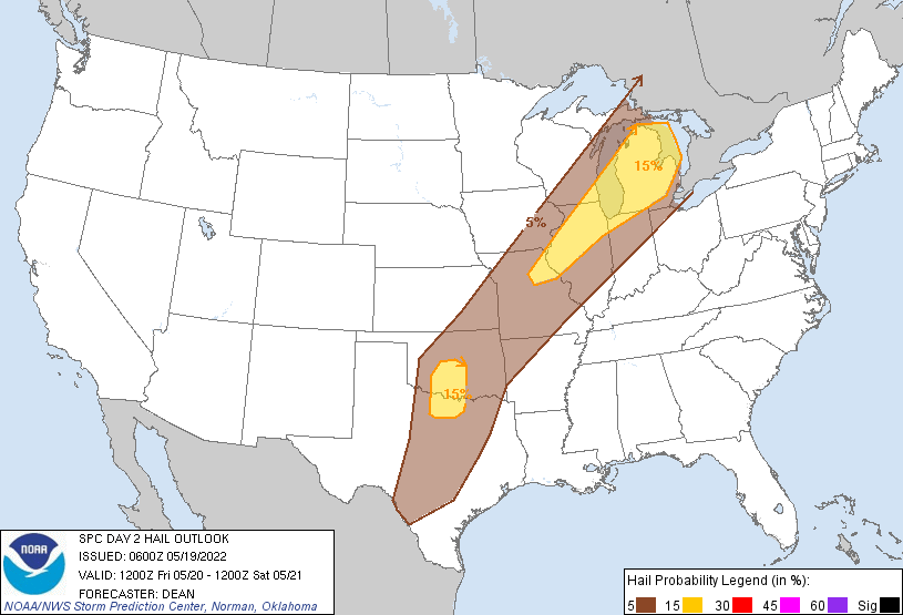
And we will see another severe threat tomorrow, mostly across south central
Oklahoma, associated with that cold front. Again, the tornadic threat is pretty
much nil.

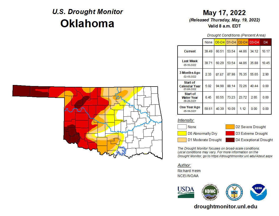
Still, we do need that rain. The western parts of the state are desperately
dry, with extreme to exceptional drought still holding sway over extreme SW
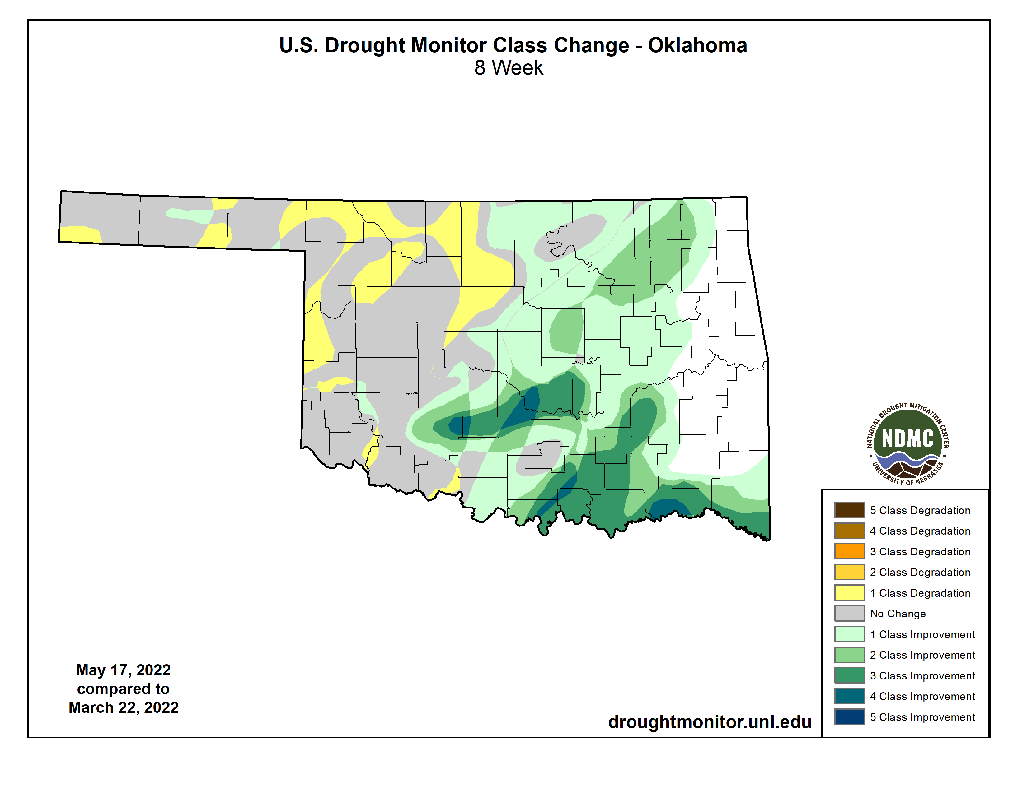
and NW Oklahoma. We have made some incredible headway against the drought
across eastern OK over the last couple of months, but at the same time, the
drought in the West has just gotten stronger (in general)...or held steady.
I'm going to show you a map of the 7-day rainfall forecast. Now some of this
forecast rainfall (never use "forecasted," if you do, you will be drummed out
of the "Coin-flip Hall of Fame") will be associated with that front tomorrow.
Where that front stalls out is where the heavier rains will be, along with those
training thunderstorms. So it could shift a bit. The bigger change will be next
Monday and Tuesday when we get another big storm system. However, the severe
threat will once again be pretty benign, at least for May in Oklahoma.

I will warn you that eating too much cheese can make your mornings a bit
troublesome. Oh, you don't come here for dietary advice? Okay then. Here's one
right up your alley (no pun intended)...I'll warn you that the last few forecasts
have shifted the heavier rain farther to the south and east. What that has done
is taken some of the more promising rains away from western OK. But that's okay,
because it could shift right back west again.
Now for the not-so-fun part, and I'll give you another warning before you
view these next maps. No, nothing to do with cheese, although they do smell
rotten like limburger. The June and June-August (or summer) outlooks are somewhat
painful to look at. They're gonna show you a rather bleak outlook for drought
across western OK, and a not so fun summer in store if they should come to
fruition. Here's the deal, though...even though La Nina is still in place, its
influence towards a warmer and drier climate for the Southern Plains is
reduced quite dramatically in the warm season. Why? Well, it's way of
influencing out weather is through movement of the jet stream to the north,
which keeps our storm system availability reduced. But during the summer, that
jet stream retreats far to the North anyway, so nana-nana-boo-boo to you,
La Nina. So when you look at these maps, know that they're based a lot on
dynamical and statistical models. Now for the western parts of Oklahoma, they're
looking at the drought in place right now, the reduction in soil moisture, and
what that can do when the summer sun starts to beat down with force. We know
that when the soil moisture is low in the summer, it sets up a latent heat
nightmare in which the sun's rays are able to heat the surface much more
quickly (no soil moisture to evaporate, which is a cooling process). This in
turn eeks out any remaining soil moisture, which allows more heating, and so
on and so on and therefore drought and heat feed off each other and worsen. As
I've said many times, you do not want to go into the summer in Oklahoma with
drought in place. Summer is the main rainy season across the High Plains region
in the Panhandle, but that is also expected to be overwhelmed by additional
heat and possible rainfall deficits.
Okay? On with the show this is it.
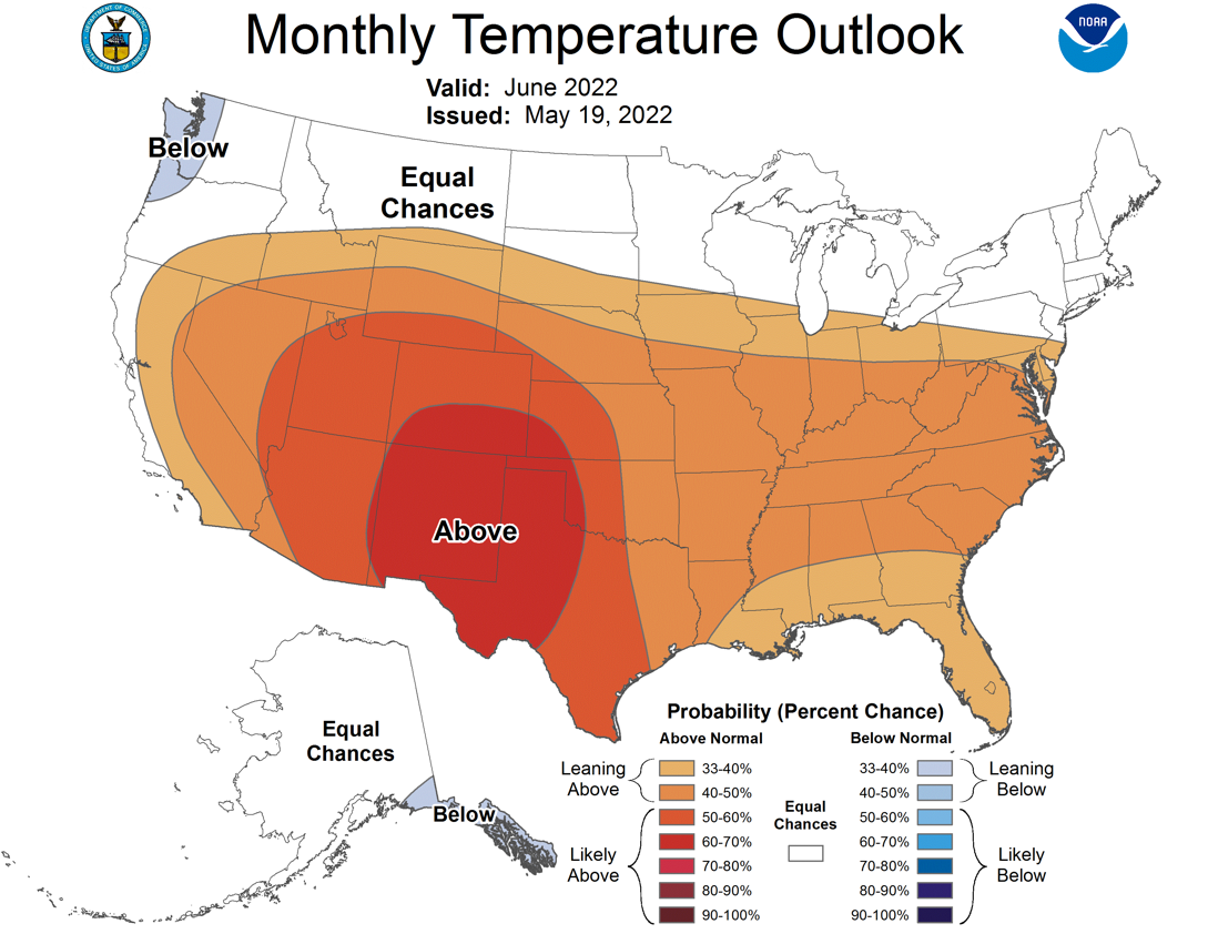
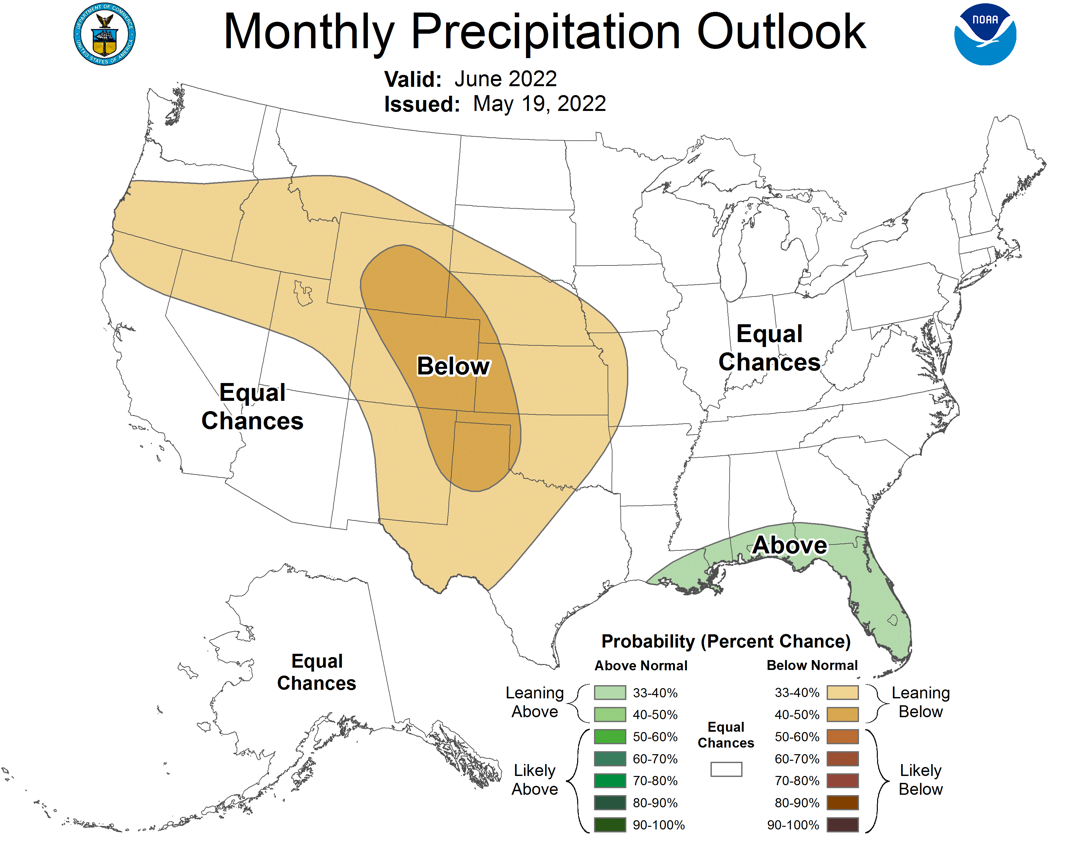
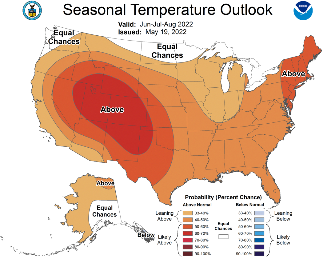

And those outlooks produce a summer drought outlook that looks like this, with
drought persisting across the western half of the state (and those incursions
into south and north central OK.
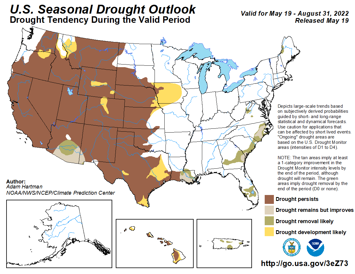
Not written in stone, obviously. With the possibility of a triple-dip La Nina
setting up for the next cool season (fall through early spring), we definitely
want to nip some of this drought in the old bud before we get to next
fall.
Drought impacts us all, even Abe Froman, the Sausage King of Bugtussle.
Gary McManus
State Climatologist
Oklahoma Mesonet
Oklahoma Climatological Survey
gmcmanus@mesonet.org
May 19 in Mesonet History
| Record | Value | Station | Year |
|---|---|---|---|
| Maximum Temperature | 107°F | ALTU | 2022 |
| Minimum Temperature | 32°F | KENT | 2019 |
| Maximum Rainfall | 5.33 inches | BOWL | 2017 |
Mesonet records begin in 1994.
Search by Date
If you're a bit off, don't worry, because just like horseshoes, “almost” counts on the Ticker website!