Ticker for April 13, 2022
MESONET TICKER ... MESONET TICKER ... MESONET TICKER ... MESONET TICKER ...
April 13, 2022 April 13, 2022 April 13, 2022 April 13, 2022
You must chill!
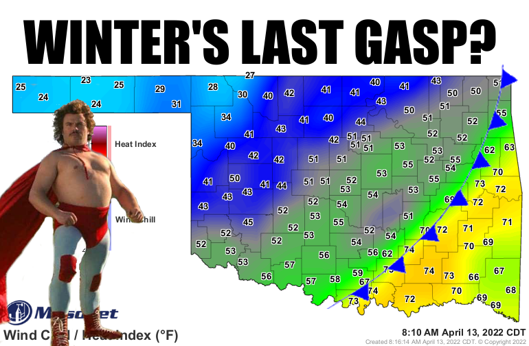
Some would say that's just spring, especially in NW OK and the Panhandle.
I sez different.
HOW DARE Mother Nature spring (winter?) this on us at this point! I mean, after
all I've done for her...well, okay, I get the point. I think I've called her
"dumb" a time or two, for this very type of weather. Well, if the dumb fits, wear
it with pride. Here's the truth, however: this is right in line with the average
last freeze dates for NW OK. For the Panhandle, maybe a week or two early.
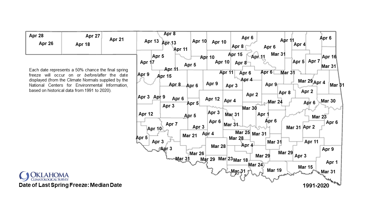
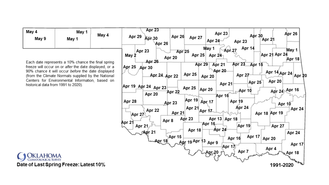
AND we have a ways to go before we get into the average latest spring freeze.
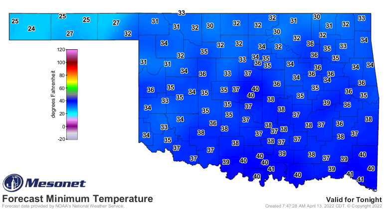
Keep those dates in mind, because there will be another freeze tomorrow
morning, and a frost for a lot more.
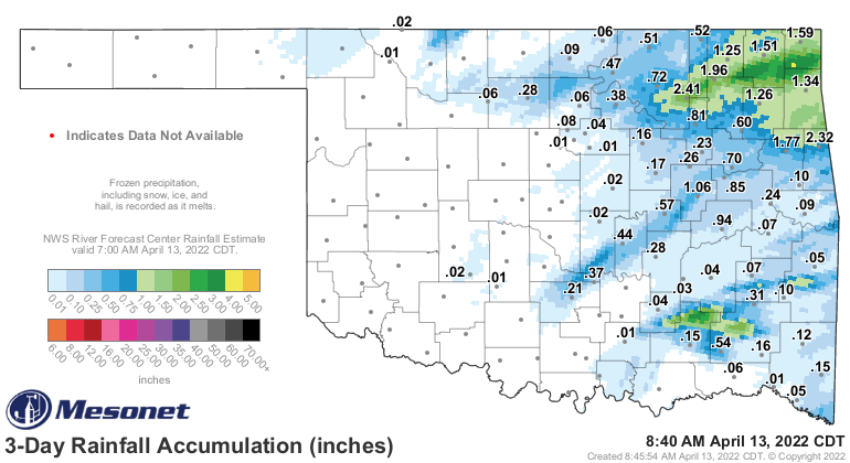
This cold front ended up being quite the dud for Oklahoma. Other than some
decent rains up across far NE OK, about all it did was kick up the fire danger
to dangerous levels. Luckily, very little in the way of severe weather, but
that also means very little in the way of moisture.
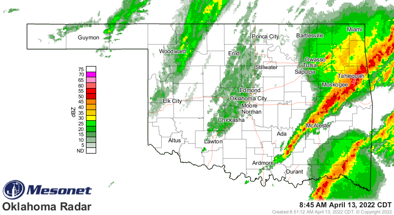
In fact, the worst storms are probably those occurring right now along the
front in SE OK, a razor-thin line with a few embedded severe storms thrown in.
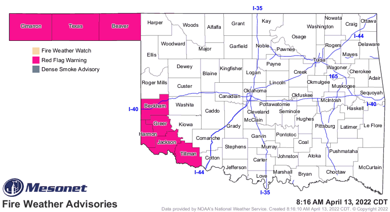
Despite the cool down, fires continue in parts of the state, and that fire
danger continues in Red Flag Warning territory out west.
I'm afraid (very afraid!) it's going to remain on the cooler side of spring
for much of the remainder of the month. For the next week, we'll see a bit of a
warm up on Friday, but more fronts come in the next two weeks and gum up the
works. That'd be fine...who am I kidding, it WON'T be fine! Let's try again,
that'd be more tolerable if we could at least get some moisture out of these
fronts, but Mother Nature continues to go through the La Nina playbook step
by step and keep most of them as dry fronts.
Yep. DUMB!
Gary McManus
State Climatologist
Oklahoma Mesonet
Oklahoma Climatological Survey
gmcmanus@mesonet.org
April 13 in Mesonet History
| Record | Value | Station | Year |
|---|---|---|---|
| Maximum Temperature | 99°F | ALTU | 2025 |
| Minimum Temperature | 19°F | BOIS | 2004 |
| Maximum Rainfall | 4.11 inches | CHER | 1999 |
Mesonet records begin in 1994.
Search by Date
If you're a bit off, don't worry, because just like horseshoes, “almost” counts on the Ticker website!