Ticker for April 11, 2022
MESONET TICKER ... MESONET TICKER ... MESONET TICKER ... MESONET TICKER ...
April 11, 2022 April 11, 2022 April 11, 2022 April 11, 2022
TUES-DOH!
I haven't seen irrational behavior like this since my high school girlfriend (you
wouldn't know her...she was from Canada). Mother Nature has really set her sights
on Oklahoma lately, with fire danger out the wazoo (lay off the chili) and a
smattering of severe weather chances. Well, tomorrow is going to be one of those
days here in Oklahoma where a whole lot can go wrong, even if the forecast isn't
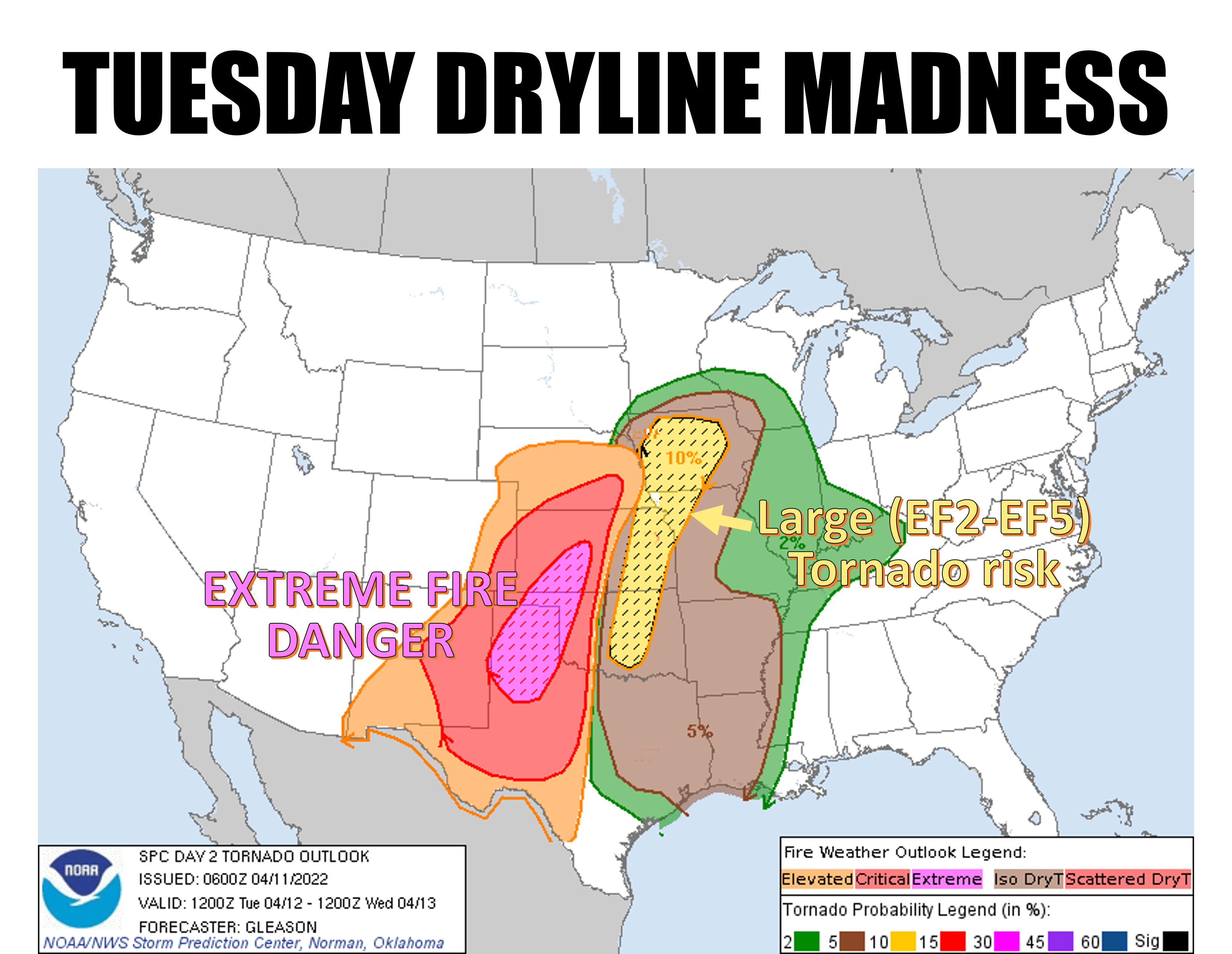
a whole lot of right. The dryline that is going to set up across the middle of the
state is going to be the dividing line between extreme fire danger to the west
and potential severe weather to the east. Notice I used different language there
for the two calamitous weather hazards. There's a method to my madness. The fire
danger is a certainty. Fires aren't, but the conditions to produce those fires
will be. Now the chances for those severe storms area bit more iffy, and to be
honest this outlook from SPC is 8 hours old and the forecast models are being
pretty pessimistic (we'll call it OPTIMISTIC for our sake) about storm chances
tomorrow due to several factors, a strong cap being one of them. I won't get into
the hairy details (ughhhh, that hurt), I'll just show you the graphics for
tomorrow.
Fire first (insanity later):
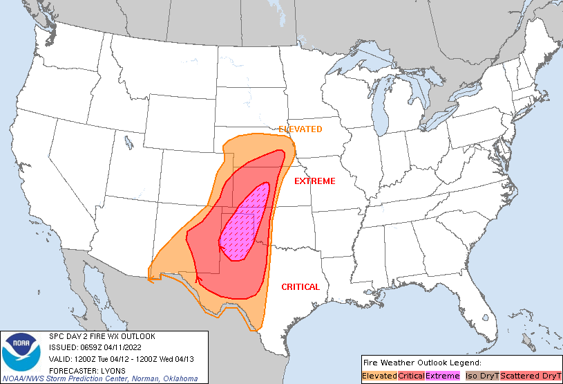
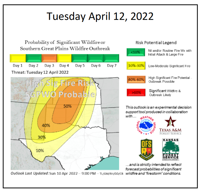
While there is fire danger today, tomorrow is the GULP! day, with OFS showing
a 50% probability of significant wildfire outbreak. Check out their rather
ominous discussion for Tuesday:
"Tuesday, April 12, will present potential for an ominous situation in
Oklahoma – Extreme fire danger west and severe storm potential east. With
regard to the fire danger, the conditions will be eerily similar to
April 12, 2018 when the Rhea Fire, 34 Complex and Shaw Fire occurred along
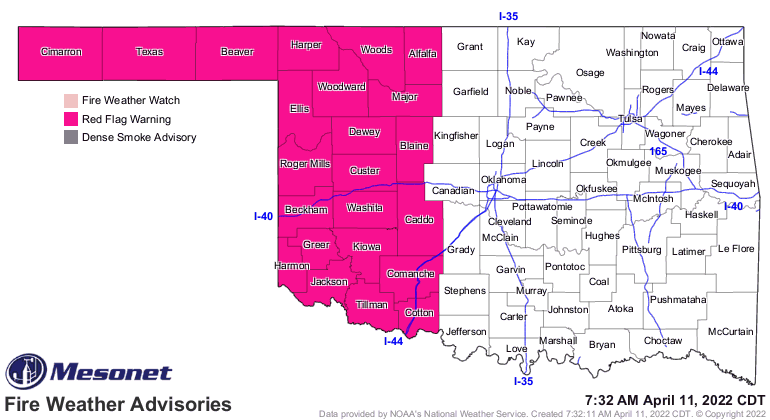
with several other impactful fires in Oklahoma. A Red Flag Warning is in
effect for Tuesday across Western Oklahoma, and the fire environment will
be supportive of significant fire occurrence (+5,000 Acres) with wildfire
outbreak conditions probable. Any fire that starts will prove challenging
to suppress and fire occurrence in contiguous rangeland fuels will likely
transition to extreme fire behavior soon after ignition. Rangeland fuels,
especially in northwest Oklahoma and eastern Oklahoma Panhandle will have
potential to exhibit head fire rates of spread 3.1-5.1 mph, spotting to
1/4 mile and extreme fireline intensity. Emergency Management and Law
Enforcement Agencies should be prepared to facilitate evacuations."
That's so ominous they even used the word "ominous" in the same sentence. Look
here, folks...you don't want to see a day being compared with April 12, 2018,
when it comes to fires. The Rhea fire alone burned 250,000+ acres. It's sort
of like comparing your severe weather risk to May 20 or May 31, 2013.
Speaking of severe weather risk, that's the other hazard that's rearing its
ugly head for tomorrow. And as with fire, today is not necessarily going to be
any picnic either. The storm system that's coming in to help generate all these
winds to fuel the fire danger will also help to bring moisture streaming back
north from the Gulf. Severe weather today and tomorrow is very conditional, but
it's enough to get you out cleaning your fraidy holes.
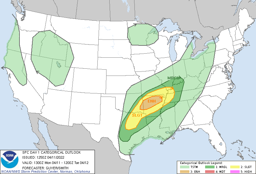
Here are both days' graphics from SPC:
TODAY
-----
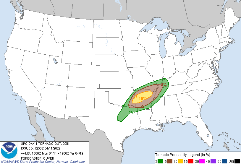
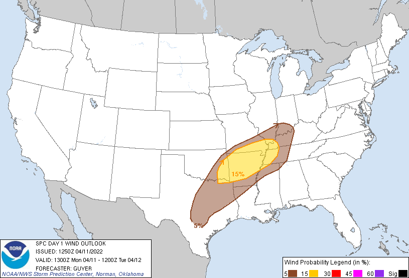
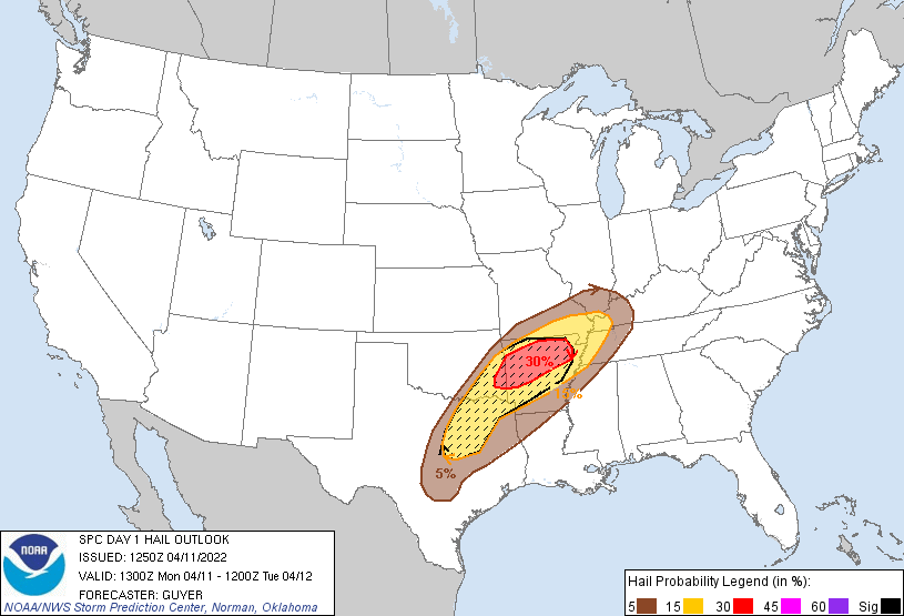
TUESDAY
-------
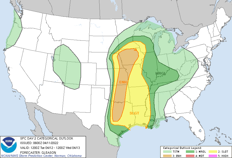
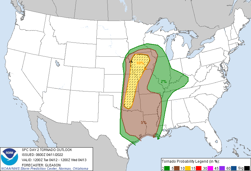
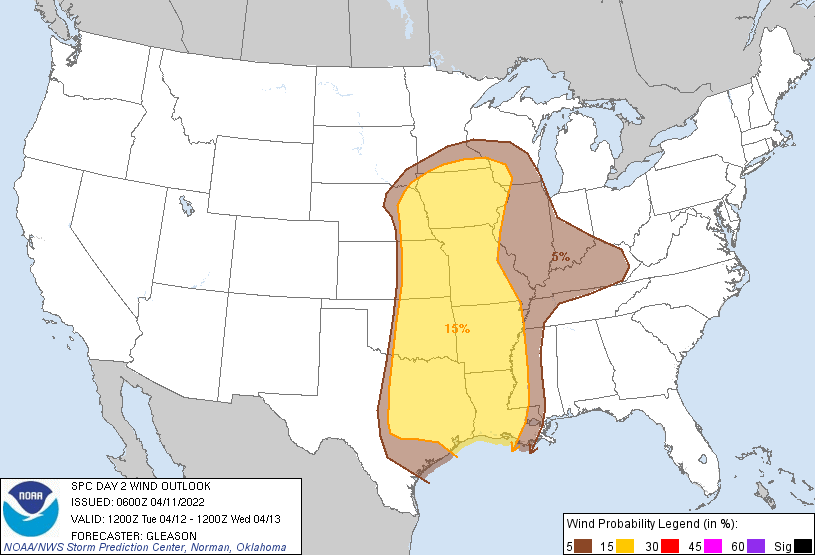
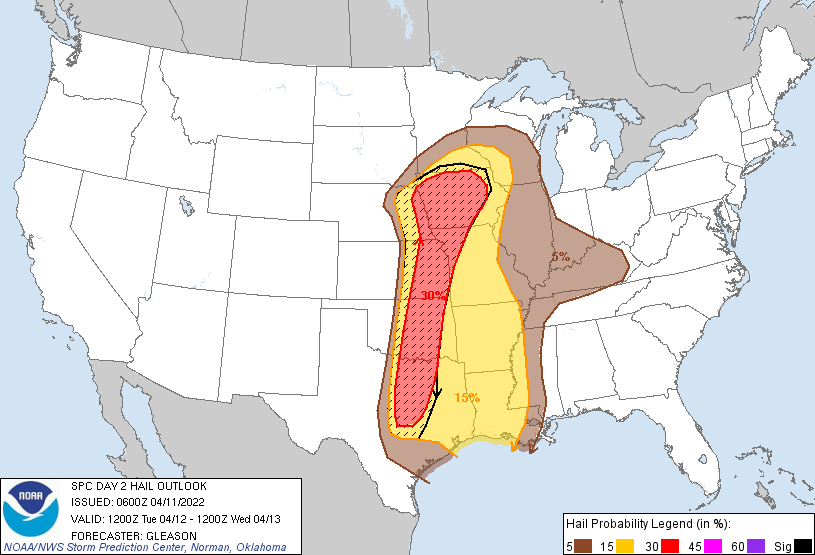
Given the drawbacks for tomorrow seeing storms at all, NWS Norman spells out
the need to remain aware:
"Given these factors, one could see why most operational models do not
develop much in the way of storms across a majority of our forecast area.
However, climatology and basic severe weather parameter space cannot be
ignored. The potential for severe storms is still there through
early Wednesday morning before the cold front clears the area as
speed max/shortwave trough progresses toward the region on
southern periphery of main/northern Plains upper low. Best
interaction with this feature will be late Tuesday night and
Wednesday morning. Thus, little change in geography and messaging
for the potential for severe storms."
We will see if there are substantial changes in the risk areas when SPC issues
their new Day 2 outlook later this early afternoon.
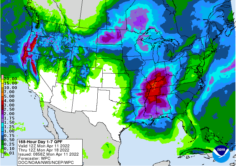
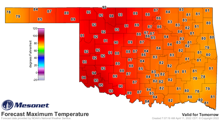
Another thing pretty certain is that our overriding hazard, drought, will
continue raging across western Oklahoma, with little hope for rainfall amidst
those high temps nearing 100 degrees tomorrow, and all that wind.
And don't look now, but parts of the state could be staring a freeze in the
face early next week.
April in Oklahoma ain't pretty.
Gary McManus
State Climatologist
Oklahoma Mesonet
Oklahoma Climatological Survey
gmcmanus@mesonet.org
April 11 in Mesonet History
| Record | Value | Station | Year |
|---|---|---|---|
| Maximum Temperature | 96°F | ARNE | 2018 |
| Minimum Temperature | 15°F | BOIS | 2013 |
| Maximum Rainfall | 4.55 inches | VINI | 1994 |
Mesonet records begin in 1994.
Search by Date
If you're a bit off, don't worry, because just like horseshoes, “almost” counts on the Ticker website!