Ticker for March 10, 2022
MESONET TICKER ... MESONET TICKER ... MESONET TICKER ... MESONET TICKER ...
March 10, 2022 March 10, 2022 March 10, 2022 March 10, 2022
One more ride
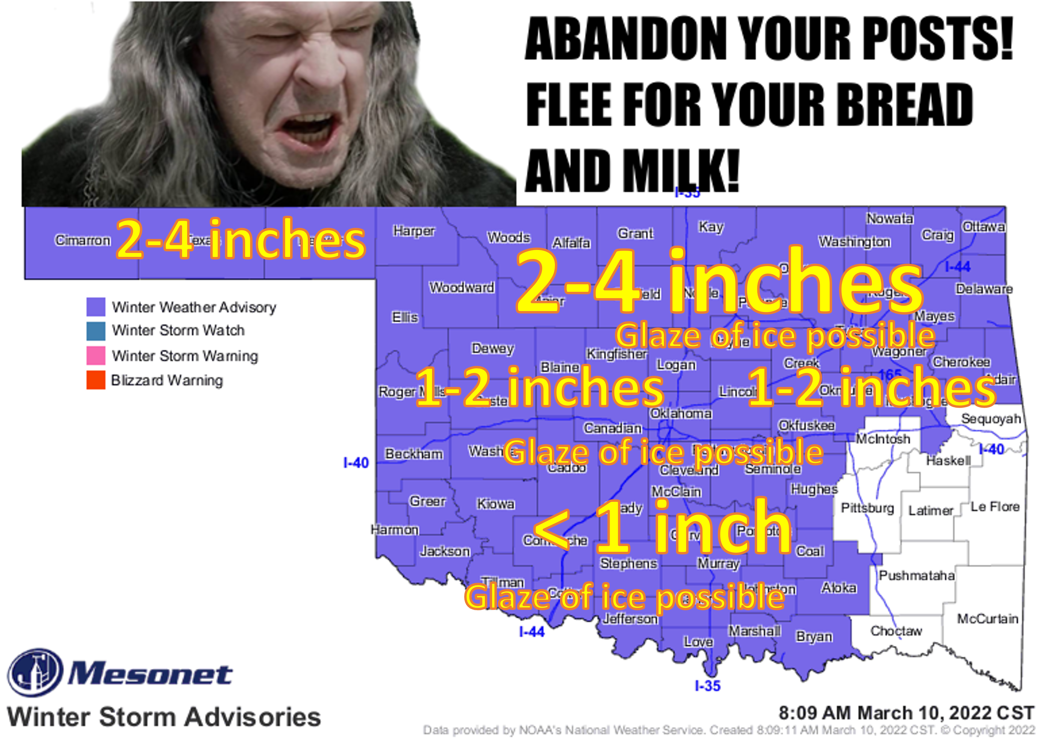
Just a lovely little storm, here to disrupt our lives for 24 hours or so before
succumbing to the pressures of our growing spring. Enjoy it, I guess. Probably
won't be the last bout of winter we see, whether that means more snow or ice,
and almost definitely not arctic-like temperatures. It's still a tricky forecast,
however, with lots of variability left up in the air (pardon the pun). These
snow amounts and whatnot should definitely be viewed as fuzzy boundaries (don't
go there!). Here's a bit more on the amounts and timing from our friends at the
local NWS offices.
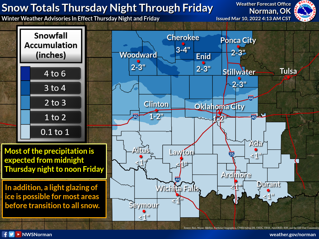
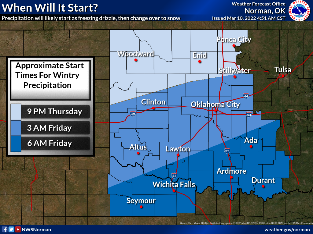
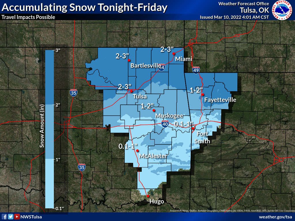
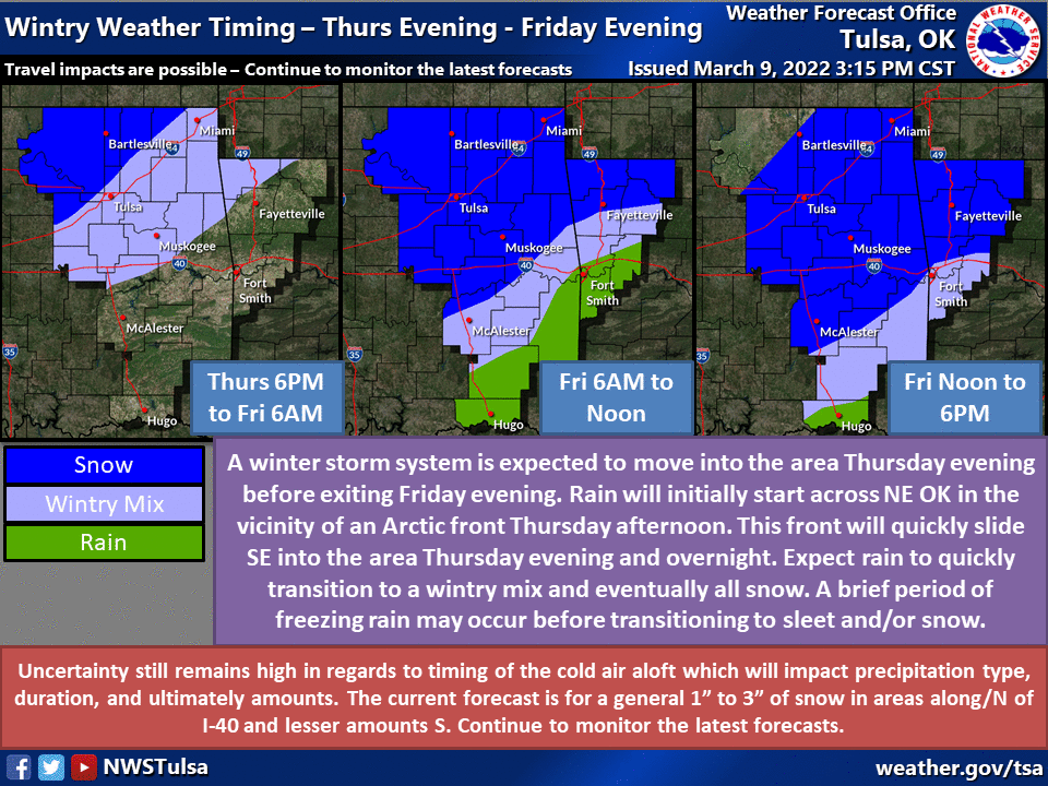
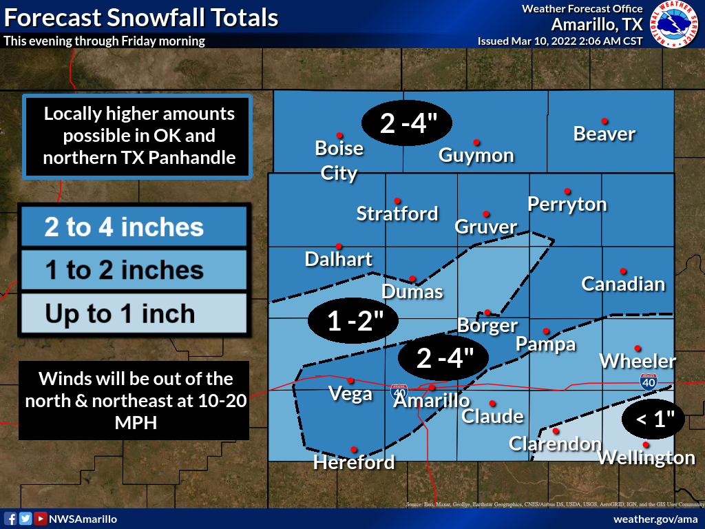
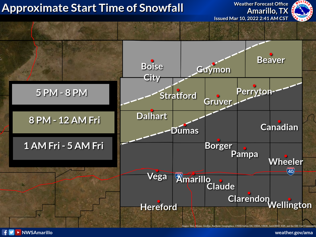
Like I said, fuzzy boundaries. The NWS forecast snow amounts reflect that. You
can see some smaller areas of greater and smaller amounts scattered about.
Wouldn't shock me to see some areas get 4-5 inches, and a county or two away
see less than an inch. The big worry BEFORE the snow is, as I've said many
times, the worst of all winter weather precip types...freezing rain. Well, in
this case, probably more freezing drizzle. Doesn't take a lot to bog down
traffic and send people to the hospital due to slips and falls. Falls and
slips are pretty bad too, but that's another story. There will be a bit more
traction once you get some snow laid down on the thin ice surface, but travel
is still very much discouraged. We should end up with some melting tomorrow
afternoon as temperatures rise above freezing for awhile before we sink back
to arctic levels overnight and things refreeze.
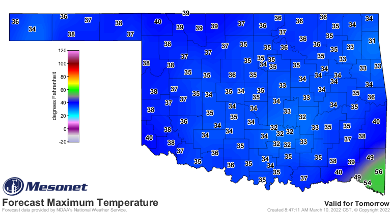
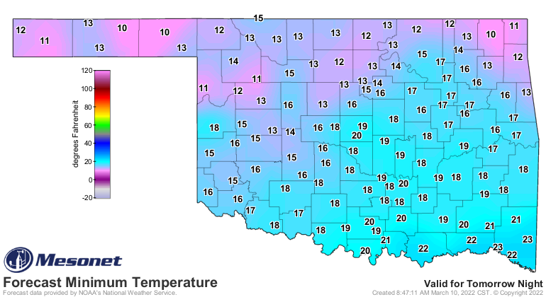
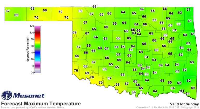
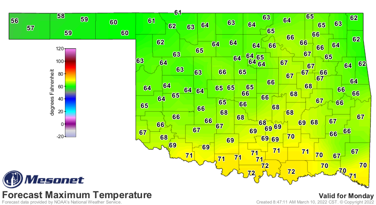
So this storm is exactly what it is advertised as...just a short burst of winter
in between some very springlike weather. Once we get to later in the day
Saturday and into early next week, we'll probably not even remember the event
as highs rise into the 60s and 70s.
These upcoming weather hazards are occurring on top of the biggie of all Oklahoma
weather hazards...drought. Yeah, I said it! Nothing impacts our state on the
scale of both size and duration like drought. Tornadoes and ice storms and
the such are obviously terrible, but drought can wipe out billions of dollars
in crops and cause many more disruptions. Plus, it's the only hazard we
climatologists are somewhat in charge of tracking, so it's a 100% biased view.
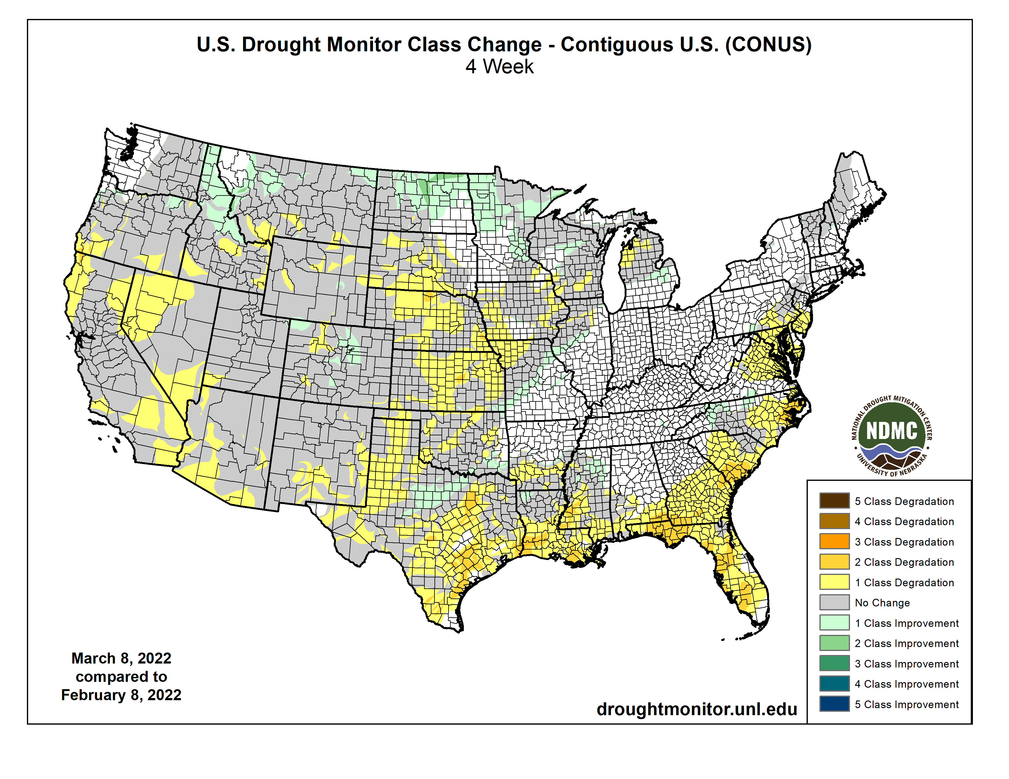
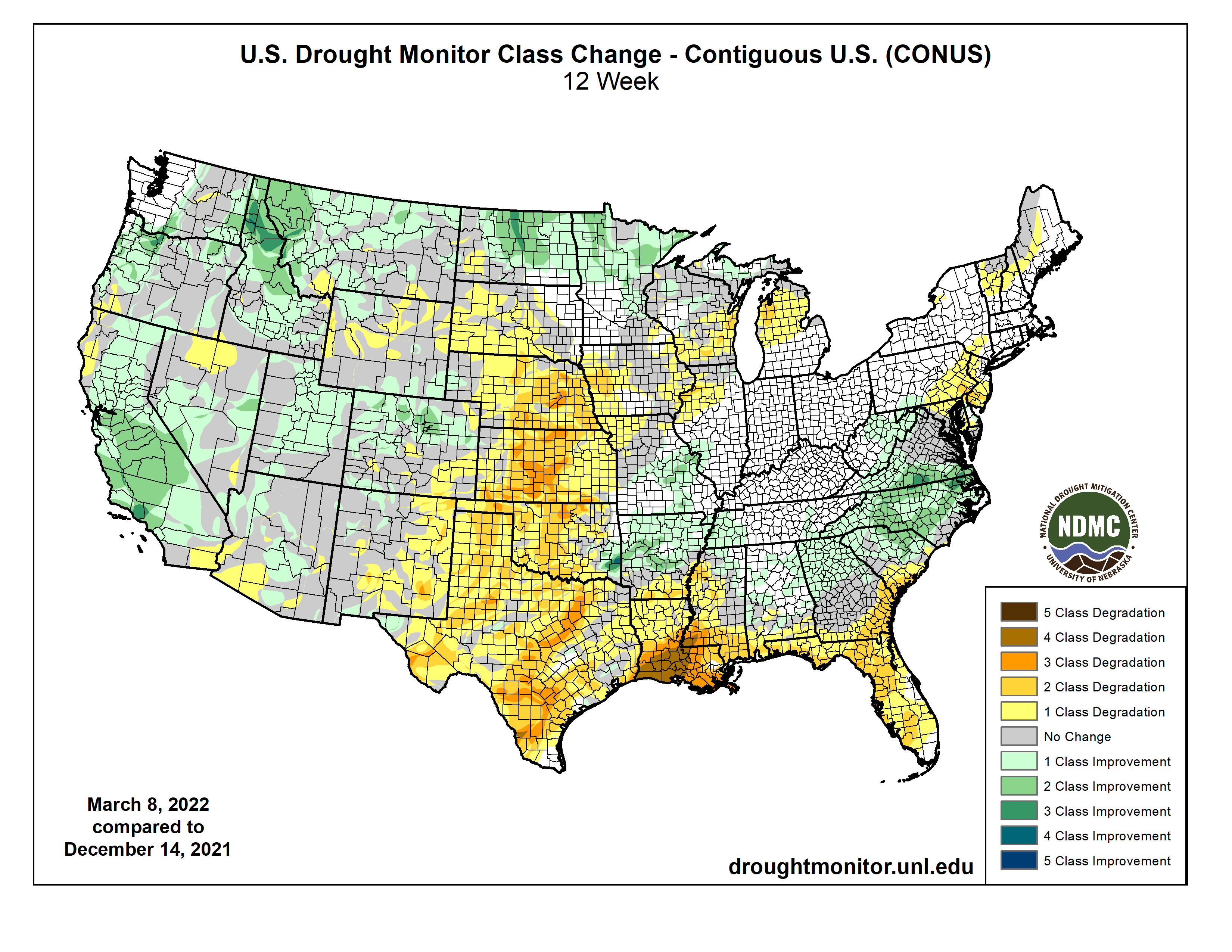
But that view is pretty darned terrible at the moment, with more and more D4
(Exceptional) drought showing up across western OK on the U.S. Drought Monitor.
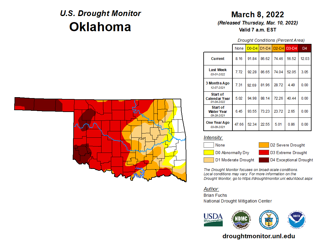
That's the most D3-D4 drought we've seen in the state since June 2014! Yeah,
not even during the 2017-18 drought did we see this much Extreme-to-Exceptional
drought in the state. Certainly more D4 drought there in the spring of 2018,
but not those two highest intensities.
Now with this storm and another possible system (this time, no winter weather)
showing up later next week, there is some hope for better moisture. It's just
now starting to show up on the 7-day precip forecast (again, the current storm
is mixed in with it). But maybe we'll see some better maps in the next couple
of days.
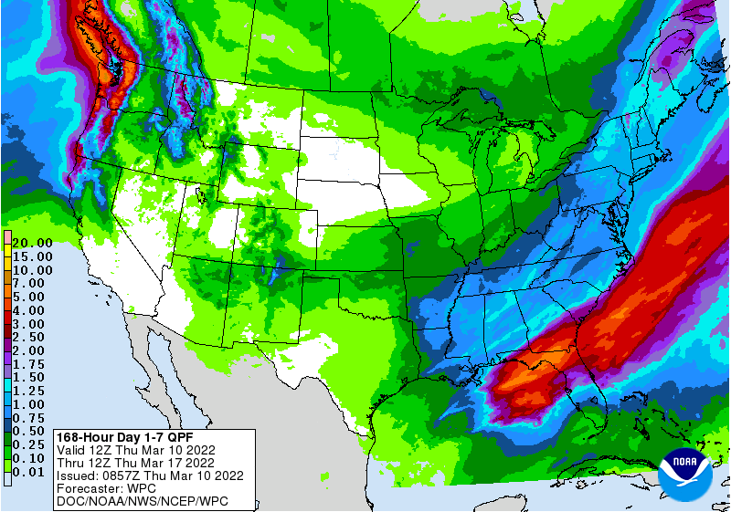
Sadly, I'll remain in the "believe it when I see it" mode. No, I'm not talking
about my secret hair growth cream I bought from Malta. That is definitely
going to work! I'm talking the better rains, especially across western Oklahoma.
But spring is just getting started, so even a disappointment next week is
not the end of hope for that part of the state.
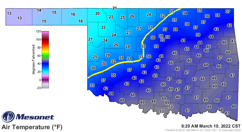
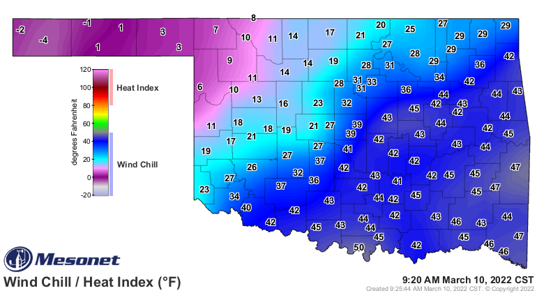
The front is slowly making its way through the state. Hopefully you are prepared.
Come on, you're not THAT person that went to work or out and about with no
coat and in shorts, right?
The Ticker is taking about a week or so off for spring break.
Okay, did we just hear applause? Just for that, we're coming back early.
MARGE, CANCEL THE PLANE TICKETS!
Gary McManus
State Climatologist
Oklahoma Mesonet
Oklahoma Climatological Survey
gmcmanus@mesonet.org
March 10 in Mesonet History
| Record | Value | Station | Year |
|---|---|---|---|
| Maximum Temperature | 87°F | MANG | 2021 |
| Minimum Temperature | 6°F | BEAV | 1998 |
| Maximum Rainfall | 1.93 inches | RING | 2012 |
Mesonet records begin in 1994.
Search by Date
If you're a bit off, don't worry, because just like horseshoes, “almost” counts on the Ticker website!