Ticker for March 7, 2022
MESONET TICKER ... MESONET TICKER ... MESONET TICKER ... MESONET TICKER ...
March 7, 2022 March 7, 2022 March 7, 2022 March 7, 2022
Shall we play a game?
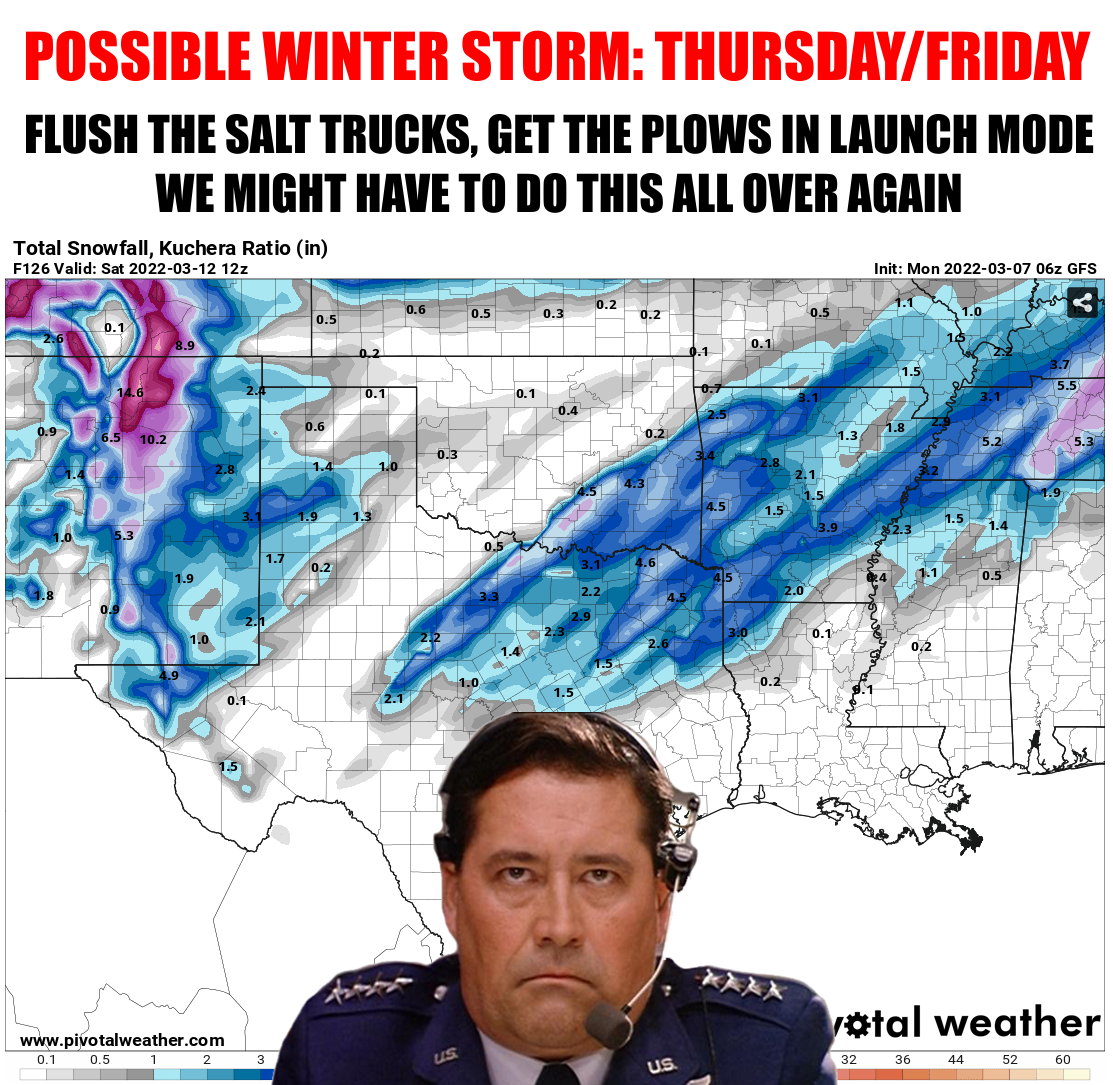
Don't be fooled by the snow amounts I've shown you on this map from one single
run of the GFS forecast model. Heck, don't be fooled by anything I try and tell
you. Except maybe that I'm about 6'4", 220lbs, with hair like Jason Momoa. That's
fairly accurate.
WHAT? How dare you! Now why would I lie about something like that?
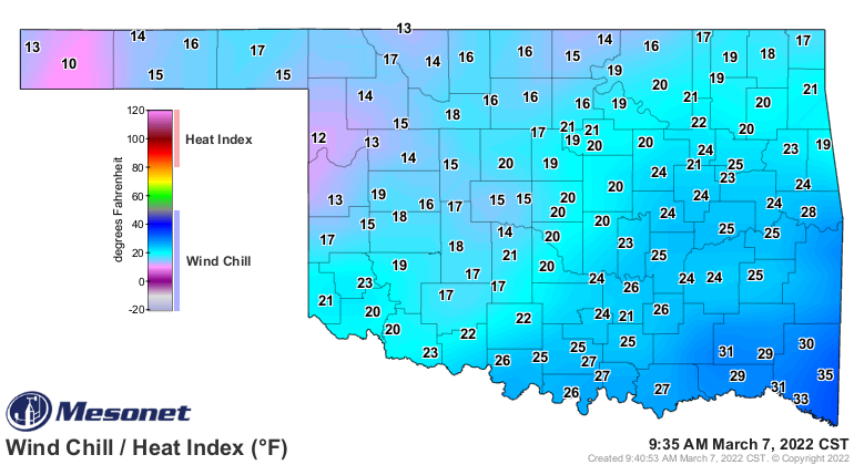
At any rate, we're experiencing another bout of winter as we speak with wind
chills down in the teens across the state from the teens through the low 30s. We
are definitely paying for our lovely week last week.
There was even a bout of freezing rain/sleet across NW OK yesterday, with lots
of accidents. That's how it can sneak up on ya. So we're gonna warm up again
this week, as is often the case this time of year, then we'll see another blast
of arctic air somewhere in the tame frame late Wednesday night into Thursday.
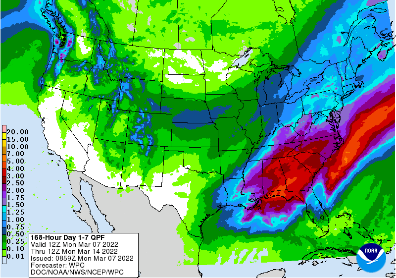
Then we get the moisture back. Not quite as exciting as when Justin T. brought
sexy back, but climatologically speaking, when you're in a pretty severe drought,
some good rain/snow is pretty darned sexy!
We *COULD* start out with some wintry mix type precip Thursday before we see
a transition to all snow as that main storm system rotates through the area
whilst the arctic air is still here. Here's how our local NWS offices see it.
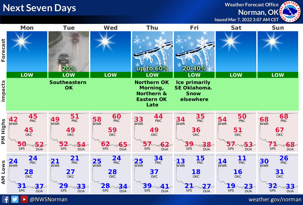
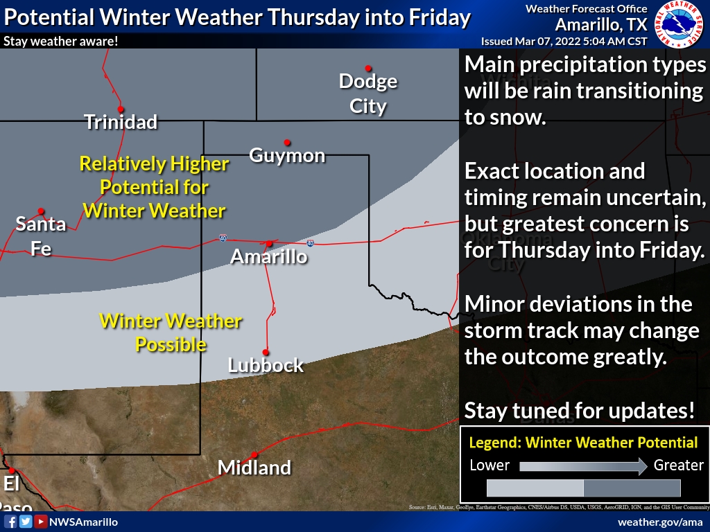
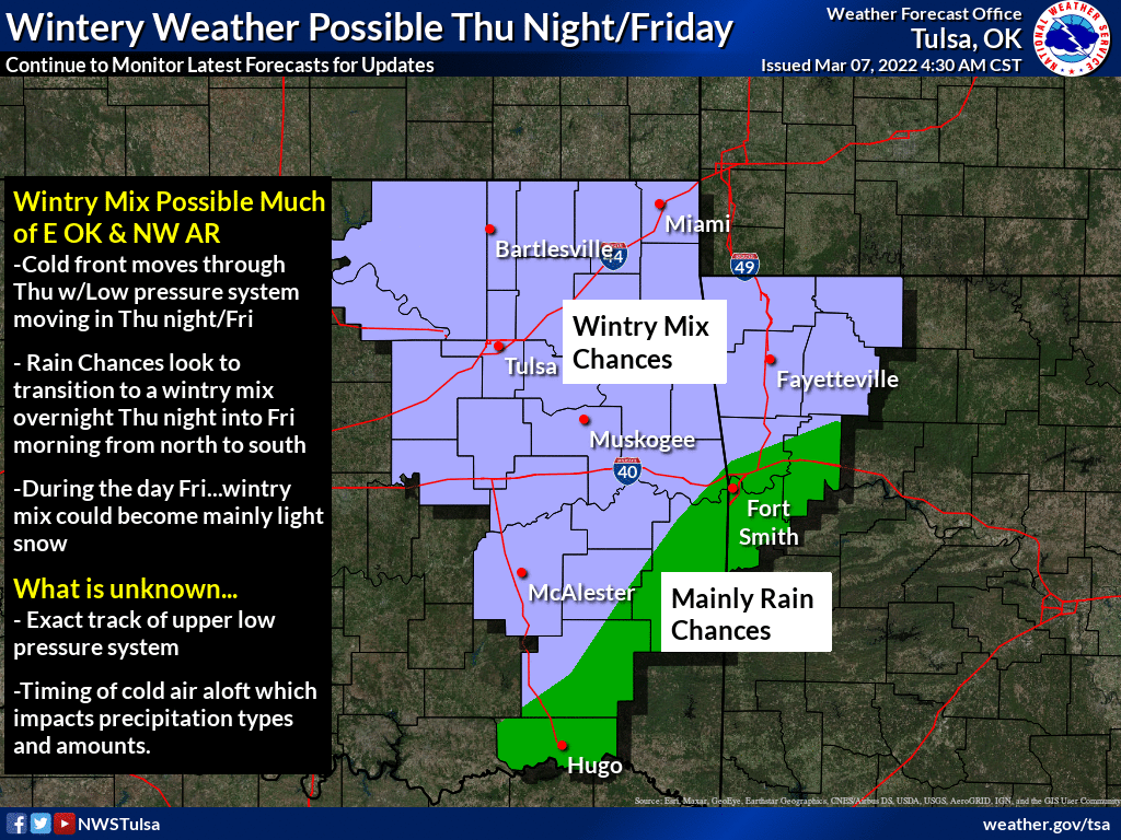
All bets are off as of now. About the only good bet would be that the forecast
will change between now and Thursday, and probably significantly. I'm not
going to go too far out on a limb, but all I'll say is that when you start
talking about possible snowstorms in March, a month when some of our biggest
snowstorms in state history have occurred, it would not be a shock to find out
in the next couple of days that this storm will have strengthened a bit more
than expected. Storm systems can get a bit more energetic this time of year,
so definitely something to be on the lookout for. The uncertainty is still
strong with this one, so stay tuned.
It could all fizzle too, of course, looking 4/5 days out. But it does look
like a momentary bout with winter with another good warm up through the
weekend into next week, that will bring us more bouts of fire danger. But each
bout with moisture, be it rain, snow or ice, brings us closer to a spring
green up which will help limit these wildfire danger days.
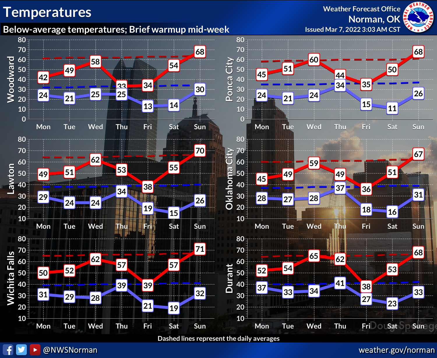
Winter is as winter does.
Gary McManus
State Climatologist
Oklahoma Mesonet
Oklahoma Climatological Survey
gmcmanus@mesonet.org
March 7 in Mesonet History
| Record | Value | Station | Year |
|---|---|---|---|
| Maximum Temperature | 87°F | HOLL | 2006 |
| Minimum Temperature | 8°F | SEIL | 2008 |
| Maximum Rainfall | 3.76″ | PRYO | 1998 |
Mesonet records begin in 1994.
Search by Date
If you're a bit off, don't worry, because just like horseshoes, “almost” counts on the Ticker website!