Ticker for January 6, 2022
MESONET TICKER ... MESONET TICKER ... MESONET TICKER ... MESONET TICKER ...
January 6, 2022 January 6, 2022 January 6, 2022 January 6, 2022
Mittens ain't enough!
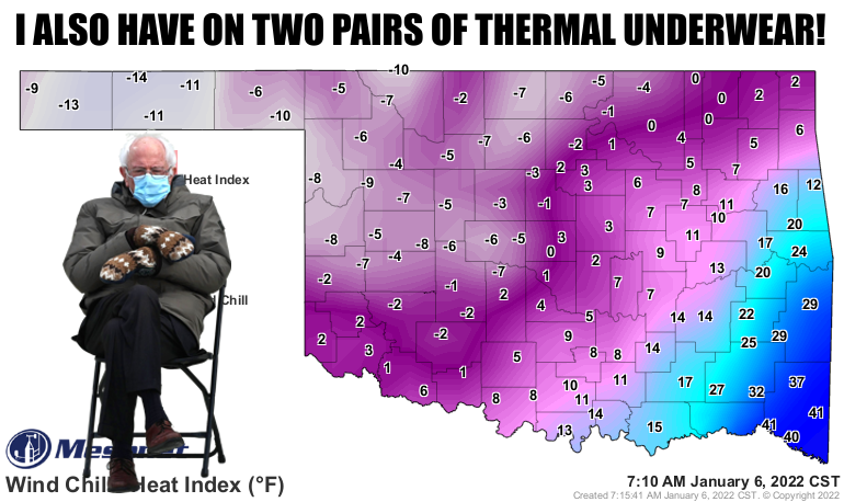
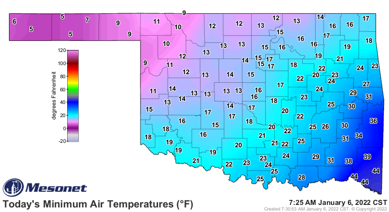
Teeth-chattering cold occurring RIGHT NOW, the second time in less than a week
since our record-chattering, errrr, shattering, December. The ONLY thing I can
think of that's good about this here cold weather is that it is slowing the
drought intensification and spread that we've seen since late in the summer.
That's not all good, however, because if there is one thing drought-stressed
winter wheat does not like, it is intense cold. Like this morning.
And drought we have, by the dry pond-load.
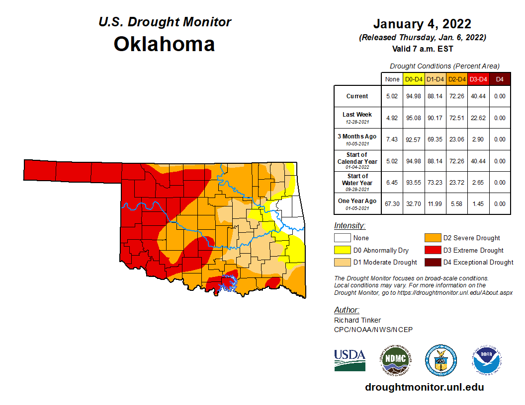
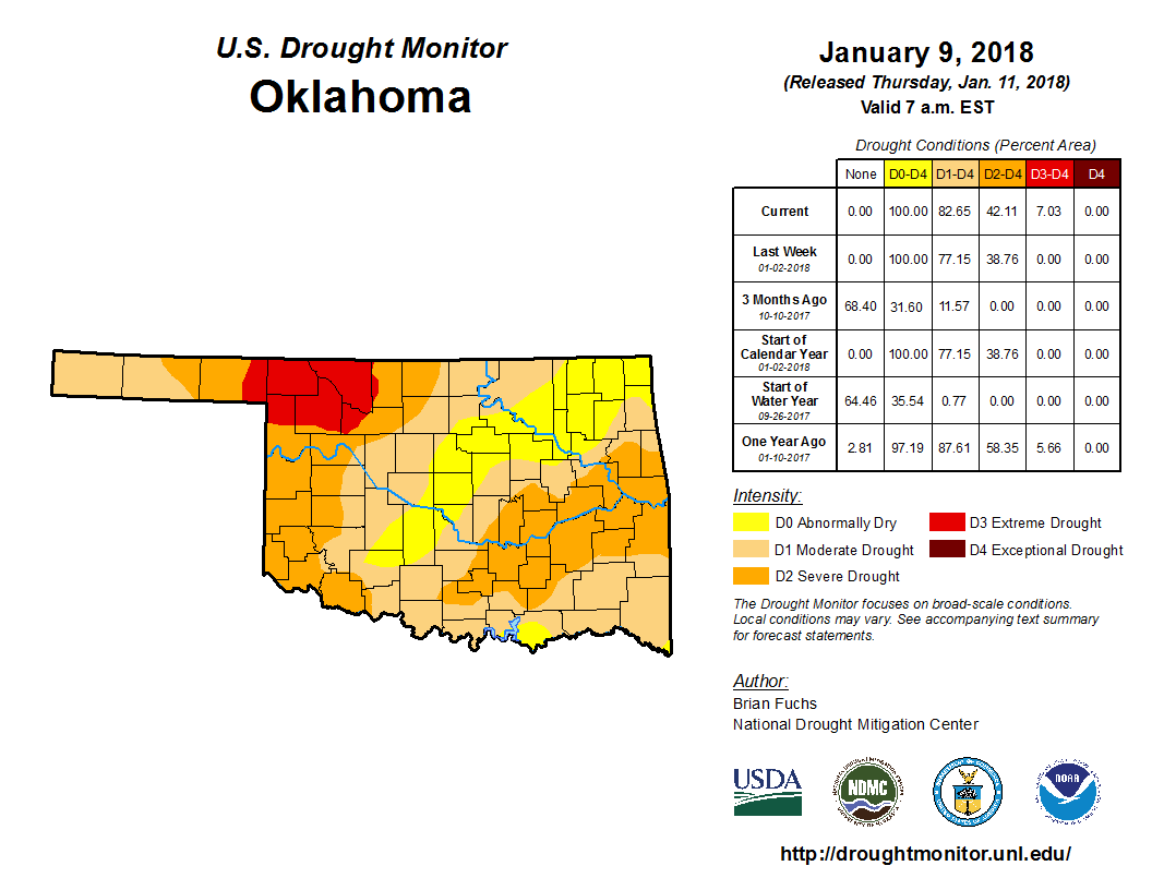
We spent a deep-dive of about 10 hours Sunday and Monday looking at the drought
indices across Oklahoma from 1-month to 24-months and then asked for a bump up
across most of the western two-thirds of Oklahoma from the U.S. Drought Monitor
author. We now sit with 88% of the state in some category of drought (D1-D4),
and another 7% in abnormally dry (D0) conditions. But even worse, we now sit
at 72% of the state in at LEAST severe drought (D2), of which 40% is extreme
(D3) drought. In other words...wow. This is the worst we've seen it since
the spring of 2018, which coincidentally enough was during our last double-dip
La Nina event. We can hope for a better outcome than that drought, which saw
us end up with much of western Oklahoma in EXCEPTIONAL drought (D4), the worst
category.
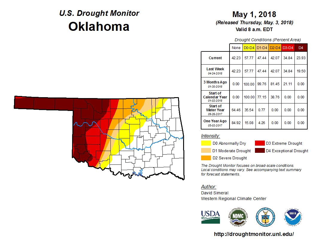
We are certainly in a bit worse shape now than we were at this time back in
2018. Let's hope for a different track as we head towards spring!
The reason for our current troubles is pretty evident...we simply haven't gotten
enough rain (or snow or whatever) since we started to dry out late in the summer.
Check out these rain maps and stats since the cool growing season began in Sept.
1.
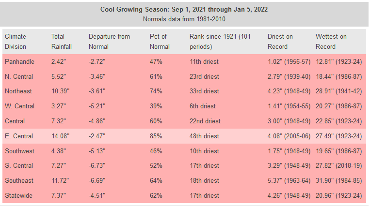
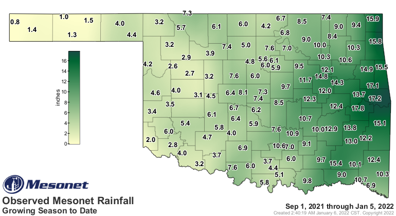
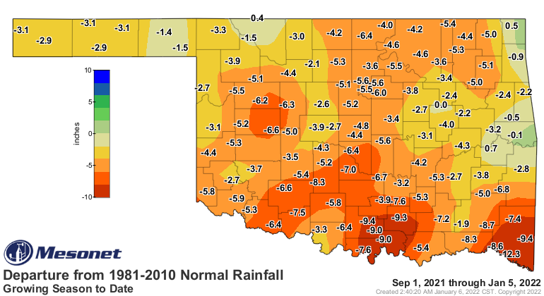
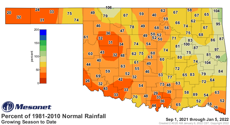
So it's not just that we're down a bit...for much of the state, we're down more
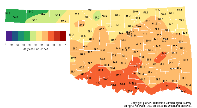
than 50% for the last 4 months at the same time that we've been unusually warm!
The September-December period was the 2nd warmest on record, since 1895, at
40.4 degrees, 5.2 degrees above normal. And for the western half of the state,
it was THE warmest on record!
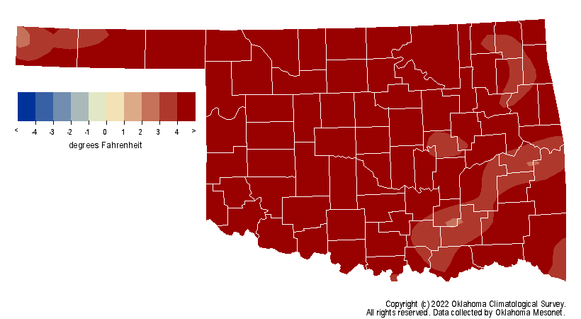
The only one warmer statewide was 1931, and I don't have to tell you what was
beginning back then. Well, as a know-it-all, I'm compelled to do so...right, it
was the first year of the Dust Bowl. Coming back to the present (do we have to?),
the next 7 days don't see much hope for relief.
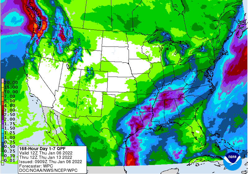
And by "much," I mean "none." There is the possibility of some moisture as we
get into next week. We do see increased odds of above normal precipitation (yay!)
and temperatures (YAY!) for that Jan. 11-15 time frame.
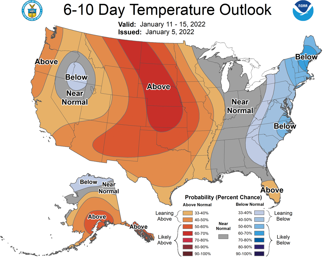
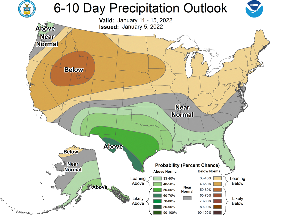
Here's the deal, though...this is the driest and coldest time of the year. So
what does "above normal" mean at this time of the year? Well, it doesn't mean
widespread 3 inches of rain and highs in the 70s, necessarily. We can look out
even farther using this probability of accumulated precip model output from
our fine friends the Canucks. Here we see the probability of at least an inch
of rain accumulating between today and Jan. 19 at 6 p.m.
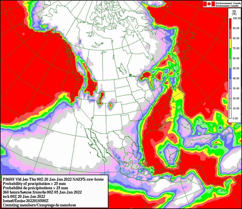
Yeah, not good. We need another pattern change. Okay, I've been writing for
quite awhile now...maybe it's warmed up by now?
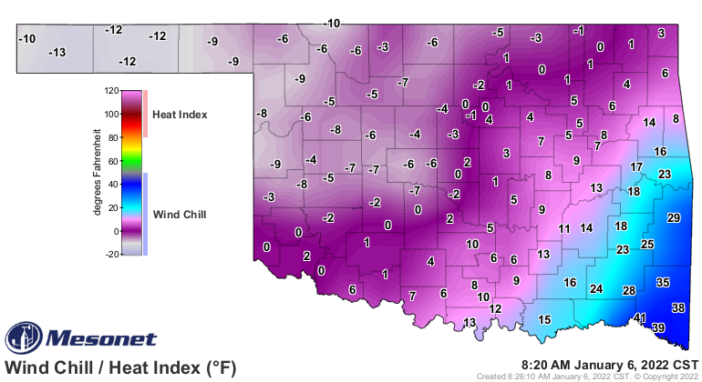
RATS!
Gary McManus
State Climatologist
Oklahoma Mesonet
Oklahoma Climatological Survey
gmcmanus@mesonet.org
January 6 in Mesonet History
| Record | Value | Station | Year |
|---|---|---|---|
| Maximum Temperature | 80°F | MANG | 2008 |
| Minimum Temperature | -12°F | NOWA | 2014 |
| Maximum Rainfall | 2.48″ | BROK | 2021 |
Mesonet records begin in 1994.
Search by Date
If you're a bit off, don't worry, because just like horseshoes, “almost” counts on the Ticker website!