Ticker for January 3, 2022
MESONET TICKER ... MESONET TICKER ... MESONET TICKER ... MESONET TICKER ...
January 3, 2022 January 3, 2022 January 3, 2022 January 3, 2022
Just go, man
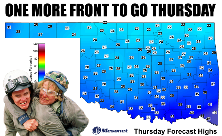
Okay, crazy people, we've had our winter, now let's get back to spring!
Yesterday's lows should kill all the bugs and allergens and whatnot that we
hear need doing each winter. Ya know, instead of freezing everybody else, you
could just grab some Raid and Flonase (be sure to not mix them up). Ah, just
kidding...I suffer from both afflictions as well. I'm hoping the cold weather
yesterday killed all my fleas.
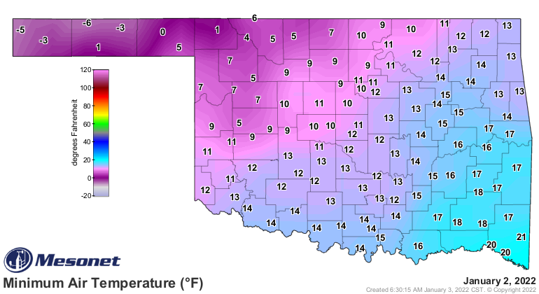
We did have lots of excitement there over the Holidays, no? Culminating (English
to Okie translation: "Ending") in a frozen New Year's Day but also plenty of
good moisture for too little of the state.
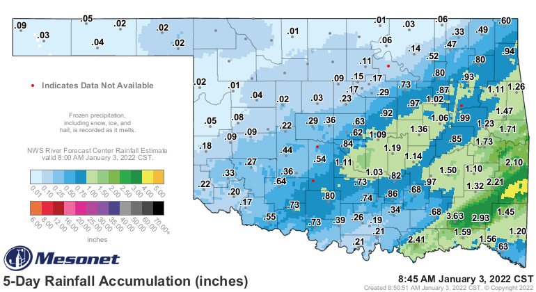
Not bad, but not nearly good enough for any of those areas outside of the green,
and even in some of those areas as well.
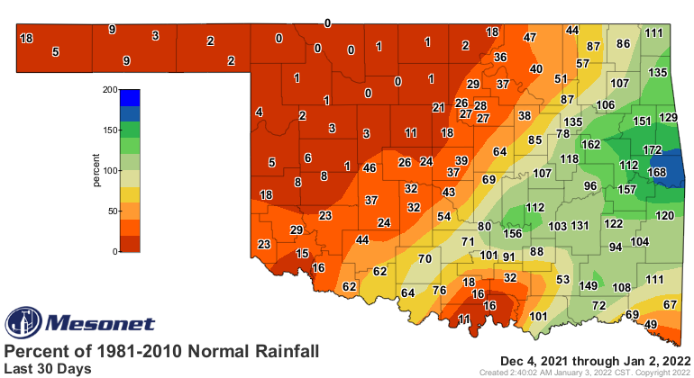
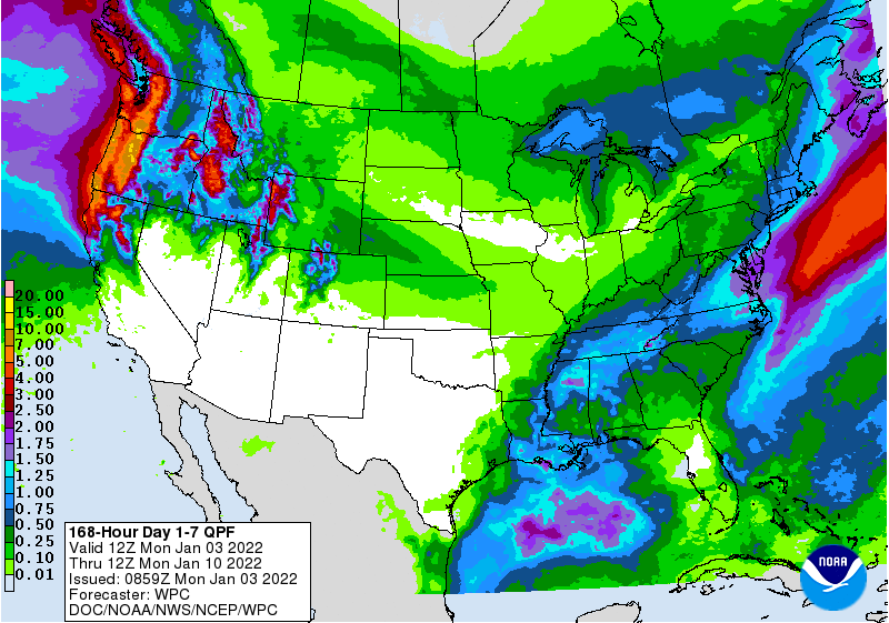
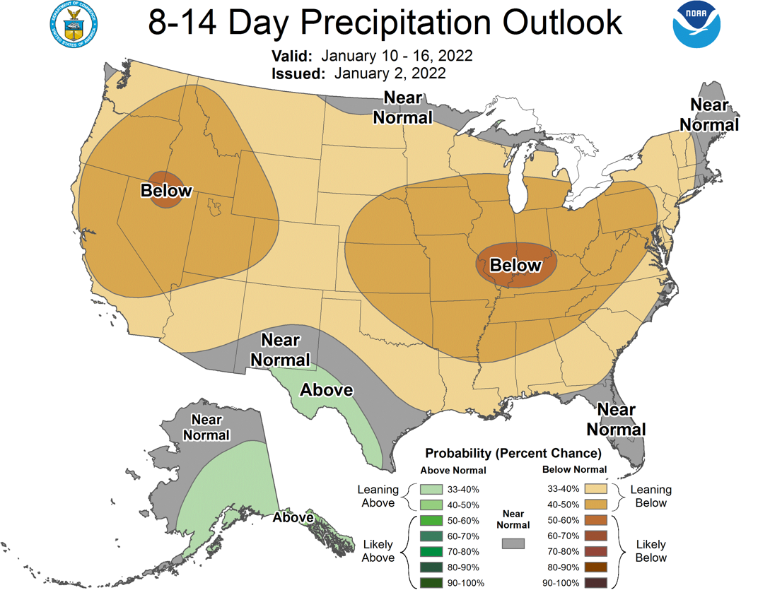
Unfortunately, for drought's sake, we're now headed back to the doldrums. No
rain is in the offing for the next 7 days at least, and beyond.
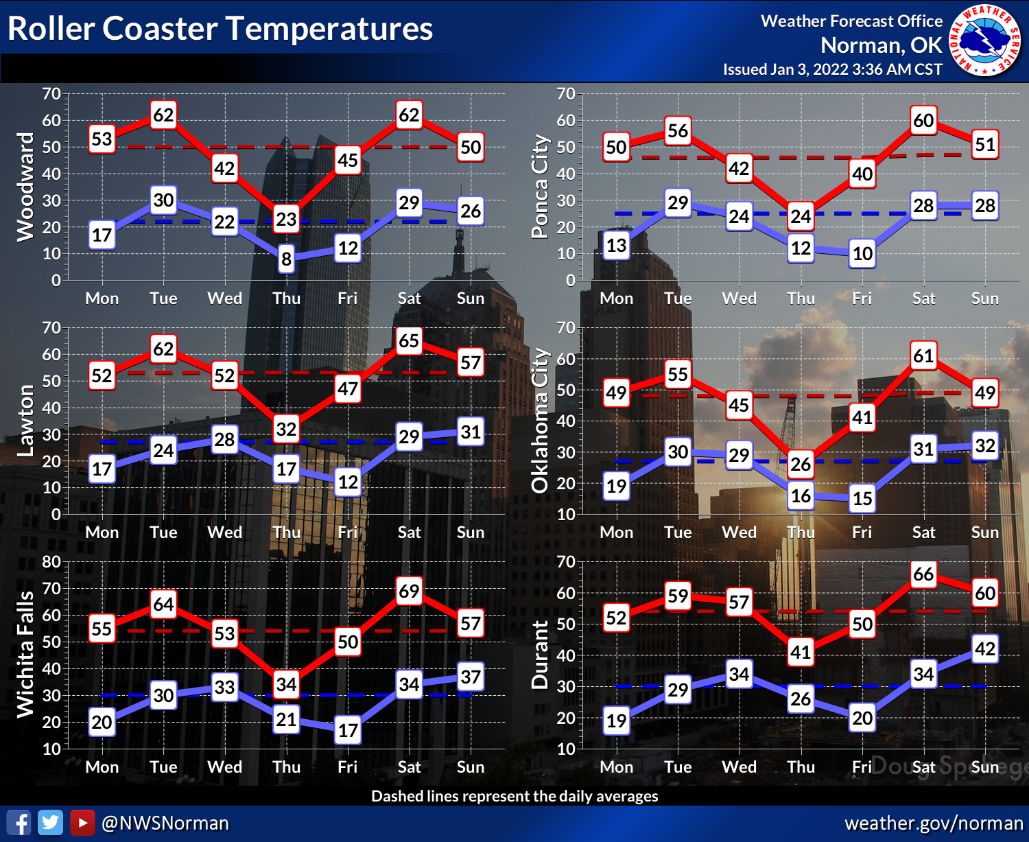
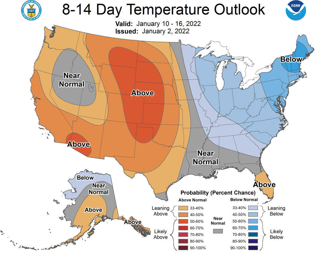
And after one more dip in our temperature roller coaster coming up on Thursday,
we appear to be headed back to above normal temperature territory as well, which
will NOT be good news for drought pressures out west.
I doubt (HOPE!!) we're not headed back to where we were in December, which was
historic for its dryness out west and MEGA-HISTORIC for temperatures statewide.
I won't blab on any longer (really? that's hurtful!), but stick around below
for a look back at the climatological Goliath that December was!
----------------------------------------------------------------------------------
December Shatters Temperature Record
Jan. 3, 2022
In what could best be described as a climatological anomaly on steroids, Oklahoma
soared to its warmest December on record, besting the previous mark by more than
5 degrees. It was a remarkable display of muscle by Mother Nature that saw the
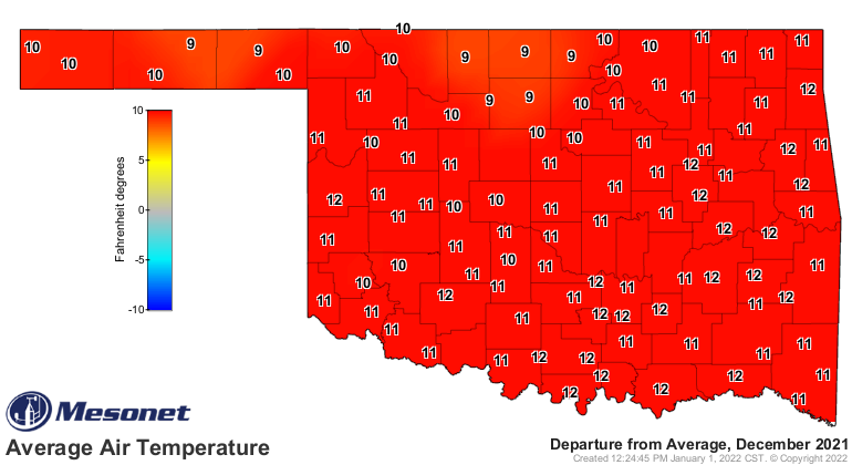
statewide average temperature finish more than 10 degrees above normal as
measured by the Oklahoma Mesonet. For some perspective, the next nine warmest
Decembers all reside within 2 degrees of each other.
-***-
Year Dec. Statewide Avg. Temp(F)
2021 50.4
1933 45.1
1965 45.1
1946 44.6
2015 44.6
1957 44.4
1906 43.8
1939 43.8
1931 43.8
1970 43.3
-****-
No other calendar month in Oklahoma has such a large spread between the top two
marks. May has the next largest difference at 1.2 degrees. December 2021 also
became the fourth warmest climatological winter month since statewide records
began in 1895, just a few tenths of a degree behind the top spot in February
1954. The cool season heat wave was a culmination of warmer and drier than
normal weather that began in earnest in mid-August and continued largely
uninterrupted right up until the ball dropped on 2022. An arctic cold front
arrived just before midnight on New Year’s Eve and brought an abrupt end to the
spring-like temperatures with snow, ice, freezing rain, and bitterly cold air.
A profound lack of precipitation combined with the unusual warmth to propel
drought forward in both coverage and intensity at speeds often reserved for the
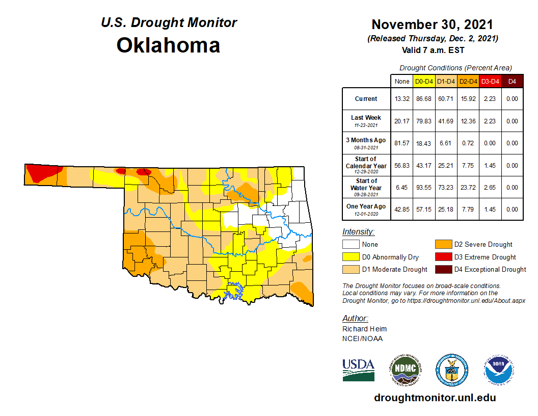
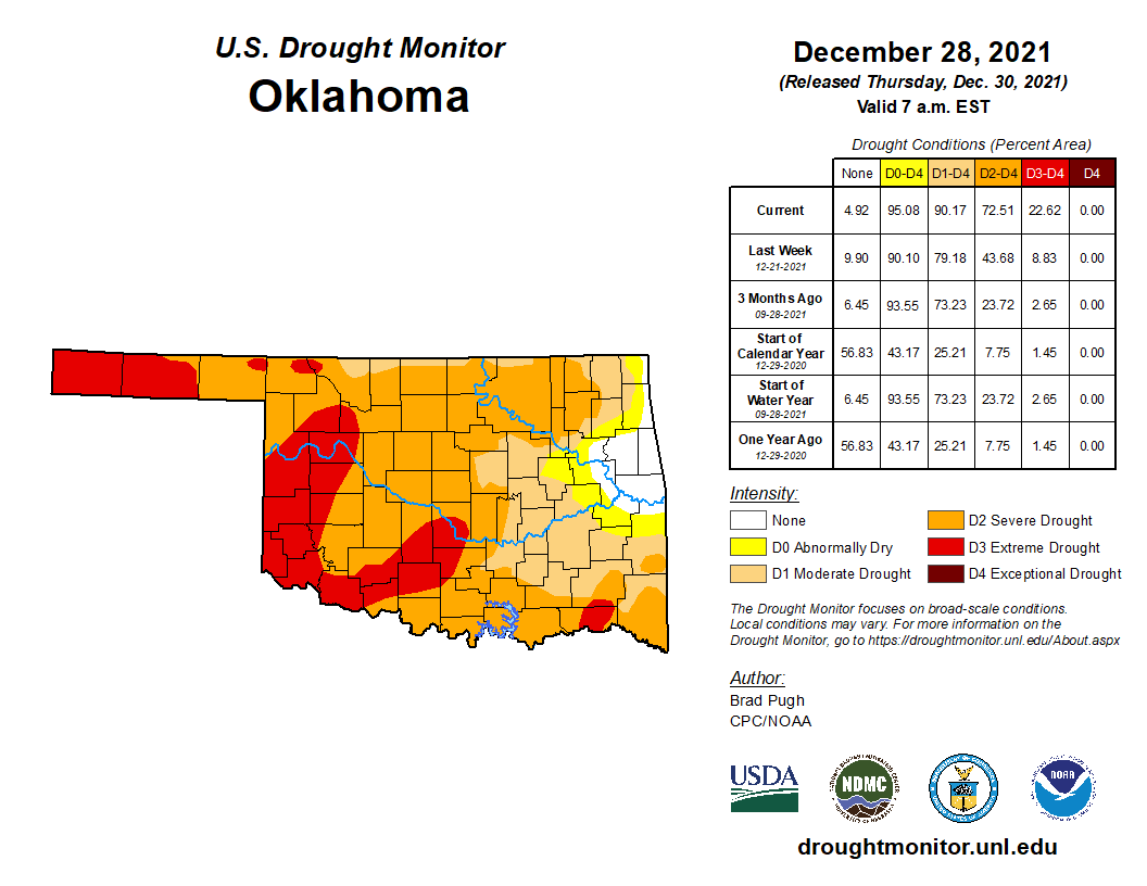
summer months. According to the U.S. Drought Monitor, drought increased from
61% of the state at the end of November to 90% at the end of December. The
amount of severe and extreme drought increased from 16% to over 72% during the
month. The Drought Monitor’s intensity scale slides from moderate-severe-
extreme-exceptional, with exceptional being the worst classification.
The addition of strong winds to the equation resulted in numerous days with
dangerous wildfire conditions. Widespread non-thunderstorm wind gusts of 60-80
mph across western Oklahoma on Dec. 15 fanned flames into the western sides of
Guymon, forcing evacuations. Dust storms closed roads in the Panhandle due to
poor visibility, producing images right out of the Dust Bowl era.
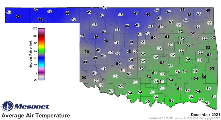
The statewide average temperature finished at 50.4 degrees, 10.3 degrees above
normal and easily surpassed the previous top mark of 45.1 degrees from both
1931 and 1965. Many individual locations across the state set similar
temperature records. Oklahoma City’s 50.7 degrees topped its previous record of
48.7 degrees in 1965, and Tulsa’s 52.2 degrees eclipsed 1931’s 47.3 degrees.
Oklahoma City and Tulsa’s records date back to 1890 and 1905, respectively. The
Mesonet recorded highs of at least 70 degrees on 25 separate days in December,
and at least 80 degrees on 13 days. The month’s highest reading of 89 degrees
at Grandfield on the 24th is the highest December temperature recorded by the
Mesonet since its temperature records began in 1997, and ninth highest compared
to longer running cooperative network data that extends back to the early 1870s.
Tops is the 92 degrees reported by Ardmore back on Dec. 30, 1951. The coldest
reading of December 2021 was 3 degrees at Camargo on the 19th. The warm
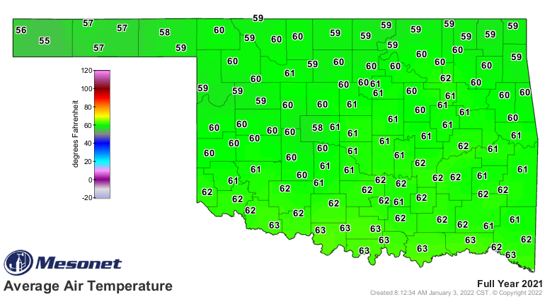
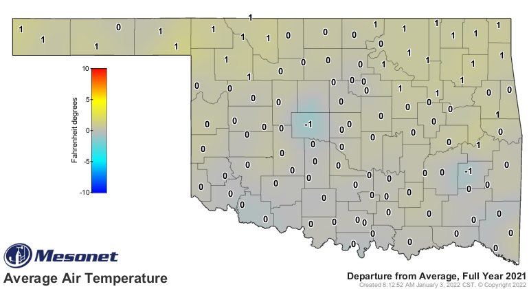
December vaulted 2021 up to a final ranking of 19th warmest at 61 degrees, 0.6
degrees above normal. 2021’s highest temperature was 107 degrees at Eva on June
23, and the lowest of minus 22 degrees was reported at Kenton on Feb. 15.
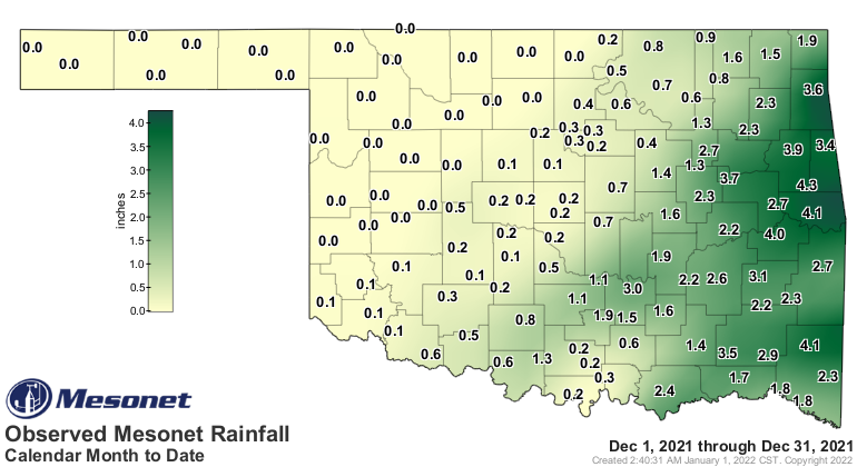
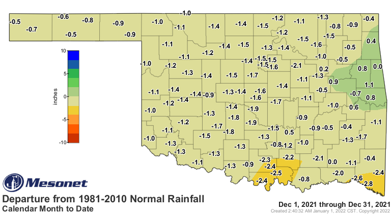
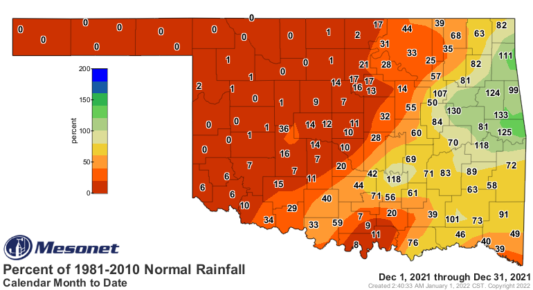
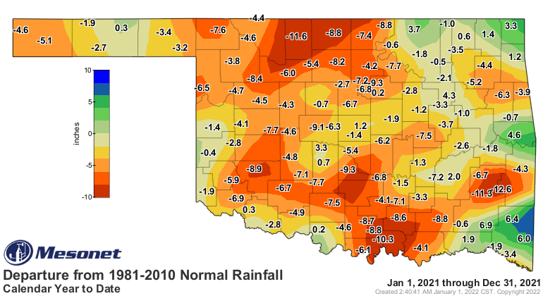
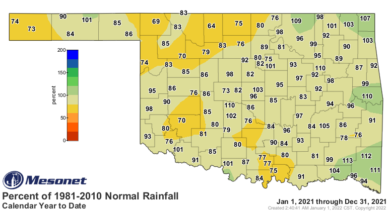
The month's statewide average precipitation total ended at 0.95 inches, 1.16 inches
below normal and ranked as the 34th driest December on record. That statistic
is bolstered by decent moisture across far eastern Oklahoma, but most of the
western two-thirds of the state experienced an alarming lack of precipitation.
Nineteen of the Mesonet’s 120 sites recorded no precipitation for the month,
and an additional 33 received a quarter-inch or less. The Panhandle suffered
its driest December on record with no precipitation for the month, west central
had its third driest at 0.01 inches on average, and north central’s 0.06 inches
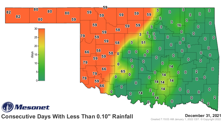
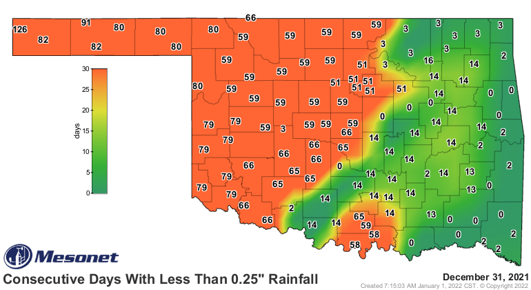
ranked as their fifth driest. Many locations in Oklahoma had not received more
than a tenth of an inch of rain in a single day for more than two months. Some
sites in the Panhandle had gone without measurable moisture since Oct. 10. The
Mesonet site at Cookson led the state with 4.26 inches, while 11 other sites
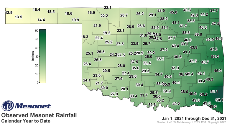
across eastern Oklahoma enjoyed more than 3 inches. 2021 finished as the 63rd
driest year on record with a statewide average of 33.63 inches, 2.73 inches
below normal. Kenton’s 12.9 inches was the Mesonet’s lowest total during 2021,
while the site at Mt. Herman won the top prize with 61.13 inches.
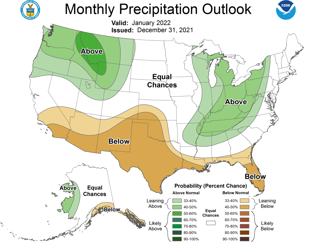
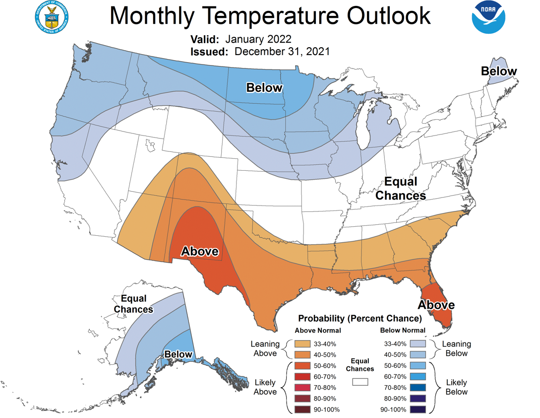
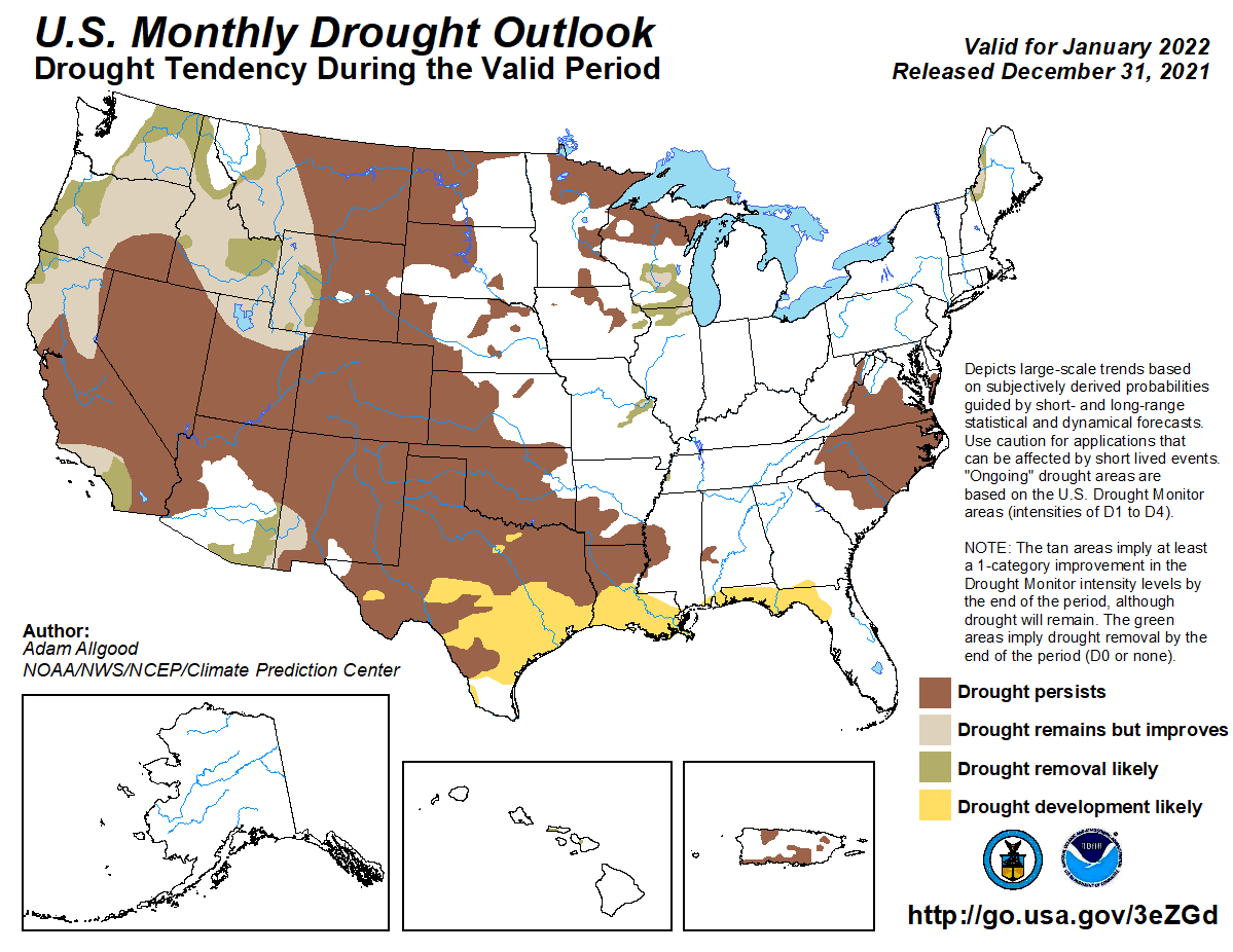
Chances for significant drought relief appear slim according to the Climate
Prediction Center’s January precipitation outlook, which indicates increased
odds of below normal precipitation across the western two-thirds of the state.
Their temperature outlook for January shows increased odds of above normal
temperatures in far southwestern Oklahoma and the western Panhandle. CPC’s
January drought outlook calls for the existing drought in Oklahoma to either
persist or intensify through January. No further spread is expected, however.
Gary McManus
State Climatologist
Oklahoma Mesonet
Oklahoma Climatological Survey
gmcmanus@mesonet.org
January 3 in Mesonet History
| Record | Value | Station | Year |
|---|---|---|---|
| Maximum Temperature | 87°F | ALTU | 2006 |
| Minimum Temperature | -8°F | KENT | 2002 |
| Maximum Rainfall | 3.32″ | CENT | 2005 |
Mesonet records begin in 1994.
Search by Date
If you're a bit off, don't worry, because just like horseshoes, “almost” counts on the Ticker website!