Ticker for December 10, 2021
MESONET TICKER ... MESONET TICKER ... MESONET TICKER ... MESONET TICKER ...
December 10, 2021 December 10, 2021 December 10, 2021 December 10, 2021
The Craptastic 4
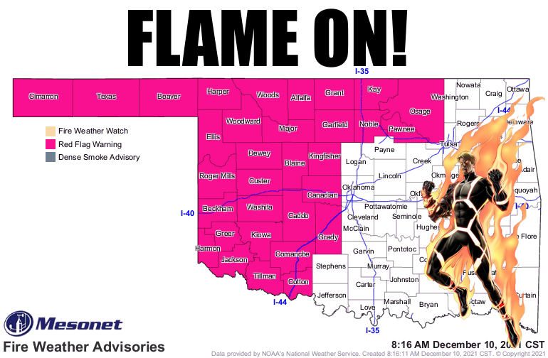
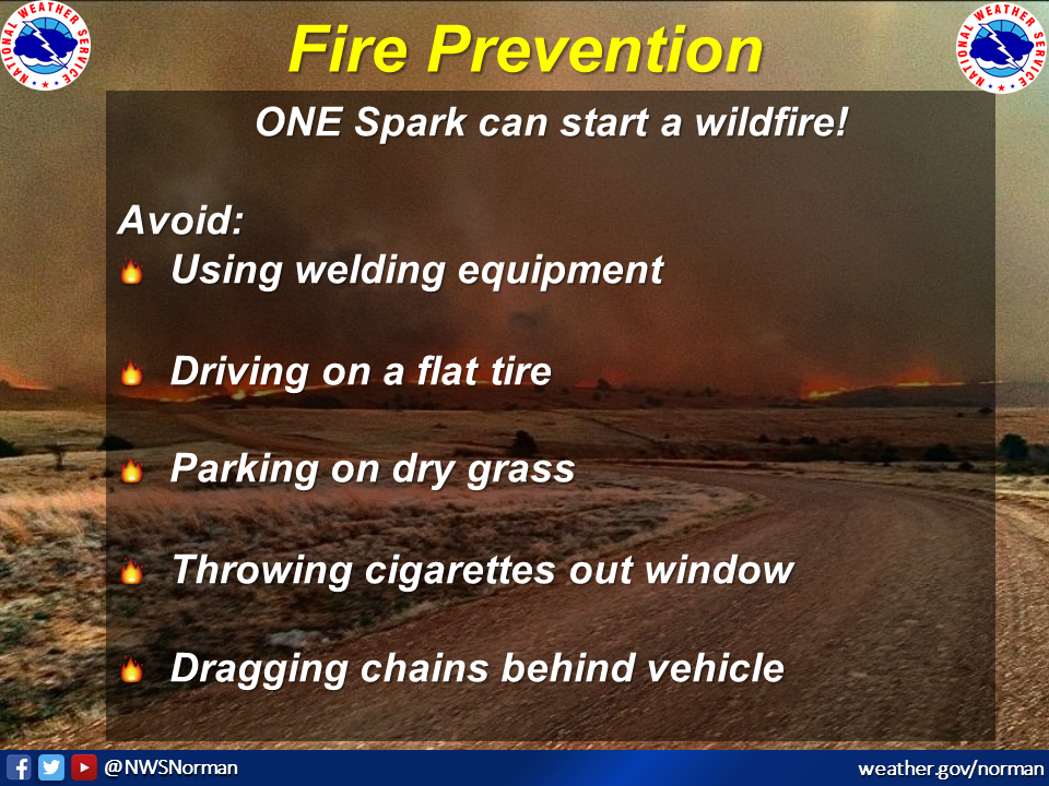
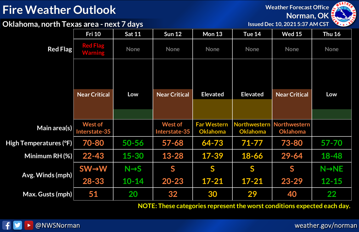
So now we have much of the NW half of the state covered by a RED FLAG FIRE
WARNING, which is the double-dog dare ya from Mother Nature to throw a
cigarette butt out the window today, or drag a chain behind your pick up. Or
cause a spark of any kind.
And what are the Craptastic 4, you ask, other than the only comic book to have
negative sales? Well, for Oklahoma today it will be:
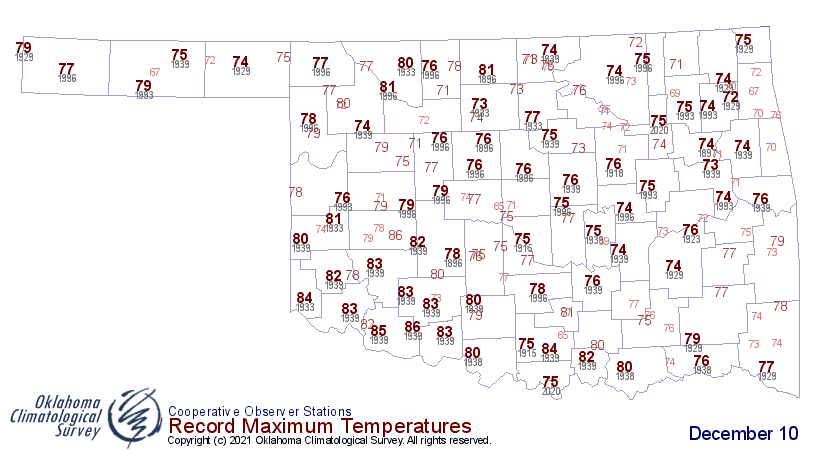
1. Record-threatening warmth, much like yesterday. In case you missed it,
Burneyville hit 82 degrees to tie for the all-time highest temperature ever
recorded in Oklahoma on any Dec. 9 in its history. Pauls Valley an Sallisaw were
the first spots to reach 82 back in 1918 and 1939, respectively. Now we watch
again for temperatures to threaten those top spots. A little tougher today with
Chattanooga and Cloud Chief reaching 86 degrees back in 1939. I don't think we'll
get quite that high, but I'm not discounting it either with some compressional
heating going on along the front.

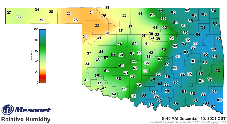
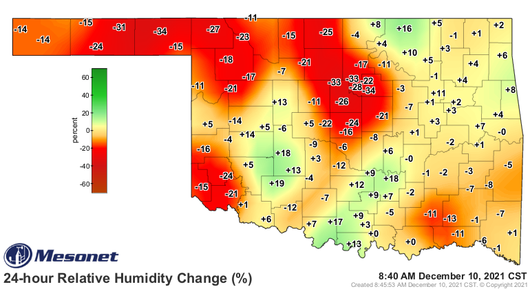
2. Low humidity. Watch for the relative humidity to drop close to the teens
today, which is lip-cracking weather. It's already pretty low up NW, but pretty
dry compared to yesterday at this time.
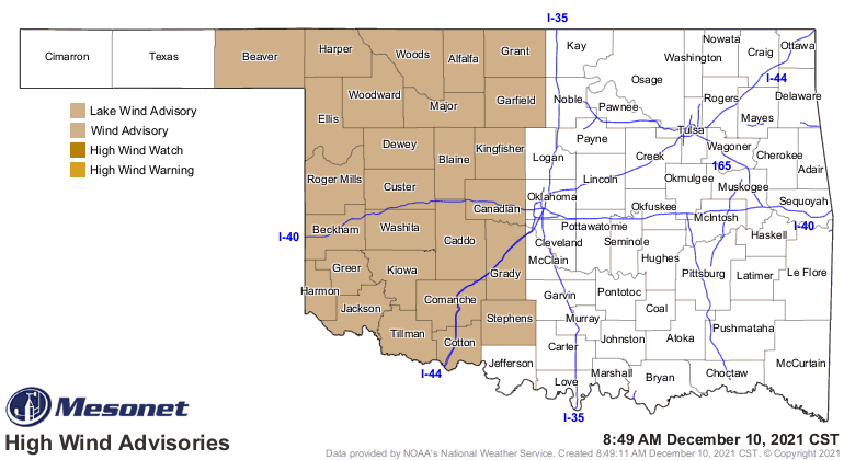
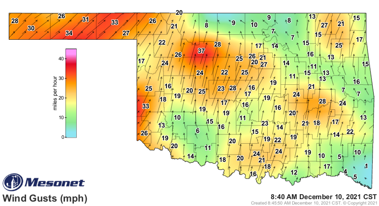
3. High winds. It's Oklahoma with a cold front coming through. Need I say more?
Hey, I heard that! So I'm a bit verbose at times. Others talk really good. I
are not. There's a wind advisory for western OK today for winds gusting to
40-50 mph. That's more of a "Hey, screw you pal" advisory, but at this point,
what's 40-50 mph winds between friends? And it's already cranked up a bit out
west.
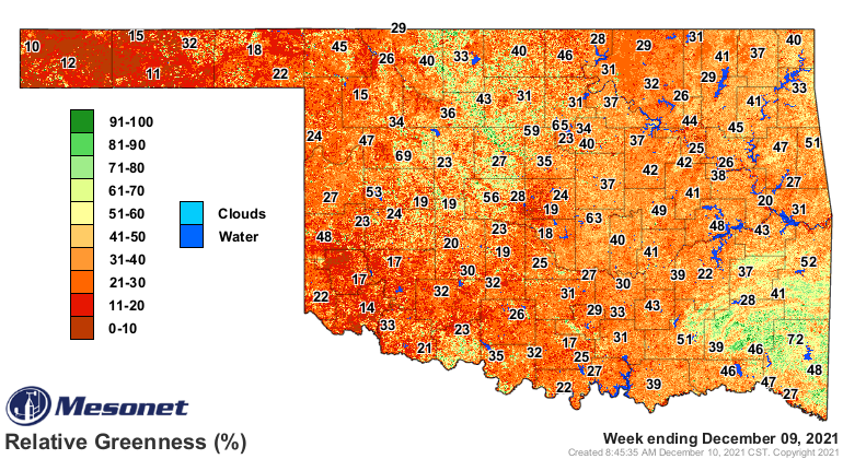
4. Dry fuels. Everything is either dormant or dead out there. No, no zombies,
just plants. Wouldn't a zombie carrot be cool though? But I digress. Keep in
mind we have an abundance of overgrowth due to the wet summer we had, at least
the first half, and we also have lots of downed limbs from the Oct. 2020's
ice storm.
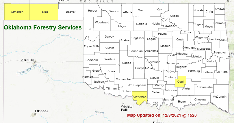
So now we're in a bit of a pickle. Some discussion from today's First Situation
Report put out by the fine folks at the OK Department of Ag, Food and Forestry.
"A Red Flag Warning is in effect beginning at 10:00
AM into the evening hours for counties generally along and north
of I-44. Extremely dry fuels will be subjected to near-record
or record temperatures, near-critical relative humidity values
and stout southwest winds ahead of a strong cold front shifting
winds to the northwest that is expected to arrive in the
Oklahoma Panhandle counties around midday progressing across the Warned
Area through the late afternoon and evening. Elevated fire
danger will be present across most of the state noting that some
very light rainfall this morning (primarily virga) and sky cover
will serve to stall early development of critical burning conditions.
Post-frontal dryness will also be a concern extending
elevated fire danger through the weekend into early next week."
We are seeing a few more burn bans cropping up across the state. Woe be unto
them that cause a fire in a county with a burn ban.
The cold front will shift winds later today, which could put firefighters'
lives in danger even more so than normal fighting fires. So knock it off with
the sparks today. As for the fire danger, we're just getting started.
Gary McManus
State Climatologist
Oklahoma Mesonet
Oklahoma Climatological Survey
gmcmanus@mesonet.org
December 10 in Mesonet History
| Record | Value | Station | Year |
|---|---|---|---|
| Maximum Temperature | 85°F | WAUR | 2021 |
| Minimum Temperature | -5°F | CAMA | 2013 |
| Maximum Rainfall | 2.15 inches | JAYX | 2022 |
Mesonet records begin in 1994.
Search by Date
If you're a bit off, don't worry, because just like horseshoes, “almost” counts on the Ticker website!