Ticker for November 18, 2021
MESONET TICKER ... MESONET TICKER ... MESONET TICKER ... MESONET TICKER ...
November 18, 2021 November 18, 2021 November 18, 2021 November 18, 2021
Happy Snowsgiving!
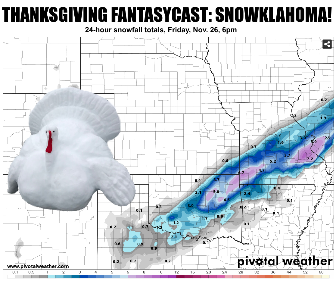
Happy Thanksnowing? Either will work. The Ticker is officially off work (come on,
were we ever ON work??) for the rest of this week and next, but the weather never
stops. Remember when Newman talked about the mail never stopping? Well, he's lucky
he wasn't in the Oklahoma weather biz. We have just a bit to talk about so let's
get to it.
Yeah, the chance of this forecast actually verifying is right up there with me
waking up with a full head of hair. Or me waking up with a full hair of head. Both
are so bizarre it ain't worth talking about. But remember the last time I did
this fantasycast proclamation was back on Oct. 19 of 2020 and we ended up with a
lot of snow and even more ice.
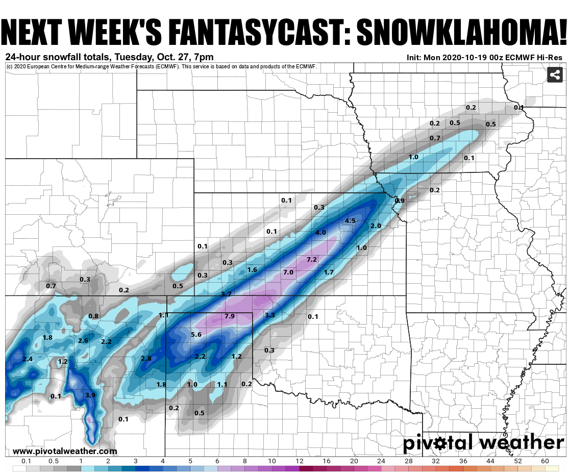
I'm definitely not saying that's gonna happen again, but it is indicative that
every once in a blue moon, these long-range forecasts actually have some merit.
But, over a week out, this one is still in that fantasy category. Once the
forecast models start to coalesce on a more unified solution amongst themselves,
then we'll have a better picture of what our Thanksgiving holiday is gonna look
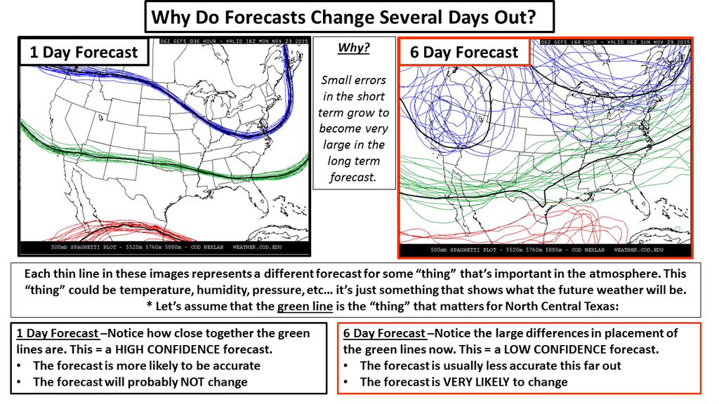
like, especially for those travelers. Now why is there so much uncertainty?
Well, we'll go back and show you this picture of the chaos that permeates those
long-term computer model forecast outputs. It gets pretty hairy (OUCH again)
when you give a storm that's still on the other side of the globe a chance to
run amuck.
And even then, if the storm arrives with some cold air to work with, we have to
think 3-dimensionally as well. The vertical temperature profile of the atmosphere
is equally as important to determine what type of precip will fall.
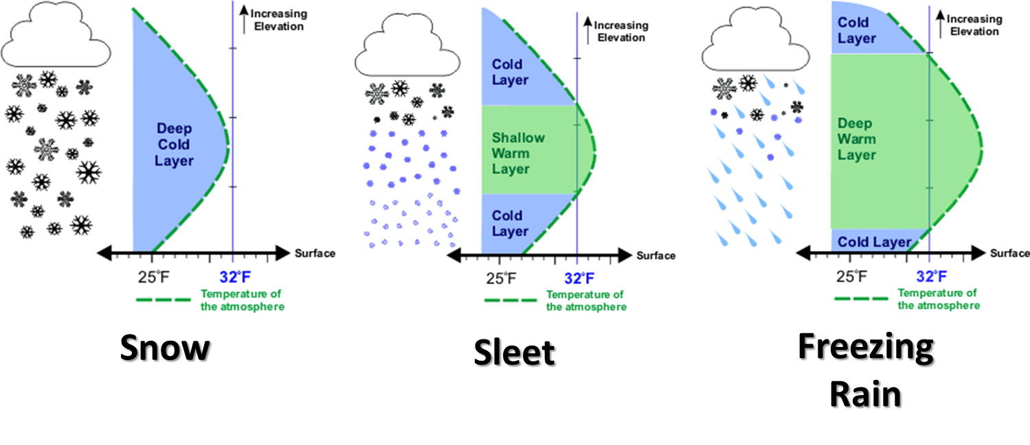
Okay, who would like freezing rain?
GET OUT! Just leave right now. You sleet and snow folks can stay. Cold rain
folks, pick a side, will ya?
I post a lot of this in jest, but it is worth remembering as we go through the
next week to keep mindful of those forecasts if you have to travel to Grandma's
house for Thanksgiving. While you're there, tell her the bird is too dry
again (the turkey, not Grandma!). And this is just ONE forecast model's
interpretation after it's latest run. Other models show us with a cold rain,
or just a cold front with little precip. Again, that's the fantasy part.
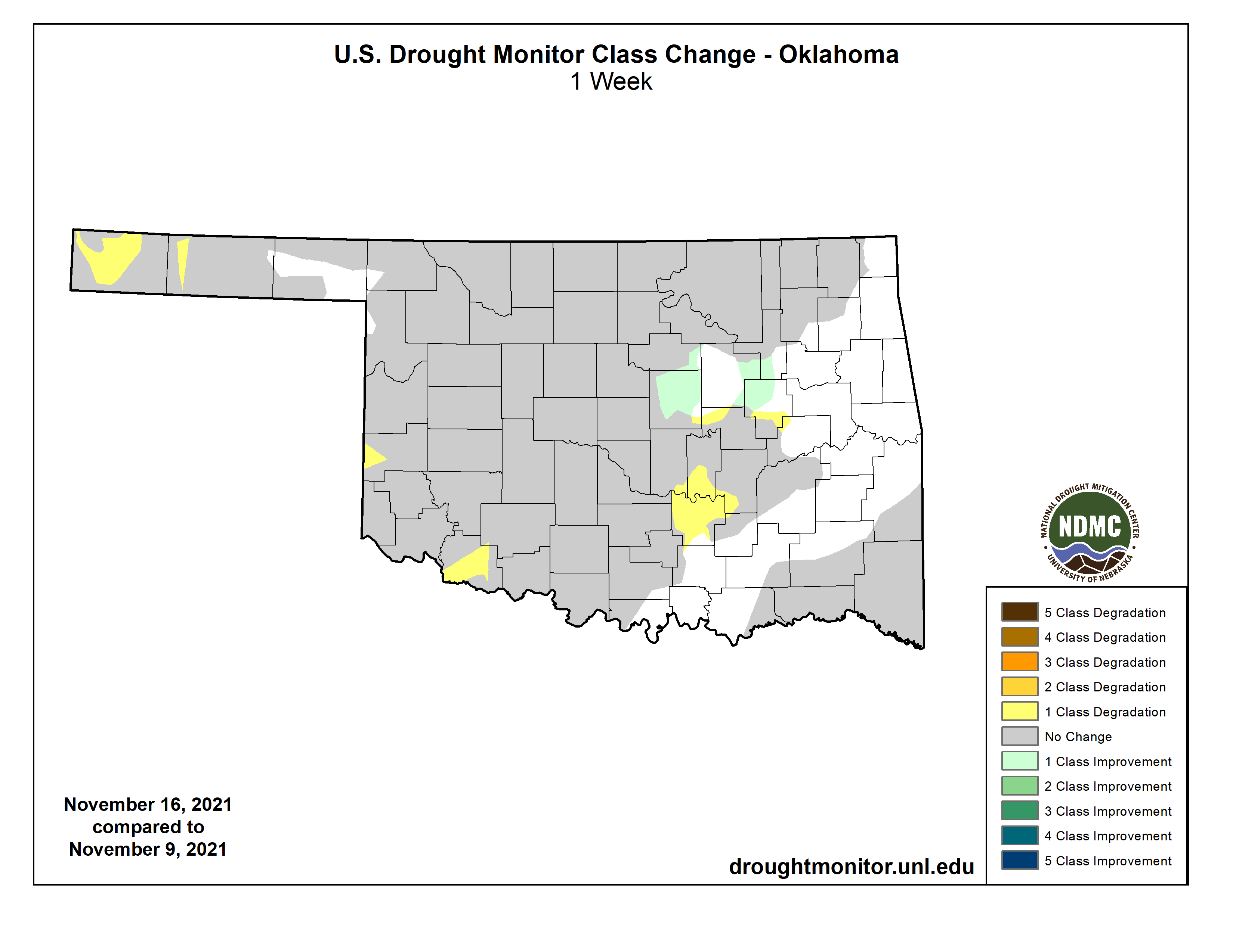
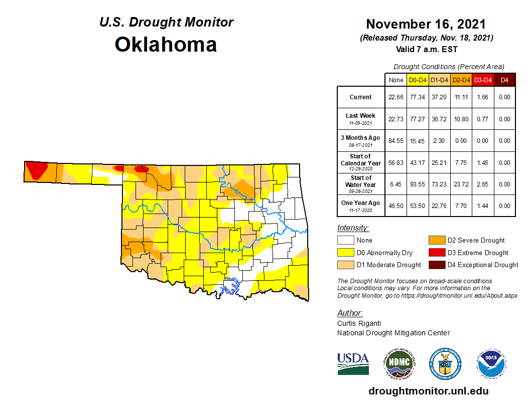
Okay, now for a completely opposite weather problem, looks like our drought
could use some rain/snow/sleet. The situation out west continues to worsen as
a look at the latest Drought Monitor shows. We did ask for a substantial increase
in that D3 (Extreme) drought in the western Panhandle, graciously given to us
by the national Drought Monitor author. Other areas saw a bit of worsening,
whilst areas of eastern OK are looking better.
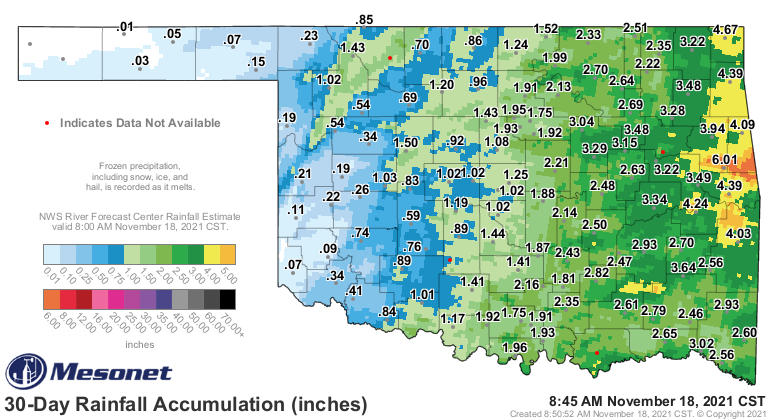
This is being driven by both long-term and short-term rain deficits and surpluses,
but the last 30 days are indicative of the impacts.
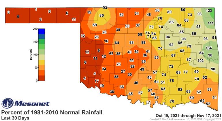
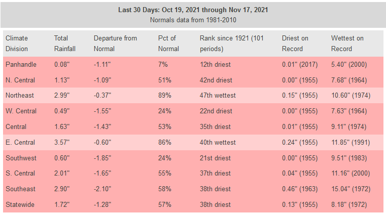
Even worse in the western panhandle.
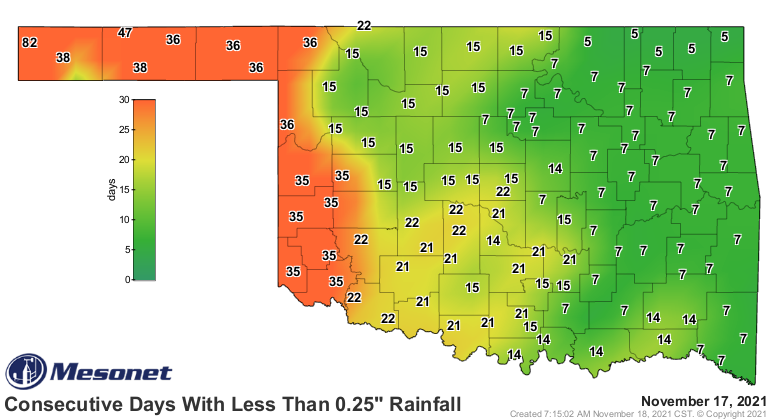
Not good, and things aren't looking up just yet. There is some indication of a
closed low developing out to our west next week, which would send smaller
systems out our way for multiple chances for precip, but again, that's ALSO
in the fantasycast territory. And remember, a closed low = weatherperson's woe.
Also weatherperson's woe is eating Taco Bell late at night. Well, at least THIS
weatherperson. Maybe if I called myself a climateperson I could pull it off.
Too scared to try.
The Climate Prediction Center's outlooks for December and again the December-
February period are not hopeful for western Oklahoma, mostly a consequence of
our current La Nina bugging up the works.
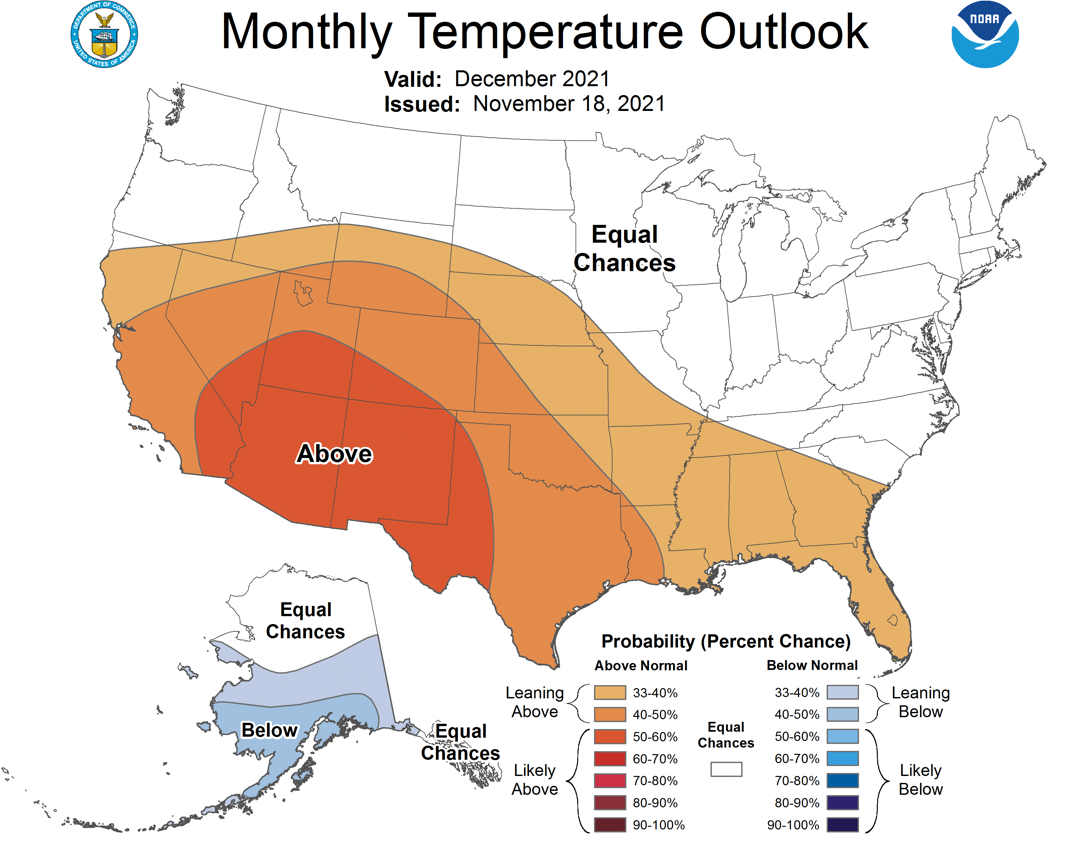
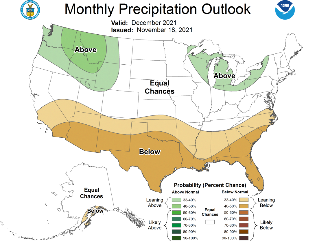
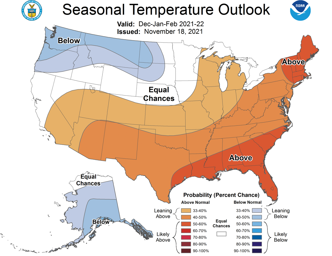
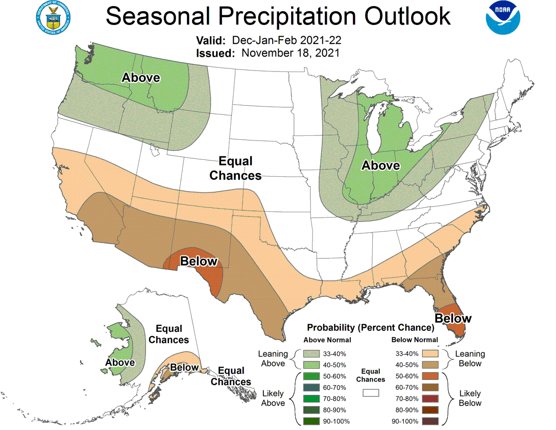
So increased odds of below normal precip and temps for the entire state for
December. Then for the winter (Dec-Feb), we see increased odds of above normal
temps for all of Oklahoma, but below normal precip is only favored across western
OK.
That leaves us with a rather depressing drought outlook, with drought persisting
where it already exists across the entire state, but developing and intensifying
across the western quarter or so of Oklahoma.
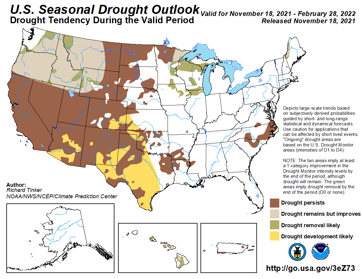
Remember, these are merely outlooks and don't account for extreme events, or
any type of precip that might fall. In other words, these outlooks don't say
we'd get rain instead of snow or ice, nor do they account for a 40-inch snowfall
event on January 23, 2022, if it should occur.
And any 40-inch snowfall amount will automatically be rounded down to 35 inches
so my hometown of Buffalo, OK, would keep the record snowstorm total of 36 inches
from Feb. 1971.
But, I don't think that's going to happen. So let's have fun with the forecast
while we can. At least it's a little more exciting to think about than just
another week of a big old zilch like my comb has to put up with.
Gary McManus
State Fantasycaster
Oklahoma Mesonet
Oklahoma Climatological Survey
gmcmanus@mesonet.org
November 18 in Mesonet History
| Record | Value | Station | Year |
|---|---|---|---|
| Maximum Temperature | 89°F | ANT2 | 2025 |
| Minimum Temperature | 8°F | NOWA | 2014 |
| Maximum Rainfall | 2.95″ | ARNE | 2024 |
Mesonet records begin in 1994.
Search by Date
If you're a bit off, don't worry, because just like horseshoes, “almost” counts on the Ticker website!