Ticker for September 28, 2021
MESONET TICKER ... MESONET TICKER ... MESONET TICKER ... MESONET TICKER ...
September 28, 2021 September 28, 2021 September 28, 2021 September 28, 2021
AUGH!
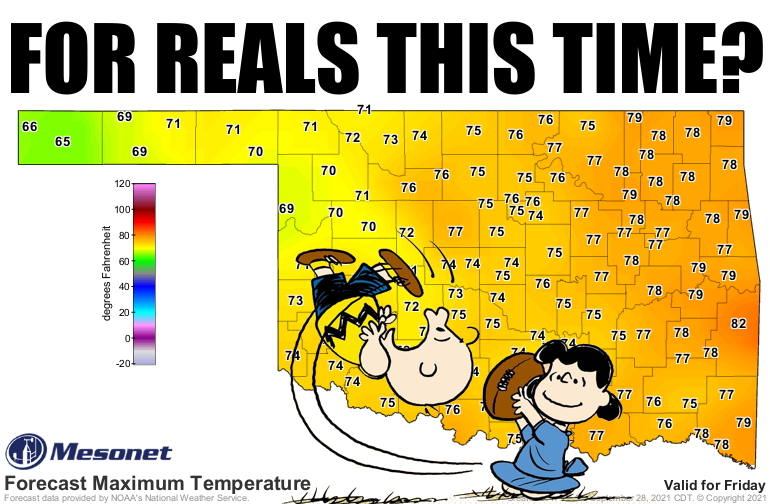
AUGH? I'm an "ARGH!" guy (Mateys), but the exclamation AND question remains the
same: is this real fall, or fake fall? We've had 2 or 3 fake falls already--oddly,
in July. This is going to be our first extended cooldown since we actually entered
the season, be it climatological fall on Sept. 1 or astronomical fall on Sept. 23.
Then there's astrological fall, on which that start date something big is going
to happen in your life, and an unexpected invitation from a friend could have you
taking a short trip, but also an old friend you may not have seen for a long time
could come to visit.
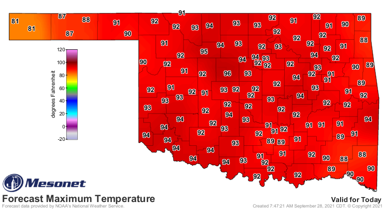
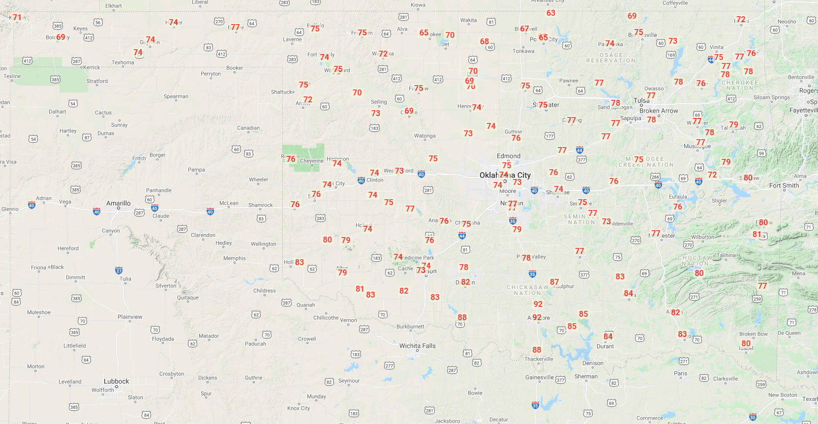
Today's would read like a horrorscope (I see what I did there!), because it's
gonna feel like August 28.
Tomorrow will be warm, probably still a bit above normal, and then we see that
front on Thursday and our plunge down to seasonal weather through the weekend.
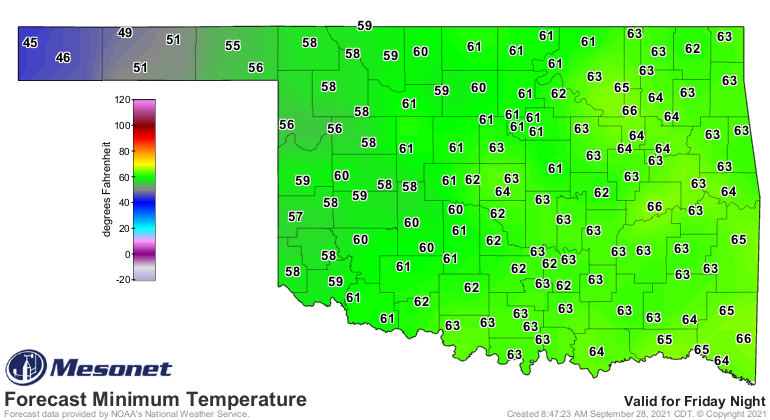
That plunge is gonna be helped by lots of clouds and occasional showers and
storms, but that'll also keep those low temperatures up. Maybe some 40s in the
Panhandle, but 50s and 60s for most after highs in the 70s.
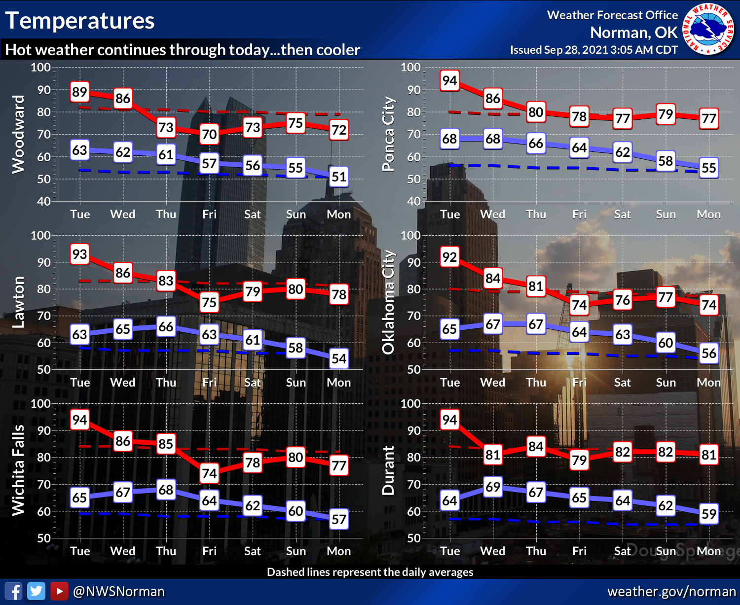
The lowest lows I can see so far are on Saturday morning.
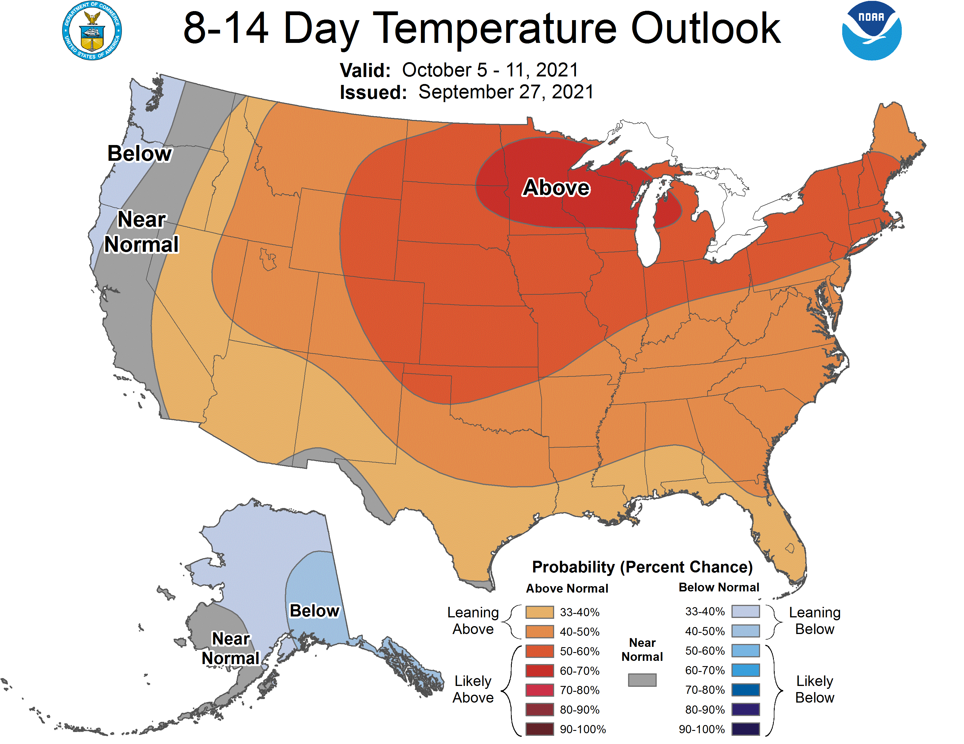
As we look towards next week, it does look like the pattern might switch right
back to above normal territory, but that doesn't mean a switch back to summer
like we've seen the last month and a half, because above normal in early
October when the highs are "normally" in the upper 70s could just be in the low
80s.
We can't get TOO cocky about fall just yet, obviously. OKC's latest 90 was
Oct. 26, way back in 1891 (92 degrees, actually), but its earliest "last 90"
was Aug. 30, 1906. Their mean last 90 (I happen to think 90s are nice, but that's
not what "mean" means here) is Sept. 27, so maybe we're right on track for the
center of the state. Tulsa's latest was Oct. 30, 1937, and earliest last was
Aug. 28 with a mean of Sept. 30. Altus had latest last 90 on Nov. 9, 1988, but
before we ooh and ahh, consider that Ardmore registered 92 degres on Dec. 30,
1951...the latest in state history. What a glorious day that must have been!
That was a lot of work to tell you that it's gonna cool down later this week,
probably warm up again next week, but maybe not as high as recently, but we
can't rule that out, and we've seen the final arbitrary level of 90 degrees both
earlier and later than now.
Does that about cover it?
Good. Let me leave you with a weather horoscope: You will have the weather of
your dreams, soon, and it will be glorious. And then you will wake up and
remember you are in Oklahoma, and your dreams of glorious weather will be
shattered.
Salutation and the best to you, Elon Musk, or whatever it is you say at the end
of horoscopes.
Gary McManus
State Climatologist
Oklahoma Mesonet
Oklahoma Climatological Survey
(405) 325-2253
gmcmanus@mesonet.org
September 28 in Mesonet History
| Record | Value | Station | Year |
|---|---|---|---|
| Maximum Temperature | 100°F | WALT | 1998 |
| Minimum Temperature | 35°F | KENT | 2006 |
| Maximum Rainfall | 3.03 inches | SEIL | 2013 |
Mesonet records begin in 1994.
Search by Date
If you're a bit off, don't worry, because just like horseshoes, “almost” counts on the Ticker website!