Ticker for September 1, 2021
MESONET TICKER ... MESONET TICKER ... MESONET TICKER ... MESONET TICKER ...
September 1, 2021 September 1, 2021 September 1, 2021 September 1, 2021
A Major Disturbance
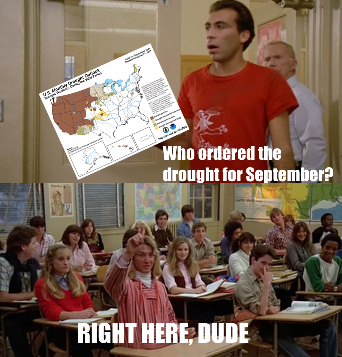
Uh oh, let's take a closer look at that pizza there.
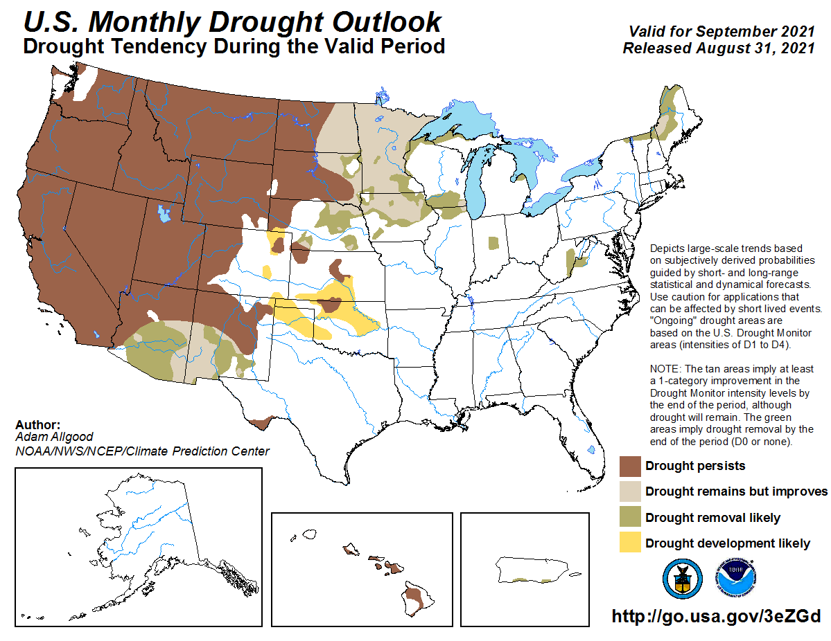
Yeah, I thought so. The September drought outlook from CPC shows drought
development as being "likely" across much of the northern half of the state. Of
course I'd much rather be learning about Cuba and having some food, but we're
on dangerous ground here. Drought is causing a major disturbance on MY time.
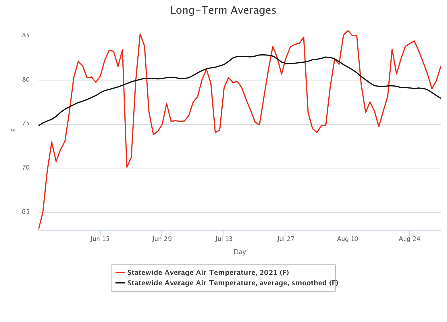
You can see the reason for the drought worries below in the August monthly
summary. We're actually in dangerous FLASH DROUGHT territory with the extended
period of dry, hot weather we've had to finish August. It's quite a change from
what we've seen all summer, really, or at least since mid-June.
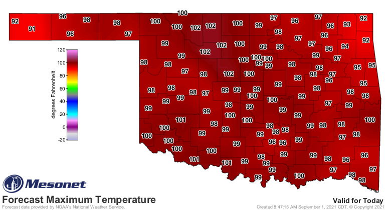
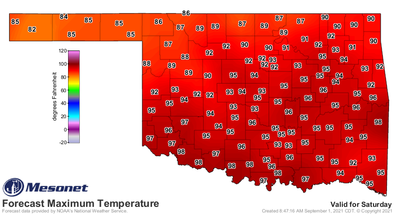
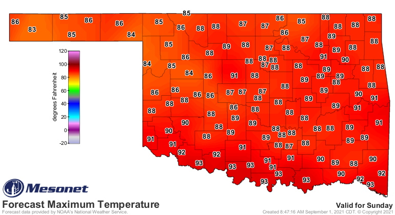
With today possibly being the hottest day of the year for some parts of the
state, not much to look forward to until the weekend. At that point, we could
see a cool front push into the state and bring us some pretty good rain chances
after a few dances with showers possible up north tomorrow and Friday. Oh,
and maybe some cooler weather for the weekend as well!
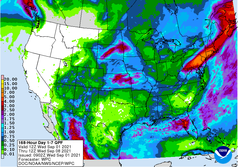
There is some hope for next week that we'll see the heat dome retreat for just
a bit before it returns. If that happens, maybe some mild, wet weather for a
bit? The 7-day rain forecast has hopes for northern OK, and if we can get that
to spread a bit farther south, maybe we can allay the drought fears for a few
weeks until we start to see the jet stream dip down our way a bit more and kick
up our minor fall rainy season.
It is actually OUR time, right? But it's Mother Nature's class.
Now, back to August and beyond!
----------------------------------------------------------------------------------
Drought Returns During Arid August
Sept. 1, 2021
A run of hot, dry weather finished off climatological summer in true Oklahoma
fashion following a delightfully mild first two months of the season. There was
very little in the way of severe weather during the month, just a smattering of
hail and high wind reports scattered about the state. A hazard of another kind
managed to flourish in the arid conditions, however, with drought once again
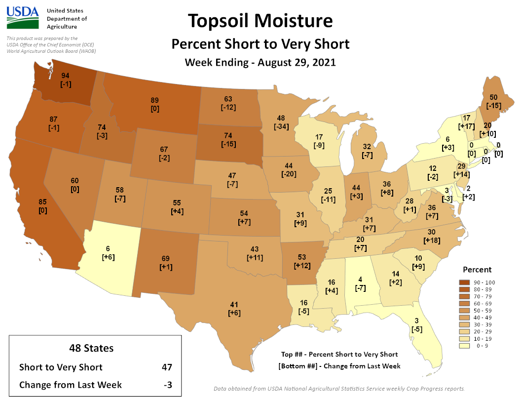
gaining a toehold across parts of northwestern Oklahoma. The USDA indicated 43%
of the state’s topsoil was considered short to very short of moisture by the
end of the month. Reports of withered crops and depleted ponds began to multiply
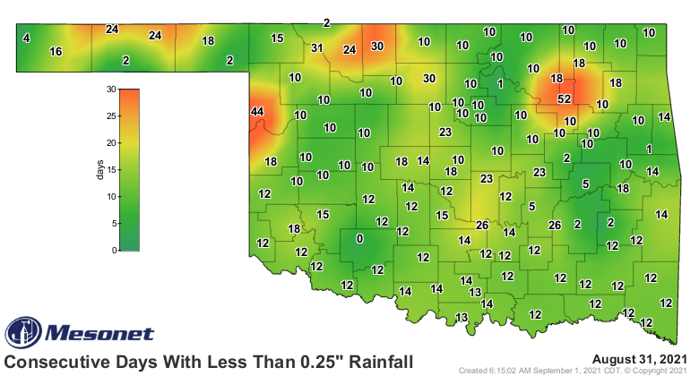
in areas plagued by the extended dry weather. Some areas had gone nearly 2
months without a single day with at least a quarter-inch of rainfall.
According to preliminary data from the Oklahoma Mesonet, the statewide average
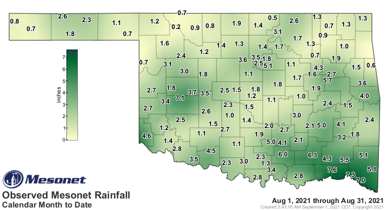
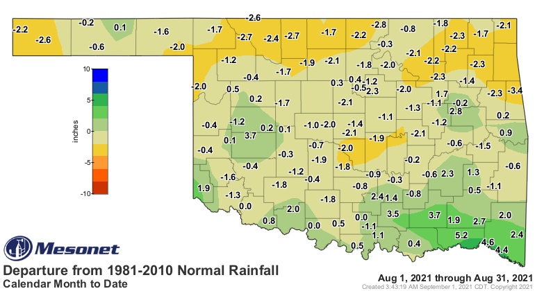
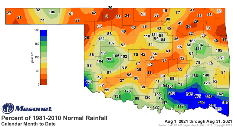
precipitation total for the month finished at 2.44 inches, 0.79 inches below
normal and ranked as the 51st driest August since records began in 1895.
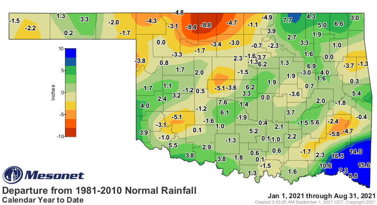
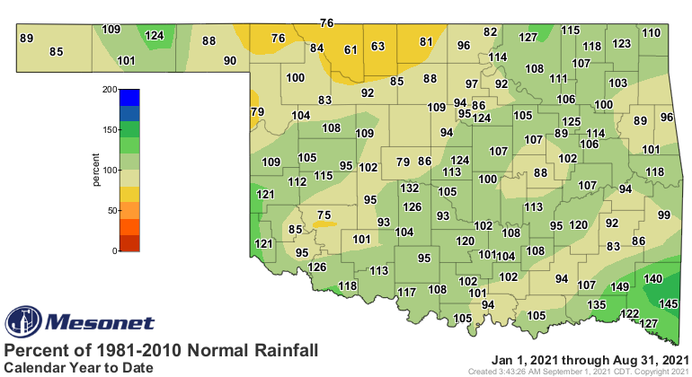
Deficits of 1-3 inches were common across the northern one-third of the state,
while surplus amounts of 2-5 inches were found along Oklahoma’s southern border.
Most sites fell below normal by 1-2 inches, in general. The Mesonet site at Hugo
led the state with 7.63 inches during August, a surplus of 5.2 inches. Freedom
brought up the rear with 0.24 inches, 2.7 inches below normal. The
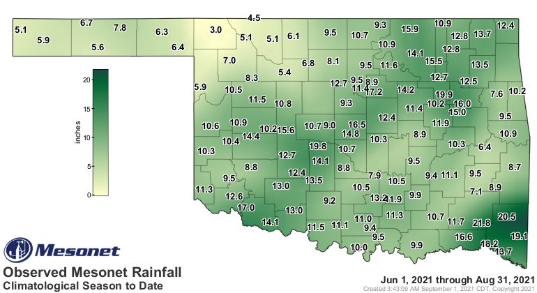
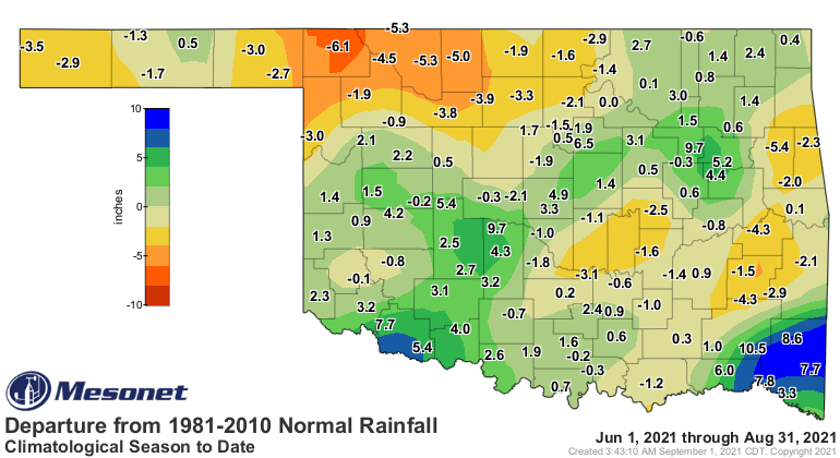
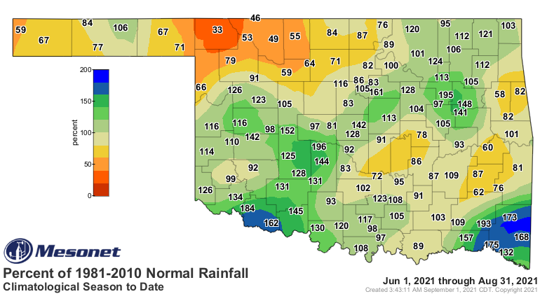
climatological summer—June 1 through Aug. 31—was 0.09 inches below normal
statewide with an average of 10.6 inches, the 44th wettest such period on
record. Significant dryness was evident across northern Oklahoma during summer
with deficits of 3-6 inches common from the western Panhandle through north
central regions. The Mesonet site at Cloudy in far southeastern Oklahoma led the
summer months with 21.8 inches of rain for a surplus of 10.5 inches. Buffalo’s
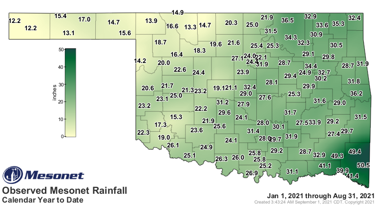
summer total of 3 inches was 6.1 inches below normal. The first 8 months of the
year saw an average surplus of only 0.42 inches across the state at 25.67
inches, the 42nd wettest January-August on record.
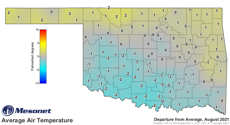
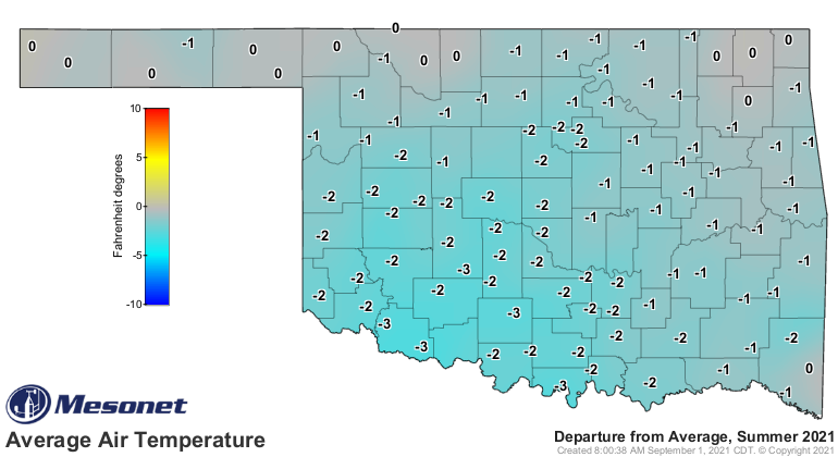
The statewide average temperature came in at 80.8 degrees, exactly normal for
the month and ranked as the 62nd warmest August since records began in 1895.
Some areas of the state were significantly warmer than others. The Panhandle
was 1.2 degrees above normal for the month, the 41st warmest August on record
for that area of the state, while south central Oklahoma enjoyed their 43rd
coolest at 1.1 degrees below normal. The month’s highest reading of 106 degrees
occurred at Beaver and Hooker on the 24th and again at Alva on the 25th. Heat
index values reached as high as 113 degrees at Okmulgee and Porter, and the
Mesonet’s 120 sites recorded values of at least 110 degrees 86 times throughout
the month. The lowest actual air temperature reading was 52 degrees from Kenton
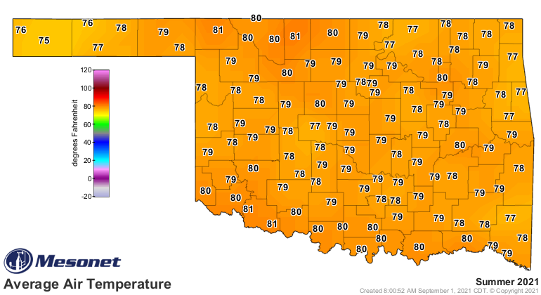
on Aug. 5. The summer finished at 79.4 degrees, 0.7 degrees below normal and
ranked as the 48th coolest June-August period on record. The highest
temperature of the summer was 107 degrees, reported at both Eva and Goodwell on
June 23, and the lowest was Boise City’s 47 degrees back on June 2. The year
remained solidly on the cool side at 61.1 degrees, 1.6 degrees below normal and
the 34th coolest January-August on record.

Drought increased from just over 1% of the state at the end of July to nearly
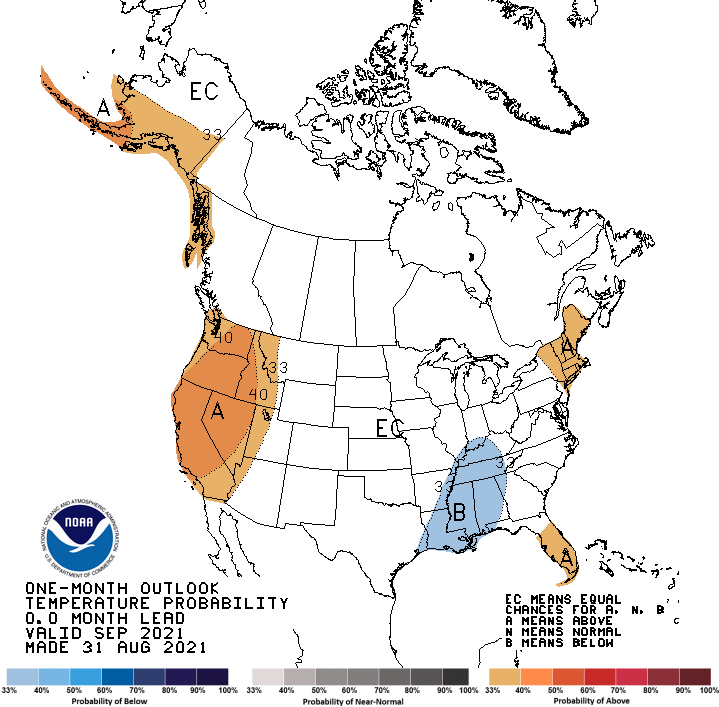
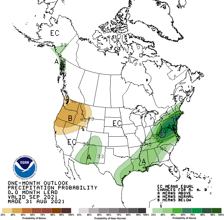
5% to end August. The latest outlooks from the Climate Prediction Center show
equal chances for above-, below-, and near-normal precipitation and temperature
values across the entire state for September. Despite the lack of a clear
signal, the threat of more hot, dry weather in early September brought concerns
for more drought development. CPC’s September Drought Outlook deems drought
development “likely” through much of the Panhandle into southwest Oklahoma, and
northwestern down through east central Oklahoma. A larger area of existing
drought in the northwest is expected to persist through the month.

Gary McManus
State Climatologist
Oklahoma Mesonet
Oklahoma Climatological Survey
(405) 325-2253
gmcmanus@mesonet.org
September 1 in Mesonet History
| Record | Value | Station | Year |
|---|---|---|---|
| Maximum Temperature | 110°F | WAUR | 2000 |
| Minimum Temperature | 49°F | GOOD | 2024 |
| Maximum Rainfall | 7.50″ | BYAR | 2020 |
Mesonet records begin in 1994.
Search by Date
If you're a bit off, don't worry, because just like horseshoes, “almost” counts on the Ticker website!