Ticker for August 2, 2021
MESONET TICKER ... MESONET TICKER ... MESONET TICKER ... MESONET TICKER ...
August 2, 2021 August 2, 2021 August 2, 2021 August 2, 2021
But it's a wet heat
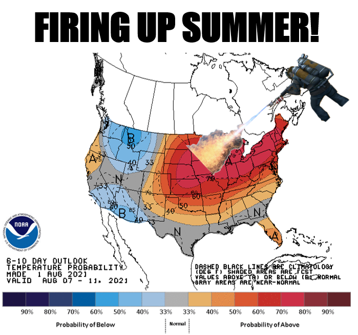
Hey, are ya like me? You know, devilishly handsome, witty, incredibly
intelligent, extremely humble, and prone to bouts of grandiose narcissism and
megalomania? Good! Then you too know that we will now start our slow march to
fall, but sometimes fast and sometimes even slower than slow until we finally
see our first frosty air sometime around Octvember. We lucked out for most of
July, although it was quite often way too steamy for my High Plains
sensibilities. We'll get to that below in the July summary. But let's talk about
now, shall we?
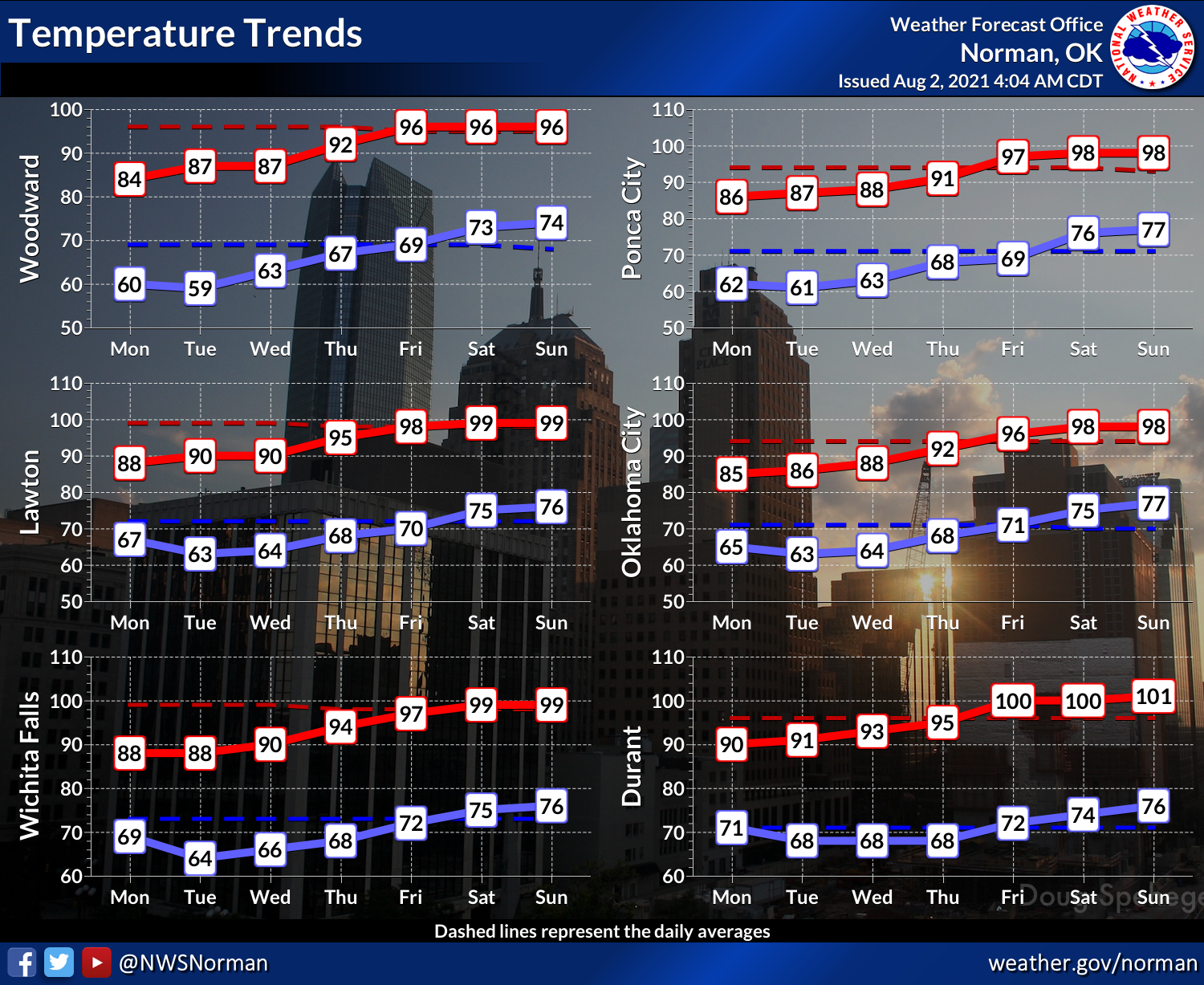
We should see another few days of deliciously and strangely mild early August
weather, then we'll start that slow trek upwards on the thermometer to more
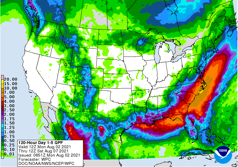
apropos temperatures for this time of year. Rain chances, for the first time in
a LONG time, appear close to nil for the next 7 days.
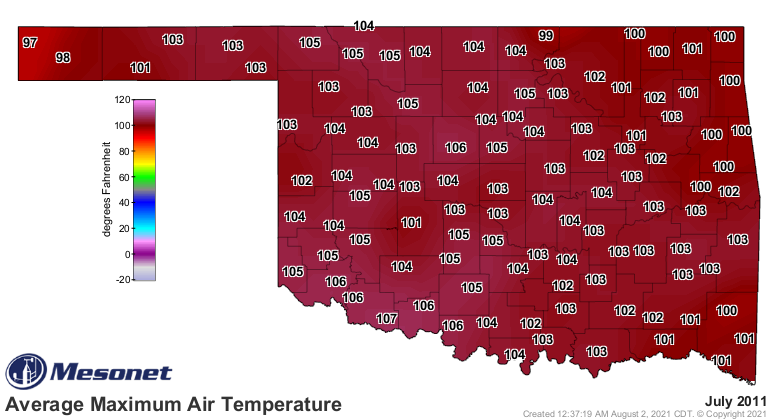
But before you feel too bad, just remember where we were a decade ago after the
grandiose (you keep using that word...I do not think it means what you think it
means) heat of that July. Remember, not only was it the hottest month by
statewide average for ANY calendar month for Oklahoma, but the hottest calendar
month for ANY STATE dating back to 1895 for which those data exist.
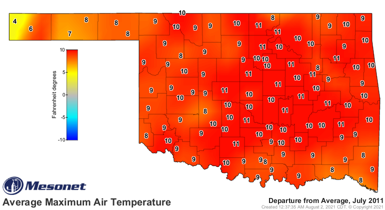
NOW read about this July's puny heat. And watch out for that six-fingered man.
---------------------------------------------------------------------------------
Summer Heat Scarce During July
Aug. 2, 2021
Oklahoma’s July was mild for the most part, and a bit wet for much of the state.
Extreme temperatures—at least as read on the thermometer—were in short supply,
but the pressure cooker heat due to high humidity seemed to be well stocked.
Severe weather did strike sporadically through the month, mostly in the form of
severe winds as is common to summer months in the Southern Plains. One tornado
touched down near Yale in Payne County on July 7, an EF-1 twister that damaged
homes and outbuildings. That brought 2021’s preliminary tornado total through
July to 25 according to the National Weather Service. Oklahoma has averaged 50
tornadoes during the first seven months of the year from 1951-2020, with an
annual average of 57.2 tornadoes.
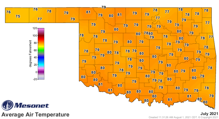
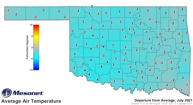
The statewide average temperature as measured by the Oklahoma Mesonet finished
at 79.5 degrees for the month, 2.4 degrees below normal and ranked as the 22nd
coolest July since records began in 1895. A decade previous in July 2011,
Oklahoma established its record highest statewide average monthly temperature
at 89.2 degrees. The mark was not only the highest for any Oklahoma calendar
month, but for any calendar month for any state since records began in 1895.
Oklahoma’s lowest monthly average temperature for July, 76.4 degrees, came in
both 1906 and 1950. Cherokee captured the highest reading for July 2021 at 103
degrees on the month’s final day, a somewhat tame extreme for an Oklahoma
summer month. Oppressive heat was still present thanks to the generous rains
that had fallen during the previous months. The Mesonet’s 120 sites hit triple
digits only 62 times during July but reached a heat index of at least 105
degrees 639 times, and 110 degrees 99 times. The lowest recorded July
temperature was 52 degrees from Eva on the 12th. The first seven months of the
year were 1.8 degrees below normal with a statewide average of 58.2 degrees,
the 26th coolest January-July period on record.
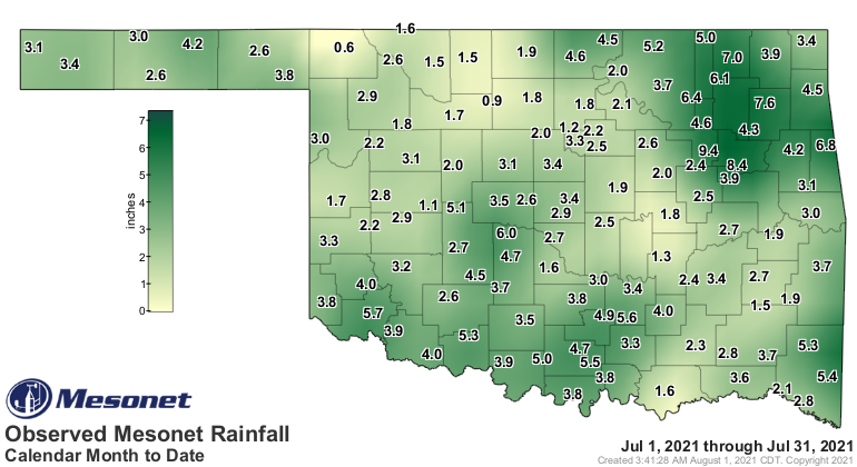
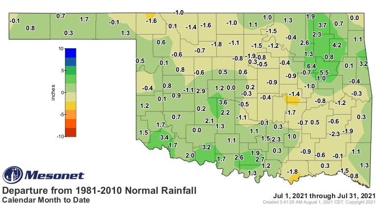
The statewide average rainfall total finished at 3.33 inches for the month,
0.13 inches above normal and ranked as the 47th wettest July since records
began in 1895. Heavier rains fell across northeastern and southwestern sections
of the state, with the southwest corner averaging 4.07 inches for the month,
its 13th wettest July on record. Northeastern Oklahoma’s average of 5.22 inches
ranked as the 22nd wettest on record. The Mesonet site at Bixby collected 9.38
inches to lead the state’s July rainfall tallies. Rains were not so plentiful
across northern Oklahoma, where Buffalo’s 0.62 inches was July’s lowest total.
A strip of Oklahoma from the northwest to the southeast experienced July
rainfall deficits of over an inch, while most areas to either side of that
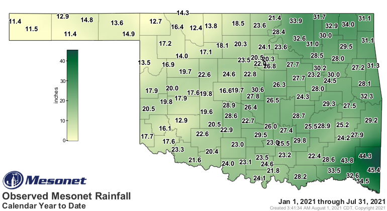
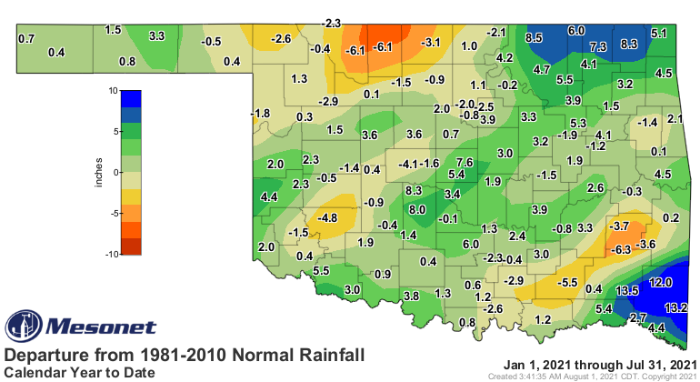
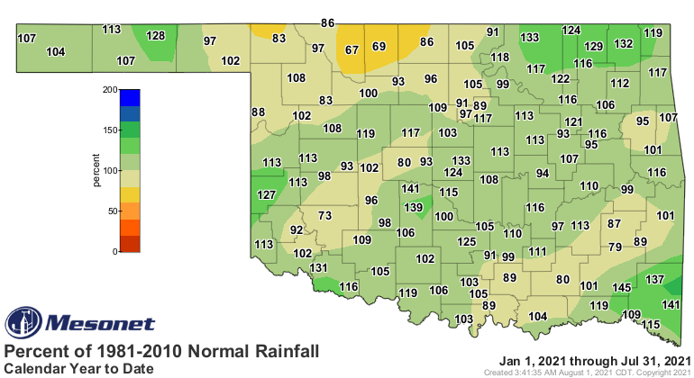
strip enjoyed surpluses of 1-4 inches. The first seven months of the year
remained on the wet side for nearly all of Oklahoma with a statewide average of
23.09 inches, 1.07 inches above normal and ranked as the 41st wettest
January-July on record. Deficits of 3-6 inches were evident across north
central and southeastern Oklahoma, as well as a localized region in the
southwest. Surpluses of 4-8 inches were common from central through
northeastern Oklahoma, ballooning to 12-14 inches across the far southeast.

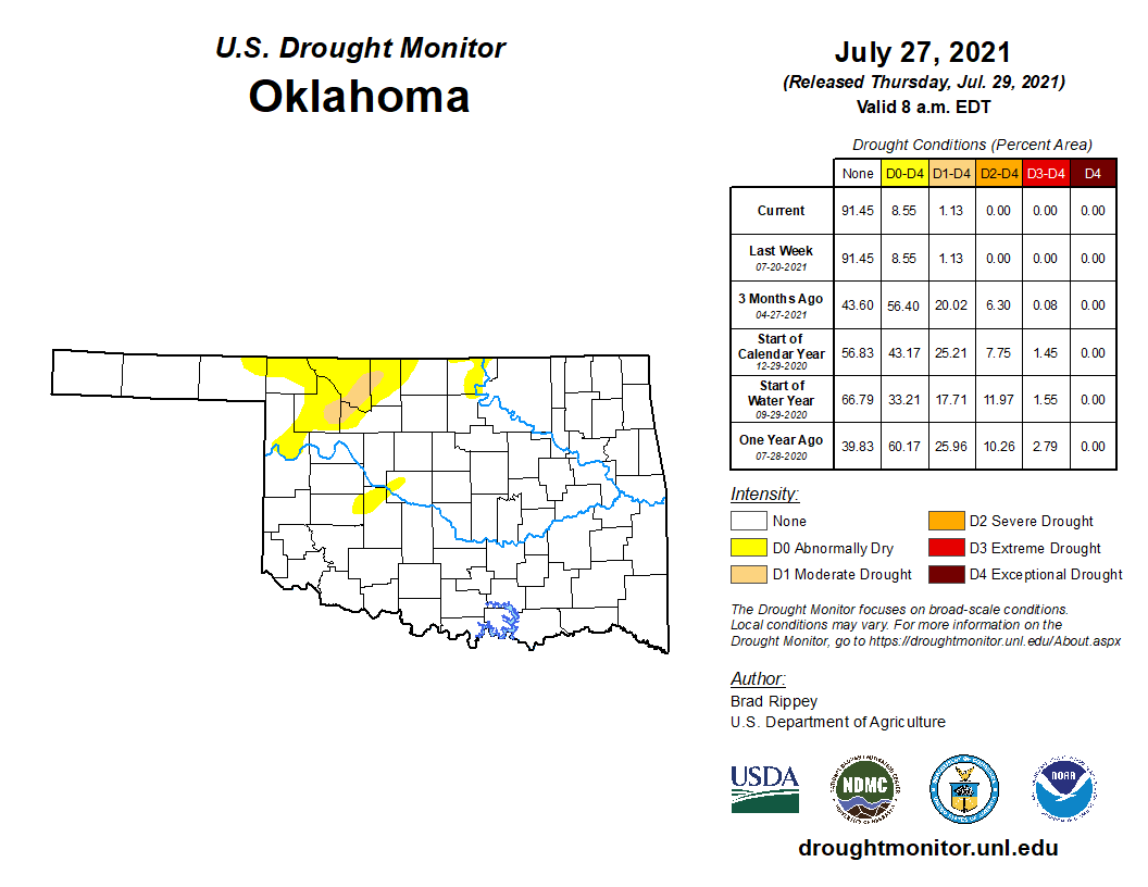
Drought coverage remained low with only 1.13 percent of the state considered to
be in drought at the end of July according to the U.S. Drought Monitor. A
little over 7 percent of the state remained in abnormally dry conditions at the
end of the month, mostly in far northwestern Oklahoma. That small area of
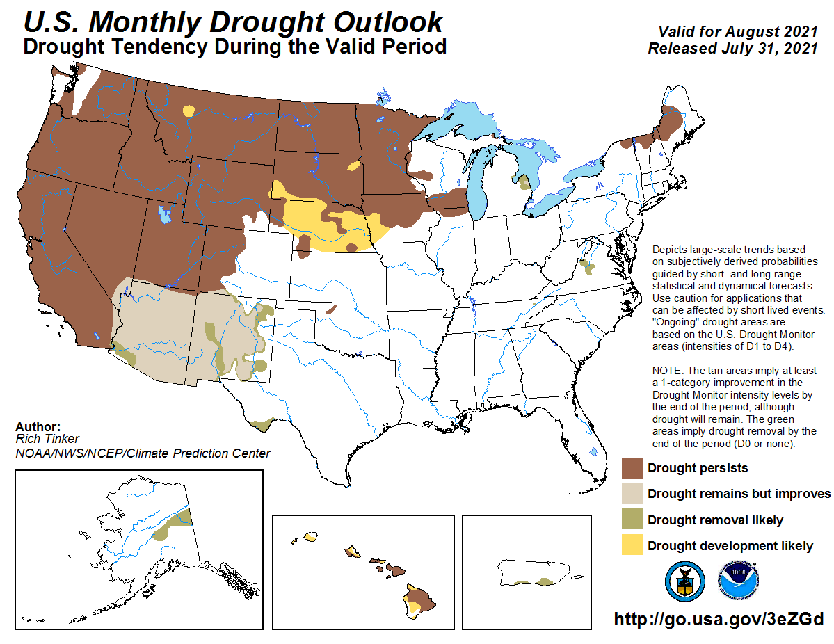
moderate drought in the northwest is expected to remain through August
according to the drought outlook from the Climate Prediction Center (CPC).
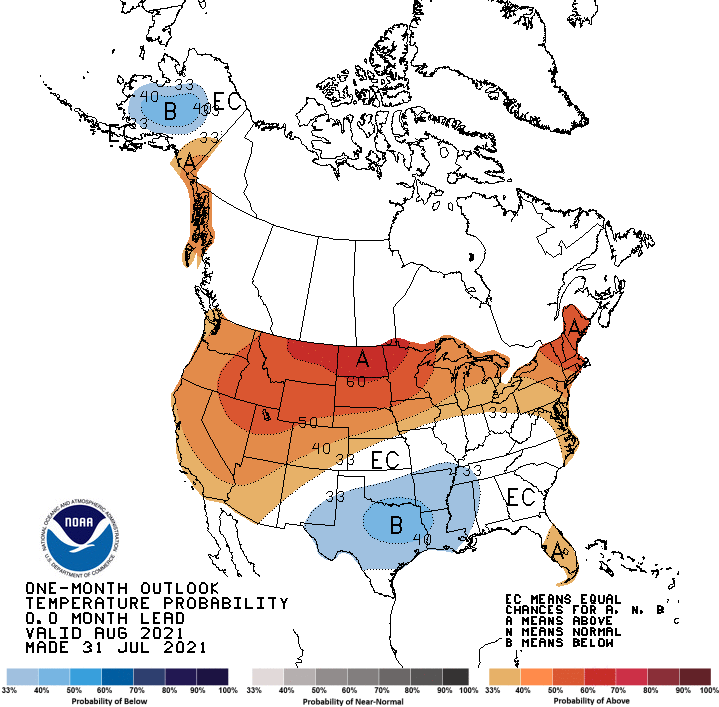
CPC’s August temperature outlook indicates increased odds of below normal
temperatures across the southeastern two-thirds of the state, but especially
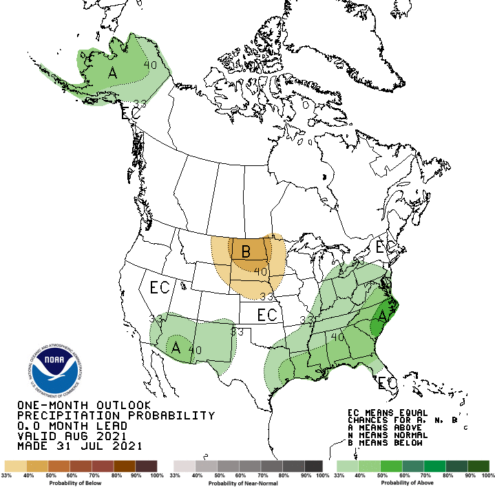
far southern Oklahoma. The precipitation outlook shows increased odds of above
normal precipitation across southeastern Oklahoma and the far western Panhandle.
Gary McManus
State Climatologist
Oklahoma Mesonet
Oklahoma Climatological Survey
(405) 325-2253
gmcmanus@mesonet.org
August 2 in Mesonet History
| Record | Value | Station | Year |
|---|---|---|---|
| Maximum Temperature | 114°F | KIN2 | 2012 |
| Minimum Temperature | 51°F | BURB | 2009 |
| Maximum Rainfall | 6.63″ | HOLL | 1995 |
Mesonet records begin in 1994.
Search by Date
If you're a bit off, don't worry, because just like horseshoes, “almost” counts on the Ticker website!