Ticker for May 17, 2021
MESONET TICKER ... MESONET TICKER ... MESONET TICKER ... MESONET TICKER ...
May 17, 2021 May 17, 2021 May 17, 2021 May 17, 2021
Nice try
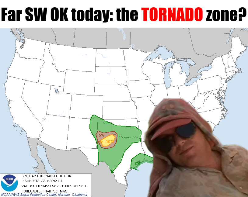
Yeah, nice try. You thought I'd use Dusty from "Twister" since it's the 25th
anniversary of its release and meme "The Suck Zone" somehow. No chance I'm giving
you hooligans to make any word plays on that! But the chance for tornadoes is
there today across far SW OK, but more so over into NW TX. The chance for big
hail is definitely there today, and so is a bit of a wind threat. And as always,
this could change (for better, for worse) as we go through the day, so stay
tuned (no, not to us, to your favorite NWS and/or media source!).
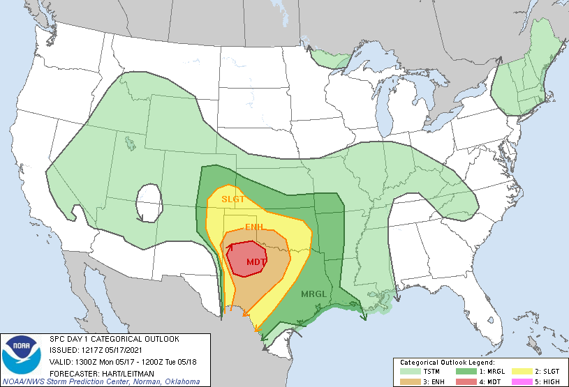
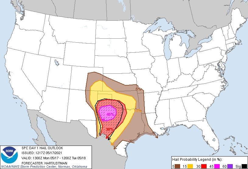
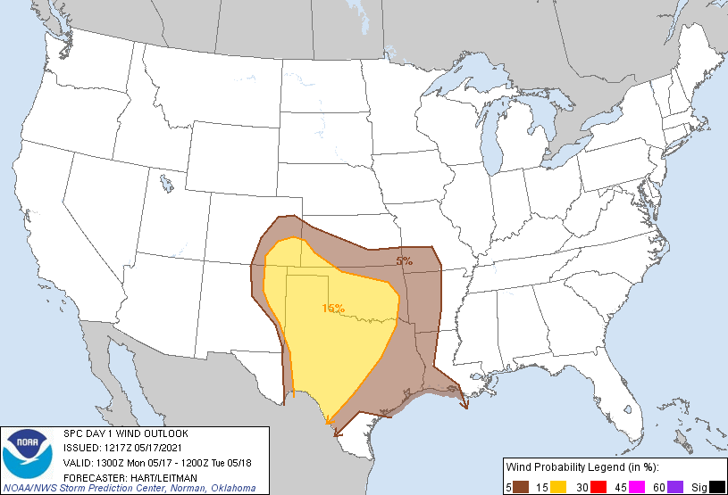
The weather setup is basically a closed low (weatherperson's woe!) spinning out
to our west, throwing out small vort-maxes (I would tell ya, but then I'd have to
kill ya...with more bad puns) or storm systems in the flow. Each one of those
smaller storm systems will interact with our moisture-rich environment to set
off more showers and storms. So tomorrow will also have a chance for a bit of
severe weather, but definitely doesn't appear like the high-end day that it
was looking like last week.
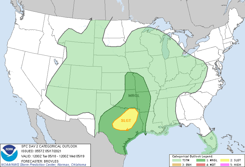
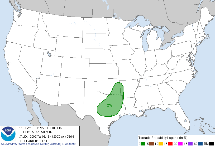

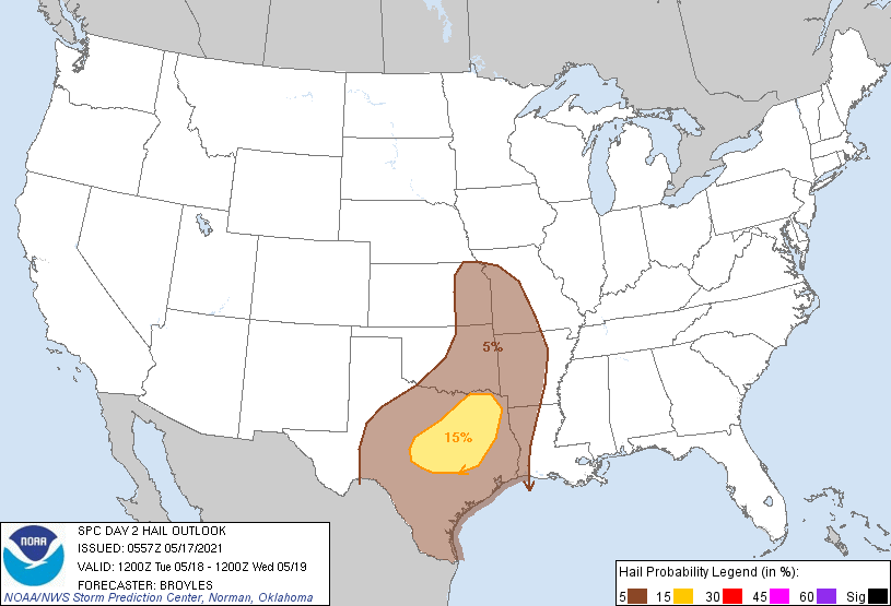
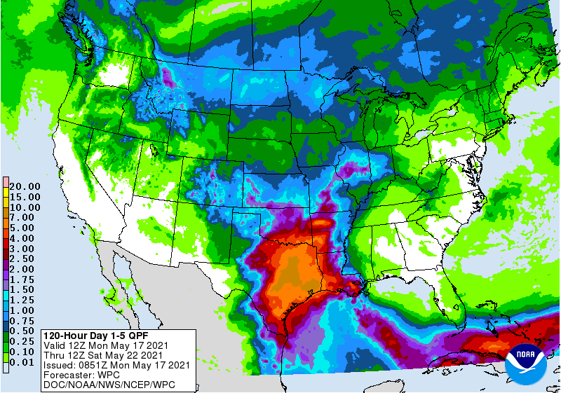
The even bigger threat looks like the heavy rainfall and flooding threat. Given
the juicy atmosphere, and the closed low spinning to our west, the accumulated
rainfall and training storms (storms forming and moving over the same location
repeatedly) in areas already water-logged from previous rains will probably
cause some problems over the next several days. Here is some more info on
that threat, including a flash flood watch through Thursday, as we could still
see another 2-4 inches of rain with even higher amounts locally.

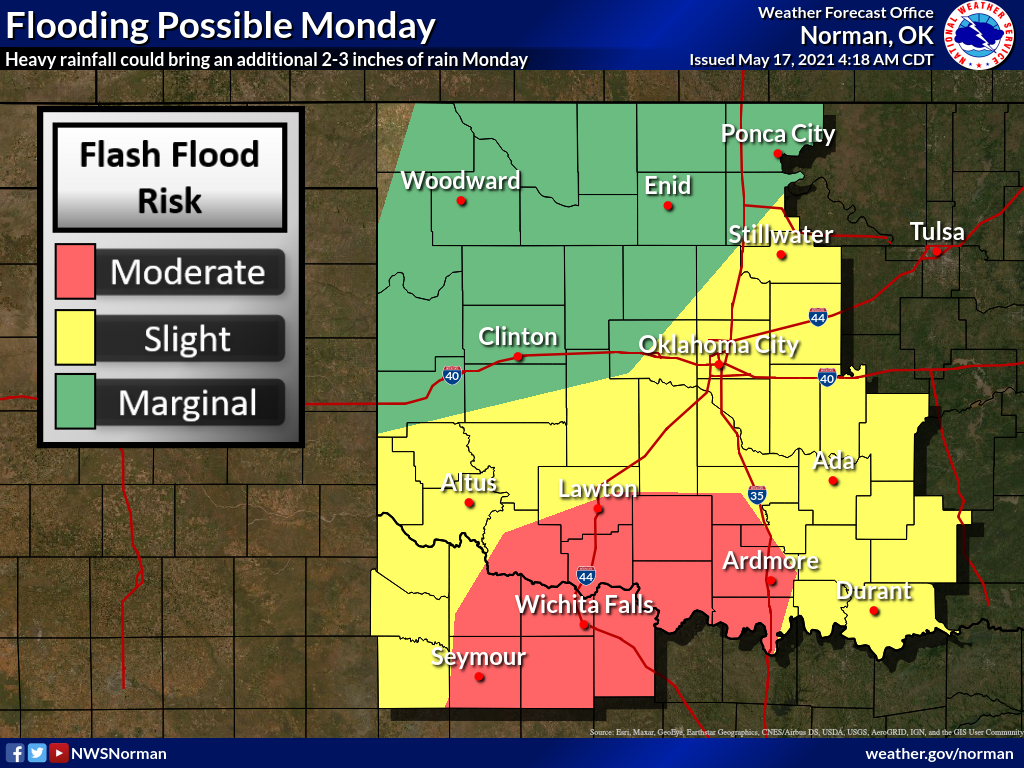
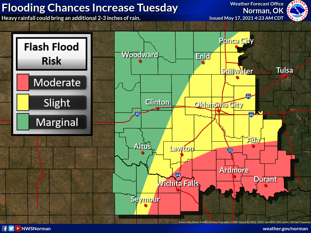
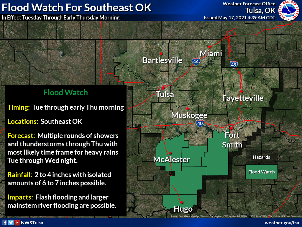
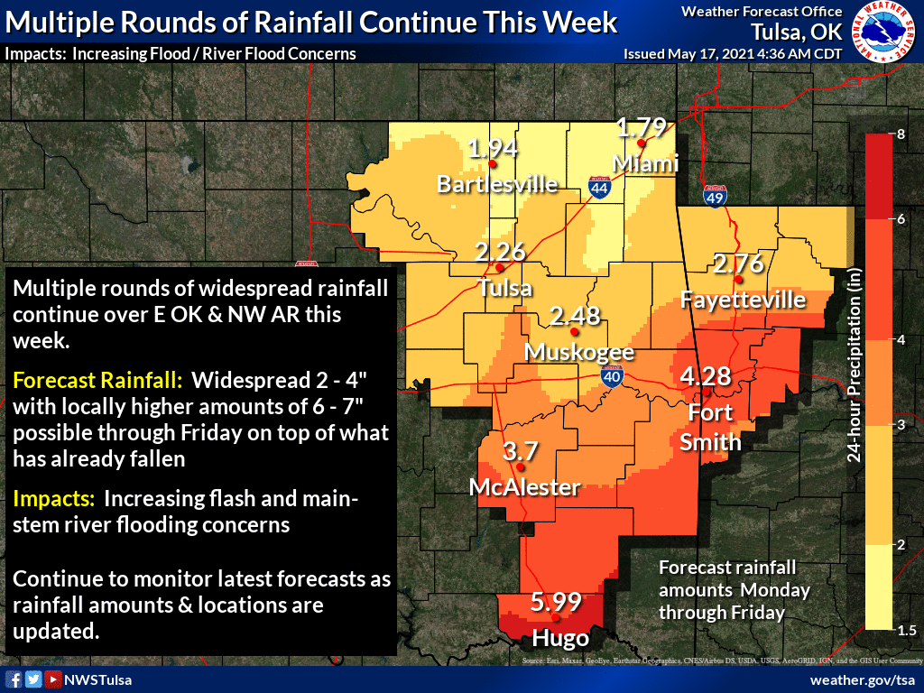
We've had some areas down there in south central OK that have already seen 2-3
inches of rain over the last couple of days, so more rain will definitely cause
problems. Not much in NW OK yet, or far east central OK, that will probably
change over the next couple of days.
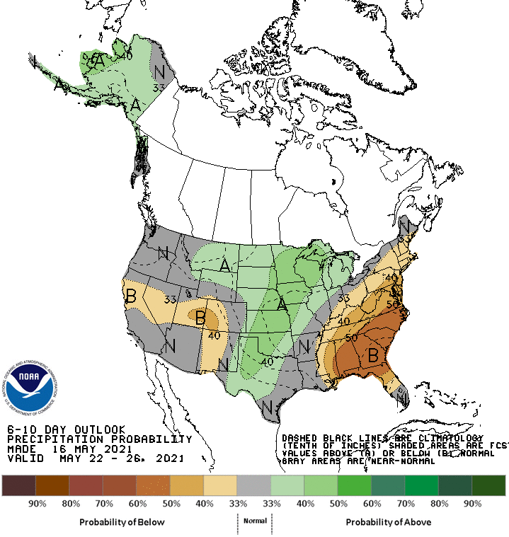
Oh, next week might be wet too, so stay tuned, part 2.
Gary McManus
State Climatologist
Oklahoma Mesonet
Oklahoma Climatological Survey
(405) 325-2253
gmcmanus@mesonet.org
May 17 in Mesonet History
| Record | Value | Station | Year |
|---|---|---|---|
| Maximum Temperature | 101°F | HOLL | 2022 |
| Minimum Temperature | 37°F | CAMA | 2009 |
| Maximum Rainfall | 3.66 inches | PORT | 2002 |
Mesonet records begin in 1994.
Search by Date
If you're a bit off, don't worry, because just like horseshoes, “almost” counts on the Ticker website!