Ticker for May 13, 2021
MESONET TICKER ... MESONET TICKER ... MESONET TICKER ... MESONET TICKER ...
May 13, 2021 May 13, 2021 May 13, 2021 May 13, 2021
Here comes May!
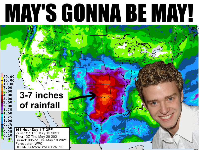
Mays are like this sometimes...you go through BLAH and all of a sudden it springs
(see what I did there?) on you all of a sudden. With virtually no severe weather
season thus far due to a variety of factors--cold weather is mostly to blame--that
has also meant less rain across parts of the state. And I know that there has
been SOME severe weather, and if you have been hit with the hail, high winds, or
even tornadoes that have dropped, then it's been a REALLY severe severe season.
But in general, it has been pretty benign. I'm not sure exactly how many tornadoes
there have been this year...maybe 10? But four of those dropped in January. Over
the last 30 days, the northwestern quarter-to-half of the state has really
started to dry out.
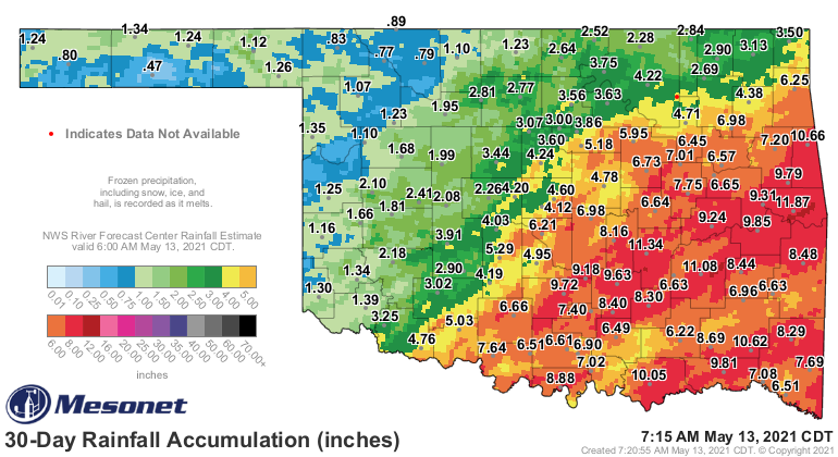
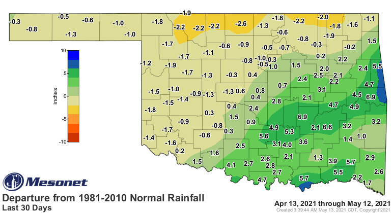
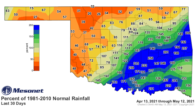
And that has led to the threat of more drought. I can't grab the official new
Drought Monitor map this morning since the site is undergoing a denial of
service attack of some sort, but here is a draft copy (we get draft copies
during the week so we can help the national Drought Monitor author fine tune
the depiction for our state).
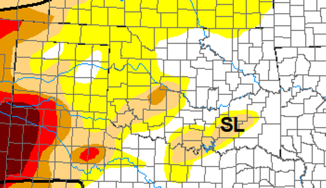
It ain't pretty, but it'll work. The site should be back up shortly if you want
to check back for the official map.
https://droughtmonitor.unl.edu/
So now we enter a more active period of typical May weather with a chance of
storms starting tonight and really extending deep into next week. Our local
NWS offices are starting to put the word out. There are still a lot of what ifs
with the upcoming weather setup in trying to determine if we're due for high-end
severe weather, but it does look like flooding could be a problem with several
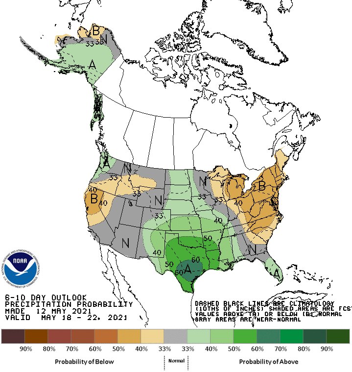
rounds of robust rains. The CPC outlook for next week sees a chance for
above normal rainfall, which for May would mean some pretty heavy rains,
possibly.
So sit back and enjoy the boat show, if you can. It would be nice to transport
some of those forecast heavy rains to the northwest, but Mother Nature might
do that anyway as the weather setup evolves.
Anyway, time to put on your May weather preparedness thinking caps now, instead
of waiting to see if we have trouble brewing next week.
Gary McManus
State Climatologist
Oklahoma Mesonet
Oklahoma Climatological Survey
(405) 325-2253
gmcmanus@mesonet.org
May 13 in Mesonet History
| Record | Value | Station | Year |
|---|---|---|---|
| Maximum Temperature | 101°F | ALTU | 2025 |
| Minimum Temperature | 30°F | BOIS | 2000 |
| Maximum Rainfall | 4.41 inches | JAYX | 2004 |
Mesonet records begin in 1994.
Search by Date
If you're a bit off, don't worry, because just like horseshoes, “almost” counts on the Ticker website!