Ticker for May 6, 2021
MESONET TICKER ... MESONET TICKER ... MESONET TICKER ... MESONET TICKER ...
May 6, 2021 May 6, 2021 May 6, 2021 May 6, 2021
For real now

Oh yeah? Well if YOU can find another word for "cold" that sounds like
"infatuation" then more power to ya! And yes, that guy used to be one of the
biggest rock stars in the world. And that hair. (Sigh). Another cold front is
headed our way, trying to put yet another damper on our transition to warm spring
from cool spring. I've Ticked about this for years, but May 5 is what I used to
call "Warm Up Day," since it seemed back in the day that was the time period
it would get warm and STAY warm until October (or December). Not this year. It
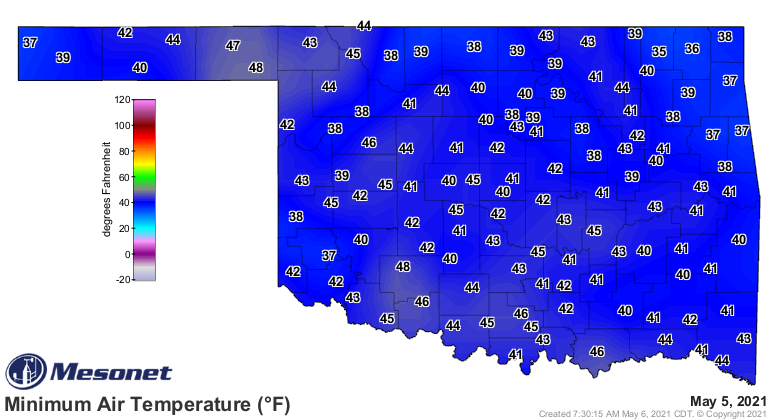
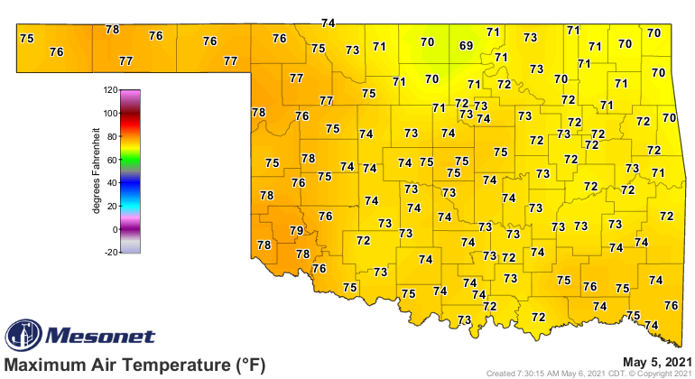
was foolishly cool(ishly) yesterday for some...probably had some frost in some
areas. The highs were okay, I guess. I was expecting more 80s by this point.
Speaking of 80s, that guy was married to supermodels in the 80s. Probably his
hair. Anyway...
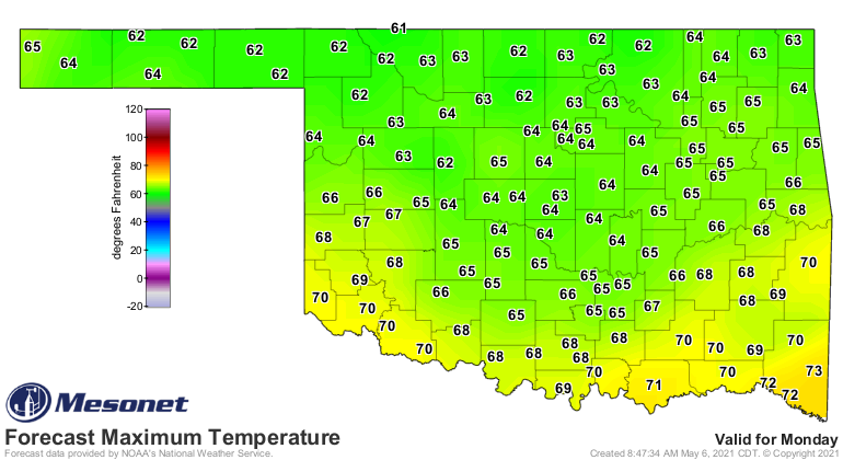
Watch for highs after the next big front on Saturday night/Sunday to drop us
back into late March territory with highs in the 60s and lows in the 40s. MIGHT
be some 30s thrown in there.
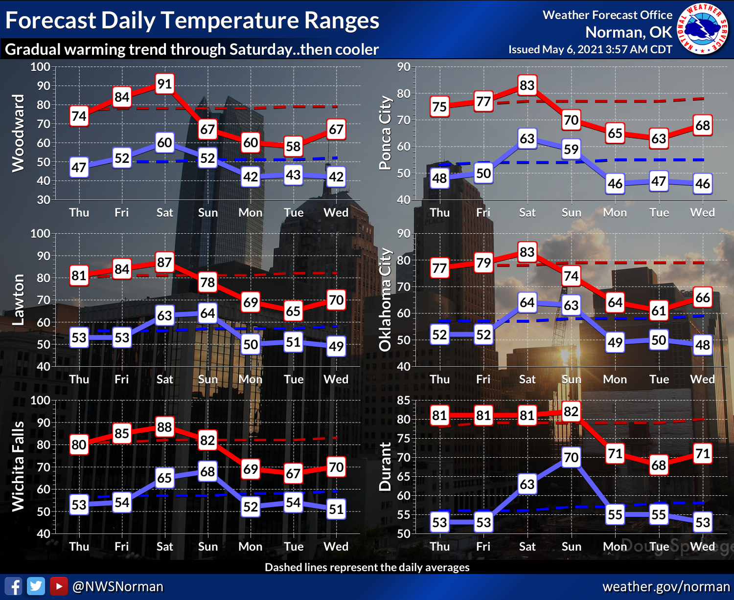

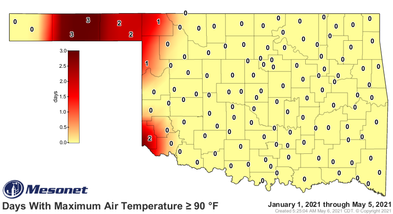
Another period with temperatures 10-15 degrees below normal. We haven't even
been able to get a good run of 90s together this year.
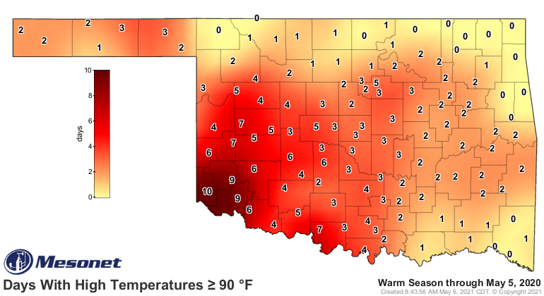
Last year we had a deliciously long period of 90s worked up already. And
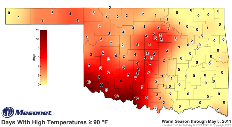
compared to our heat-filled spring/summers of 2011 and 2012, not even in the
same ballpark (which is a good thing).

Oh well, someday it will get warm and STAY warm. Mark my words. Word my marks,
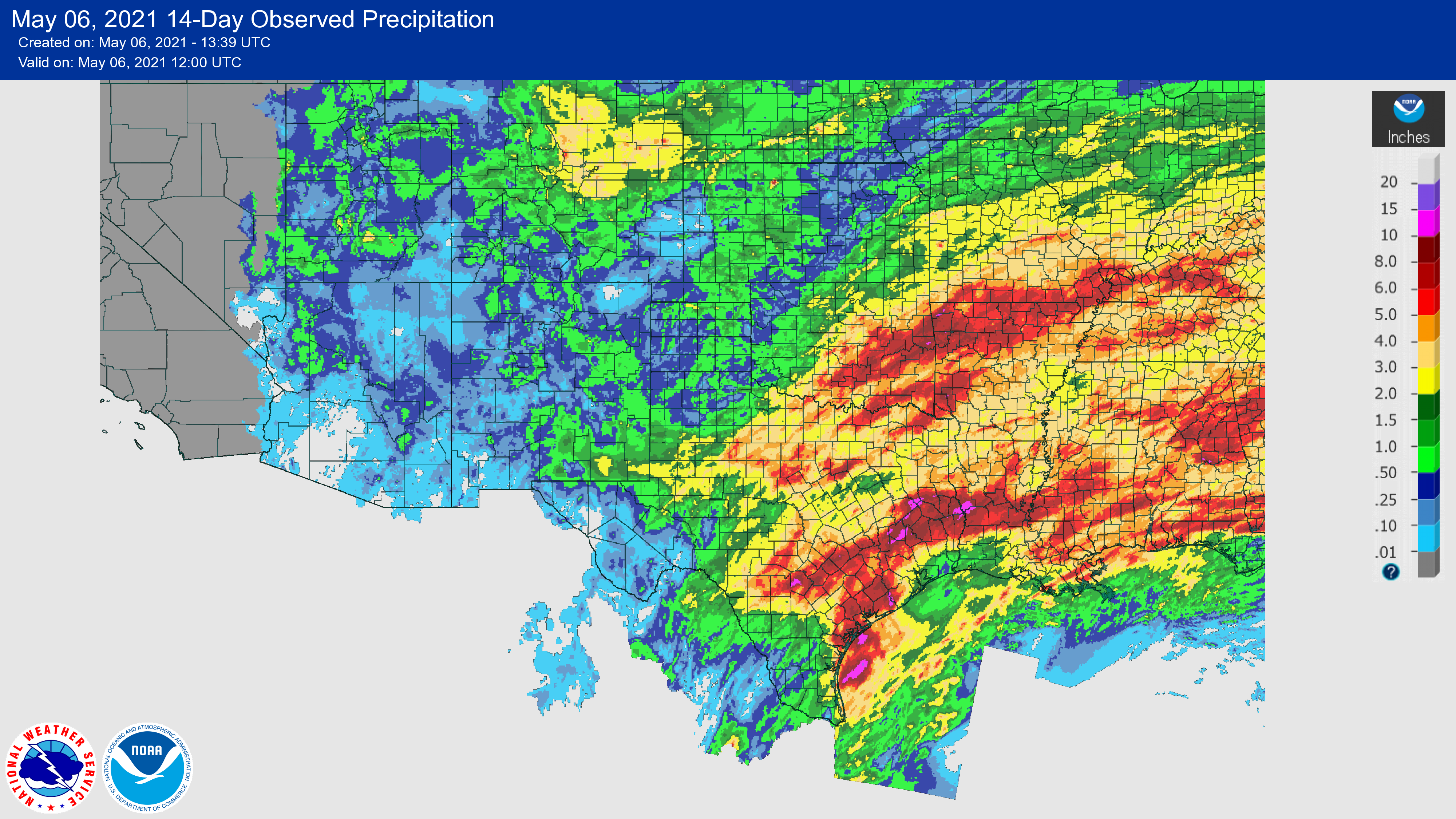
maybe that will get it started. The rainfall situation has improved somewhat,
but not enough in the northwest. The rain they received last night helped a
little.

Longer-term deficits are still there, however.

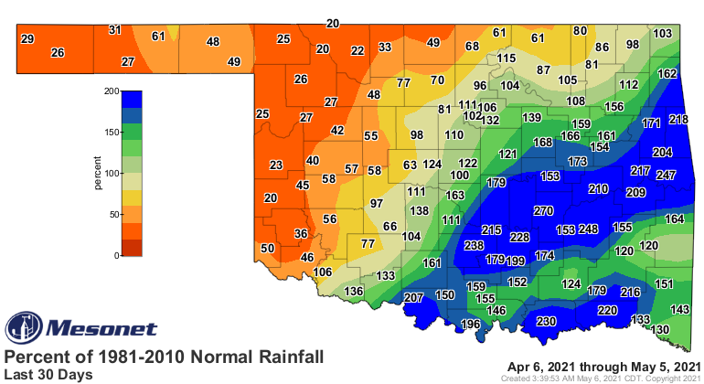
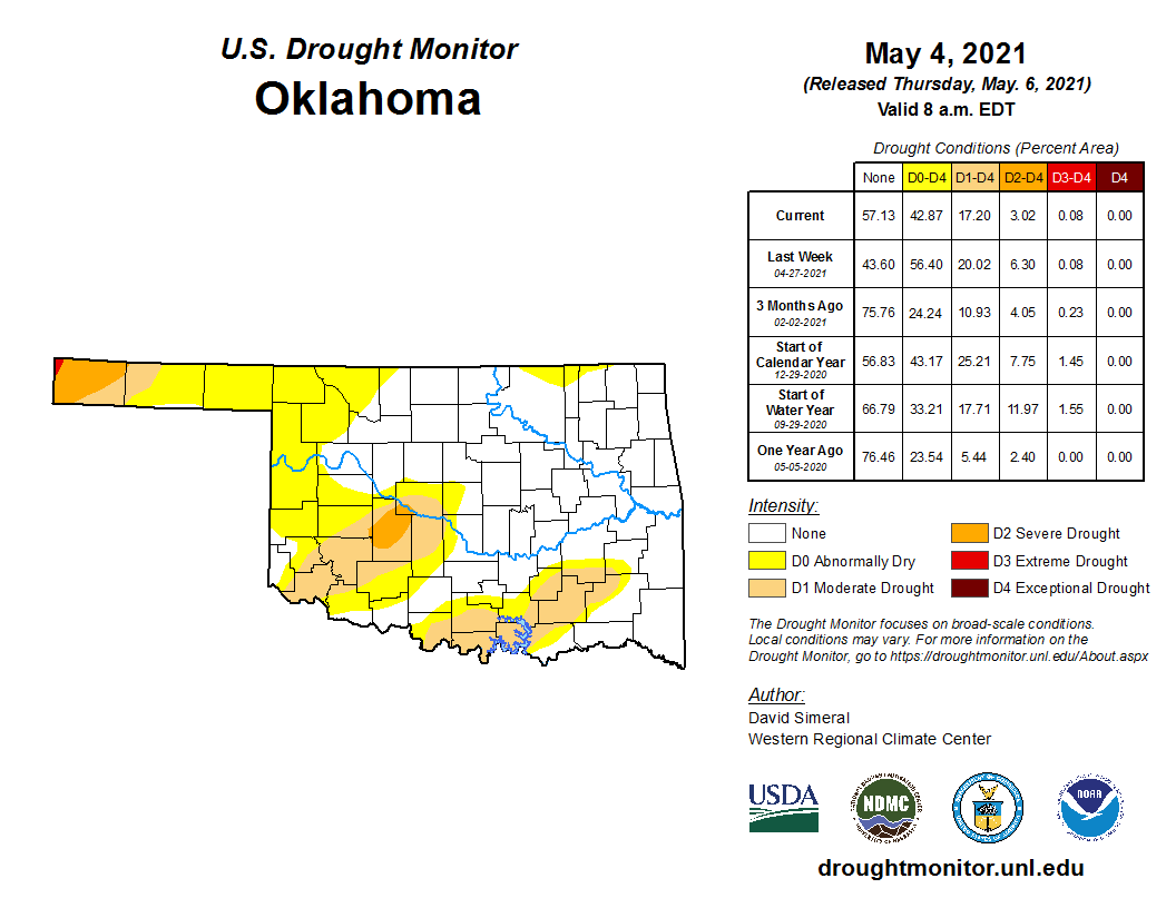
We have had substantial improvements across the Southern Plains this week in
the Drought Monitor, including south central Oklahoma. The rains of the past
two weeks have been generous enough to warrant this widescale changes.
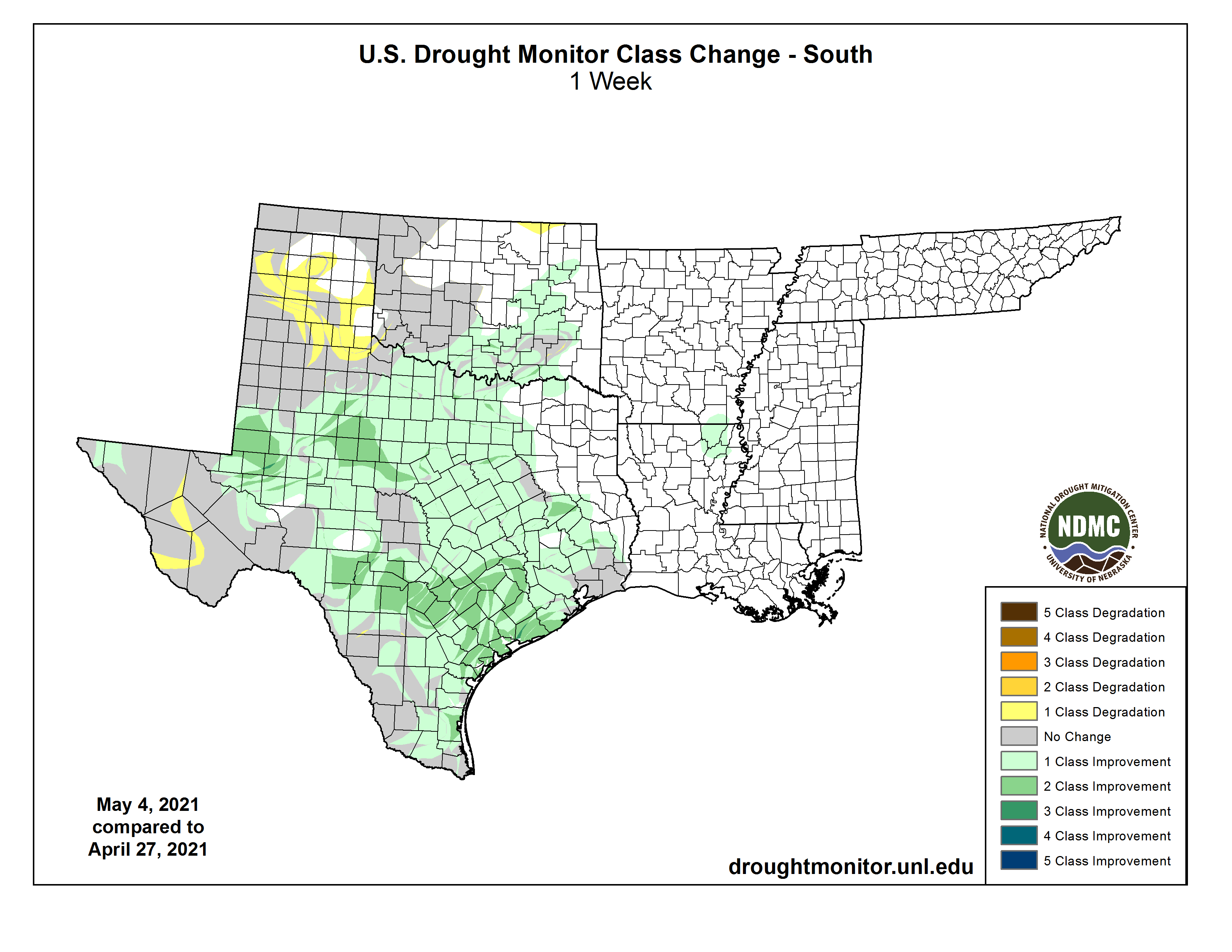
That leaves us with a bit nicer looking Drought Monitor map, but with lots of
areas of danger still there for drought development...especially across NW OK.
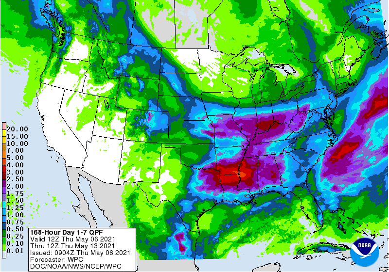
Improvements are possible with rain chances coming up this weekend and into
next week, but once again the heavier rain totals appear more likely across
eastern OK.
Now wake up, May, I think I got somethin' to say to you!
Gary McManus
State Climatologist
Oklahoma Mesonet
Oklahoma Climatological Survey
(405) 325-2253
gmcmanus@mesonet.org
May 6 in Mesonet History
| Record | Value | Station | Year |
|---|---|---|---|
| Maximum Temperature | 105°F | CHER | 2014 |
| Minimum Temperature | 33°F | BOIS | 1999 |
| Maximum Rainfall | 5.02 inches | OKCE | 2015 |
Mesonet records begin in 1994.
Search by Date
If you're a bit off, don't worry, because just like horseshoes, “almost” counts on the Ticker website!