Ticker for April 9, 2021
MESONET TICKER ... MESONET TICKER ... MESONET TICKER ... MESONET TICKER ...
April 9, 2021 April 9, 2021 April 9, 2021 April 9, 2021
The eyes have it
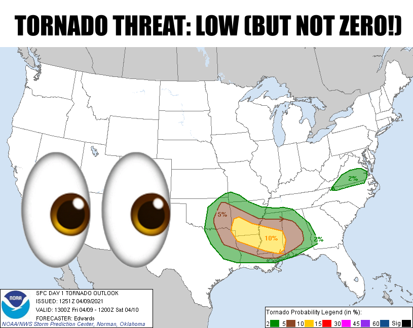
Urgh! (Okie to English translation: "Ugh!"). It's another one of "those" spring
days in Oklahoma. You know, one of "those" days where you keep your eye to the
sky, your ear to the weather radio, and your TVs tuned to your favorite media
weather source. I guess if you're watching TV, you can't keep an eye on the sky.
If you can, I guess that'd make you Marty Feldman (google, youngsters...start with
"Young Frankenstein" and go from there). Just do the best you can, okay? The
area in peril today would appear to be right around I-44 and east of I-35. Here
are the rest of the outlooks from SPC. The biggest threat appears to be big
hail and severe winds, but again that tornado threat does exist.
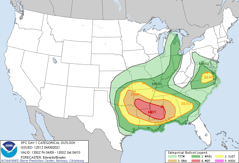
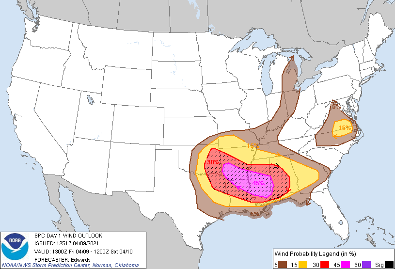
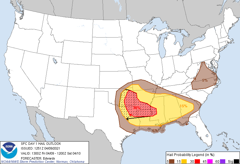
Here's a bit of a better look from our friends at the Tulsa NWS office.
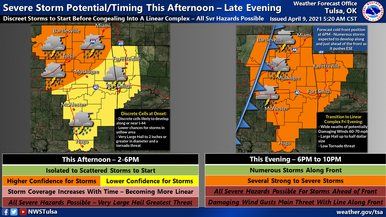
Again, all modes of severe weather are possible for the eastern half of the
state, but especially across SE OK.
Western Oklahoma will just get plain old wind with the front that's
coming through. What else is new?
Gary McManus
State Climatologist
Oklahoma Mesonet
Oklahoma Climatological Survey
(405) 325-2253
gmcmanus@mesonet.org
April 9 in Mesonet History
| Record | Value | Station | Year |
|---|---|---|---|
| Maximum Temperature | 100°F | HOLL | 2011 |
| Minimum Temperature | 18°F | KENT | 2013 |
| Maximum Rainfall | 4.69″ | GUTH | 2008 |
Mesonet records begin in 1994.
Search by Date
If you're a bit off, don't worry, because just like horseshoes, “almost” counts on the Ticker website!