Ticker for March 29, 2021
MESONET TICKER ... MESONET TICKER ... MESONET TICKER ... MESONET TICKER ...
March 29, 2021 March 29, 2021 March 29, 2021 March 29, 2021
March hair dryer
I was cooking a steak after supper last night. My wife walked in and asked why
I was cooking a steak after we had just eaten. I told her it was for the dogs. Why
was I cooking a steak for the dogs, she asked. Well, they don't know how, I said.
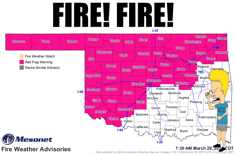
Why do I begin today's Ticker with that story? Because Monday. And it's going to
be one of THOSE days in early springtime in Oklahoma when the wind comes sweeping
down the plain (up the plain, really...and we all know just how painful that can
be) ahead of a mostly dry cold front. That means strong southerly to strong and
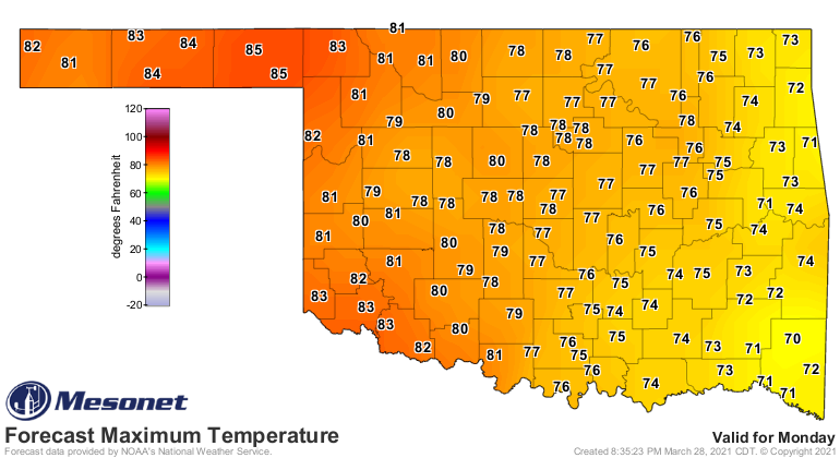
painfully dry southwesterly winds, temperatures shooting up 10-15 degrees above
normal, and lots and lots of fire danger. The vegetation is still shocked silly,
if not downright dead, from our two-week February encasement in ice, so it's ready
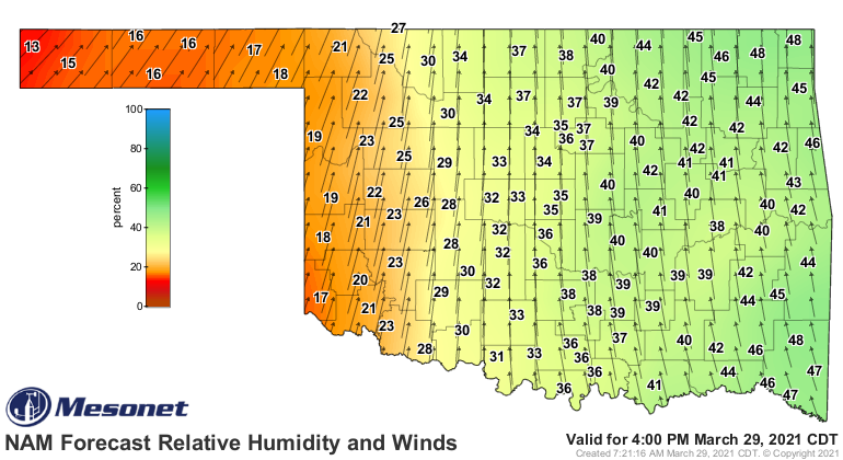
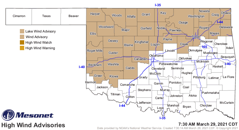
to burn. Here is what today will look like at 4pm, with lip-desiccating relative
humidity values in western Oklahoma and winds gusting to over 45 mph; high
enough to warrant a wind advisory. Highs will be into the 80s out west, making
for a tinderbox.
You can see the lack of green up on the latest relative greenness map from our
OK-FIRE website.
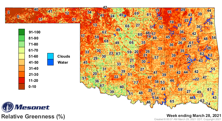
We had quite a few fires yesterday, and it wasn't even windy. So add wind to the
equation and you have the makings of some pretty bad fires. Here is a reminder
from our Amarillo NWS friends concerning fire danger.

Remember, during the winter and early-spring fire season, there doesn't need to
be drought in place. Drought supplies lots of dead/dormant/dry vegetation during
the warm months, when things are supposed to be green. During this time of year,
the vegetation is still dead/dormant/dry because it has yet to green up. So until
we see that greening, we will continue to see fire danger when the proper weather
conditions warrant. And that will occur several times this week.
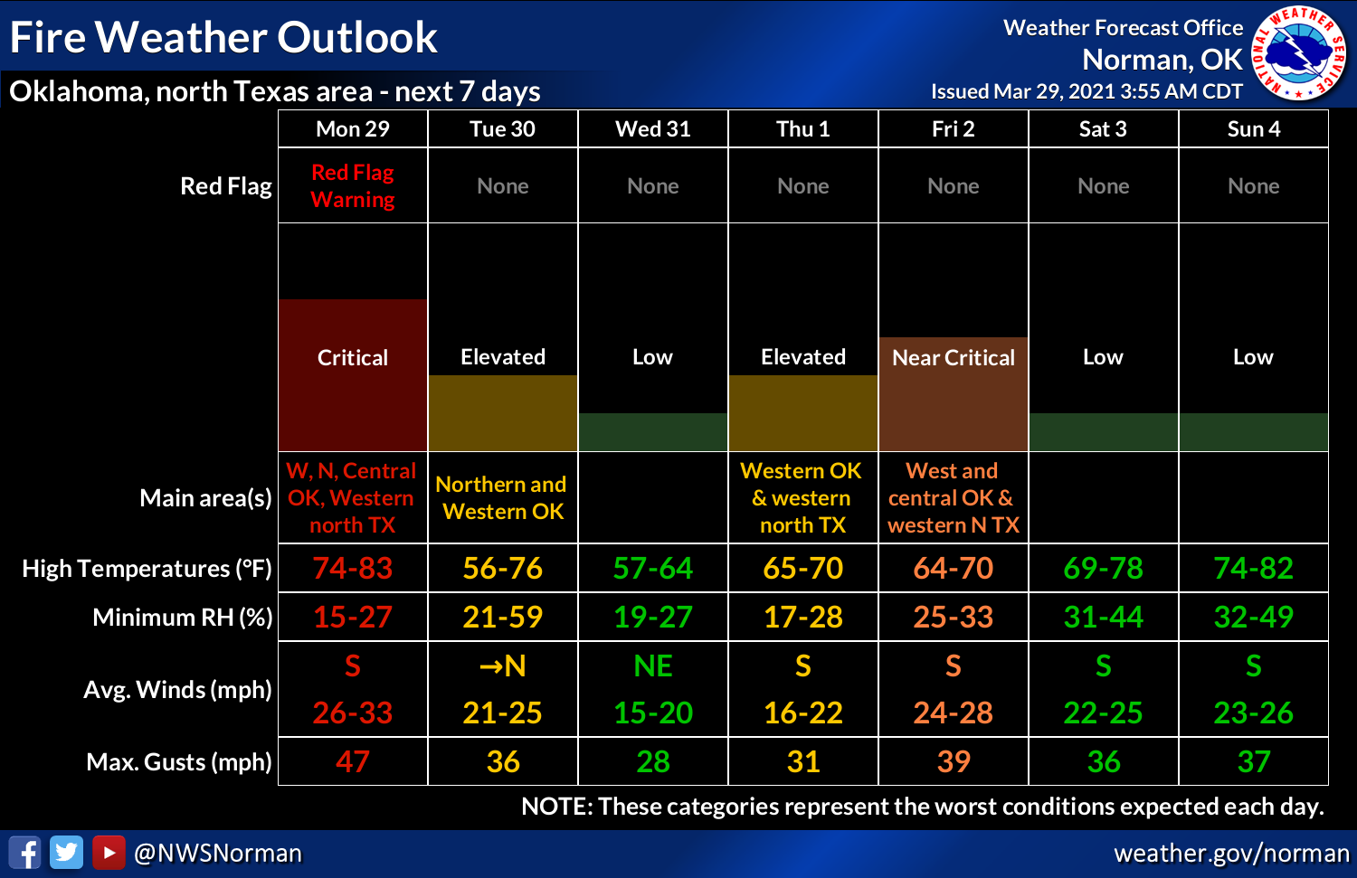
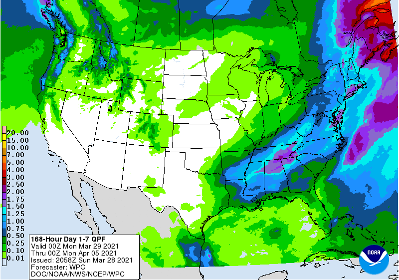
You can even have rain in the morning and fire danger in the afternoon, if it
dries out quickly enough. But rain is not really a factor this week...just a
smidgen of moisture looks to be had here and there.
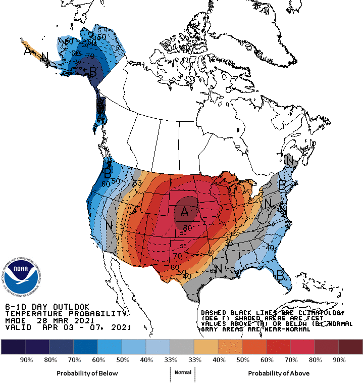
So look for a cool down tomorrow and Wednesday after the cold front tonight,
then we start zooming back up the thermometer by the weekend, and next week
looks particularly warm and dry.
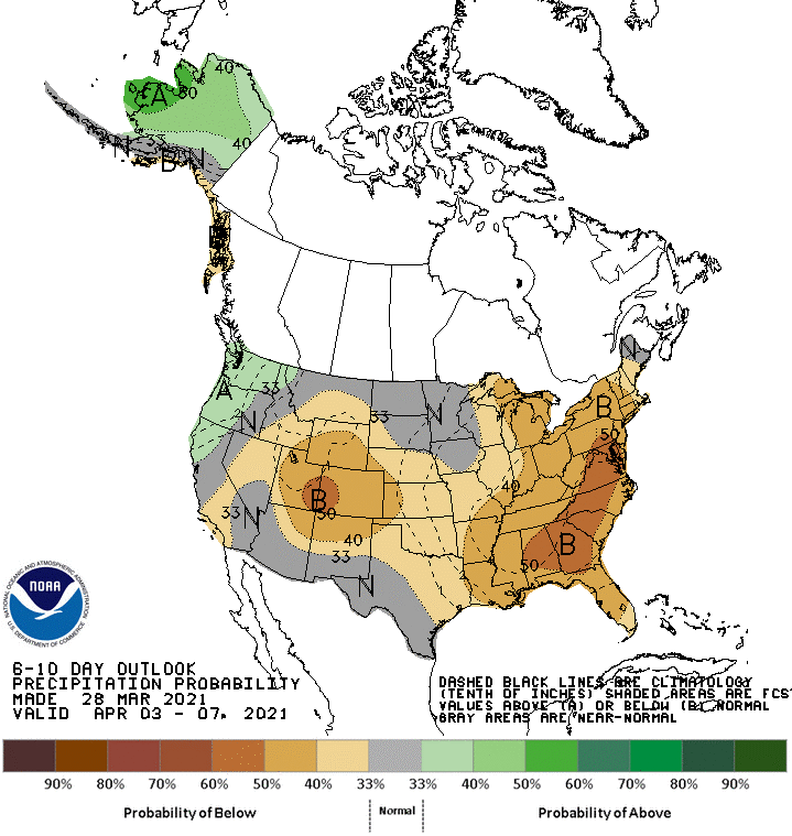
Are ya like me (sorry, there is help) and you like the warm weather? Yeah, it's
sort of a necessary component this time of year to facilitate the green up
needed to prevent fire danger, but it is also a component that increases fire
danger.
We could just let dogs forecast fire. Trouble is, they don't know how.
Gary McManus
State Climatologist
Oklahoma Mesonet
Oklahoma Climatological Survey
(405) 325-2253
gmcmanus@mesonet.org
March 29 in Mesonet History
| Record | Value | Station | Year |
|---|---|---|---|
| Maximum Temperature | 94°F | HOLL | 2022 |
| Minimum Temperature | 16°F | BOIS | 2009 |
| Maximum Rainfall | 2.93″ | WATO | 2007 |
Mesonet records begin in 1994.
Search by Date
If you're a bit off, don't worry, because just like horseshoes, “almost” counts on the Ticker website!