Ticker for February 15, 2021
MESONET TICKER ... MESONET TICKER ... MESONET TICKER ... MESONET TICKER ...
February 15, 2021 February 15, 2021 February 15, 2021 February 15, 2021
Ludicrous cold!
Okay, that about covers the snow, no? If you're upset that you didn't get 12-16
inches instead of the 7 or 9 that you did get, well aren't you a denizen of the
Arctic all of a sudden! You'll get 7 or 9 and like it! Besides, the 3-foot drifts
should make you feel better. Let's talk temps.
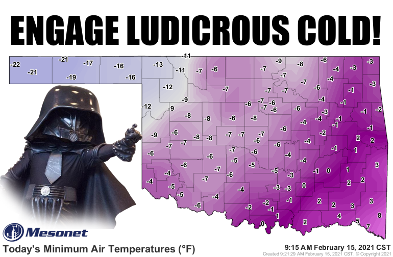
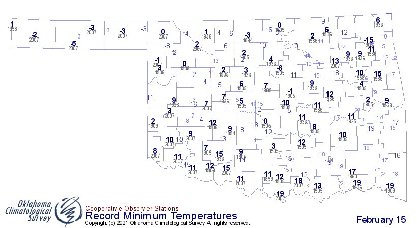
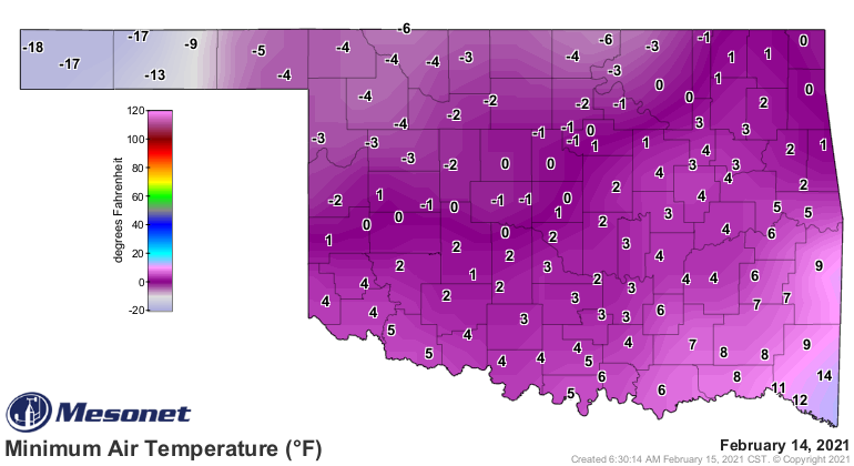
The -22 degrees recorded at Kenton this morning ties the lowest temperatures
recorded in the state since the Miami Mesonet site dropped to -22 degrees back
on Jan. 17, 2018. In fact, the -22 degrees measured this morning at Kenton is
ever recorded this late in the season, and easily the lowest temperature ever
recorded for all Feb. 15ths on record for the state...-15 at Vinita back in 1905
was the previous record. Remember, the all-time record low for Oklahoma is -31
degrees set at the Nowata Mesonet site back on Feb. 10, 2011.
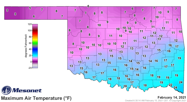
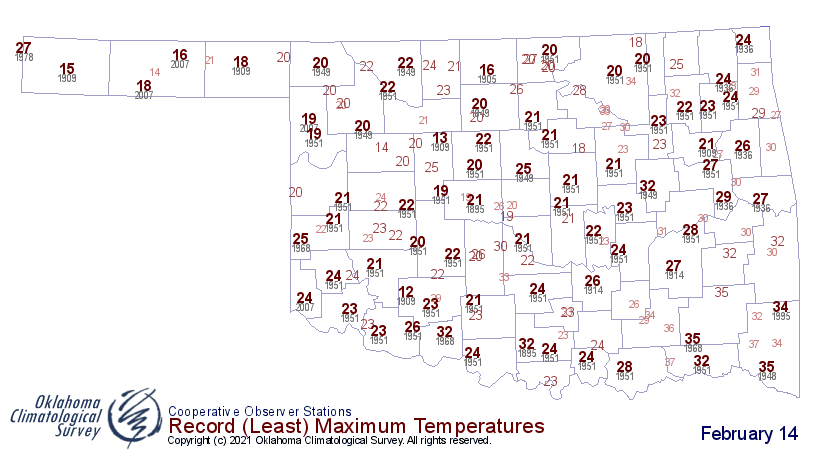
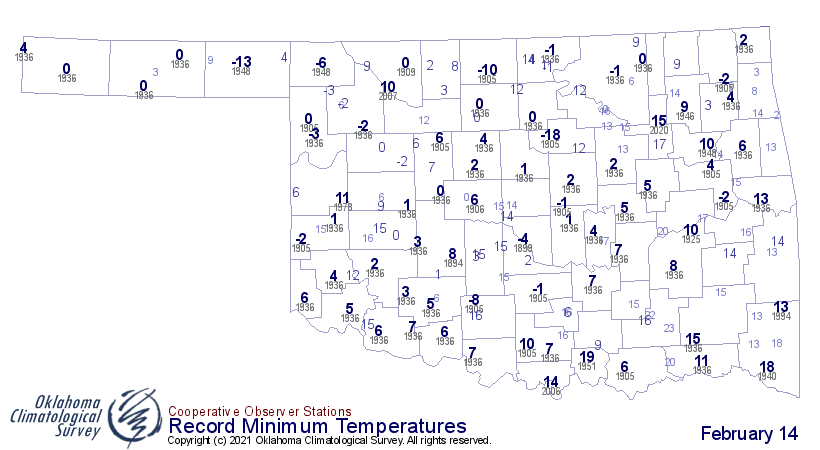
More ludicrousness? Okay, how about yesterday's highs beat the record low max
temperature readings (I say "max" because I don't want to say "record low high
temperature") at every locations across the state, and most of them by over
10 degrees. And most of those readings yesterday came right after midnight since
the temperatures continued to drop all day. The previous low max temperature was
12 degrees at the Wichita Mountain Wildlife Refuge back in 1909.
Right before midnight LAST night, the temperatures had dropped enough to break
record low temperatures as well.
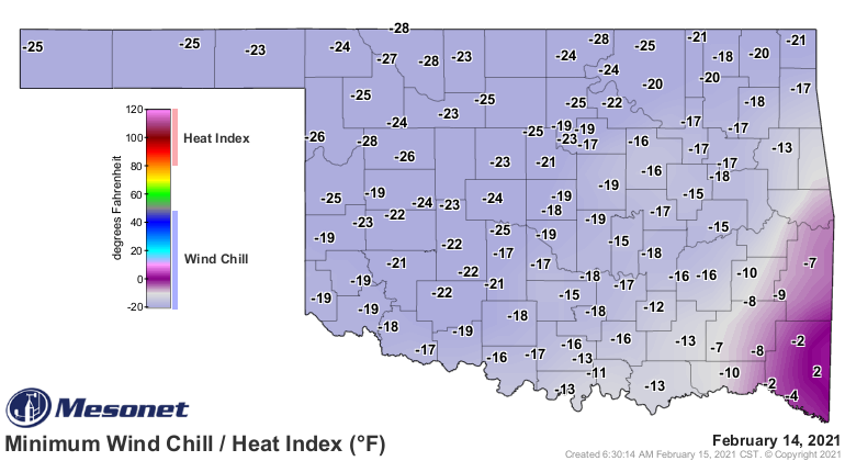
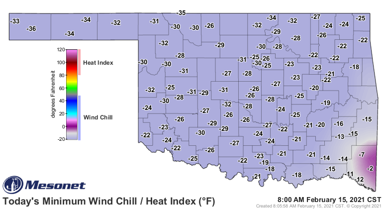
Wait, we ain't done! How about the wind chills?
Wow, you kiss your mother with that mouth? I just report 'em, okay? The -36
degrees at Boise City (and a lot of those other readings) are *ALMOST* the
lowest wind chills we've seen since Feb. 10, 2011, as well. Hooker hit -38
degrees back on Dec. 18, 2016. Yeah, I don't remember that either, but I bet
the folks in Hooker do. Here are the lowest wind chill maps from the today and
yesterday.
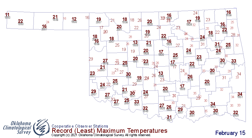
Unfortunately, we're not done with the ludicrous temps. Today we should shatter
the record low high temps again across the state, and tonight we'll approach
more record setting lows.

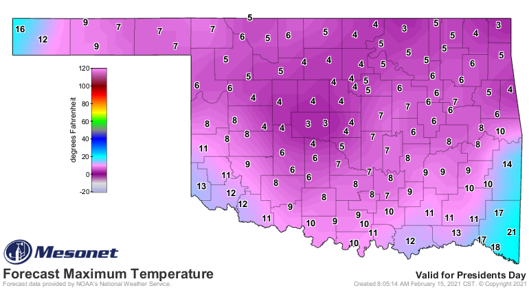
Here are the record low high temp temperature (dang it, I did it anyway!)
readings for today.
Our statewide temperatures are zooming up the record books as well. Yesterday's
statewide average temperature of 6.7 degrees marks Feb. 14, 2021, as the
15th coldest day in state history. We calculate these back to 1915, to ensure
adequate station coverage.
-***-
Date Statewide Avg. T
12/22/1989 1.9F
12/22/1983 3.5F
12/23/1989 3.6F
12/24/1983 4.2F
12/25/1983 4.7F
01/04/1947 4.7F
01/17/1930 5.2F
01/22/1930 5.5F
12/23/1983 5.6F
01/12/1918 5.6F
01/04/1959 5.8F
01/18/1930 6.3F
12/22/1990 6.5F
02/08/1933 6.5F
02/14/2021 6.7F
-****-
Our 2-day average of 10.3 degrees from Feb. 13-14 is tied for the 25th coldest
2-day period on record. Dec. 22-23, 1989's 2-day average of 2.7 degrees is
almost unbeatable.
As for Mesonet-only records, yesterday we had 80 sites with highs 15F or below,
50 with highs 10F or below, 3 with highs 5F or below, all new records. The
Mesonet temperature record stretches back to spring 1997. This morning's count
of 99 Mesonet sites at or below zero for low temperatures is just behind
Feb. 10, 2011s count of 101, easily topping Feb. 3, 2011's 63 for second place.
The 100 sites with a minimum wind chill of -10F or below is right behind Feb.
10, 2011's 103 stations, and topping Feb. 2, 2011's 97 stations.
I'm afraid when it comes to low temperature records, that Feb. 10, 2011, set of
extremes is going to be hard to beat. Maybe tonight?
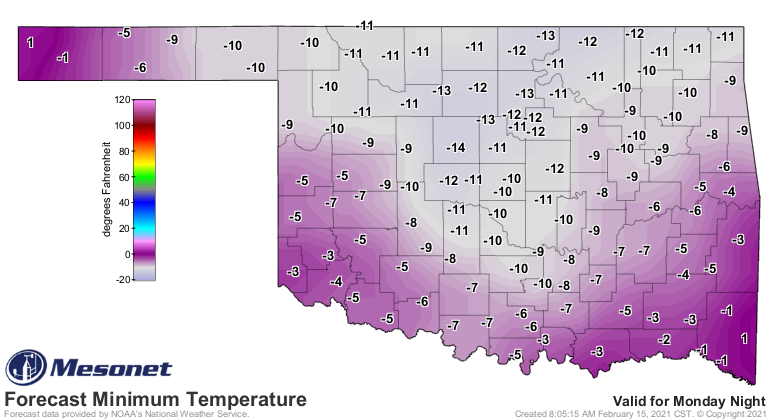
-31 (air temp) and -47 (wind chill) are probably safe, but some of those others,
like stations below and whatnot, could fall.
I know we were supposedly done with talking about snow, but not quite yet.
Mother Nature won't allow it. Get ready for another dose tomorrow, as winter
storm watches are already out for our second snowstorm of the week, even as
eastern Oklahoma still deals with the current winter storm warning! Wait, eastern
Oklahoma is also under a winter storm watch? Now how does that work? In a winter
storm warning AND watch at the same time?
Ludicrous!
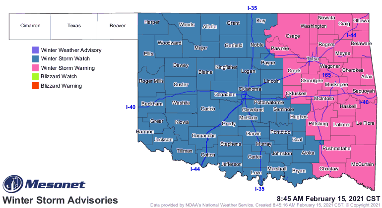
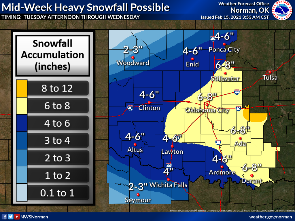
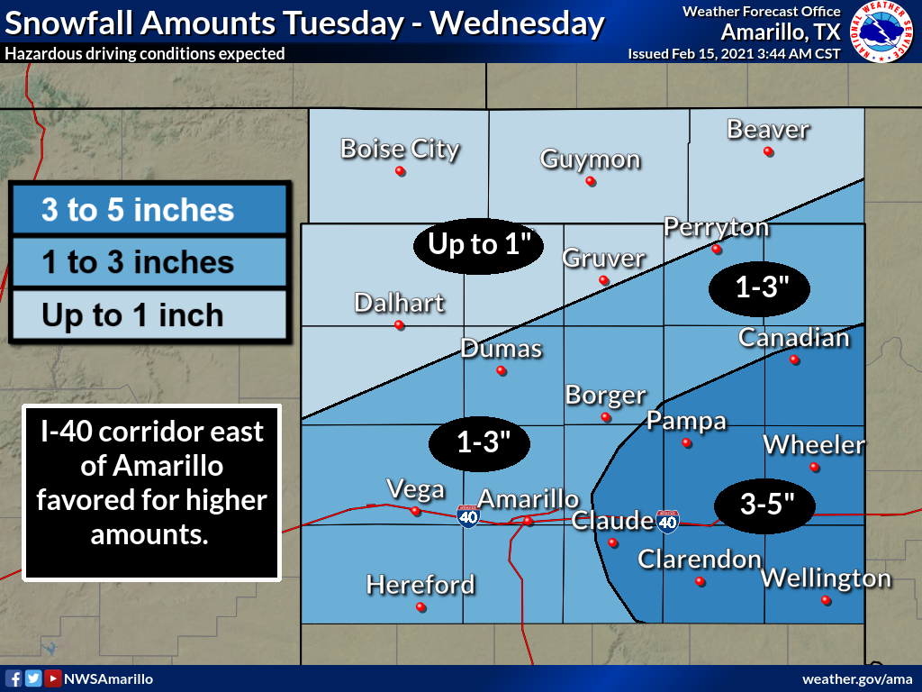
Forgive Tulsa for being too busy with round 1 to put out a graphic for round
2, but you can expect accumulations once again from 4-10 inches across the area.
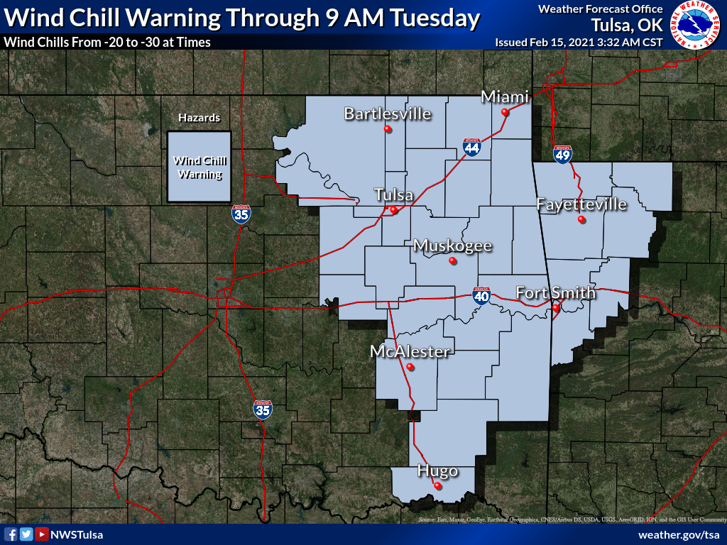
And don't forget the wind chill warning!
Ludicrous!
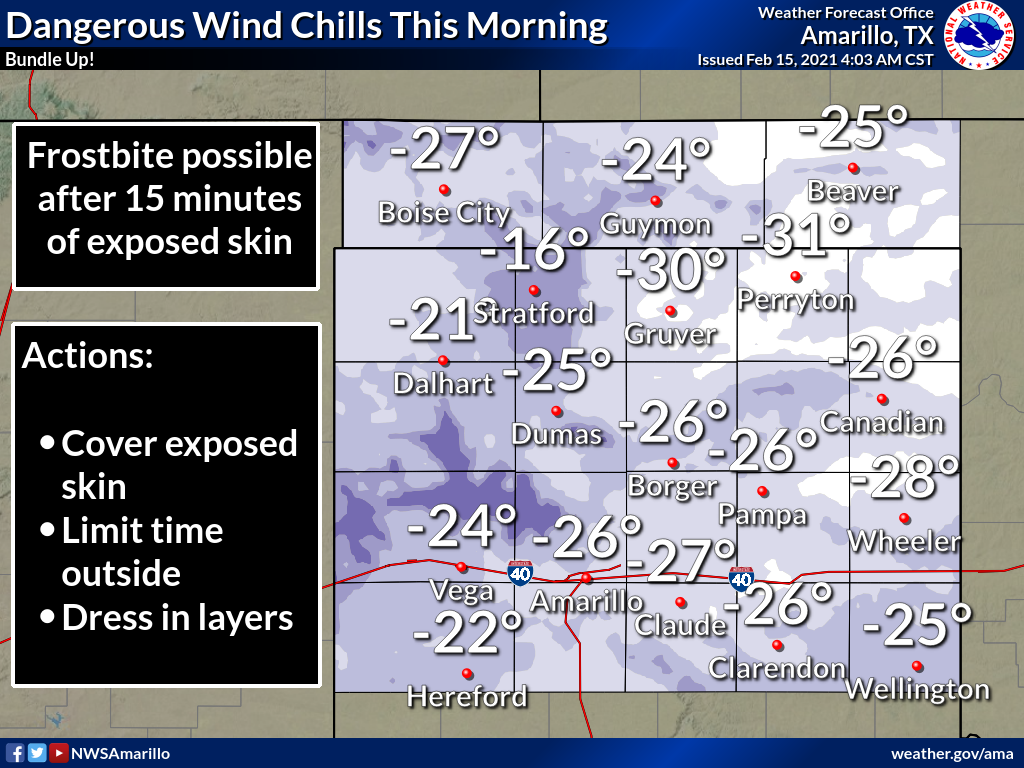
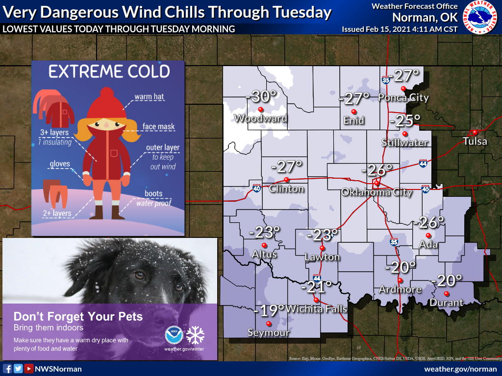
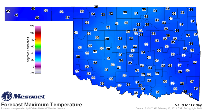
Okay, I've been tallying and writing for hours. I'm going to call it quits
here. Some of these records might have already changed since I started. I'm
gonna leave you with this...being excited for forecast highs in the low 30s
for Friday?
Ludicrous!
Gary McManus
State Climatologist
Oklahoma Mesonet
Oklahoma Climatological Survey
(405) 325-2253
gmcmanus@mesonet.org
February 15 in Mesonet History
| Record | Value | Station | Year |
|---|---|---|---|
| Maximum Temperature | 86°F | BURN | 2000 |
| Minimum Temperature | -22°F | KENT | 2021 |
| Maximum Rainfall | 2.12 inches | CLOU | 2001 |
Mesonet records begin in 1994.
Search by Date
If you're a bit off, don't worry, because just like horseshoes, “almost” counts on the Ticker website!