Ticker for February 4, 2021
MESONET TICKER ... MESONET TICKER ... MESONET TICKER ... MESONET TICKER ...
February 4, 2021 February 4, 2021 February 4, 2021 February 4, 2021
Who ordered winter?
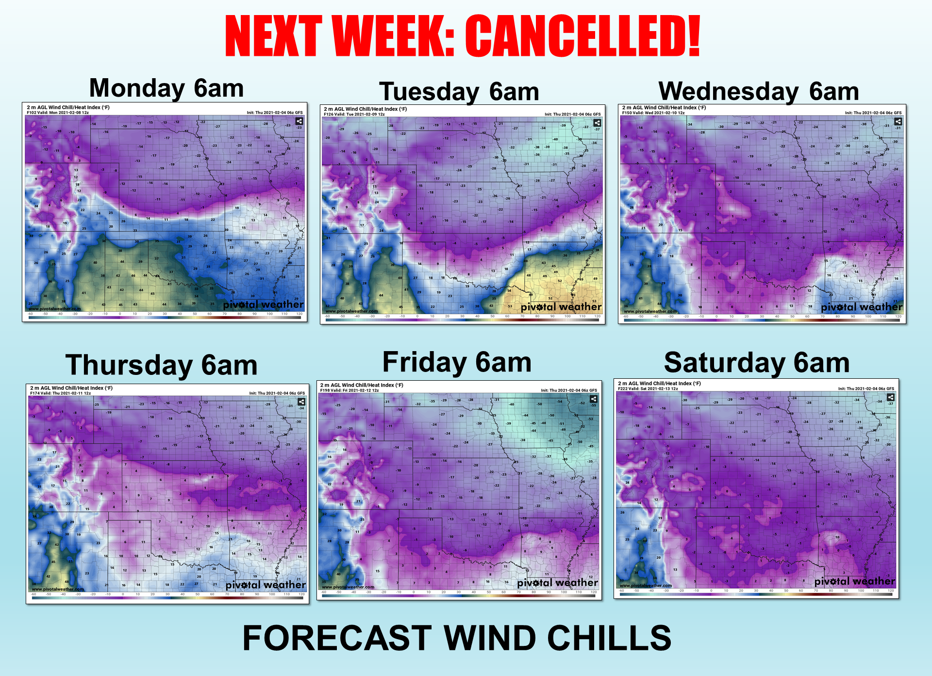
Your weather is only as good as your morning wind chills, I always say. Okay, I've
NEVER said that, but it works for today's Ticker so NOW I always say that. Right
when we thought it was safe to think the cold air outbreak that was scheduled
for this weekend was cancelled, we find out it has just been delayed until next
week. And next weekend. And maybe after that? The above series of wind chill
forecasts is just one forecast model's (GFS) imaginings, but darned if it doesn't
look like we're going to have an extended winter chill for all of next week and
possibly into early next week.
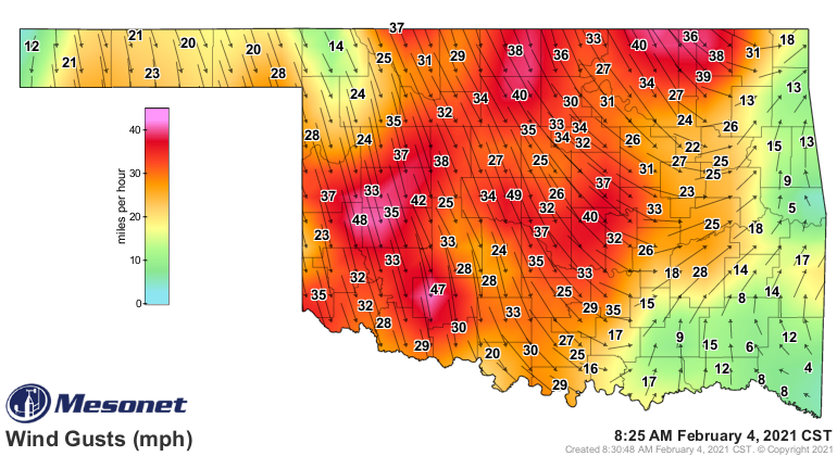
The first kick back to seasonal temps comes, well...right now! If'n you haven't
seen the front moving through yet, just wait awhile. And notice the really cold
air poised to our north. We have a a few days yet until that possibly plunges
down.
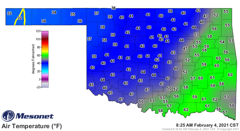
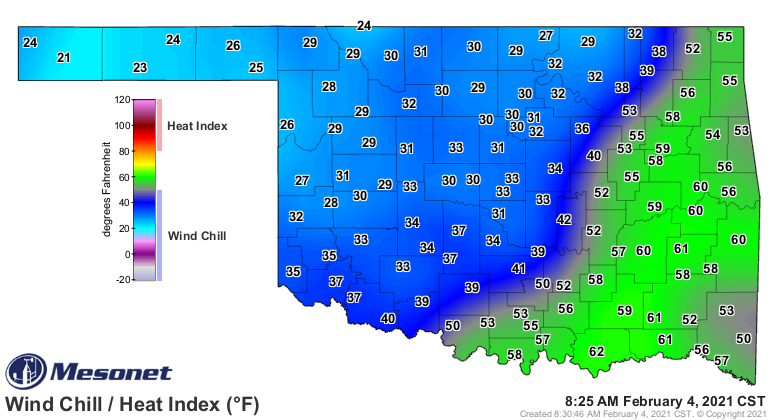
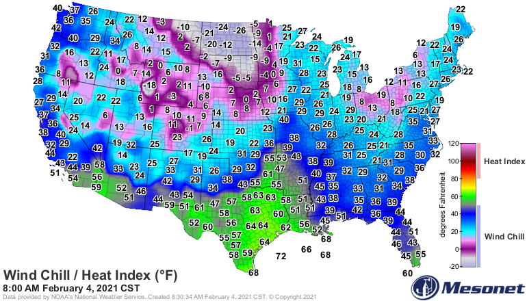
You can't handle the cold? Heck, the winds'll probably kill ya! (Thanks Butch).
We'll actually see a nice warm up through much of the weekend, but that first
front later on Sunday will spell our doom.
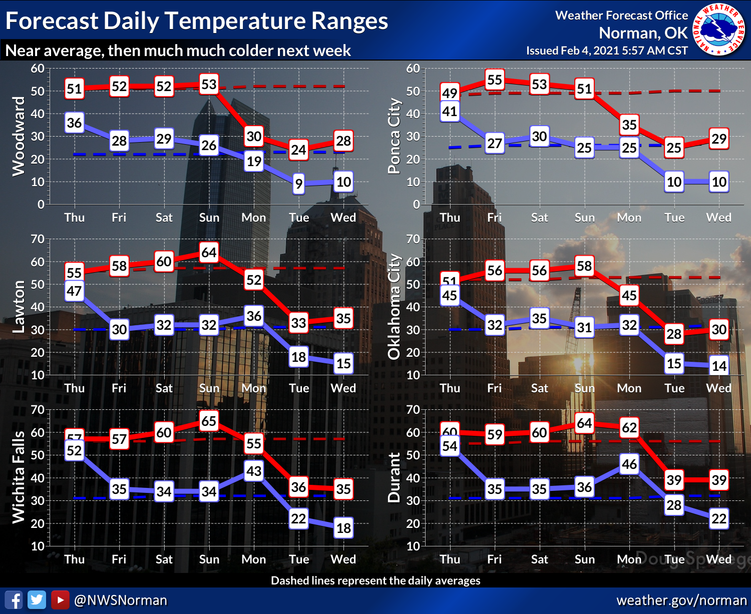
If the GFS forecast model is to be believed, we don't see seasonable
temperatures again until Wednesday. No, not Wednesday the 10th...Wednesday the
17th! Argh. Here we see CPC's temperature outlook for much of that time.
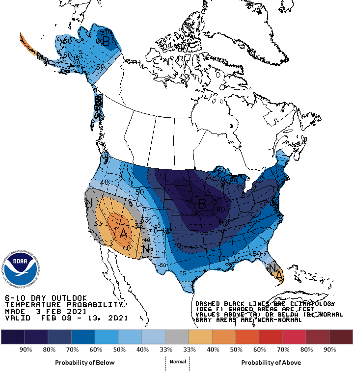
The forecast models have already changed quite a bit with the nature and timing
of this air mass, so maybe it will slide off to the east more quickly, or
not plunge as far south.
For my own personal tragedy, here's me driving around yesterday with my gas
tank just a sliver above E (oblivious to that fact).

Dang, I'd kill for that hair! Anyway, here's me getting out earlier this
morning, seeing the dreaded yellow fuel light come on.

I'd also kill for that hair, but that's not important right now. I figure if I
only dive south, I can coast for quite a ways. Plus, it's much warmer down
south.
Hmmmm....
Gary McManus
State Climatologist
Oklahoma Mesonet
Oklahoma Climatological Survey
(405) 325-2253
gmcmanus@mesonet.org
February 4 in Mesonet History
| Record | Value | Station | Year |
|---|---|---|---|
| Maximum Temperature | 84°F | NEWP | 2008 |
| Minimum Temperature | -12°F | KENT | 2022 |
| Maximum Rainfall | 2.37 inches | MTHE | 2020 |
Mesonet records begin in 1994.
Search by Date
If you're a bit off, don't worry, because just like horseshoes, “almost” counts on the Ticker website!