Ticker for January 13, 2021
MESONET TICKER ... MESONET TICKER ... MESONET TICKER ... MESONET TICKER ...
January 13, 2021 January 13, 2021 January 13, 2021 January 13, 2021
FIRE! FIRE!
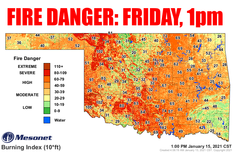
(Map courtesy of the Mesonet's OK-FIRE program).
You know, when notorious slow-talker Hans Gruber needed that last magnetic lock
to be disabled on the vault at the Nakatomi building, he counted on the FBI. Here
in Oklahoma when winter gets really boring and we're looking for excitement, we
are given...fire danger? I'm afraid so. This is a mainstay of Oklahoma winters
when the vegetation all dies or goes dormant and we get dry cold frontal passages.
The humidity craters and the wind kicks up--first from the southwest at the
approach of the front, then from the north AFTER the front. The dry, relatively
warmer air that is drawn up on those southerly winds desiccates things even
further, increasing the fire danger, and leaves things prone to fire even in
the windy cool following the front. We will see some dangerous wildfire
conditions Thursday and Friday as we go through this scenario, capped by Friday's
extreme conditions.
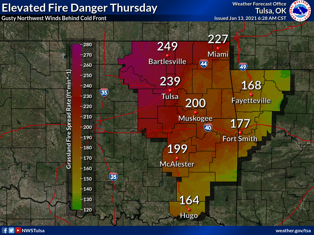
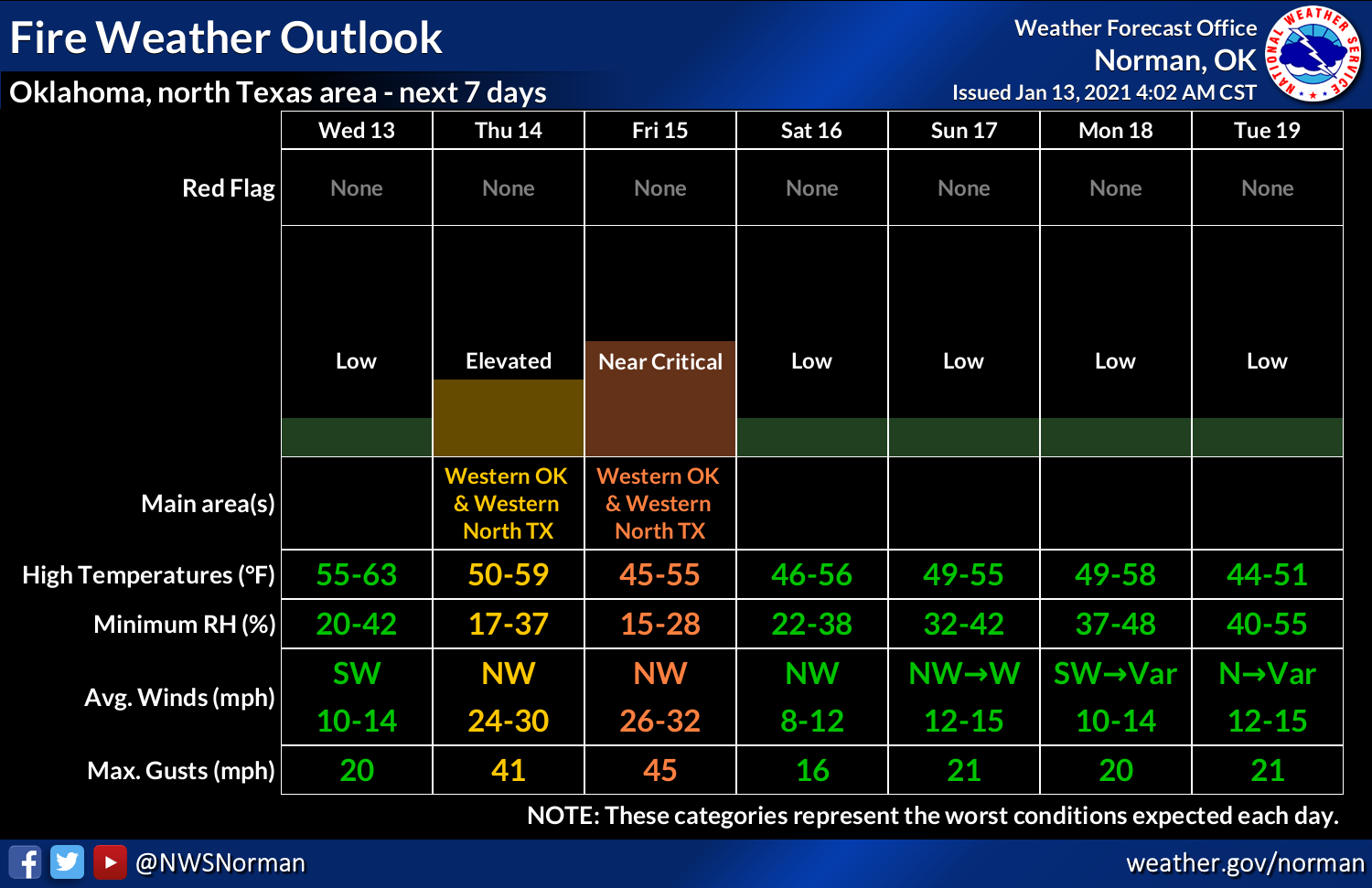
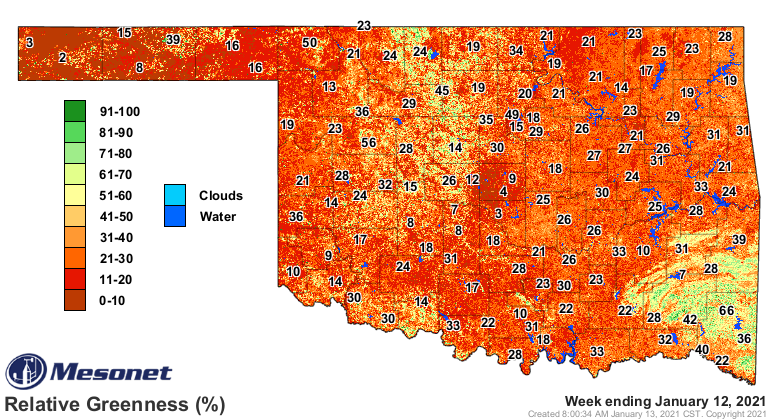
You can see the state of our vegetation in this relative greenness map, which
indicates just how green the vegetation is currently compared to a 10-year
database (2003-2012). Ab RG value of 100% signifies that this is the highest
greenness level ever reached during the multi-year period, while an RG value
of 0% indicates that this is the lowest greenness level reached over that same
time period. Obviously, much of the state is in the lower percentages.
So couple that fuel for the fires with the low relative humidity levels and all
you need is wind. We'll have that and then some.
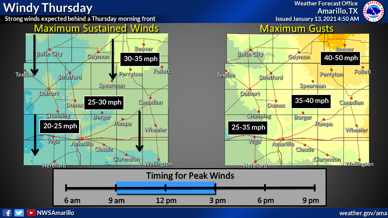
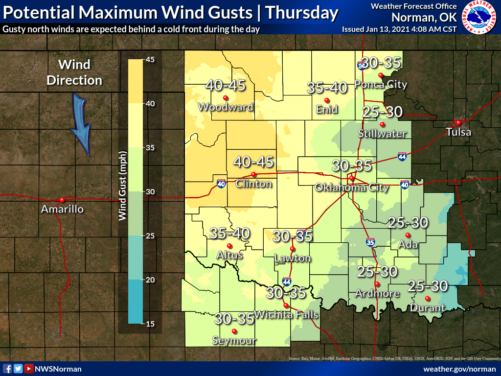
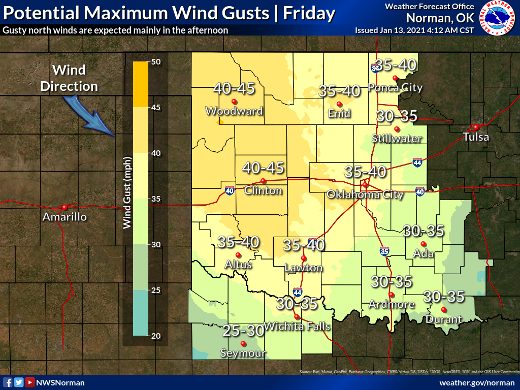
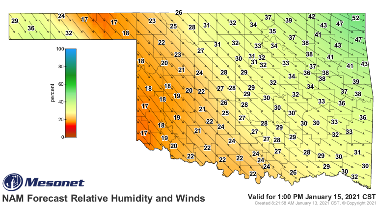
Here's a predictive map of the relative humidity and winds we will see coming
up on Friday at 1pm. The longer the arrow, the higher the wind.
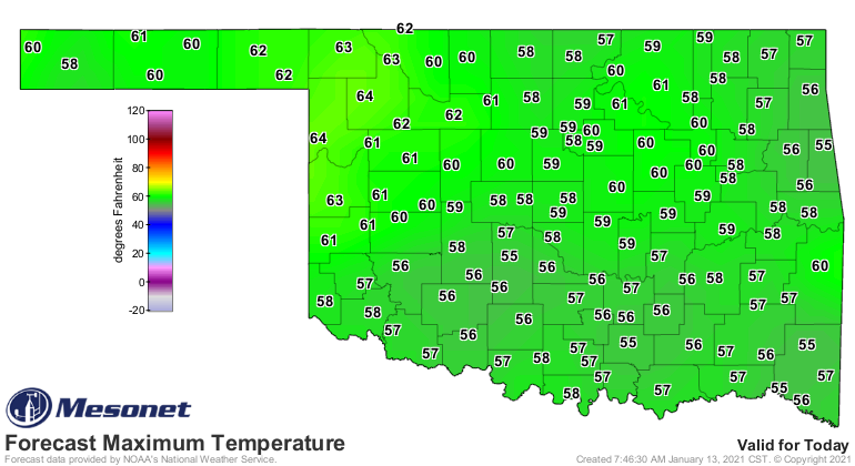
Neither day will be pleasant, so I suggest we look forward to today, at least,
where we will have highs in the 50s and 60s with relatively calmer winds.
Anybody miss the snow, yet? How about summer?
YES!
Gary McManus
State Climatologist
Oklahoma Mesonet
Oklahoma Climatological Survey
(405) 325-2253
gmcmanus@mesonet.org
January 13 in Mesonet History
| Record | Value | Station | Year |
|---|---|---|---|
| Maximum Temperature | 76°F | WAUR | 2022 |
| Minimum Temperature | -6°F | KENT | 2024 |
| Maximum Rainfall | 3.48″ | WIST | 1995 |
Mesonet records begin in 1994.
Search by Date
If you're a bit off, don't worry, because just like horseshoes, “almost” counts on the Ticker website!