Ticker for January 7, 2021
MESONET TICKER ... MESONET TICKER ... MESONET TICKER ... MESONET TICKER ...
January 7, 2021 January 7, 2021 January 7, 2021 January 7, 2021
It's cut!
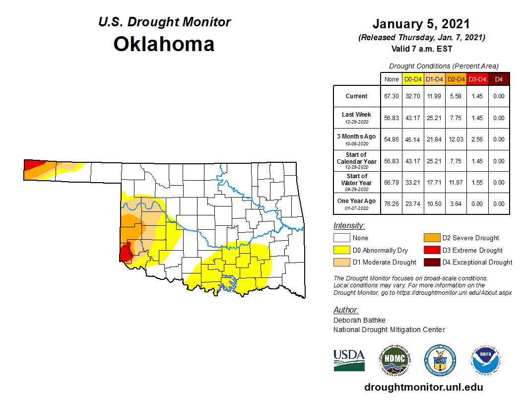
It took 4 snowstorms (and the rain that came with it) to finally put a dent in
our drought. As you can see there from the U.S. Drought Monitor map released
this morning, we lost ALL of the moderate (D1) drought that had plagued south
central and southeastern Oklahoma, and trimmed a bit more in the SW and EC
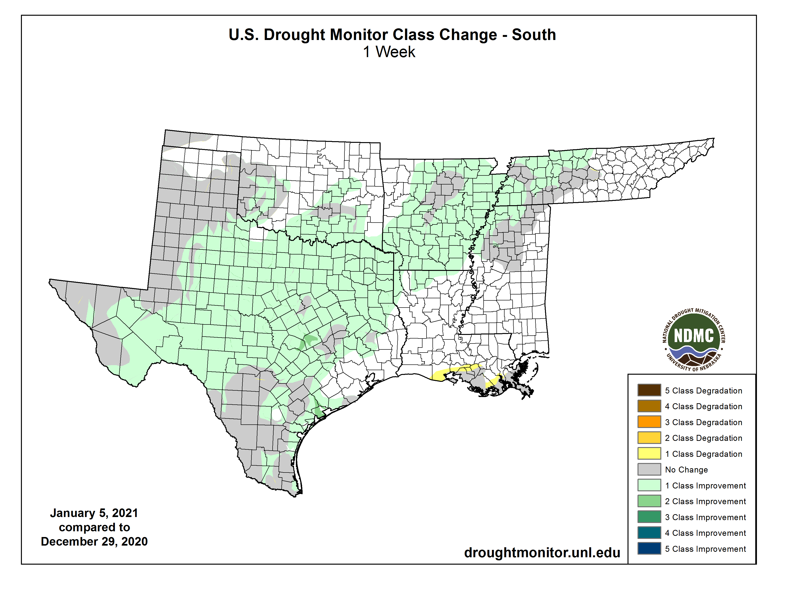
sections of the state. Here's a more refined look at those changes, not only
across Oklahoma, but the entire Southern region of the U.S. That's how big this
last storm system was that effected change.
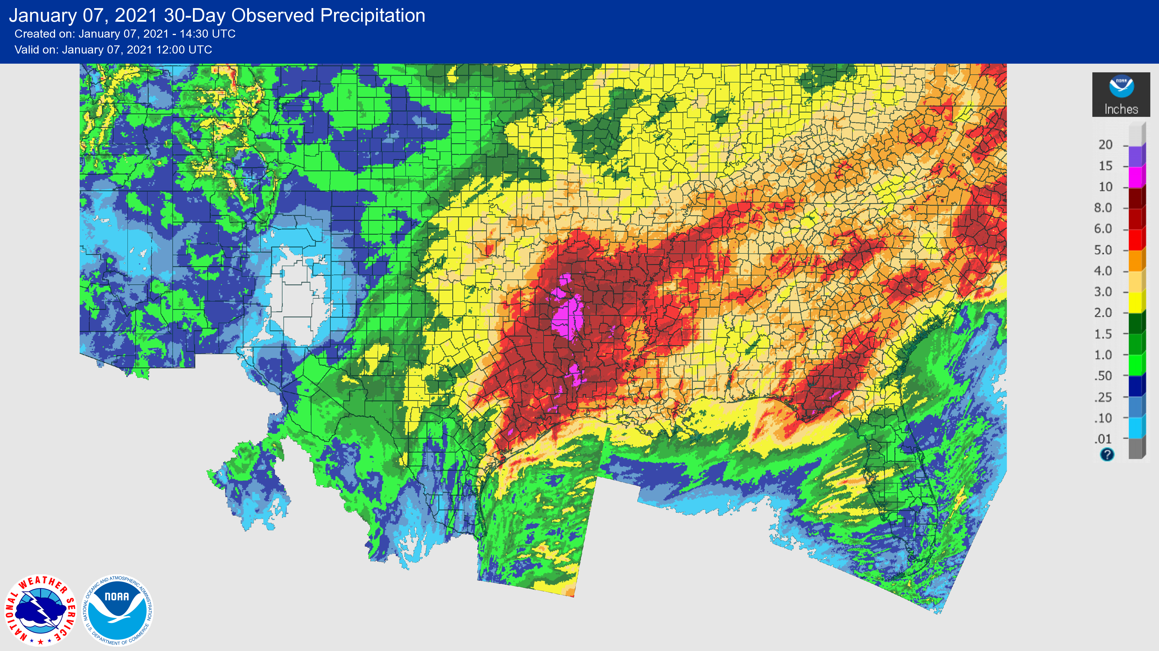
You can see the enormity of the storm's footprint in this massive 30-day rainfall
map. There are other storms thrown in there, but the bulk of these totals fell
in that New Year's storm system.
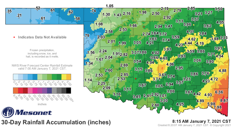
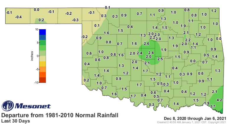
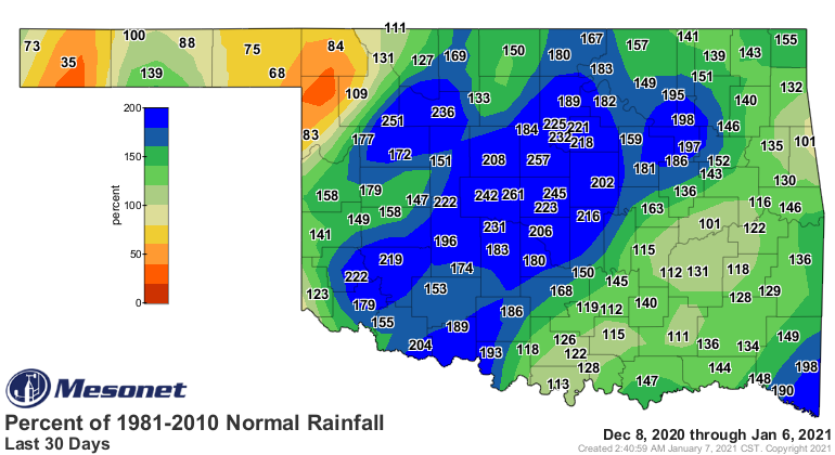
For Oklahoma, these 30-day maps give us a better picture of why we are seeing
improvements.
Okay, that's what HAS happened. Now what WILL happen? Well, we're going to be
dealing with lots of cold weather over the next few days, then some snow chances
will arrive again for western and southern OK Saturday night into Sunday. Here
are some choice graphics from our local NWS offices for this weekend that give
you a clear picture of what is expected, and it also saves you from reading
me droning on and on about how much I dislike cold weather, am tired of snow,
would like to see summer back immediately, how I wish 100s would pop up
tomorrow, because if there's one thing I can't stand it's just somebody
endlessly complaining, using too many phrases separated by commas, especially
about the weather, and...
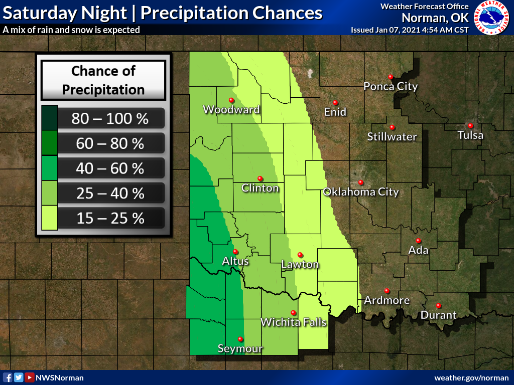
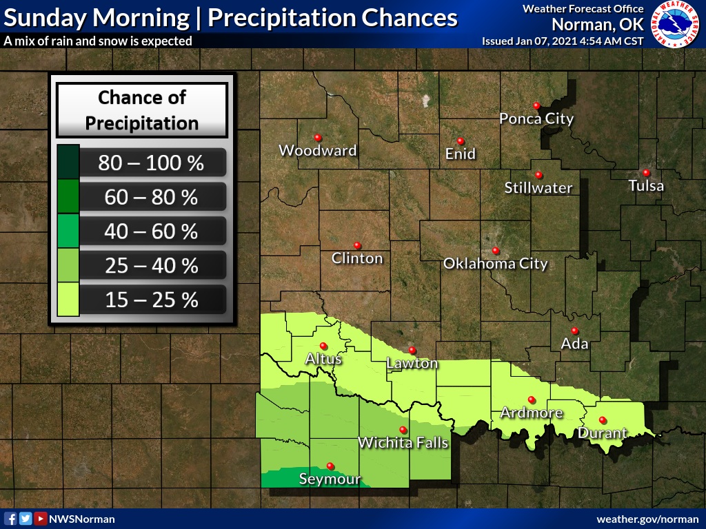
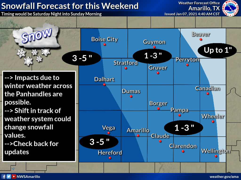
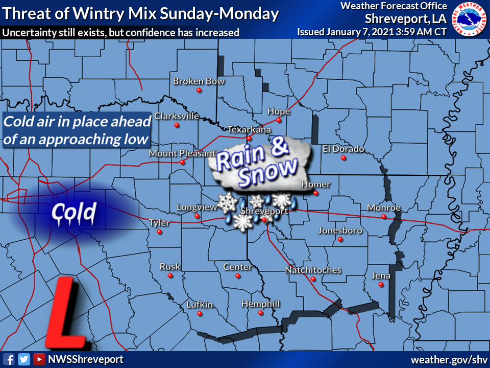
Biggest impacts are expected in the western Panhandle, it would appear. As we've
seen in the past (heck, last month several times!), these forecasts can change
significantly even the day of the event, so best to stay weather aware as
the weekend approaches.
Gary McManus
State Climatologist
Oklahoma Mesonet
Oklahoma Climatological Survey
(405) 325-2253
gmcmanus@mesonet.org
January 7 in Mesonet History
| Record | Value | Station | Year |
|---|---|---|---|
| Maximum Temperature | 85°F | WOOD | 2006 |
| Minimum Temperature | -19°F | KENT | 2017 |
| Maximum Rainfall | 2.75″ | PORT | 2008 |
Mesonet records begin in 1994.
Search by Date
If you're a bit off, don't worry, because just like horseshoes, “almost” counts on the Ticker website!