Ticker for April 21, 2020
MESONET TICKER ... MESONET TICKER ... MESONET TICKER ... MESONET TICKER ...
April 21, 2020 April 21, 2020 April 21, 2020 April 21, 2020
Not bad!
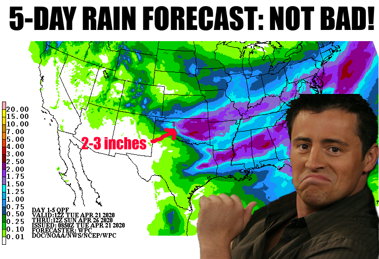
Notice that says "RAIN FORECAST?" I'm going to be bold (foolish?) enough and
say (wish?) that Mother Nature is done with the frozen stuff, at least for the
majority of the state. I see a steady flow of spring for the next week at least,
which gets us into almost-May territory, well past the date of reasonable worry
about a hard freeze. At least for most of the state. I'm throwing way too many
caveats out there. Maybe I'm being too bold. I think I just guaranteed a hard
freeze on April 30. Shoot, I have the statistics to back me up, don't I?
Ignore my inner dialogue...talk amongst yourselves.
Okay, let's get back to the rain. As I mentioned yesterday, this will come with
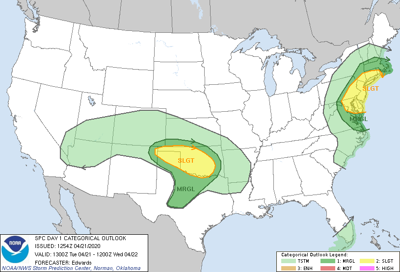
a chance of severe weather. Now there is a very small chance of some tornadic
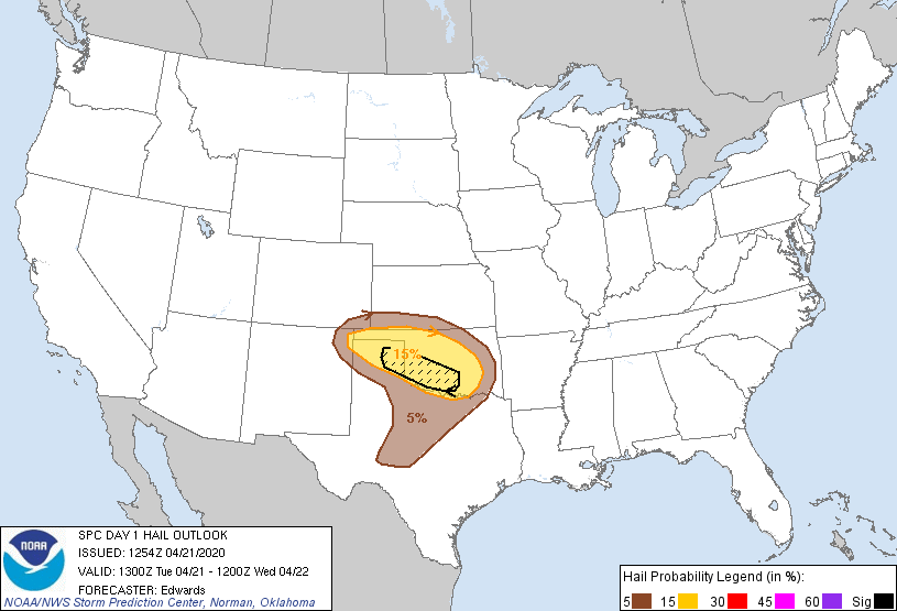
activity, but that risk is very low. This would appear to
be a severe hail event, in the event the event turns into a severe weather event.
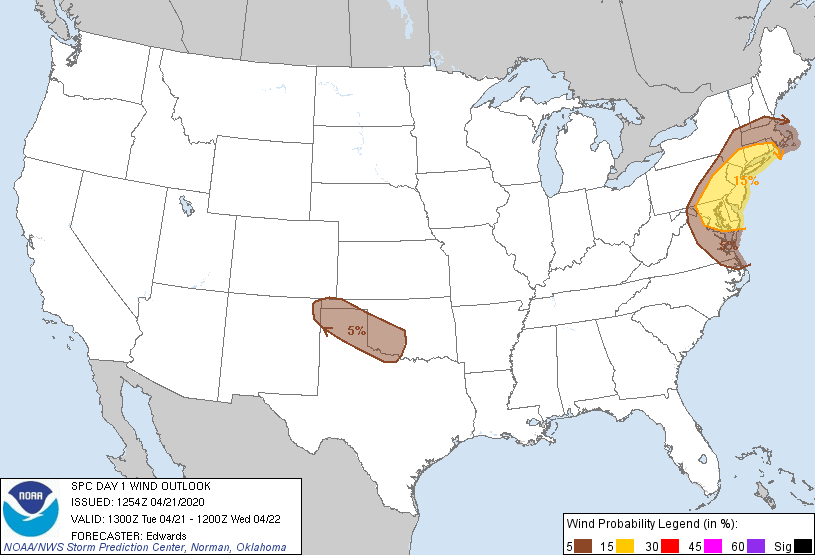
EventUALLLY (ha, fooled ya), the storms that fire out to our west will work their
way towards the center of the state. SPC gives us some detail on where the worst
of the hail could be, as well as the wind threat.

The storm system will continue to threaten the area on Wednesday, this time with
a focus on the southeast. The area of threat appears a bit more broad, but this
could tighten up when SPC releases their outlooks late tonight and again
tomorrow.
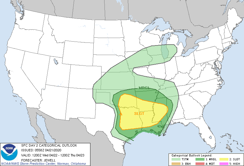

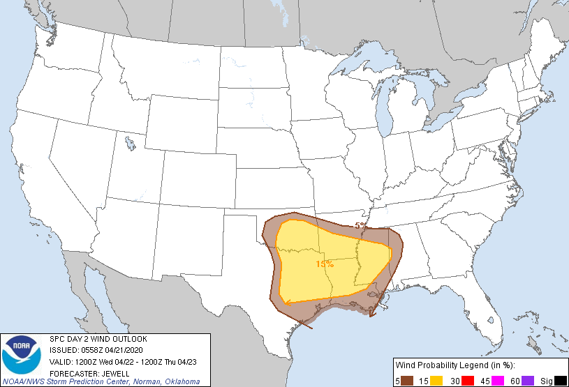
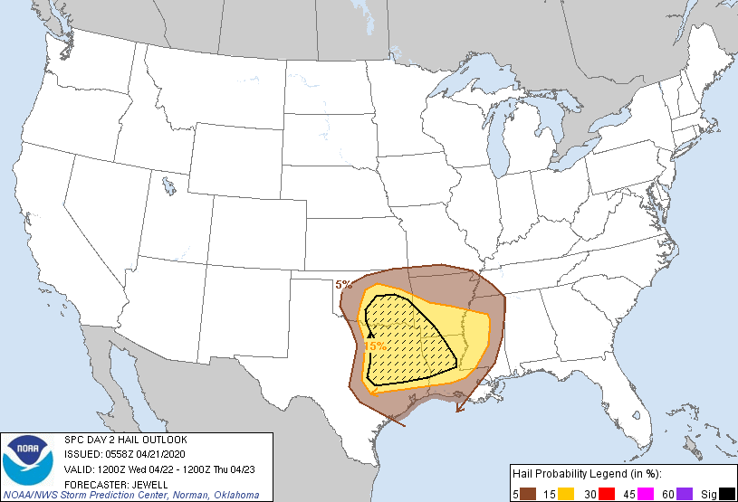
Again, hail seems to be the big threat for tomorrow as well, but that definitely
needs watching.
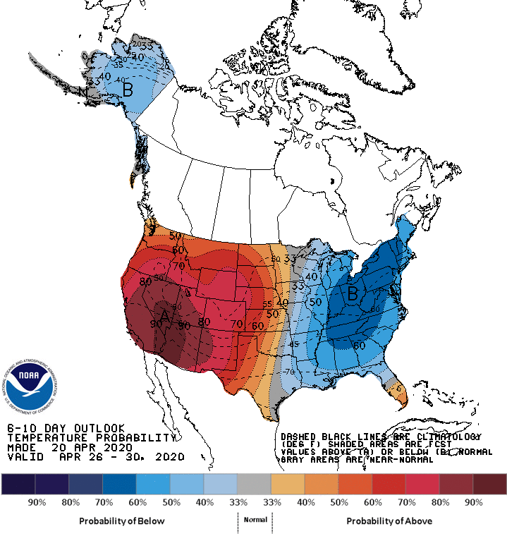
As we get into the weekend and the middle of next week, we could be seeing some
heat build into the state from the West. It won't come with much chance of
rain, so we do need the forecast to hit for the next couple of days. We're at
a point now where we're going to need plenty of moisture to keep up with the
added evaporation from warmer weather and increased sun, as well as what the
vegetation is needing. There is a rain chance later this week, so we'll see
how "sure" that one is as we get closer.
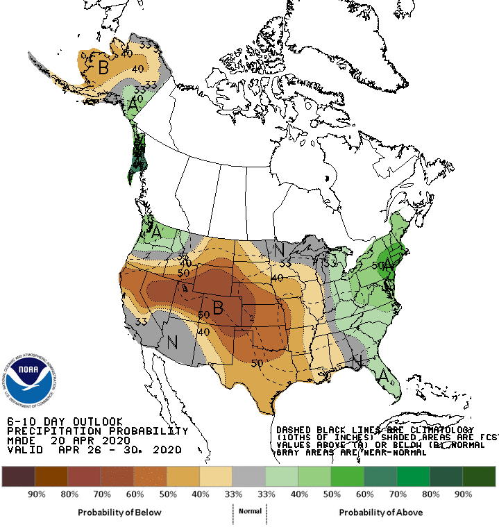
So time to stay weather aware. Shouldn't be too bad by Oklahoma's standards.
In between any storms, enjoy that lovely spring weather.
Gary McManus
State Climatologist
Oklahoma Mesonet
Oklahoma Climatological Survey
(405) 325-2253
gmcmanus@mesonet.org
April 21 in Mesonet History
| Record | Value | Station | Year |
|---|---|---|---|
| Maximum Temperature | 98°F | HOLL | 2022 |
| Minimum Temperature | 22°F | KENT | 2021 |
| Maximum Rainfall | 4.95″ | CHAN | 2017 |
Mesonet records begin in 1994.
Search by Date
If you're a bit off, don't worry, because just like horseshoes, “almost” counts on the Ticker website!