Ticker for April 16, 2020
MESONET TICKER ... MESONET TICKER ... MESONET TICKER ... MESONET TICKER ...
April 16, 2020 April 16, 2020 April 16, 2020 April 16, 2020
High Plains Drifts
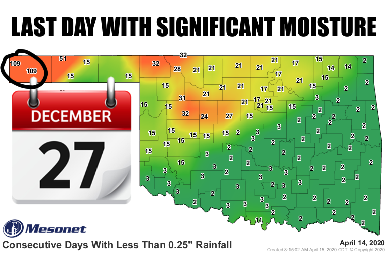
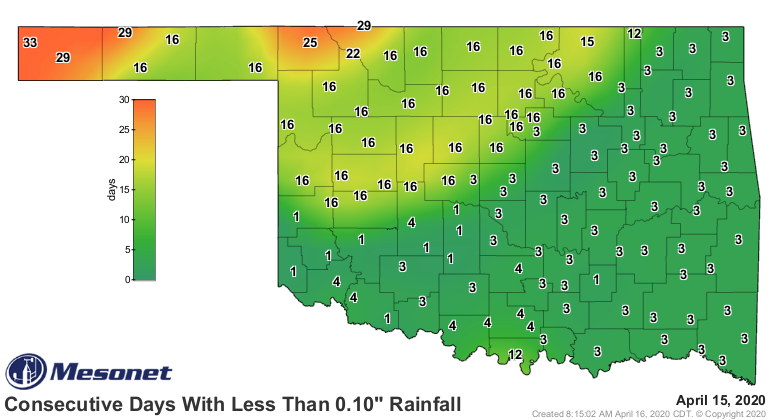
Dec. 27, 2019. Two days after Christmas, Boise City recorded 0.46 inches of
moisture and only an inch since. Kenton is even drier with only 0.9 inches. That's
110 days (including today, map will update tomorrow morning) without significant
moisture. So in that arid air out that way, with the wind and heat at times, the
soils have had to try and hold onto that half-inch or less of moisture with
grim determination. The drought actually goes back even further than that, of
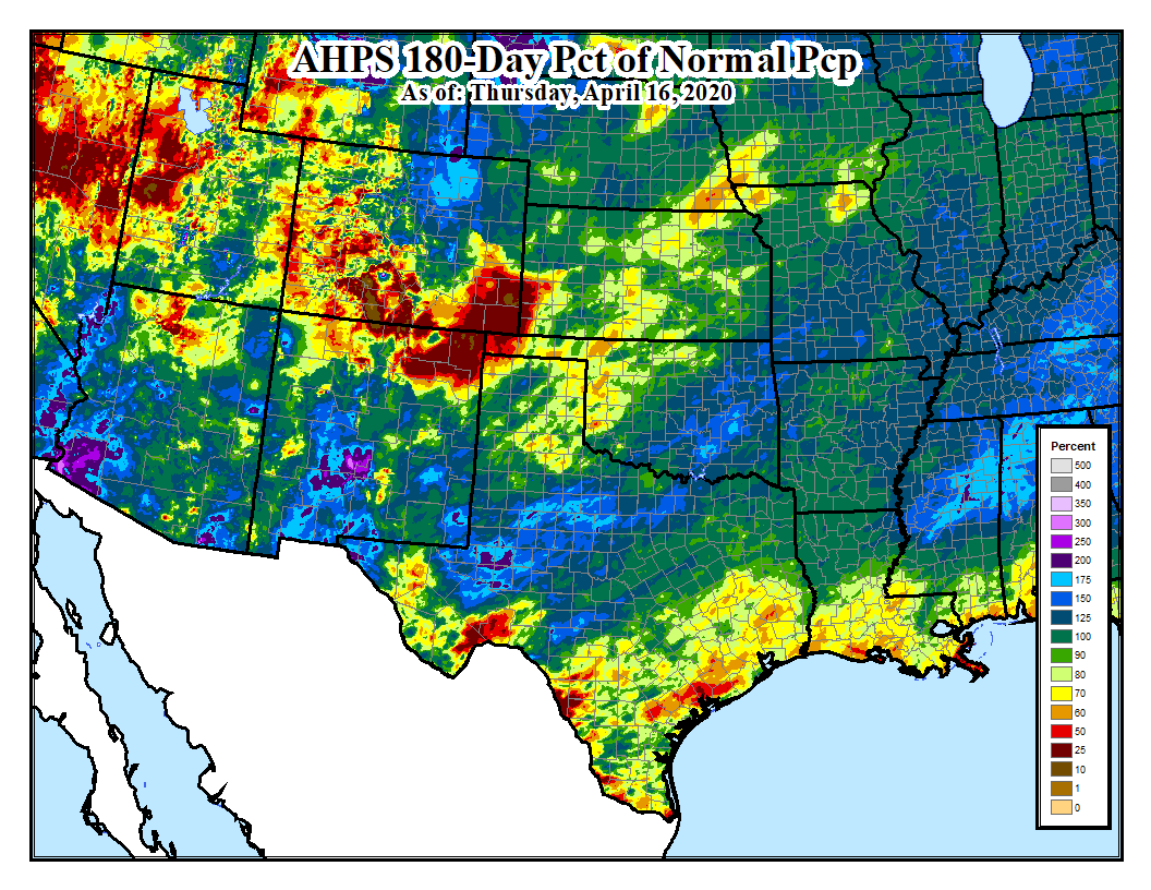
course. We can go all the way back to mid-October and see the High Plains area
of OK, CO, NM, and KS suffering from some pretty big deficits.
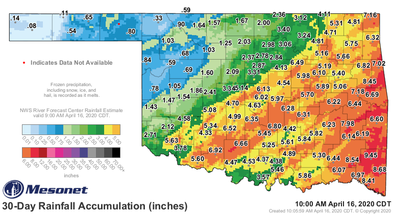
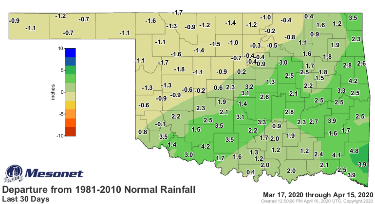
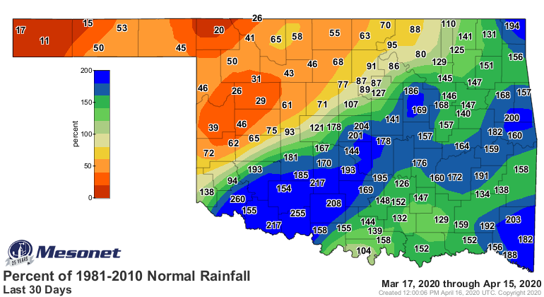
And those deficits have continued to grow over the last 30-plus days, and have
expanded in scope.
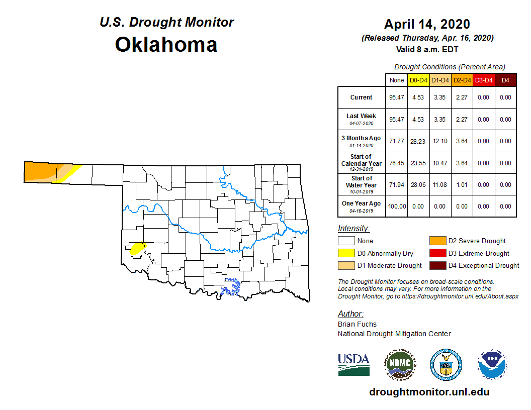
That leads to one more week of a nasty looking Drought Monitor map for that
region, painted with moderate and severe drought.
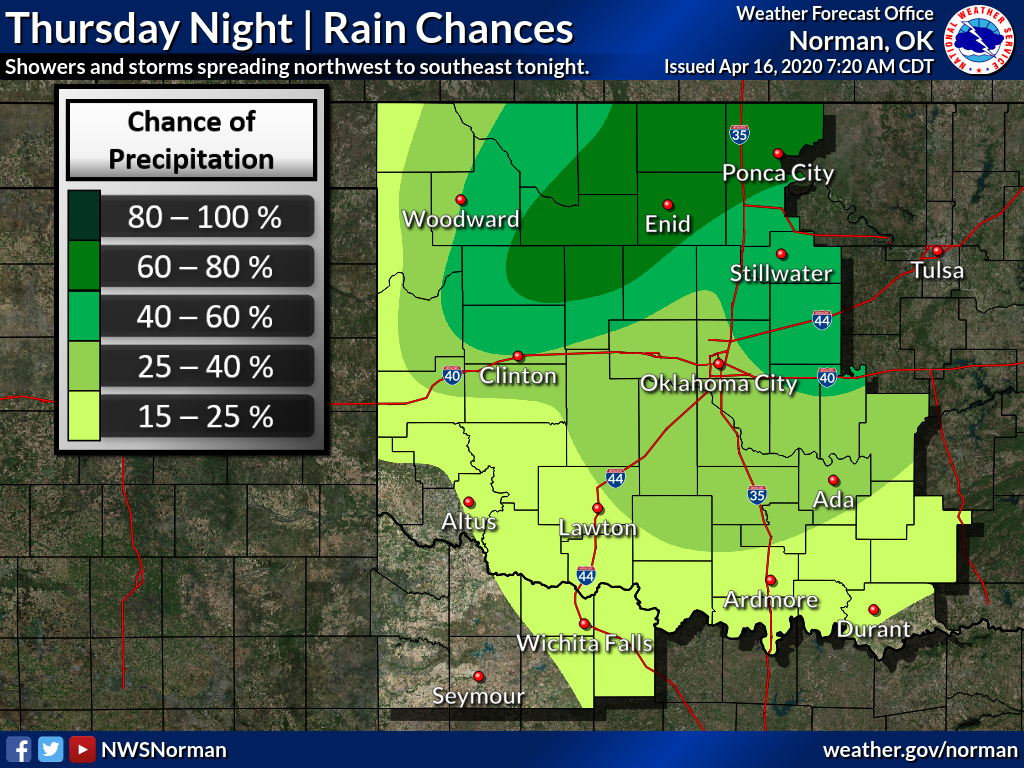
There is some hope for that area as we get into next week and a better chance
of rain. Chances go up across north central Oklahoma tonight, associated with
another idiotic cold front (bullying cold fronts is acceptable, no?).
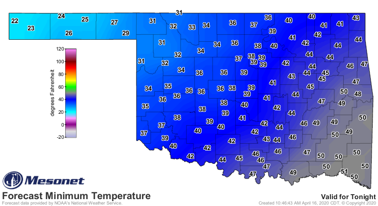
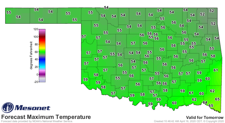
That cold front will set us up for another colder-than-normal day tomorrow,
and another freeze in the NW.
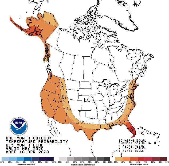
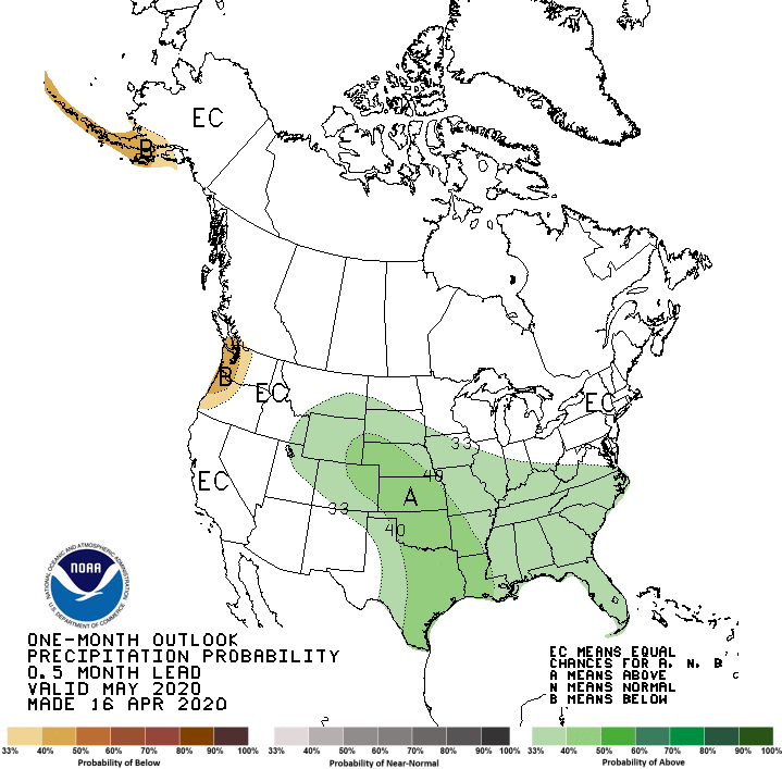
The Climate Prediction Center has released its May and May-July outlooks, and
they don't hold out much hope for the western Panhandle.
Slightly increased odds of above normal precipitation across that area for May,
with higher odds across the rest of Oklahoma. The temperature outlook goes
with Equal Chances for much of the center U.S., including Oklahoma, signalling
equal odds of above-, below- and near-normal temperatures occurring next
month.
We really need that bit of an odds booster for precip to hit next month if the
May-July 3-month seasonal outlook comes to fruition. There we see increased
odds of above normal temperatures across the state, and precipitation as well
except the far western Panhandle and SW OK.
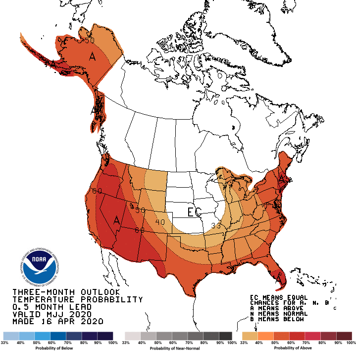
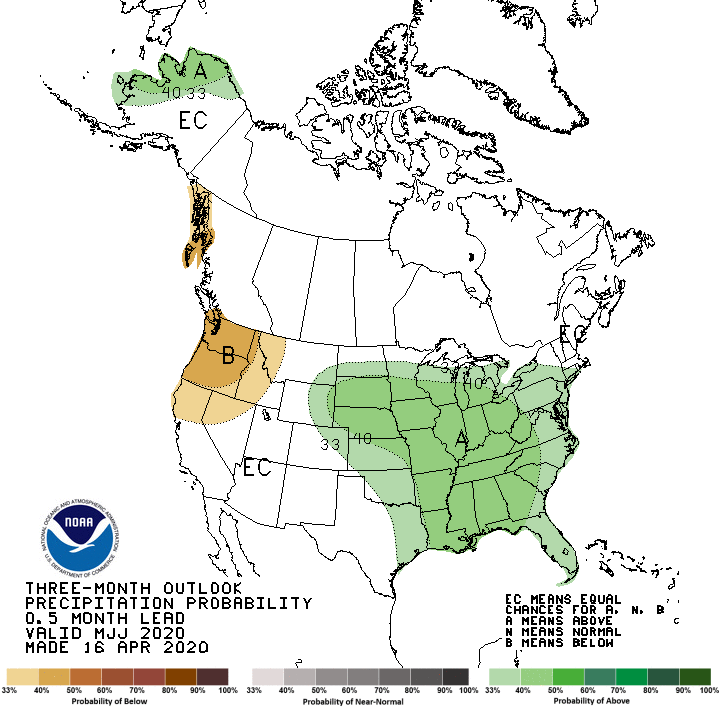
I don't think those maps can be that precise when you get down to that fine
of a scale, down to the county level. So fuzzy boundaries either help us or
hurt us there. When we take a look at the April-July drought outlook, however,
CPC thinks that drought persists or intensifies in the western Panhandle.
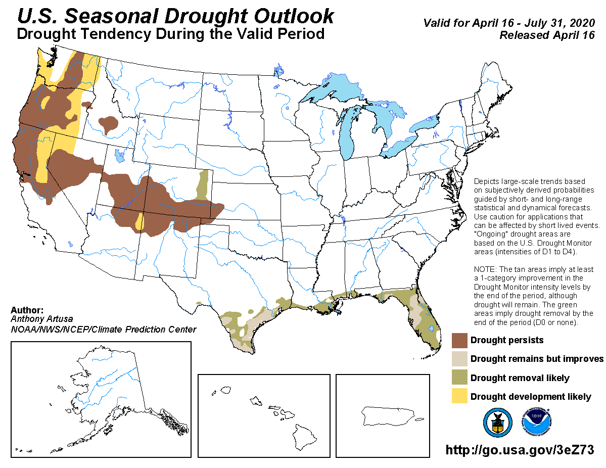
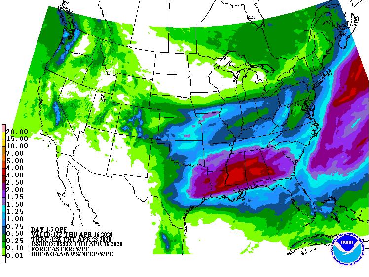
Regardless, much of NW OK needs rain NOW, and can't wait until next month.
The 7-day forecast shows some hope, but we need raindrops, not hopedrops.
Gary McManus
State Climatologist
Oklahoma Mesonet
Oklahoma Climatological Survey
(405) 325-2253
gmcmanus@mesonet.org
April 16 in Mesonet History
| Record | Value | Station | Year |
|---|---|---|---|
| Maximum Temperature | 96°F | BURN | 2006 |
| Minimum Temperature | 20°F | FORA | 2018 |
| Maximum Rainfall | 3.75″ | TIPT | 2016 |
Mesonet records begin in 1994.
Search by Date
If you're a bit off, don't worry, because just like horseshoes, “almost” counts on the Ticker website!