Ticker for February 4, 2020
MESONET TICKER ... MESONET TICKER ... MESONET TICKER ... MESONET TICKER ...
February 4, 2020 February 4, 2020 February 4, 2020 February 4, 2020
Would an idiot forecast that?
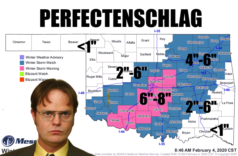
Aha! Just as I (others) predicted yesterday, the, uhhhhhh, predictions for snow
expanded the coverage and increased the amounts. We now have a winter storm
warning for the I-44 corridor and points about a county SE of it where the
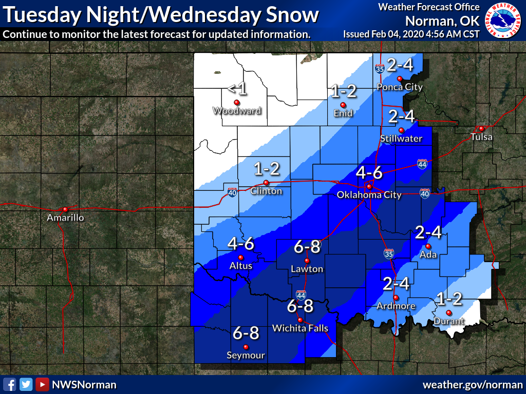
forecast models are starting to pinpoint a strip of enhanced snowfall. Amounts
still look to be in the 6-8" range, but I'm thinking there might be some heavier
local amounts within that strip. And remember, that strip could very easily shift
to the NW or the SE just a tad, so that winter storm warning will probably expand
this afternoon to allow for that. The area outside the warning is in a winter
storm watch for the possibility of 3-5" of snow. And remember there could be a
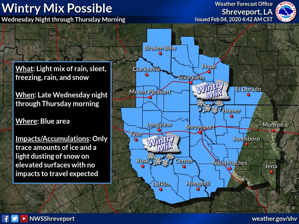
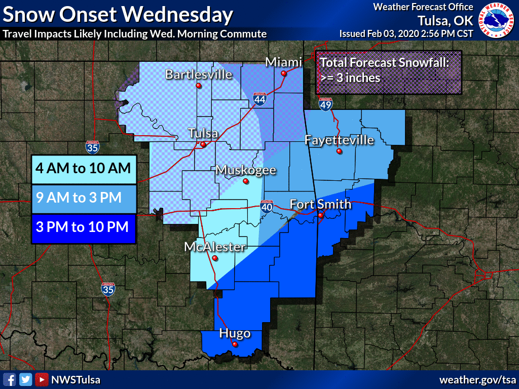
bit of ice with this storm as it transitions over to snow. Here are the pertinent
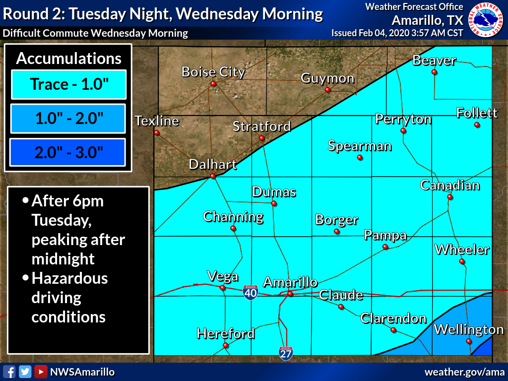
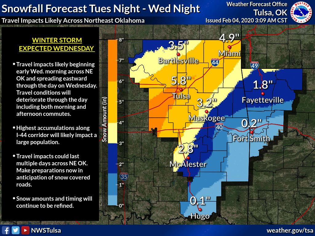
graphics from our local NWS offices detailing the forecast amounts and timing of
the wintry weather.

Here's a bit of what NWS Norman is thinking:
"Frontogenesis is forecast maximizing early Wednesday morning especially
in the 850-800 mb layer, but the placement of this frontogenesis and
ageostrophic response to this frontogenesis enhancing lift is
still somewhat uncertain at this point."
HA! That's what you get for asking. Well, you didn't ask but I told ya anyway.
Now, kneel before Zod.
Here's something more English-ish to chew on instead:
"Overall, the snow forecast is pretty similar to previous
forecasts with the axis of heaviest snow currently forecast to be
from roughly Vernon to Duncan to Shawnee, but this axis could
shift a little bit northwest or southeast from this current
forecast depending on where the banding sets up. But even if the axis
shifts somewhat, there is a high enough chance that some of these
areas will see 4 or more inches of snow that we will upgrade a
portion of the watch to a warning this morning. We will not
upgrade the entire area where we are currently forecasting 4 plus
inches of snow given the potential for some shift in the axis, but
will let the day shift expand the warning as needed..."
Not really much else to say. You need to stay weather aware this throughout the
next couple of days if you are in the watch/warning areas. There will be subtle
shifts in the forecast over the next 24 hours, right up until the event itself.
Travel will be highly discouraged, and discouragement will be highly traveled.
This will be a blip as we warm back up for the weekend, but a necessary blip
to get the anticipation and realization of snow out of our collective system.
It is exciting though, ain't it?
Gary McManus
State Climatologist
Oklahoma Mesonet
Oklahoma Climatological Survey
(405) 325-2253
gmcmanus@mesonet.org
February 4 in Mesonet History
| Record | Value | Station | Year |
|---|---|---|---|
| Maximum Temperature | 84°F | NEWP | 2008 |
| Minimum Temperature | -12°F | KENT | 2022 |
| Maximum Rainfall | 2.37″ | MTHE | 2020 |
Mesonet records begin in 1994.
Search by Date
If you're a bit off, don't worry, because just like horseshoes, “almost” counts on the Ticker website!