Ticker for February 3, 2020
MESONET TICKER ... MESONET TICKER ... MESONET TICKER ... MESONET TICKER ...
February 3, 2020 February 3, 2020 February 3, 2020 February 3, 2020
A Snowmageddon for the rest of us

Finally, the rest of us get to experience what those across northern and western
Oklahoma have seen several times this season...the slipping into ditches, the
falling on frozen sidewalks, cannibalism after being stuck in houses for nearly
24 straight hours (come on, surely you could have waited??). Central Oklahoma
had to wait for more than 3 months since northwestern Oklahoma saw as much as
13 inches on Halloween, for crying out loud? Well, nobody said Mother Nature was
fair. Here's the setup...oh to heck with it, let's just get straight to the
exciting pictures!
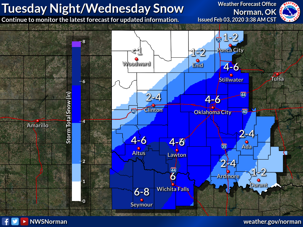
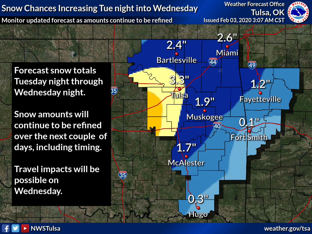
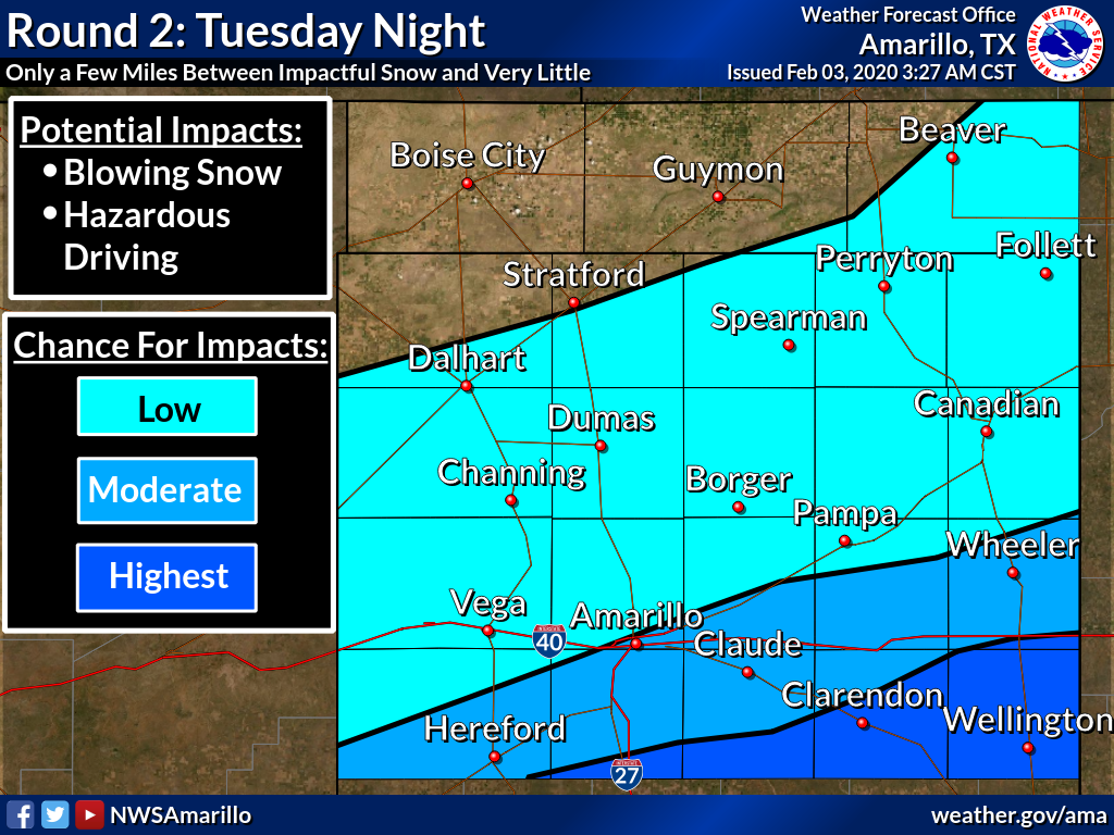
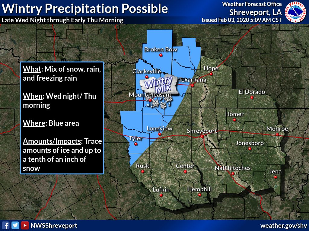
Hmmmm, is Aunt Mabel still at your house for your Super Bowl party? Maybe get
het to stay until Wednesday. NO, we kid, we kiiiiid. Just prepare now so you
won't have to get out and drive Wednesday, because not only could you have
dangerous driving conditions, add to that bitter wind chills should you get
stuck.
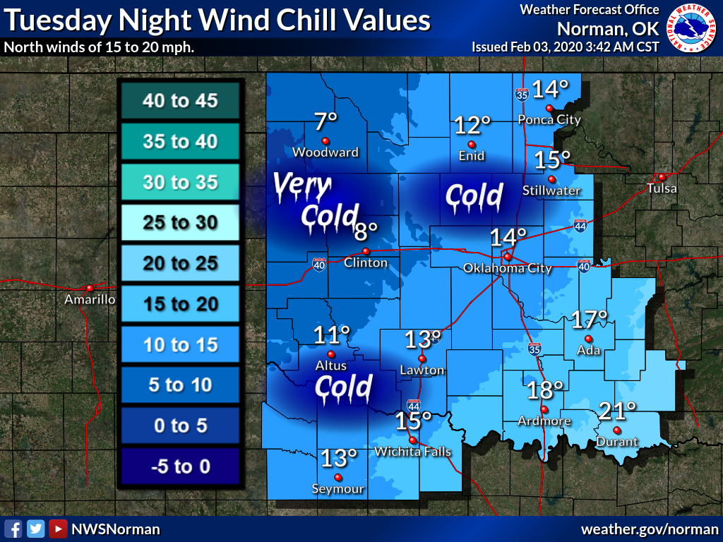
You have a couple of days to prepare before the cold front moves in tomorrow.
Maybe some showers and storms ahead of it, some light snow in the NW behind
it. The main show starts Tuesday night into Wednesday. As the storm system
digs in through the Southern Plains before ejecting to the northeast, it
could/should dump a goodly amount of snow along a swath from southwest to
northeast somewhere in the Oklahoma/Texas vicinity. Not Houston, not Boise City,
but somewhere in between. The forecast models are trying their darndest to
come together and paint that heavy snow (4-6 inches, but I wouldn't be shocked
to see somewhere get 10+ inches) from northwest Texas up the I44 corridor
right into central Oklahoma. Could shift 50 miles or some to the northwest or
southeast, hence the broadened winter storm watch.

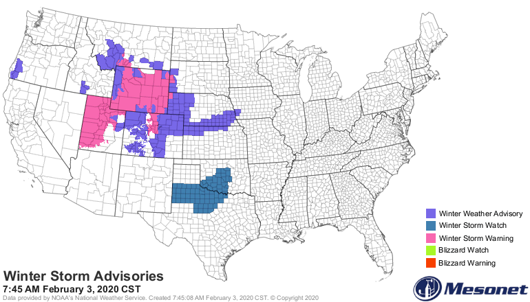
Okay, now that we've piqued your interest with the prospects of an upcoming
SNOWMAGEDDON, how about we go back and check out the SNOWMAGEDDON of January?
And tornadomageddon, and rainmageddon, etc. Here's your January weather recap.
------------------------------------------------------------------------------
Snow Thrives Despite Warm January
Feb. 3, 2020
Although January’s weather continued this winter’s general tilt towards
unusually mild conditions, that failed to prevent several bouts of wintry
weather from striking the state. In true Oklahoma fashion, the first bout of
snow and ice was foreshadowed by severe weather, including a couple of
tornadoes. Those weak twisters struck on January 10 near Prague and Park Hill
according to National Weather Service reports. The Park Hill tornado was the
more destructive of the two, damaging roofs, outbuildings and trees. Notably,
the first two tornadoes in 2019, on the way to a record total of 149, did not
come until April 17.
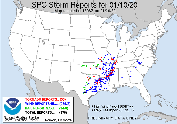
The snow and ice that followed the severe weather was generally light, but it
was enough to disrupt traffic through the 11th. Localized amounts of 2-3 inches
were reported in the northeast. Light freezing rain and snow created hazardous
driving conditions across northern Oklahoma on the 17th and 22nd. The most
impressive winter storm struck in the northwest on the 28th, however. A heavy
wet snow – bolstered by half-dollar sized flakes – fell across the northwest
quarter of the state. Totals from 3-5 inches were common, with as much as 10
inches being reported from Turpin in the eastern Panhandle. Heavy winds caused
blowing and drifting snow and made for `hazardous driving conditions. Despite
the multitude of winter storms, most of the state lacked any significant
snowfall for the season through January.
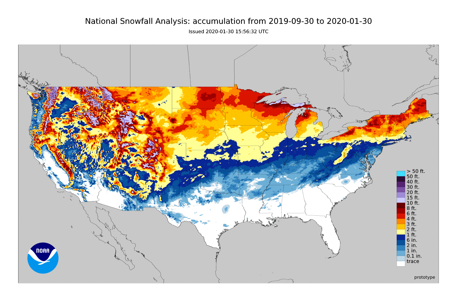
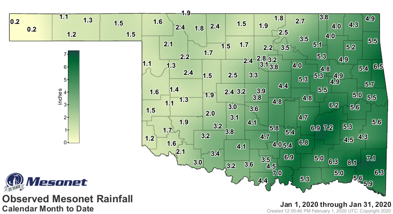
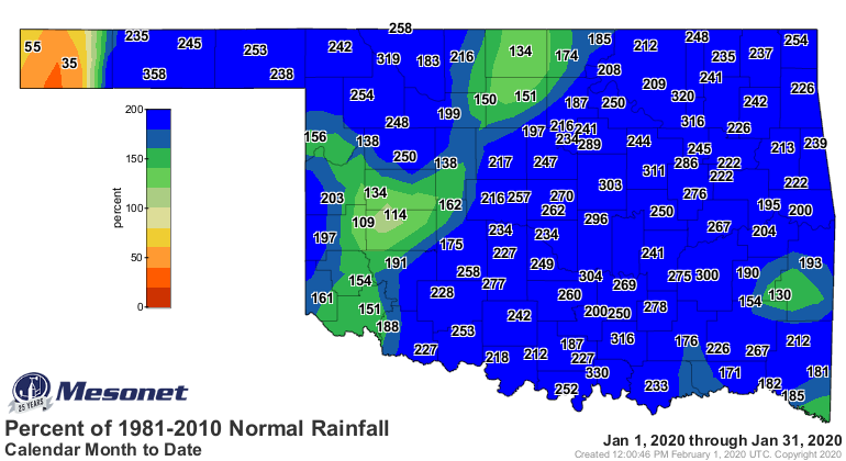
According to preliminary data from the Oklahoma Mesonet, the statewide average
precipitation total was 3.48 inches, 1.92 inches above normal and ranked as the
sixth wettest January since records began in 1895. Totals ranged from 4 to 8
inches across eastern Oklahoma, with the Cloudy Mesonet site leading the way at
8.08 inches. Boise City and Kenton were the only two sites failing to reach an
inch of precipitation at 0.17 and 0.23 inches, respectively. Deficits of about
a quarter-inch covered that area, while the rest of the state had surpluses of
1-5 inches.

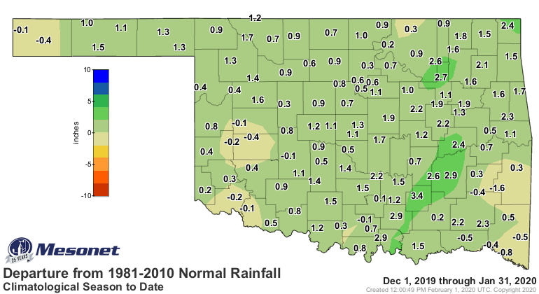
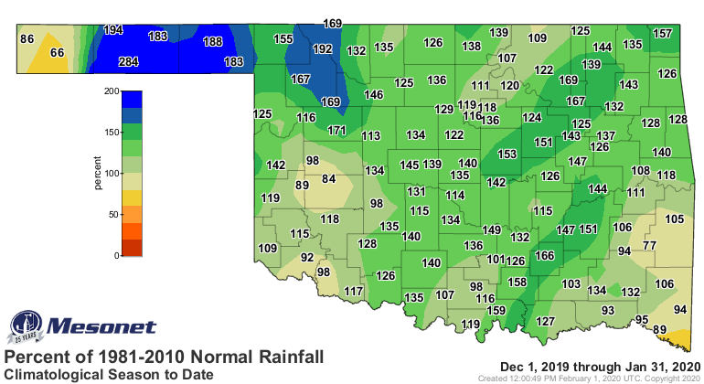
A very similar pattern emerged for the December-January period, with
precipitation totals ranging from just under an inch in the far western
Panhandle to more than 8 inches in the southeast. The December-January
statewide average finished at 4.54 inches, a surplus of 0.92 inches, to rank as
the 20th wettest such period on record.

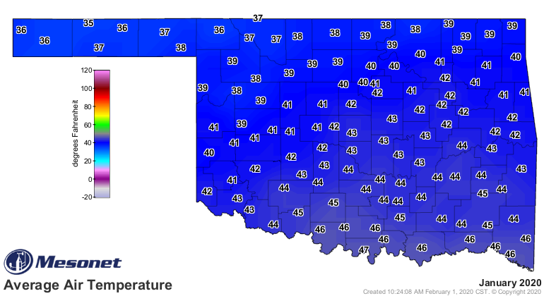
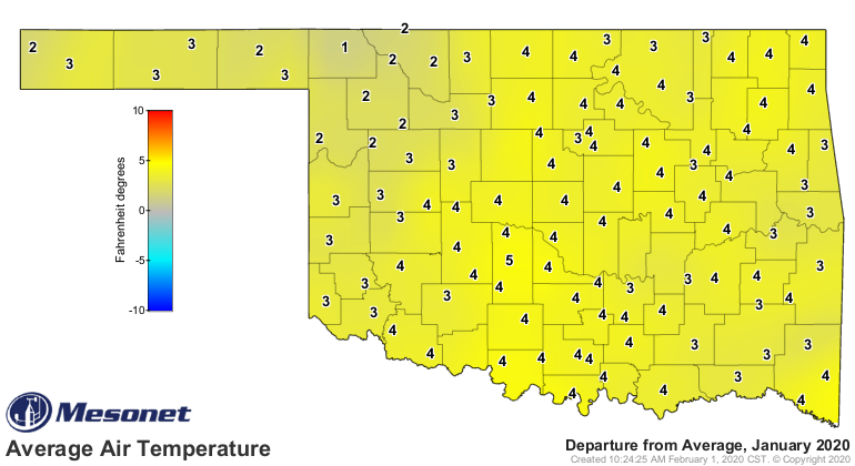
The statewide average temperature was 41.9 degrees, 4.2 degrees above normal
and the 14th warmest January on record. The Panhandle was an outlier at just
2.7 degrees above normal, but still warm enough to rank as the 18th warmest
February for that area of the state. Above normal minimum temperatures were
responsible for much of the state’s positive January temperature anomaly. Lows
were 5-6 degrees above normal while highs were generally 1-3 degrees above
normal. There was a slew of 70s during January, with Hugo’s 77 degrees on the
15th leading the pack. The lowest temperature recorded by the Mesonet was 5
degrees at Boise City on the 11th.
The December-January statewide average of 42.5 degrees was the fifth-warmest
first two months of winter on record, 4.2 degrees above normal. Remarkably,
the Mesonet recorded only six single-digit temperatures at its 120 sites over
that period.
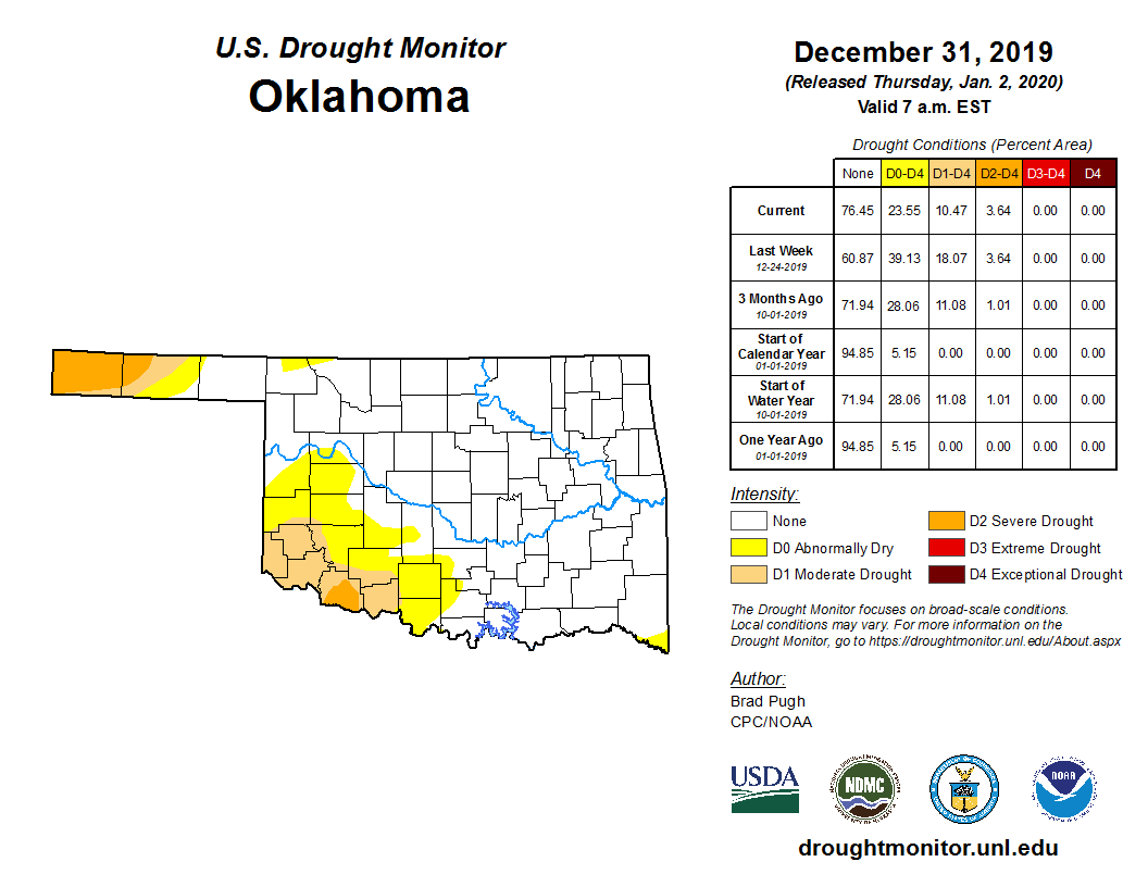
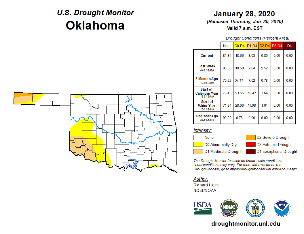
The abundant moisture continued to slowly whittle away at persistent drought
conditions across southwest Oklahoma and the western Panhandle. Areal coverage
of drought dropped about 2% during the month – from 10% to 8%. – according to
the U.S. Drought Monitor. Chances for further reductions appear slim according
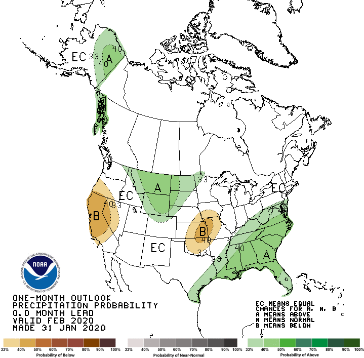
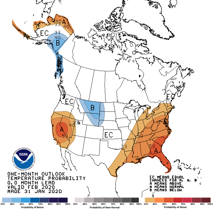
to the Climate Prediction Center (CPC). Their February precipitation outlook
indicates Increased odds of below normal precipitation across most of the
state, with those odds a bit greater across north central Oklahoma. The
temperature outlook shows equal chances for above-, below- and near-normal
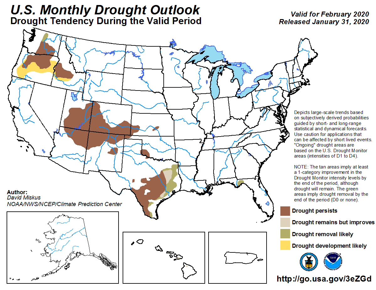
temperatures across the entire state. CPC’s February Drought Outlook expects
the remaining drought to either persist or intensify through the month.
Gary McManus
State Climatologist
Oklahoma Mesonet
Oklahoma Climatological Survey
(405) 325-2253
gmcmanus@mesonet.org
February 3 in Mesonet History
| Record | Value | Station | Year |
|---|---|---|---|
| Maximum Temperature | 89°F | SEIL | 2025 |
| Minimum Temperature | -18°F | NOWA | 2011 |
| Maximum Rainfall | 2.76 inches | SEIL | 2012 |
Mesonet records begin in 1994.
Search by Date
If you're a bit off, don't worry, because just like horseshoes, “almost” counts on the Ticker website!