Ticker for December 19, 2019
MESONET TICKER ... MESONET TICKER ... MESONET TICKER ... MESONET TICKER ...
December 19, 2019 December 19, 2019 December 19, 2019 December 19, 2019
A New Hope?
In all the fun and games -- and angst -- over worrying about snow, and the lack
thereof, we tend to forget that it's REALLY dry out west. And this is during a
part of the year that's already dry. Drought has been plaguing western Oklahoma
for months now...longer in the southwest, but starting to get more serious in the
Panhandle. Check out the latest U.S. Drought Monitor map.
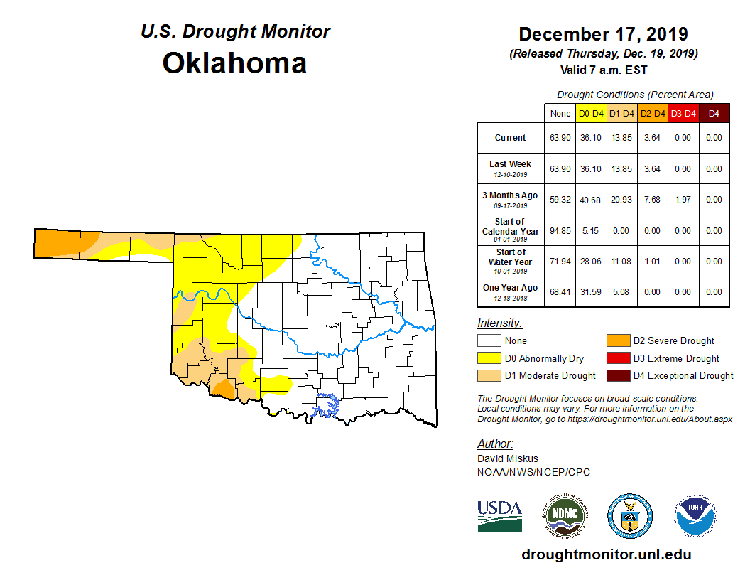
The areas in severe drought are still just 3.64% of the state, but about 14% of
the state is in actual drought, according to the Drought Monitor. The areas to
be concerned about are those in yellow (abnormally dry conditions). That is an
indication of areas tending towards drought in this instance. You can also get
that intensity level on the Monitor when coming out of drought. Sadly, that's not
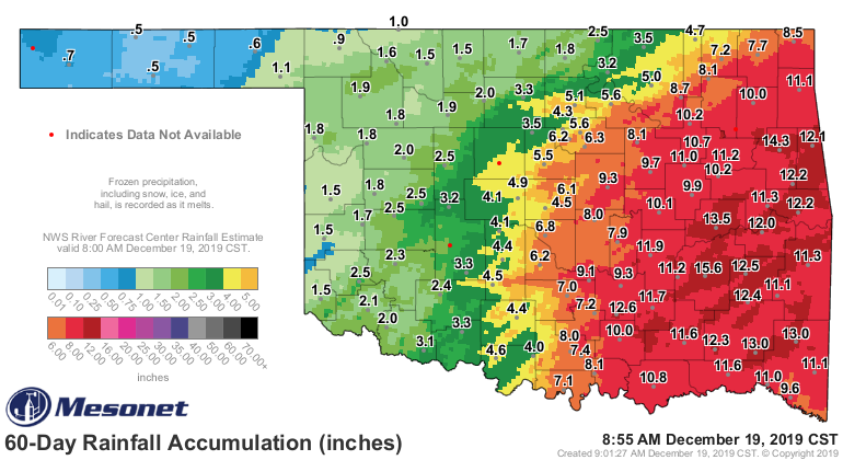
the case here. The rainfall maps from the last 30-60 days continue to show the
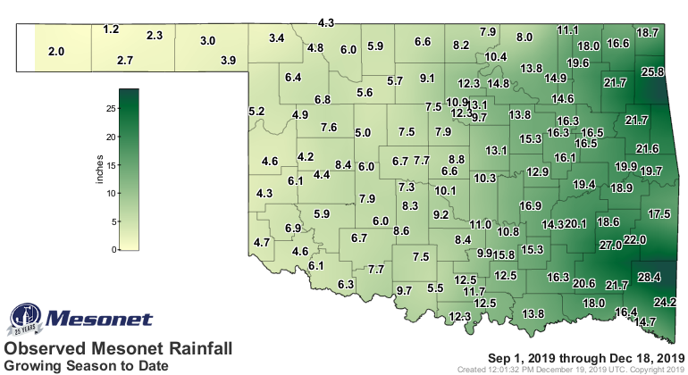
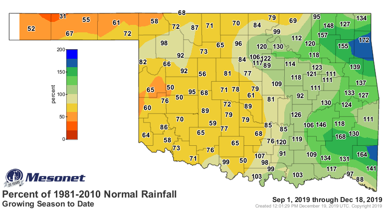
troubled areas, but we can go all the way back to the start of the cool growing
season, Sept. 1, to see the general dryness that has plagued western Oklahoma
over that period.
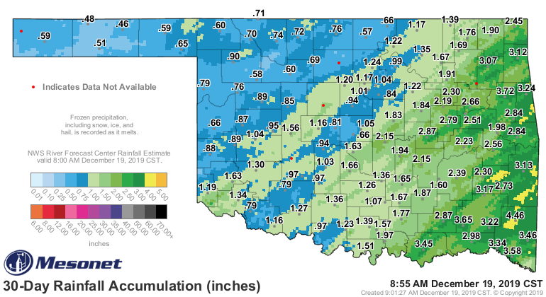
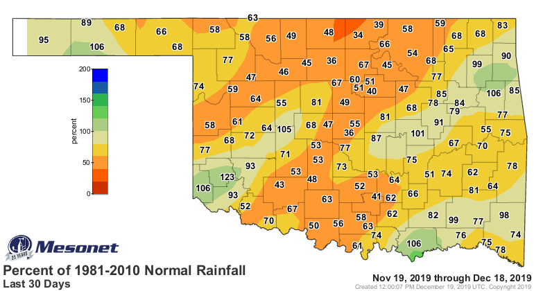

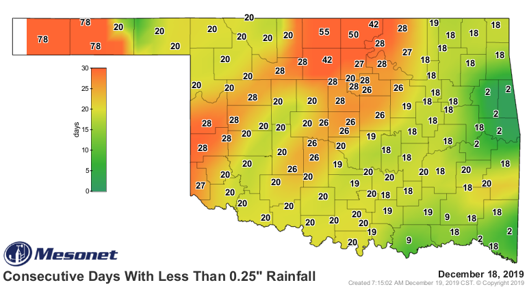
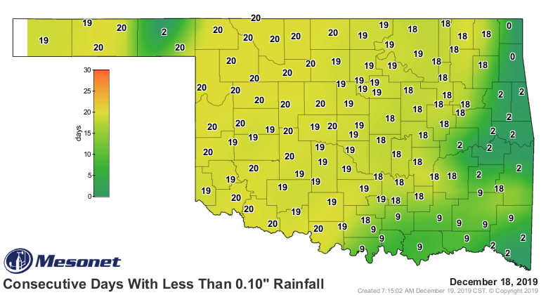
And the lack of a significant amount of precipitation in a short period of time
is troubling. You can have 3 inches of rain over 3 months, but if it comes
in quarter-inch increments, you don't get that soak that would allow for
recharge into the deeper soils. We can see this with our consecutive days
without a quarter-inch of rain map from the Mesonet. But the tenth of an inch
map is starting to look troubling as well.
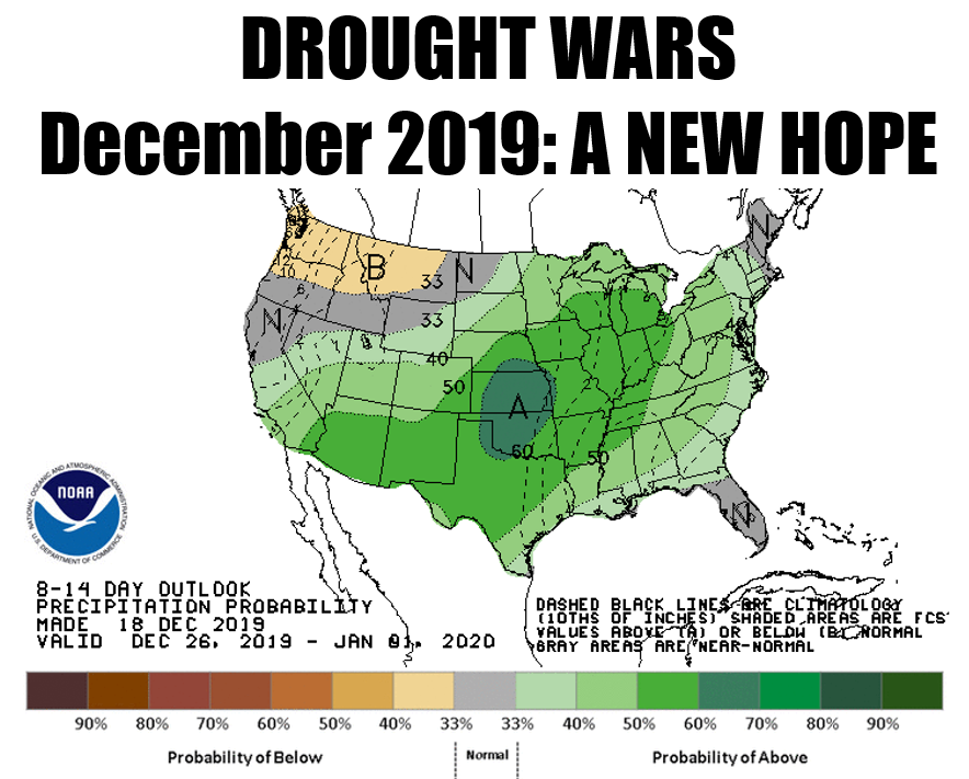
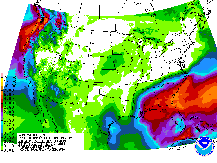
When will the relief come? Well, the top map shows HOPE for the end of the
year, so HOPEfully that will come to fruition. Not much in the next week,
I'm afraid.
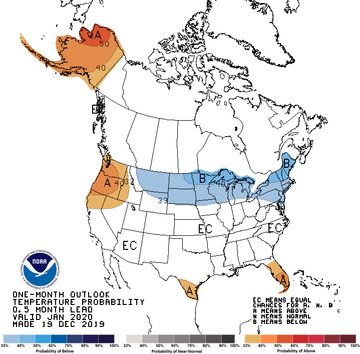
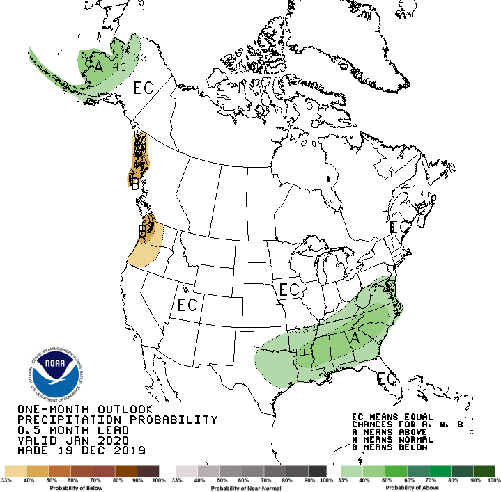
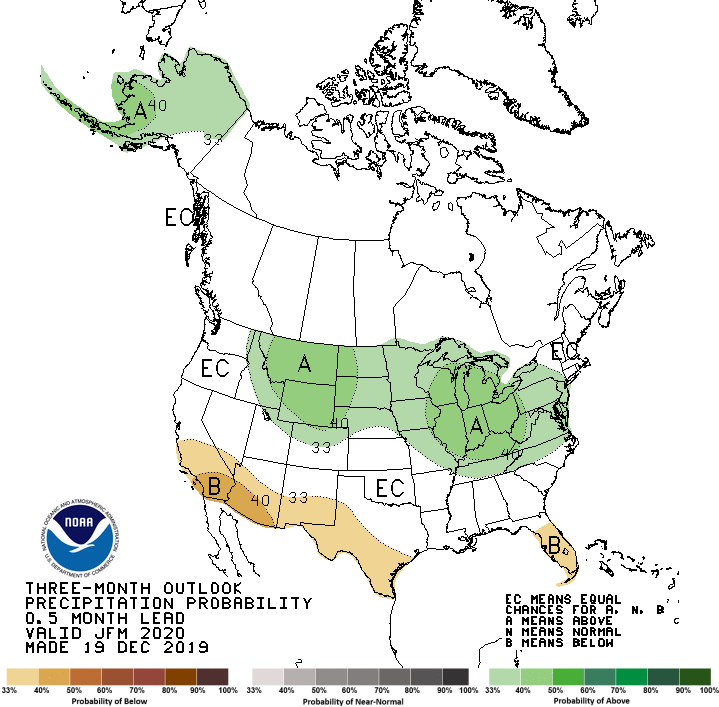
How about down the road? Well, we can look out to January AND January-March
with the CPC outlooks released this morning. I'm afraid there just isn't a
definite signal showing up as far as clues to the next few months weather.
Mostly the noncommittal "EQUAL CHANCES" (equal odds of above-, below- and
near-normal) on both the temperature and precipitation outlooks. Maybe a
warm tilt on the back end of winter (okay okay, knock it off) and above normal
precip in the southeast during January.

Let's talk about our possible wet ending to the year. Does that mean we might
have a chance of snow? Yeah, couldn't hold off on going back there for too
long. But yes, of course there will be a chance of snow. It is winter after all.
But in looking at the temperature outlook for that period, we're going to have
to replace some of this more mild pacific air with some good old fashioned
arctic air.

That could definitely change between now and then. Unfortunately, so could the
precipitation outlook. Only thing we can do is watch...and hope.
Live long and prosper.
Gary McManus
State Climatologist
Oklahoma Mesonet
Oklahoma Climatological Survey
(405) 325-2253
gmcmanus@mesonet.org
December 19 in Mesonet History
| Record | Value | Station | Year |
|---|---|---|---|
| Maximum Temperature | 75°F | IDAB | 2012 |
| Minimum Temperature | -10°F | EVAX | 2016 |
| Maximum Rainfall | 2.94 inches | BUTL | 2006 |
Mesonet records begin in 1994.
Search by Date
If you're a bit off, don't worry, because just like horseshoes, “almost” counts on the Ticker website!