Ticker for November 7, 2019
MESONET TICKER ... MESONET TICKER ... MESONET TICKER ... MESONET TICKER ...
November 7, 2019 November 7, 2019 November 7, 2019 November 7, 2019
Wait for it
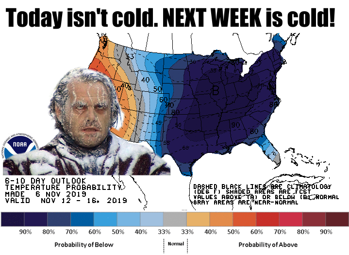
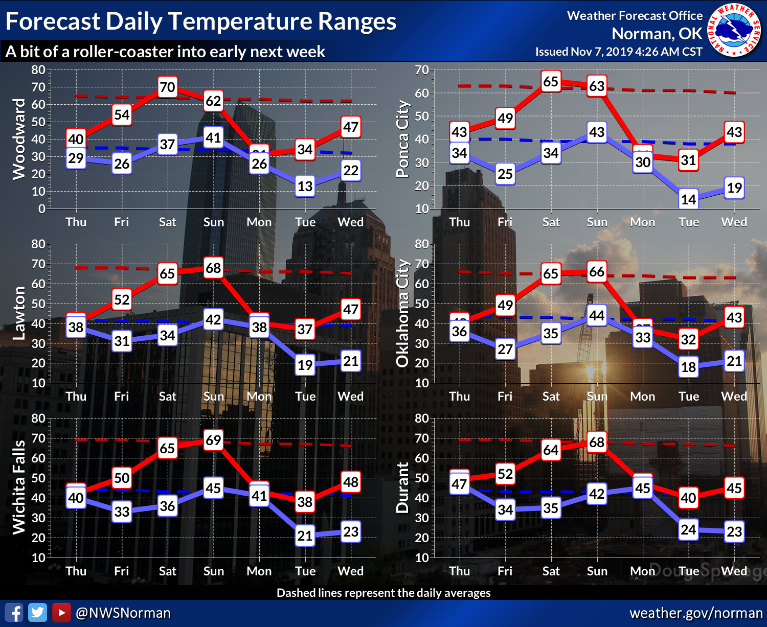
How about highs in the 20s and 30s, and lows from the single digits to teens?
DONE! Next Monday and Tuesday, you're golden. Frozen, but golden. Congrats. Maybe
a bit of snow here and there. Doesn't look like there will be a lot of moisture
return from the Gulf of Mexico to make it too messy, though.
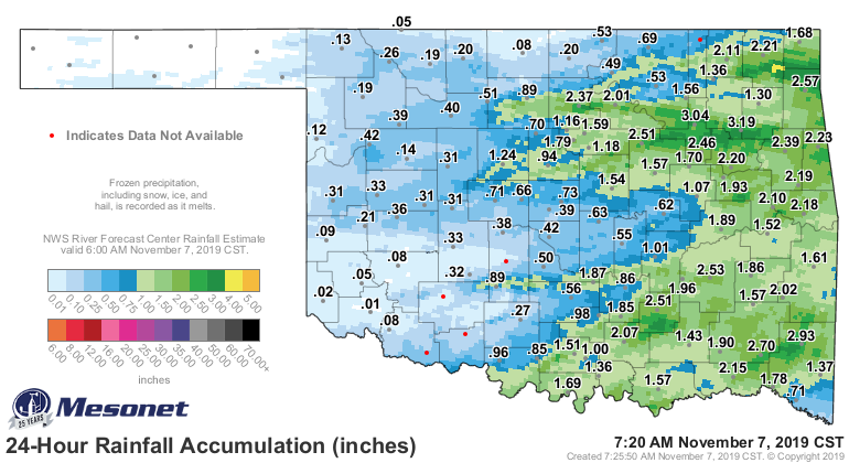
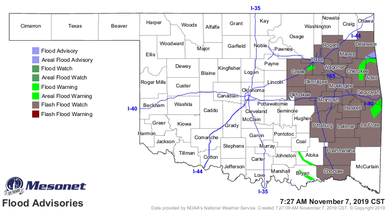
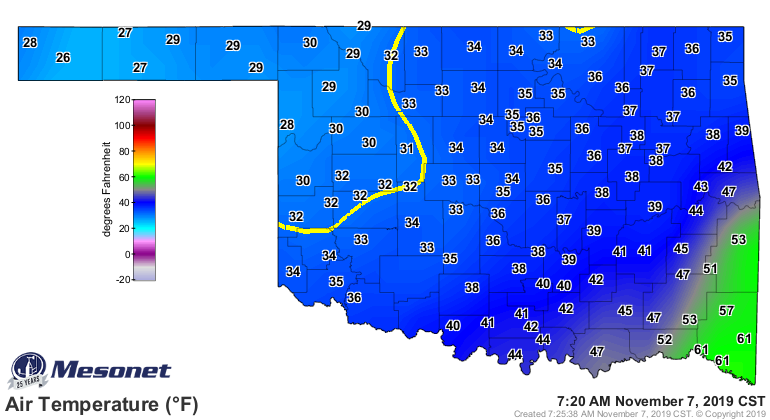
TODAY is messy. Lots of rain, and after last night's cold front, some slippery
weather in the northwest. Meanwhile, we have flooding going on in the southeast.
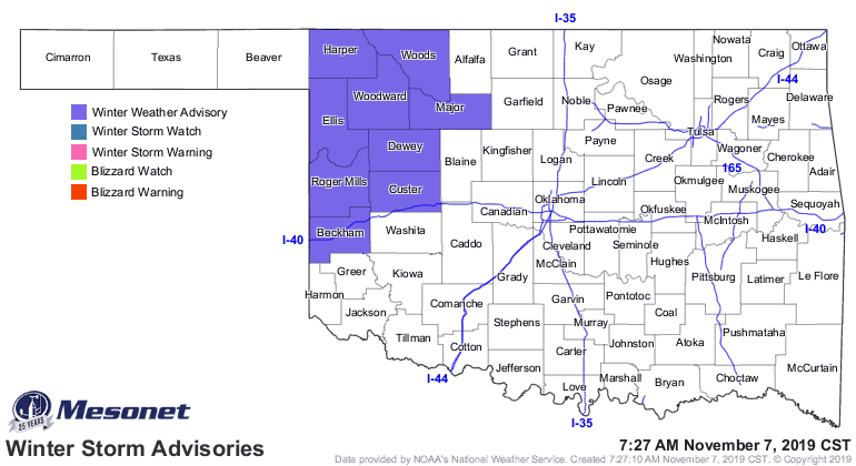
A look at the current temperature map shows where some of that light precip in
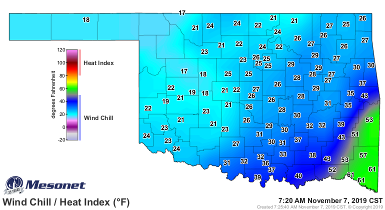
the northwest is causing problems. Not only that, the possibility of frozen
anemometers (and we all know just how painful that can be) is messing up our
wind chill map!
So get ready for the temperature roller coaster again. Near-historic cold
weather for the eastern half of the country next week, and we're gonna get
a glancing blow. Before that, a nice warm up to help punctuate just how cold
it's gonna get.
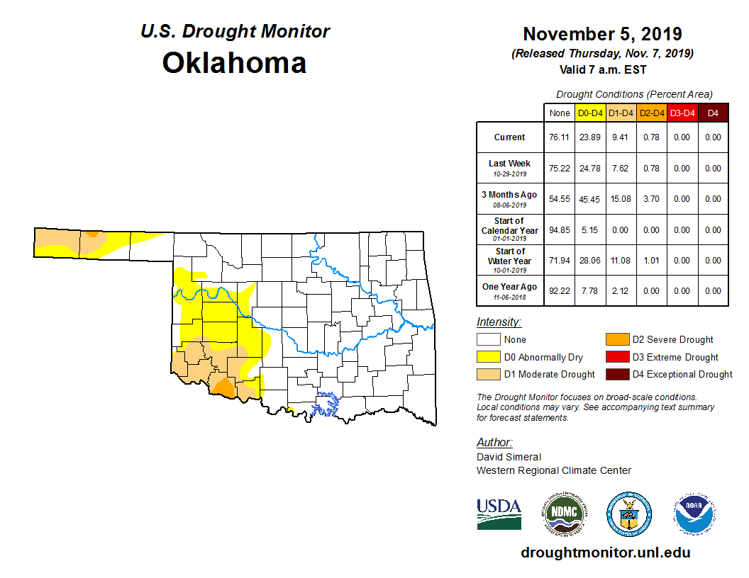
The cold helps slow down drought, as does the rain, of course. But we still
need some moisture across the west; especially in the western Panhandle and
far SW corner of the state.
Best enjoy the weekend. It's gonna be a COLD Veteran's Day.
Gary McManus
State Climatologist
Oklahoma Mesonet
Oklahoma Climatological Survey
(405) 325-2253
gmcmanus@mesonet.org
November 7 in Mesonet History
| Record | Value | Station | Year |
|---|---|---|---|
| Maximum Temperature | 95°F | HOLL | 2023 |
| Minimum Temperature | 18°F | BEAV | 2003 |
| Maximum Rainfall | 5.03″ | ELRE | 2011 |
Mesonet records begin in 1994.
Search by Date
If you're a bit off, don't worry, because just like horseshoes, “almost” counts on the Ticker website!