Ticker for November 5, 2019
MESONET TICKER ... MESONET TICKER ... MESONET TICKER ... MESONET TICKER ...
November 5, 2019 November 5, 2019 November 5, 2019 November 5, 2019
Rain and Roses
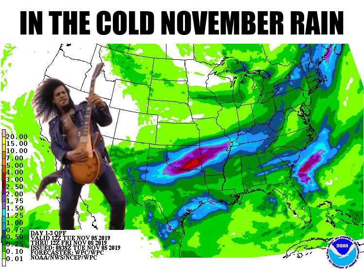
Hey, be happy for Slash. I had an Axl Rose version ready to go as well. Here's
what we're faced with, a bigtime front and a bigtime storm system which will
lead to bigtime rains (my spellchecker wants me to say "big time," but I run
Bartertown) Wednesday night into Thursday. Then we're gonna end up with a chilly,
soggy Thursday afternoon and a frigid Friday morning.
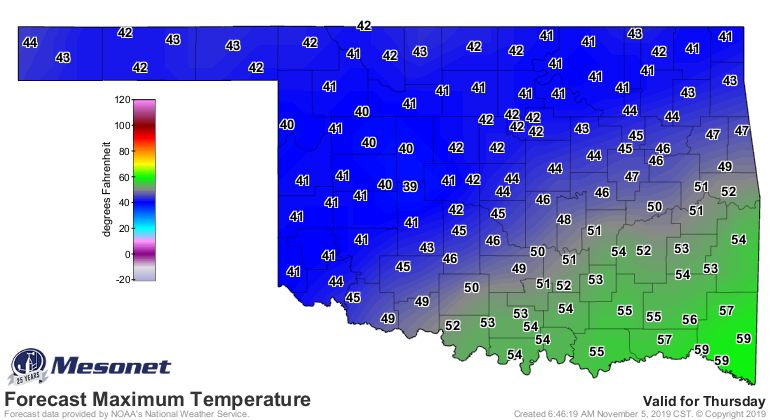
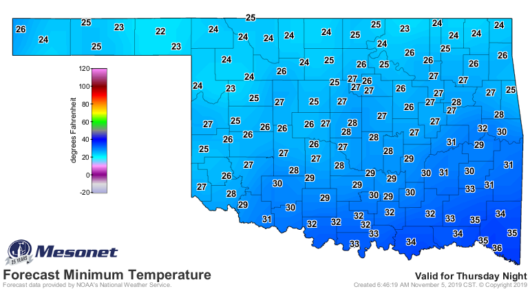
We should jump BACK up to near normal for this time of year over the weekend
before we see another strong cold front for Thursday.
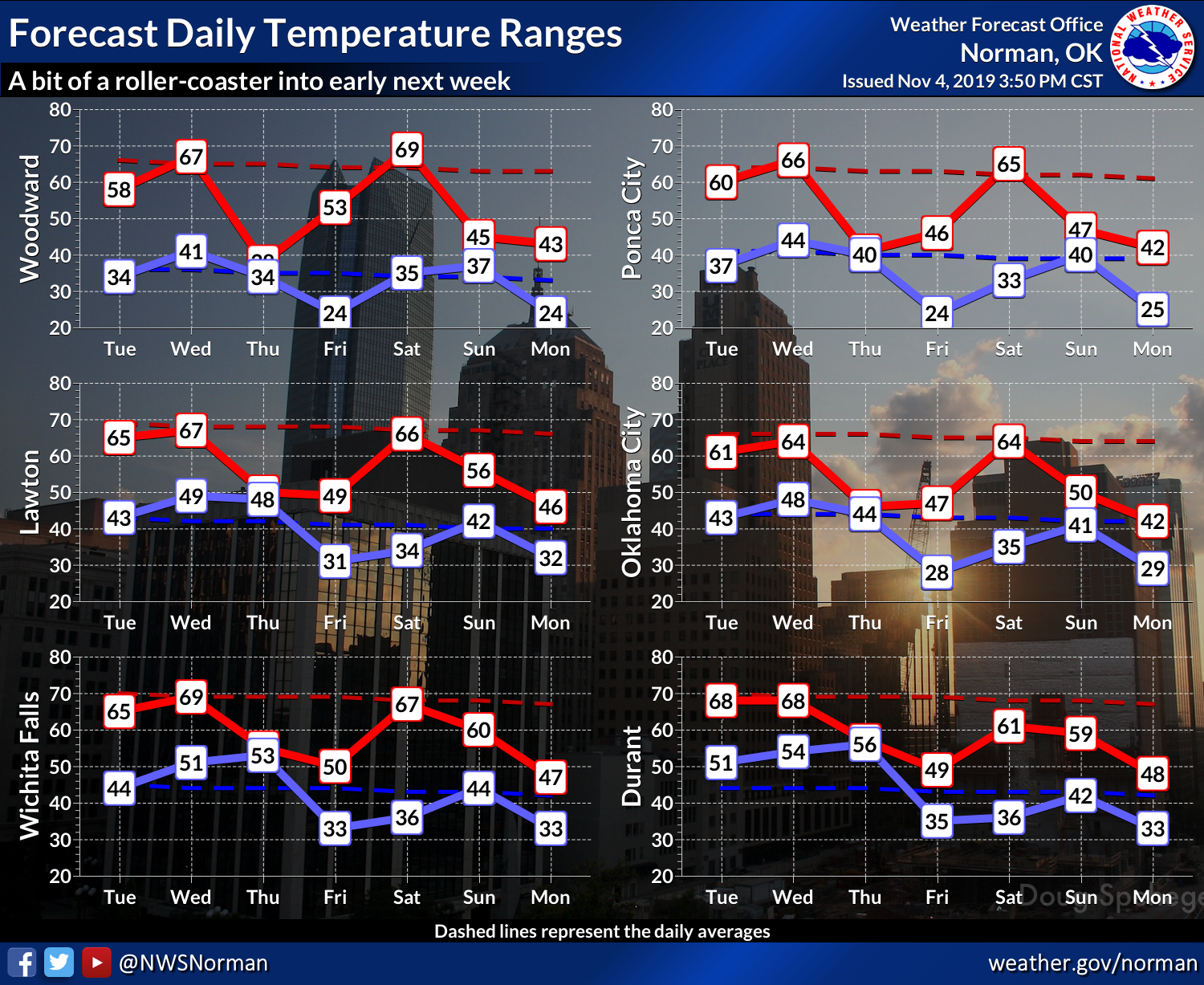
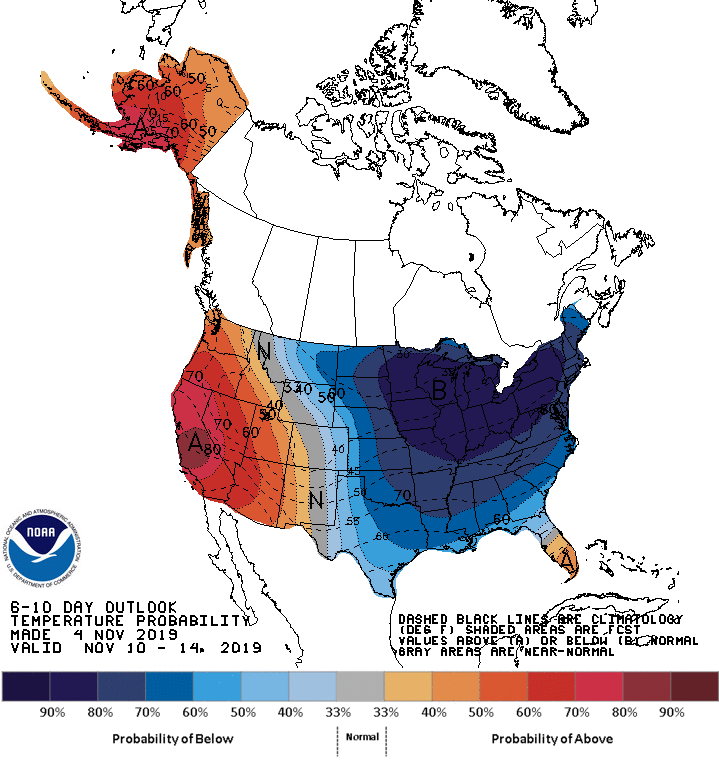
The eastern half of the U.S. is going to be dealing with one of those half-
continental scale cold air outbreaks, while the western half will be warm. So we
will take our familiar place as the dividing line, which means we're going to
be seeing occasional cold fronts that turn our weather to winter, then quick
turn-arounds back into fall.
Precipitation just depends on how quickly moisture can return from the Gulf
after getting scoured by these cold fronts.
Just remember, Nothin' lasts forever, and we all know the weather can change.
Gary McManus
State Climatologist
Oklahoma Mesonet
Oklahoma Climatological Survey
(405) 325-2253
gmcmanus@mesonet.org
November 5 in Mesonet History
| Record | Value | Station | Year |
|---|---|---|---|
| Maximum Temperature | 91°F | BURN | 2017 |
| Minimum Temperature | 20°F | BEAV | 2010 |
| Maximum Rainfall | 4.60 inches | IDAB | 2000 |
Mesonet records begin in 1994.
Search by Date
If you're a bit off, don't worry, because just like horseshoes, “almost” counts on the Ticker website!