Ticker for October 9, 2019
MESONET TICKER ... MESONET TICKER ... MESONET TICKER ... MESONET TICKER ...
October 9, 2019 October 9, 2019 October 9, 2019 October 9, 2019
Fall Wars
Mother Nature's gonna put take cold front, and whop you on the right side of your
face, and you wanna know something? There's not a darn thing you're gonna be able
to do about it.
Yes, I hate to mix Star Wars and Billy Jack, but sometimes it's called for. Heck,
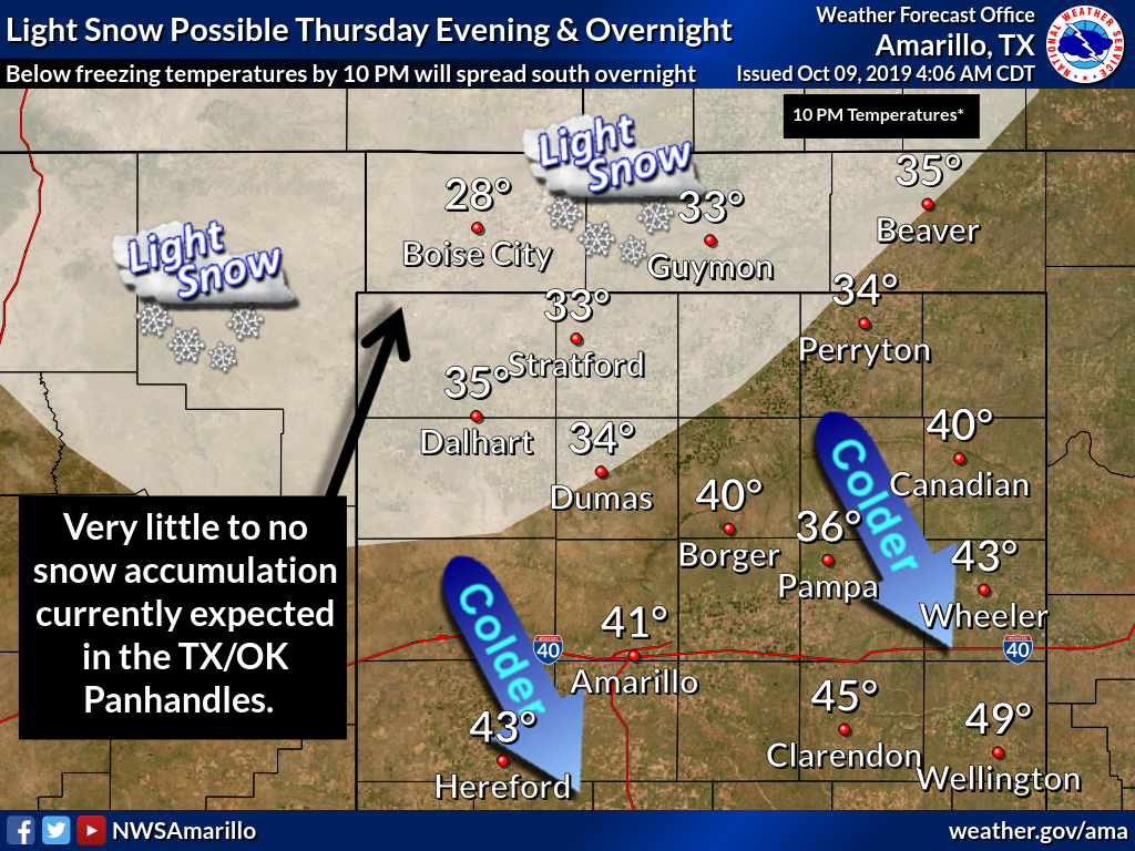
the Panhandle might even see snow Thursday night into Friday morning!
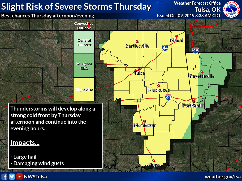
That cold front is coming fast. It's even bragging it make the Kessel Run in 12
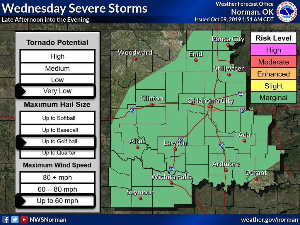
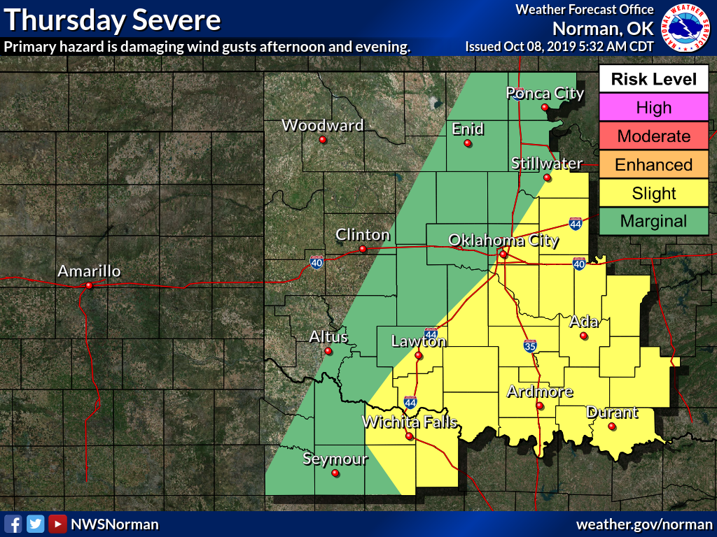
parsecs. For the restovus, we could see storms lingering around today, and with
the front tomorrow, maybe some severe weather. The severe threat is somewhat
limited today, but possible. From the NWS Norman forecast discussion:
"Storms will likely be isolated as lingering clouds and subsidence
behind the morning shortwave may inhibit convective development.
For any storm that is able to sustain itself, would not be surprised
to see some supercellular structures given the shear magnitude, with
an attendant risk for damaging wind gusts and large hail. An isolated
tornado cannot be ruled out given decent low-level shear, but
relatively high LCL`s should temper this risk."
I translate that as "STAY WEATHER AWARE!"

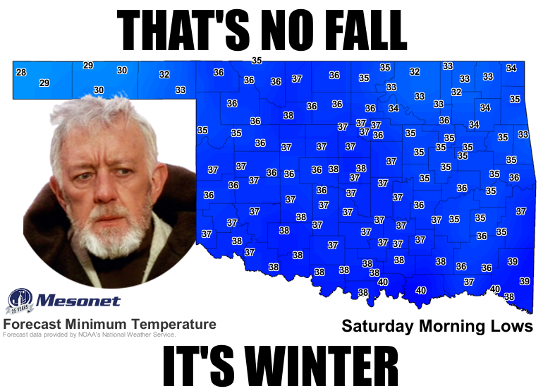
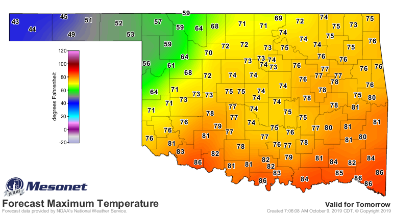
After that excitement, prepare for the arrival of fall...errrrr, winter? Friday
will be cool, and the mornings will be well below normal for a bit.
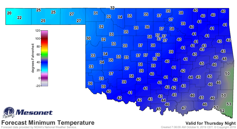
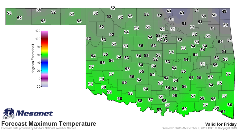
Don't worry. Summer is only 6...no, make that 5 months away. Yeah, March. You
just watch.
Gary McManus
State Climatologist
Oklahoma Mesonet
Oklahoma Climatological Survey
(405) 325-2253
gmcmanus@mesonet.org
October 9 in Mesonet History
| Record | Value | Station | Year |
|---|---|---|---|
| Maximum Temperature | 102°F | FREE | 2021 |
| Minimum Temperature | 16°F | ELRE | 2000 |
| Maximum Rainfall | 4.15 inches | WAUR | 1997 |
Mesonet records begin in 1994.
Search by Date
If you're a bit off, don't worry, because just like horseshoes, “almost” counts on the Ticker website!