Ticker for August 26, 2019
MESONET TICKER ... MESONET TICKER ... MESONET TICKER ... MESONET TICKER ...
August 26, 2019 August 26, 2019 August 26, 2019 August 26, 2019
August Oklahoma
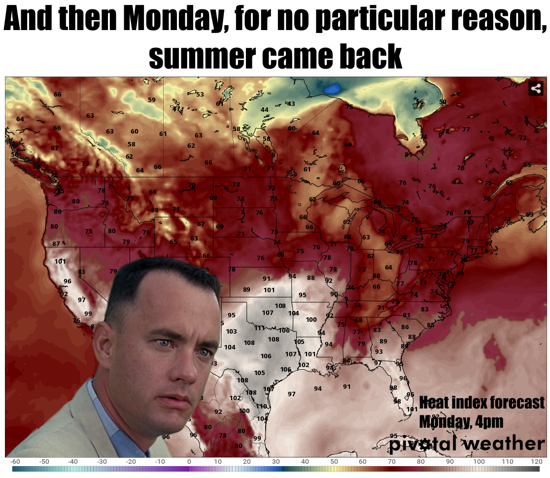
Well, there actually IS a reason summer came back; it's still summer! August.
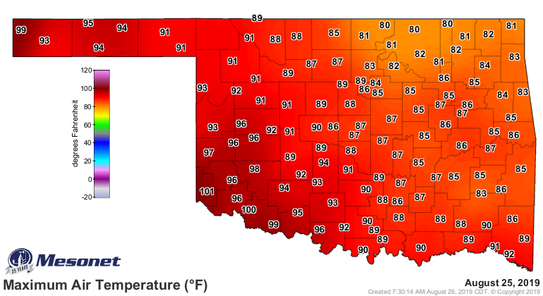
Oklahoma. Hot things happen. Did ya enjoy the respite, though? I know it wasn't
perfect, but darned if it didn't feel about 20-30 degrees better at times after
the seemingly interminable (Okie translation: endless) oppressive weather. It
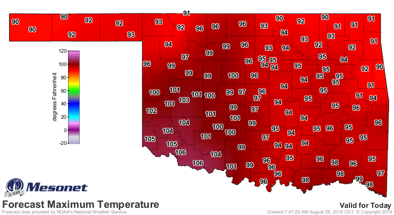
*started* to get hot again yesterday in the southwest, and that transition back
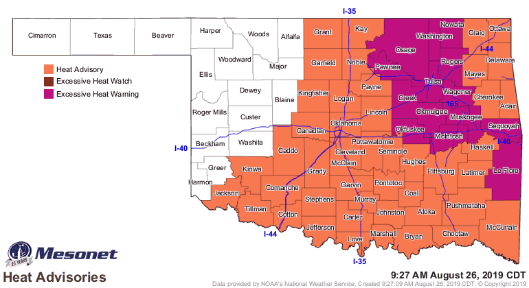
to summer will be complete for most of the state today. Heat indices could top
115 degrees today in eastern Oklahoma, prompting heat advisories.
Just in the nick of time, here comes another cold front to bring us some
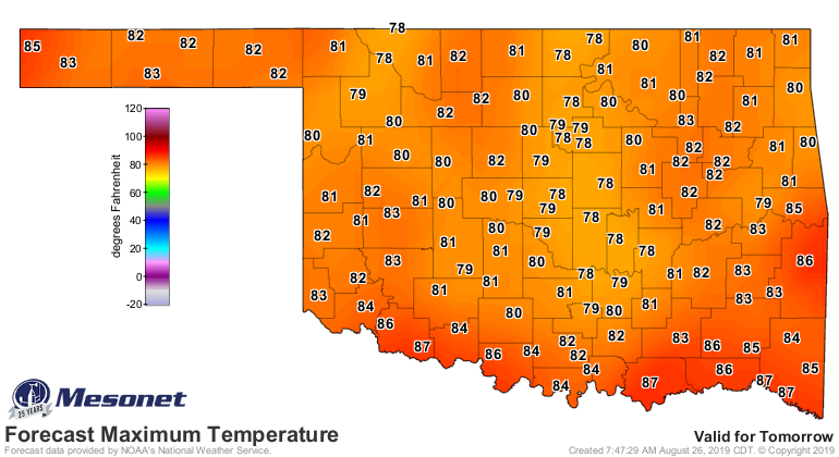
unseasonably cool weather, as well as more chances for rain. Look for highs
tomorrow in the 80s, with some areas across the north possibly struggling to
get out of the 70s. That somewhat cooler weather should stick around for the
foreseeable future, at least long enough to get to the weekend. Maybe not quite
this low, but not in the triple-digits either.
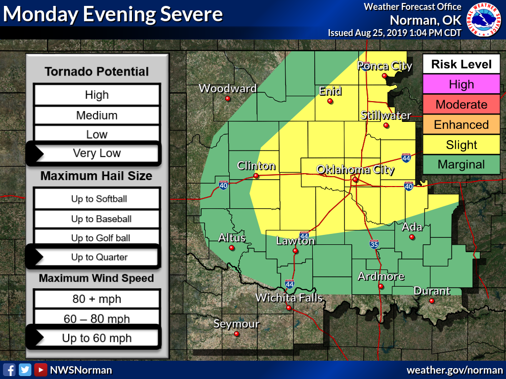
That front is poised to our north, and is fixing to (English translation: about
to) swoop down our way and push through the state.
With the rain chances, expect some strong-to-severe (translation: strong-to-
severe...dang it, translator's stuck in the "on" position again...hang on)
storms along that front on its sojourn south. Biggest threats will be strong
winds, hail of various sizes, and heavy rainfall. The tornado threat is
low, but not zero, especially across northeastern Oklahoma. The storms should
be a bit more potent overall up that way. There were tornado warnings issued
for Beaver County over the weekend, so always best to stay weather aware when
severe storms are expected.

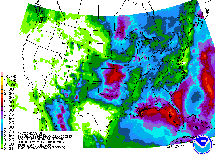
There will be additional rain chances over the next week, so hopefully we can
get some moisture across the drought areas in SW OK.
So be excited! Be excited for the front and the cooler air! Be excited for the
rain! Be excited about a week with temperatures 10-15 degrees below normal!
If you're excited about heat indices of 115 degrees today, keep it to yourself.
Gary McManus
State Climatologist
Oklahoma Mesonet
Oklahoma Climatological Survey
(405) 325-2253
gmcanus@mesonet.org
August 26 in Mesonet History
| Record | Value | Station | Year |
|---|---|---|---|
| Maximum Temperature | 110°F | WAUR | 2023 |
| Minimum Temperature | 46°F | SEIL | 2010 |
| Maximum Rainfall | 5.24 inches | BROK | 2020 |
Mesonet records begin in 1994.
Search by Date
If you're a bit off, don't worry, because just like horseshoes, “almost” counts on the Ticker website!