Ticker for May 28, 2019
MESONET TICKER ... MESONET TICKER ... MESONET TICKER ... MESONET TICKER ...
May 28, 2019 May 28, 2019 May 28, 2019 May 28, 2019
HOLY SCHNIKIES!
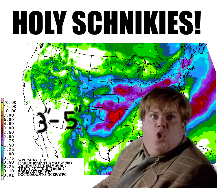
Now listen, I can sit here and argue with all you "Tommy Boy" aficionados (sing
it loud, sing it proud!) about the correct spelling of "schnikies," but sooner
or later we need to come to grips with the fact that more rain is gonna fail on
our beleaguered state. And that's the first time that sentence has ever been
uttered in the history of civilization. Can't speak for pre-history, but I doubt
it. But anyway, we've already seen a near historic levels of rain. How much, you
ask? Well, think "almost May 2015" levels.
So far this May, we've seen a statewide average of 9.70 inches of rain according
to the Oklahoma Mesonet. That not only puts May 2019 in the wettest Mays on
record for Oklahoma, but the wettest MONTHS of any calendar month, dating back
to 1895. Check out the updated list of wettest Oklahoma months, with four more
days to go in our current month.
May 2015: 14.44"
Oct 1941: 10.75"
May 1957: 10.54"
May 1982: 10.38"
May 2019: 9.70"
May 1943: 9.66"
Jun 2007: 9.51"
May 1902: 9.14"
Jul 1950: 9.07"
It's not a coincidence that six of the nine wettest months in state history are
May. And also note just how badly May 2015 shattered the previous record holder,
October 1941. Nearly 4 inches! If it wasn't for May 2015, we'd be talking about
May 2019 approaching hallowed ground, challenging October 1941 for wettest
month on record. At any rate, it still has a bit of time to move up the rankings.
Hope it doesn't, but more rain looks likely. Here's what the month has looked
like in maps so far.
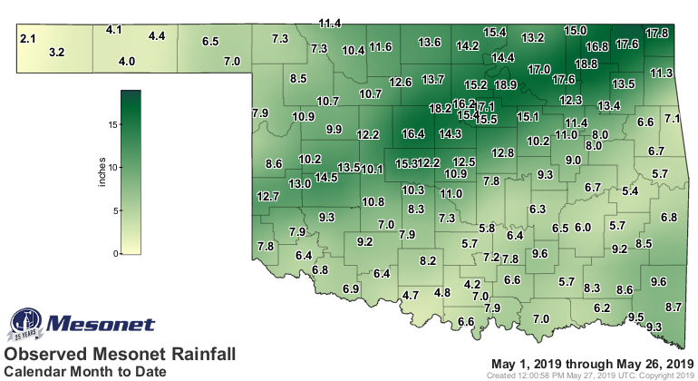
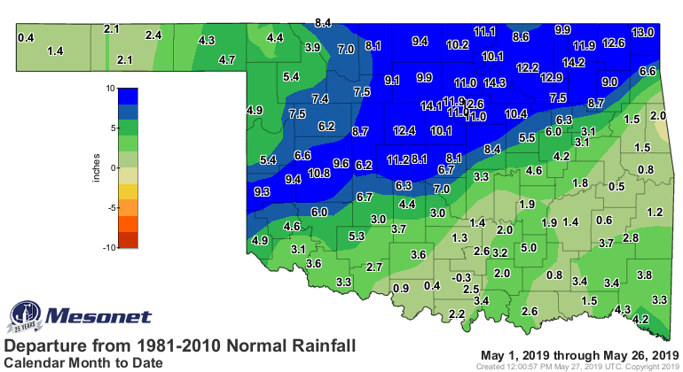
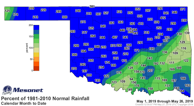
And now for the stats!
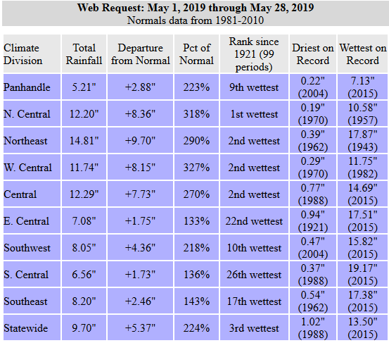
So thus far, north central Oklahoma has managed to eclipse 1957 for it's wettest
May 1-27 on record, so any rainfall they get tonight is just gravy. They will
no doubt end up with their wettest May on record as well. Northeast, west
central, and central Oklahoma could eclipse their previous records as
well if they get any substantial rain before Saturday. They're battling some
hefty totals, but it's possible, unfortunately. If it does happen, it would
no doubt be catastrophic to add that much more rain to the state.
We do have a threat of severe weather again today, of course. BECAUSE WHY
WOULDN'T WE! I will post just the basic graphics from the SPC as a notice to
stay weather aware today. I hesitate to go into many more details since these
are from early this morning, an update is coming soon, and these things tend
to evolve so much during the day it should encourage you to stay abreast of
the weather as the day unfolds.
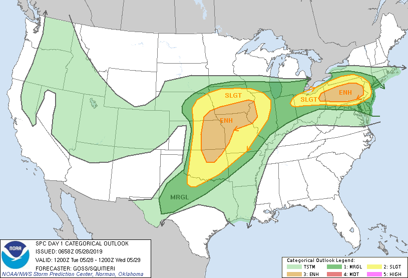

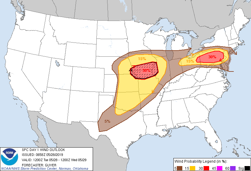
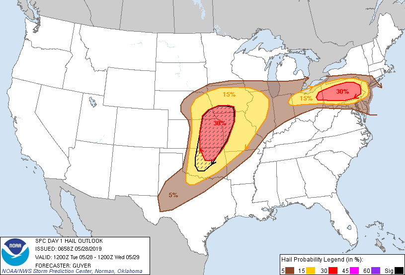
My advice? Stay VERY weather aware.
Ugh, I can actually hear it getting wetter.
Gary McManus
State Climatologist
Oklahoma Mesonet
Oklahoma Climatological Survey
(405) 325-2253
gmcmanus@mesonet.org
May 28 in Mesonet History
| Record | Value | Station | Year |
|---|---|---|---|
| Maximum Temperature | 105°F | BEAV | 2022 |
| Minimum Temperature | 39°F | KENT | 2016 |
| Maximum Rainfall | 4.53″ | MANG | 2023 |
Mesonet records begin in 1994.
Search by Date
If you're a bit off, don't worry, because just like horseshoes, “almost” counts on the Ticker website!