Ticker for April 11, 2019
MESONET TICKER ... MESONET TICKER ... MESONET TICKER ... MESONET TICKER ...
April 11, 2019 April 11, 2019 April 11, 2019 April 11, 2019
KERSPLAT!
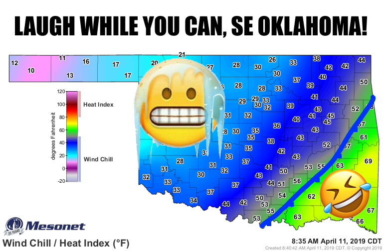
I can't think of a better sound effect to describe the loss of the brief glimpse
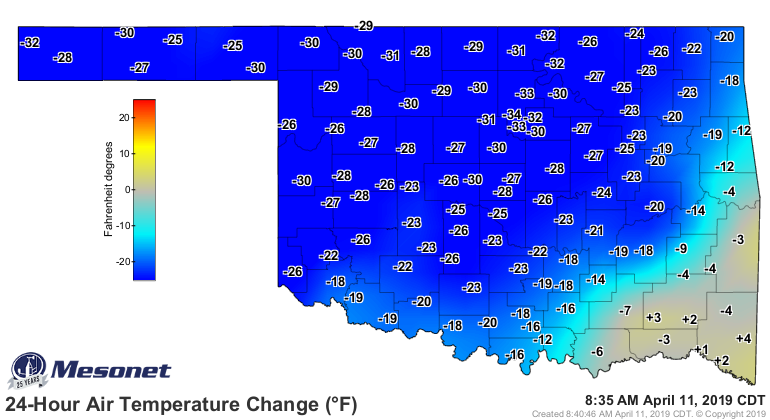
of spring (i.e., summer) we saw over the last few days. When your 24-hour
temperature change map looks like this, you know the fun days are over for a bit.
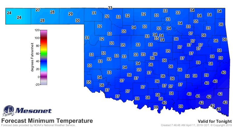
And the Panhandle had a pretty good freeze last night. Yikes!
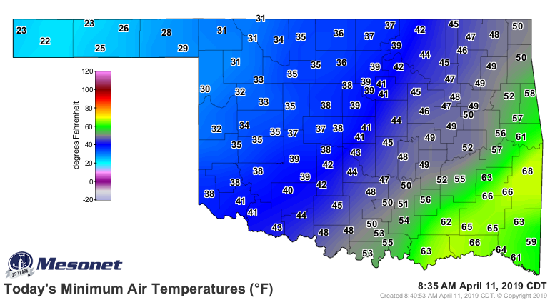
Heck, it's STILL freezing out that way.
For those worried about their crops/gardens/ornamentals, what's it look like
going forward? Well, tonight is a bit of a concern for far NW OK, as does
Sunday morning.

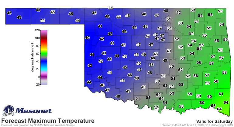
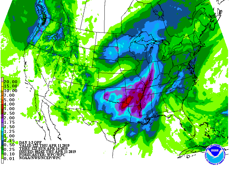
Saturday just looks plain cold, with highs in the 40s/50s and lots of rain.
So a freeze across far NW Oklahoma is likely, and a frost might be possible
a bit farther southeast. The rain should take care of lingering precipitation
deficits across much of the state, at least if the amounts forecast come close.
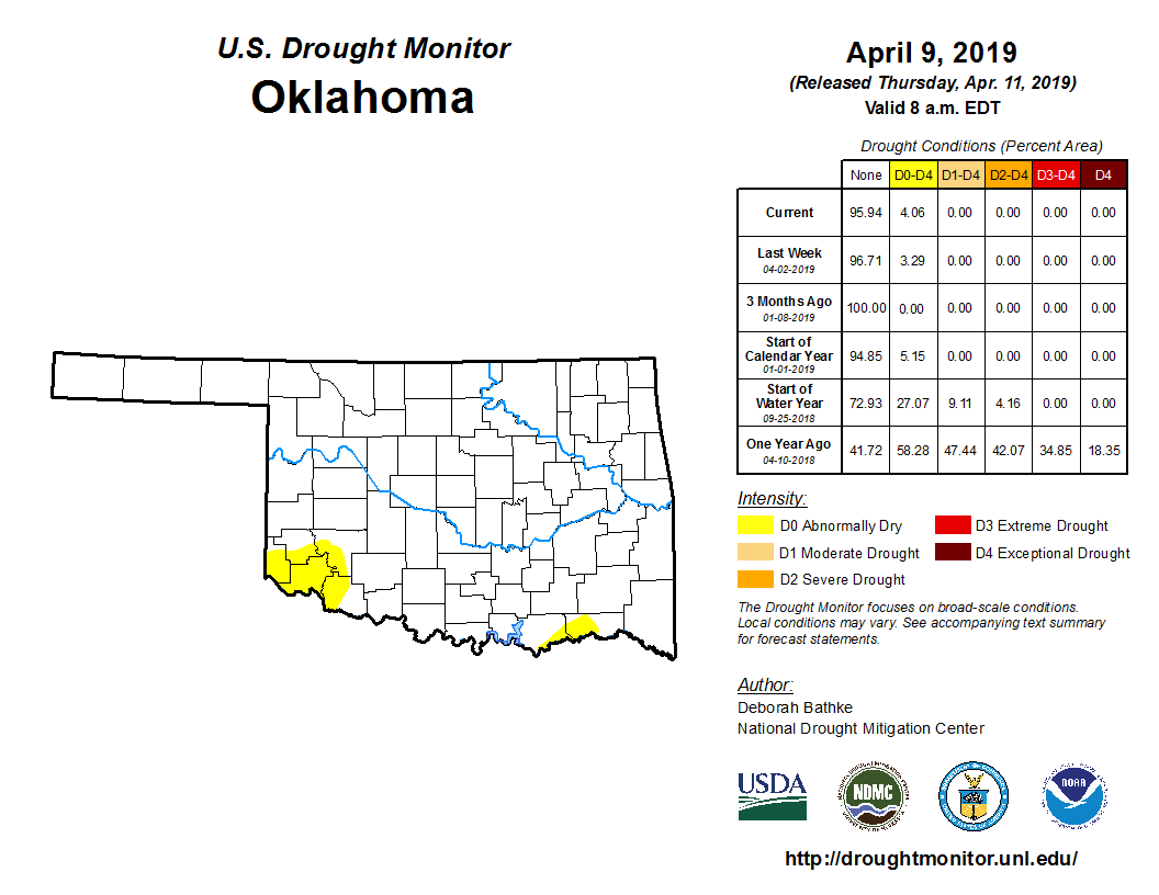
Today's Drought Monitor shows a bit more yellow down in SE OK, a consequence
of those growing deficits.
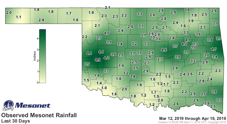

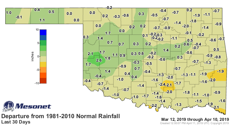
This is the time of year if you go a week or two without rain, you WILL have a
significant deficit starting to build, so it's important to get that soil
moisture recharged when you can. Might not be a problem in the future, but hey,
it's Oklahoma.
Gary McManus
State Climatologist
Oklahoma Mesonet
Oklahoma Climatological Survey
(405) 325-2253
gmcmanus@mesonet.org
April 11 in Mesonet History
| Record | Value | Station | Year |
|---|---|---|---|
| Maximum Temperature | 96°F | ARNE | 2018 |
| Minimum Temperature | 15°F | BOIS | 2013 |
| Maximum Rainfall | 4.55 inches | VINI | 1994 |
Mesonet records begin in 1994.
Search by Date
If you're a bit off, don't worry, because just like horseshoes, “almost” counts on the Ticker website!