Ticker for January 29, 2019
MESONET TICKER ... MESONET TICKER ... MESONET TICKER ... MESONET TICKER ...
January 29, 2019 January 29, 2019 January 29, 2019 January 29, 2019
HODOR!
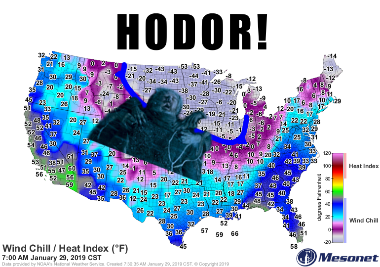
Thank goodness for glancing blows! From the "it could be worse" department, the
Upper Midwest (and in reality the eastern U.S.) continues to get hammered by that
arctic air mass (AKA the "polar vortex") that has been displaced southward. That's
why we keep getting these backdoor cold fronts, which come in from the northeast
and drop us down into uncomfortable territory for a day or two, then the frigid
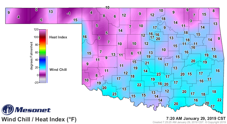
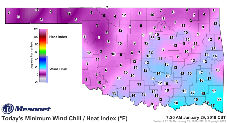
air pulls off to the east and we warm up again. Now this morning is no picnic for
us Okies...
But like I said, it could be worse! We definitely don't want to see the -40 to
-50 degree wind chills they're experiencing in the Northern Plains and the
Great Lakes region. And if the current wind chills from the -20 to -40s aren't
bad enough, that's still not the bottom. That comes tomorrow morning when they
could see wind chills down in the -50s and -60s.
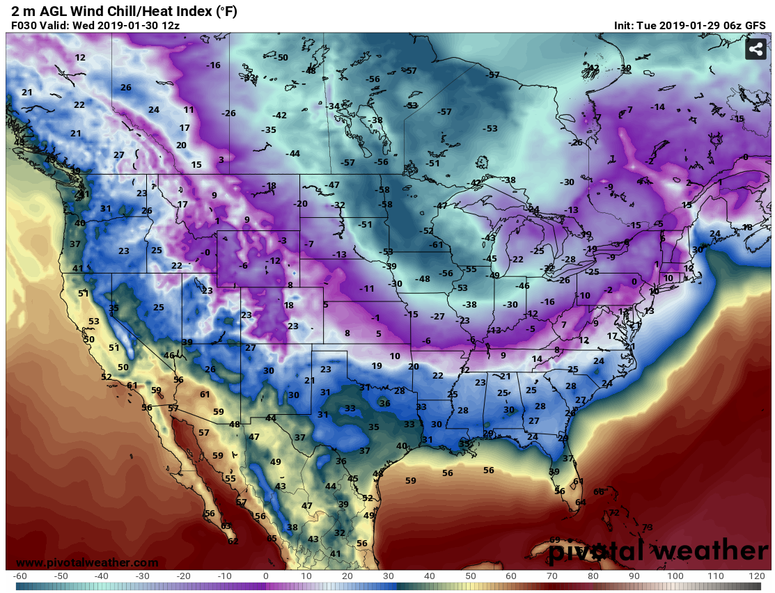
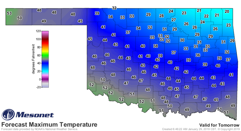
For us in Oklahoma, we get a piece of that cold air tomorrow as we see highs
in the 20s for tomorrow in the northeast, but moderating as you go west.
Then we see a lovely warm up through the weekend, with highs in the 60s by
Saturday (maybe a 70 or two on Sunday???)!
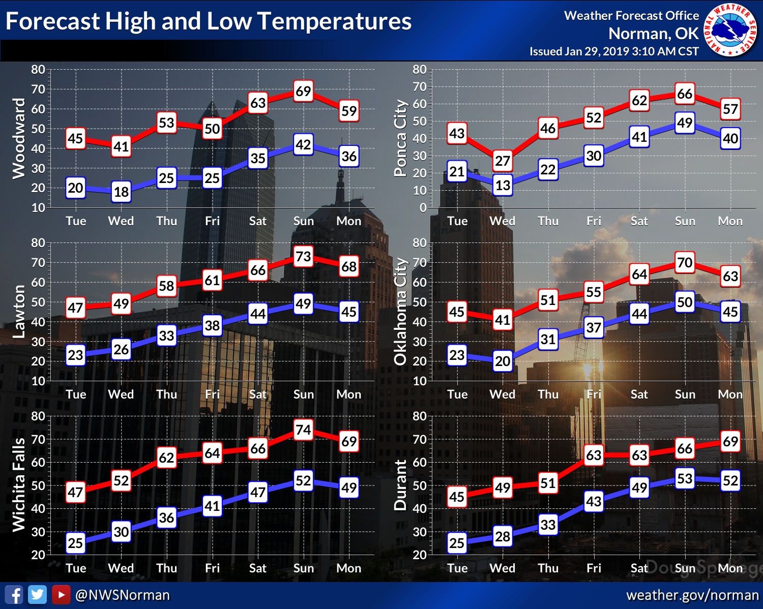
Our next chance for excitement (unless you consider lots of NW flow with
periodic dry cold fronts exciting...then God help you) comes early next week
with the possibility of a bit stronger system setting up.
And before we're done Ticking, let's remember that it CAN get that cold in
Oklahoma. I don't know if we've ever seen -60 degree wind chills here in the
state, but in just the last 25 years of Mesonet data, we've seen similar
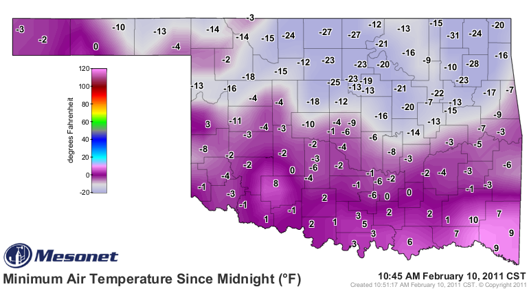
readings. Feb. 10, 2011, will long be remembered as the coldest day many of
us have seen in the state with minimum actual air temperatures in the -20s to
as low as -31 degrees at Nowata, and wind chills down into the -40s.
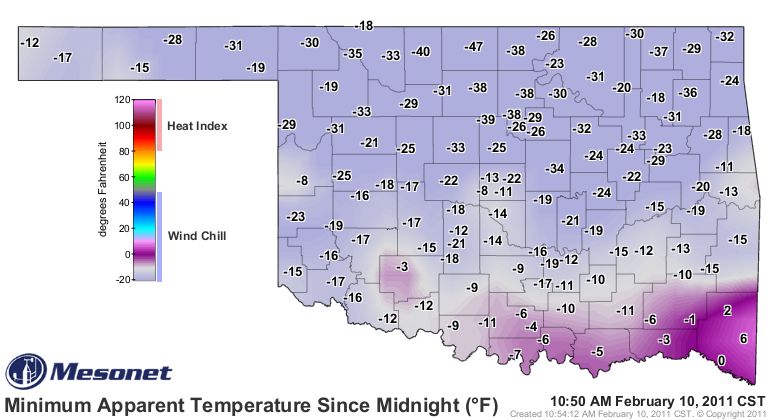
What's the difference between the -47 degree wind chill at Medford and the -60
up north? Your eyeballs freeze in 3.7 minutes instead of 2.8 minutes.
Now what's the difference between our "historic" brutal cold weather and up
north? A week later, we're in the 70s and 80s.
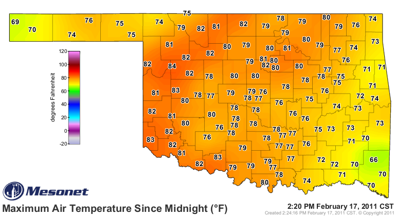
That's a 110-degree swing at Nowata.
Put that in your frozen pipe and smoke it!
Gary McManus
State Climatologist
Oklahoma Mesonet
Oklahoma Climatological Survey
(405) 325-2253
gmcmanus@mesonet.org
January 29 in Mesonet History
| Record | Value | Station | Year |
|---|---|---|---|
| Maximum Temperature | 81°F | MANG | 2016 |
| Minimum Temperature | 2°F | BUFF | 2014 |
| Maximum Rainfall | 3.19 inches | BREC | 1999 |
Mesonet records begin in 1994.
Search by Date
If you're a bit off, don't worry, because just like horseshoes, “almost” counts on the Ticker website!