Ticker for January 10, 2019
MESONET TICKER ... MESONET TICKER ... MESONET TICKER ... MESONET TICKER ...
January 10, 2019 January 10, 2019 January 10, 2019 January 10, 2019
Droughtaway
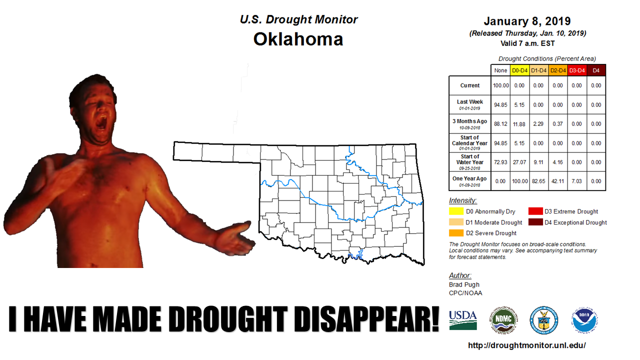
Fire, FIRE! Whoops, wrong meme, Beavis. We're talking the first totally clean
(meaning no drought OR abnormally dry conditions) Drought Monitor map for Oklahoma
since June 14, 2016. We've been close a time or two, as you can see in this
Drought Monitor time series since January 2016, but this is indeed the first
TOTALLY clean map.
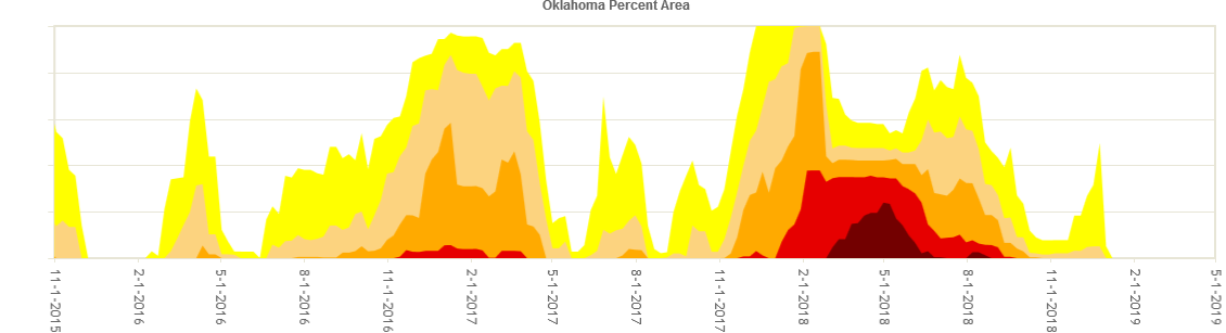
Also pretty easy to see the pretty bad flare-up we had late last winter through
early summer, a drought period that fueled the horrible fires across western
Oklahoma early last spring. And things were looking a bit bleak as we continued
into December. That spike in abnormally dry (the yellow) was built off a period
of up to 80 days without significant moisture across northern and western
Oklahoma. Then Mother Nature decided to open the spigot. Our rainfall for *MOST*
of the state since December 1 has been beneficial for a lot, and prolific for
some.
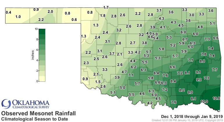
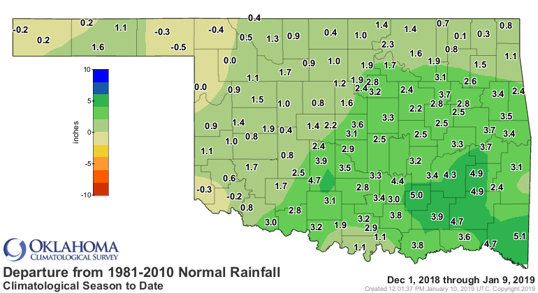
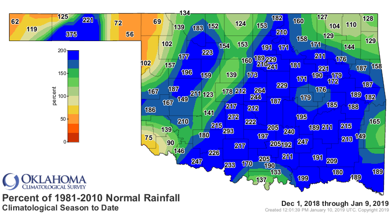
We do need to recognize that parts of southwestern, northwestern and the
Panhandle are still in deficit mode for that period. Previous moisture going
back to the 90+ day period allowed their dry conditions to be alleviated by
their abbreviated Dec. 1-onward totals. Those areas will have to be watched
closely (and since it's drought...slowly) for deterioration.
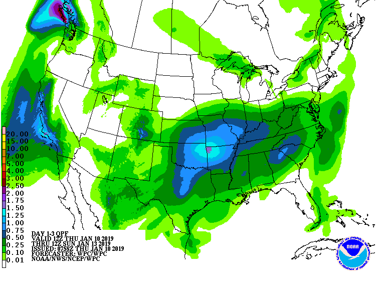
If somebody needs some more rain, there will be chances over the next 2-3 days.
A system will move through tonight and with moisture returning from the south,
those rain chances will begin in earnest later tonight through Saturday
morning.
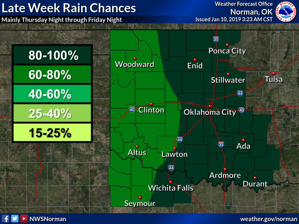
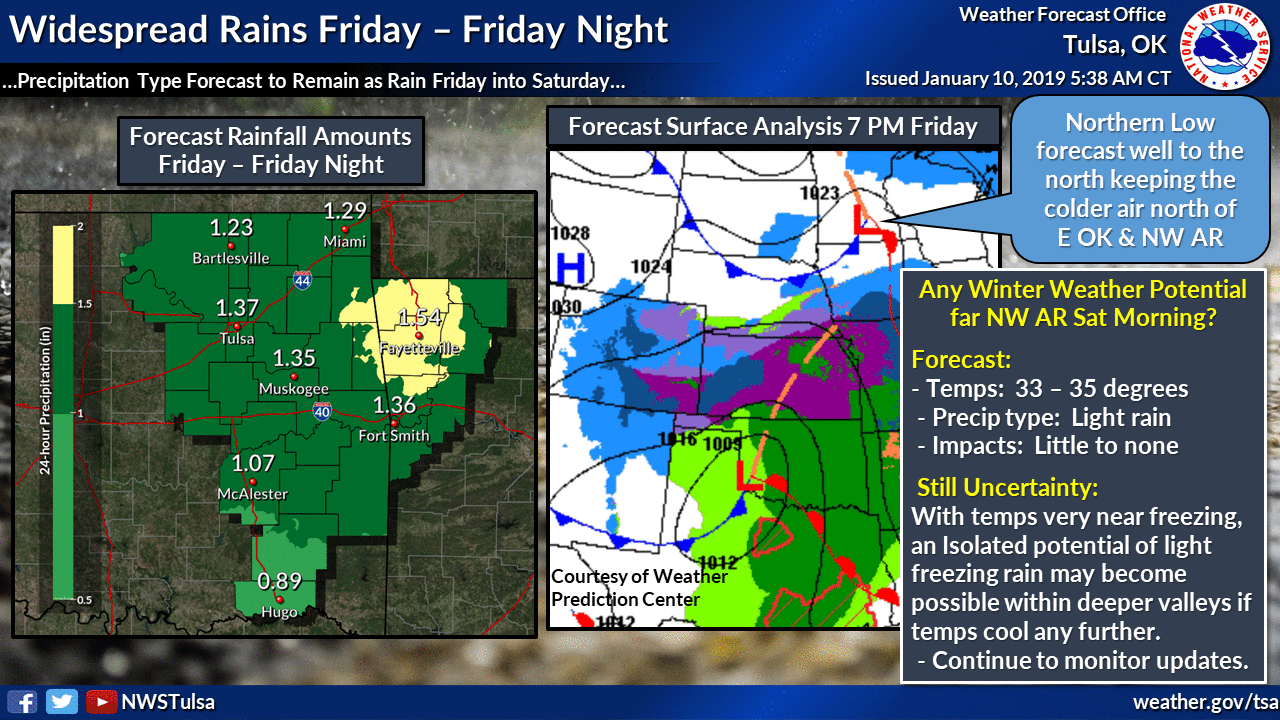

It's a decent bit of moisture for January, with an inch or more possible across
eastern Oklahoma. Unfortunately, not as much across the west. What else is new.
We call that "climatology."
To what do we owe the pleasure of all this moisture we've been receiving over
the last 1-3 months? The much-promised El Nino? Well, El NoNo. The pacific
air circulation patterns have never gotten their act together and synced with
the sea surface temperature warm anomalies to produce a true El Nino episode.
Here's a bit more explanation from the Climate Prediction Center.
"The majority of models in the IRI/CPC plume predict a Niño3.4 index
of +0.5°C or greater to continue through at least the Northern
Hemisphere spring 2019. Regardless of the above-average SSTs, the
atmospheric circulation over the tropical Pacific has not yet shown
clear evidence of coupling to the ocean. The late winter and early
spring tend to be the most favorable months for coupling, so
forecasters still believe weak El Niño conditions will emerge shortly.
However, given the timing and that a weak event is favored, significant
global impacts are not anticipated during the remainder of winter,
even if conditions were to form."
So what gives, Mother Nature? We'll just call it "climatology."
Gary McManus
State Climatologist
Oklahoma Mesonet
Oklahoma Climatological Survey
(405) 325-2253
gmcmanus@mesonet.org
January 10 in Mesonet History
| Record | Value | Station | Year |
|---|---|---|---|
| Maximum Temperature | 84°F | BURN | 2023 |
| Minimum Temperature | -6°F | VINI | 2010 |
| Maximum Rainfall | 4.31 inches | MADI | 2020 |
Mesonet records begin in 1994.
Search by Date
If you're a bit off, don't worry, because just like horseshoes, “almost” counts on the Ticker website!