Ticker for January 7, 2019
MESONET TICKER ... MESONET TICKER ... MESONET TICKER ... MESONET TICKER ...
January 7, 2019 January 7, 2019 January 7, 2019 January 7, 2019
They can't all be snow days
Blah. Blah blah blah blah? Blah!
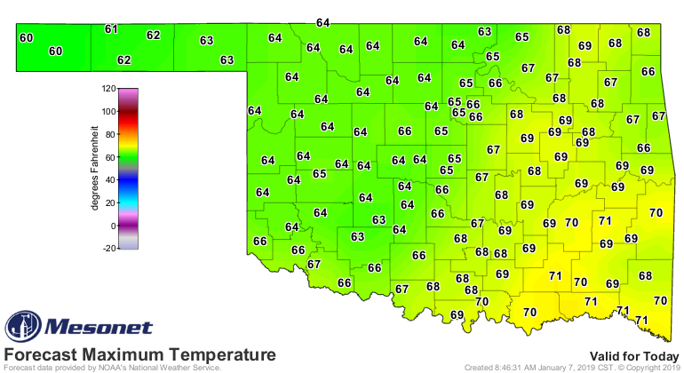
Yes, the weather is back to "blah." After our excitement with all the rain and
freezing rain and sleet and snow and thunder-sleet and thunder-freezing rain and,
well...that about covers it. What was I talking about? Oh yeah, after all that
excitement last week, we now return to our regularly scheduled January. We're in
for another warm day, then a cold front tonight and tomorrow will cool things down
to more seasonable weather, maybe a chance of rain here or there, but that's about
it. So let's enjoy this last day of 60s.
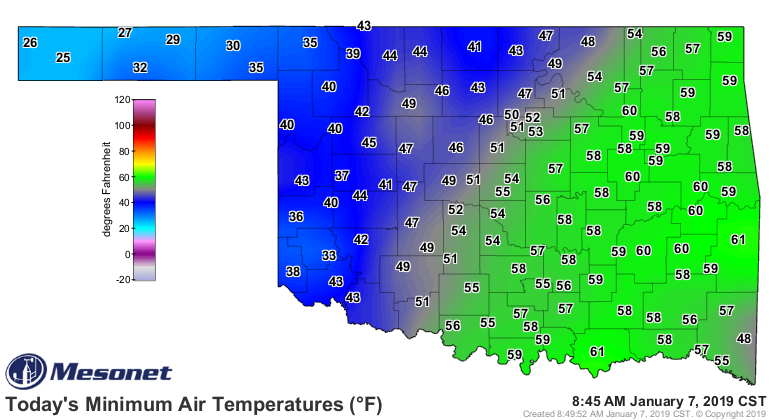
Heck, those of us that had cloud cover overnight stayed in the 50s. Remember,
cloud cover at night helps trap that heat lost at night by radiational cooling
from the surface, acting somewhat like a blanket to preserve the heat. Those
under the clear skies to the west saw that heat just keep on radiating upwards,
and therefore lower overnight temperatures.
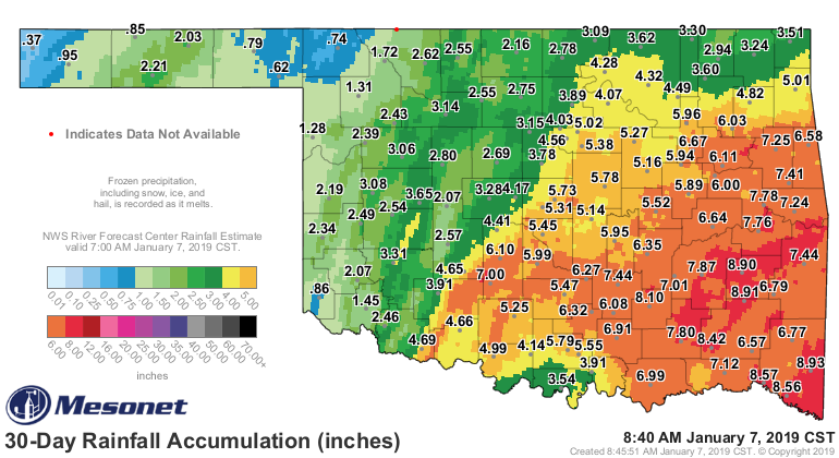
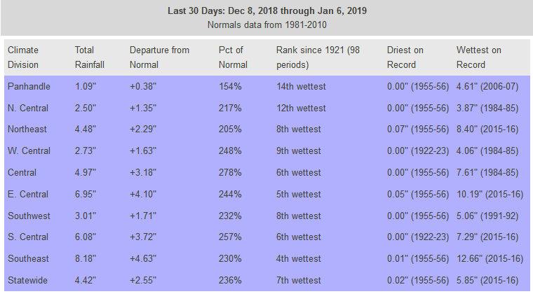
But back to the last week's storm...'twas a wet one, and combined with the
previous storm a couple of weeks ago right after Christmas it makes the last
30 days look even more impressive. Only a few spots, including the most
important city (town? hamlet?) in the state...Buffalo, are running a deficit
over that time frame. Some areas across southeastern OK are nearly 6 inches
above normal, and most are at least an inch or two in the black.
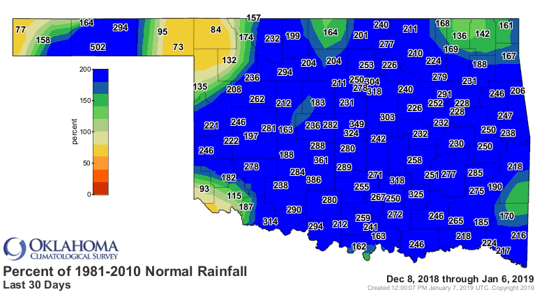
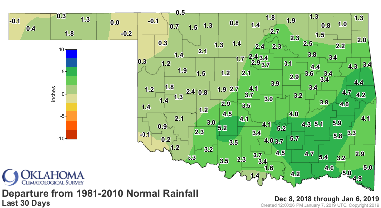
Even more impressive are the statistics themselves, with the last 30 days
being the 7th wettest such period on record since at least 1921. Zounds!
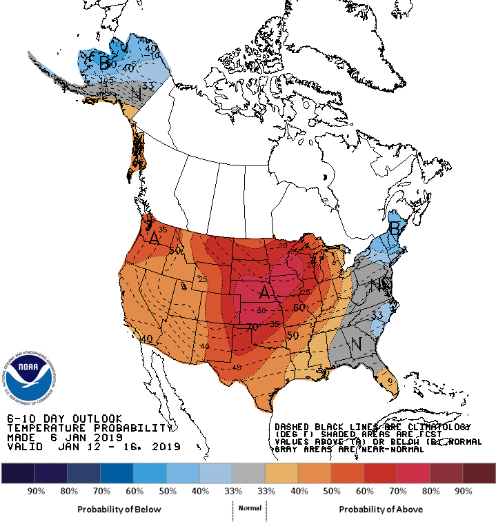
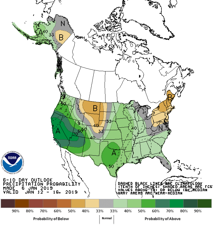
If you believe next week's outlooks from the Climate Prediction Center, we may
be in for more precip, by don't look for a repeat of last week's winter
nightmare...I mean wonderland!
Gary McManus
State Climatologist
Oklahoma Mesonet
Oklahoma Climatological Survey
(405) 325-2253
gmcmanus@mesonet.org
January 7 in Mesonet History
| Record | Value | Station | Year |
|---|---|---|---|
| Maximum Temperature | 85°F | WOOD | 2006 |
| Minimum Temperature | -19°F | KENT | 2017 |
| Maximum Rainfall | 2.75 inches | PORT | 2008 |
Mesonet records begin in 1994.
Search by Date
If you're a bit off, don't worry, because just like horseshoes, “almost” counts on the Ticker website!