Ticker for December 13, 2018
MESONET TICKER ... MESONET TICKER ... MESONET TICKER ... MESONET TICKER ...
December 13, 2018 December 13, 2018 December 13, 2018 December 13, 2018
WHOOSH!
AHA! So, think you're smart, do ya? You bigshots with your full head of hair and
whatnot. HOW'S THAT HAIR LOOK NOW, SMART GUY OR GAL! Okay, it's the one type of
weather day where those of us in the follicularly challenged club can crow. Now
crows themselves had best stay in the lower branches, or they'll end up in south
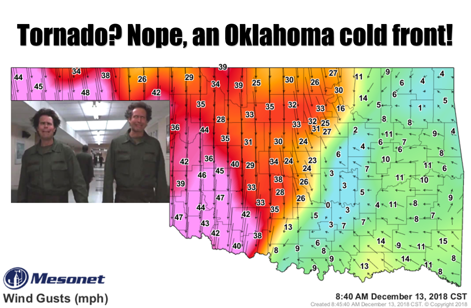
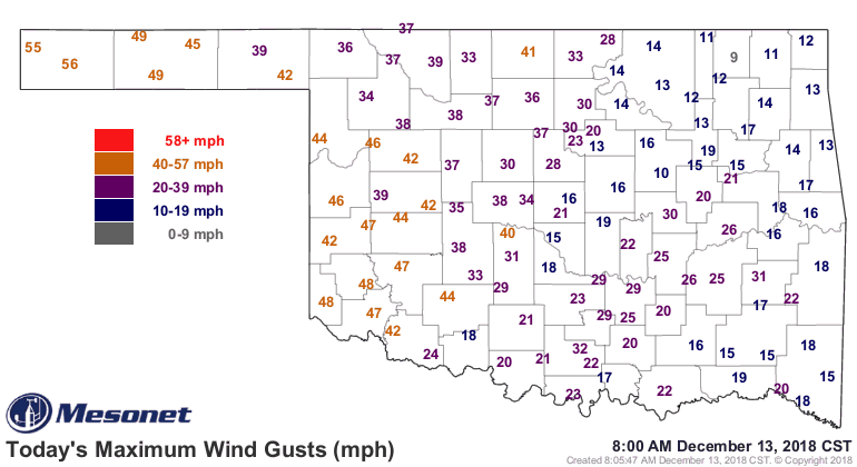
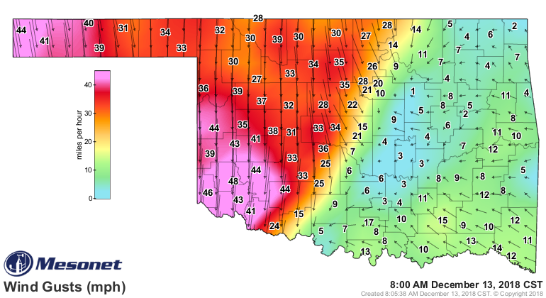
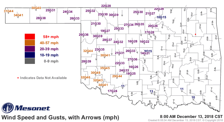
Texas, and we all know just how painful that can be. Winds are expected to gust
to 60 mph in the high wind warning area to the west, and up into the 50s in the
wind advisory to the east. But I wouldn't count out some of those 60 mph winds
making it into south central OK either.
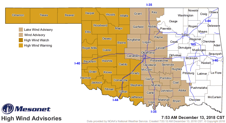
Severe thunderstorm winds begin at 58 mph, and we could easily exceed that today
across a large swath of western and central Oklahoma. We're not quite there yet...
those stronger winds will come a bit later as the pressure gradient tightens up
as a surface low approaches along with a cold front. You can see what the winds
are already doing, however.
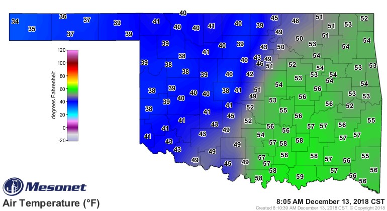
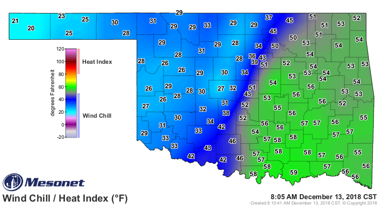
Now let's see...winds 50-60 mph, cold front, I wonder what that will do to the
wind chill? Well, it ain't pretty. Air temperatures behind the front in the
40s will feel like the 20s and 30s.
So when you see that front approaching your area, that's about as good as it's
going to get for you. It's all downhill from there, as our friends to the
west can attest. There will be some rain with this, mainly to the southeast of
the I44 corridor where heavy rainfall can be expected, especially down in the
far southeast. What else is new, right?
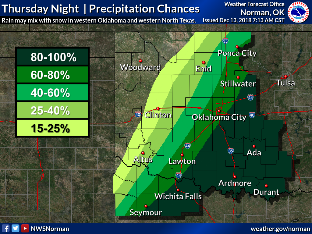
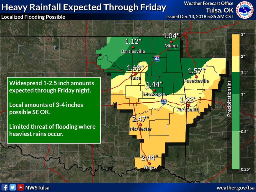
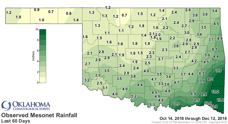
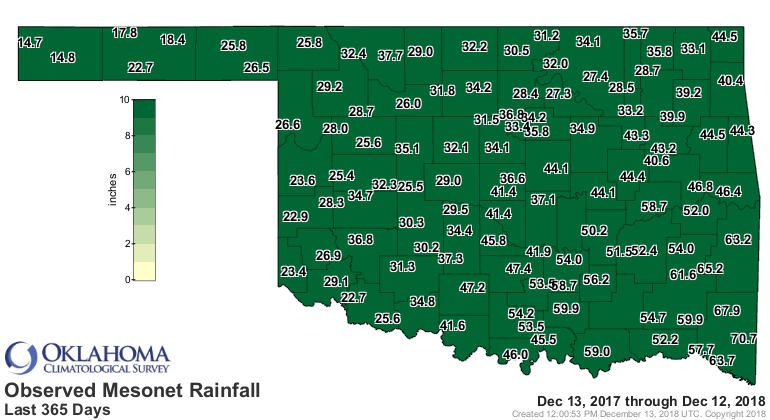
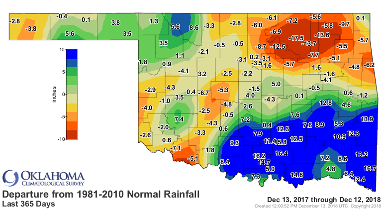
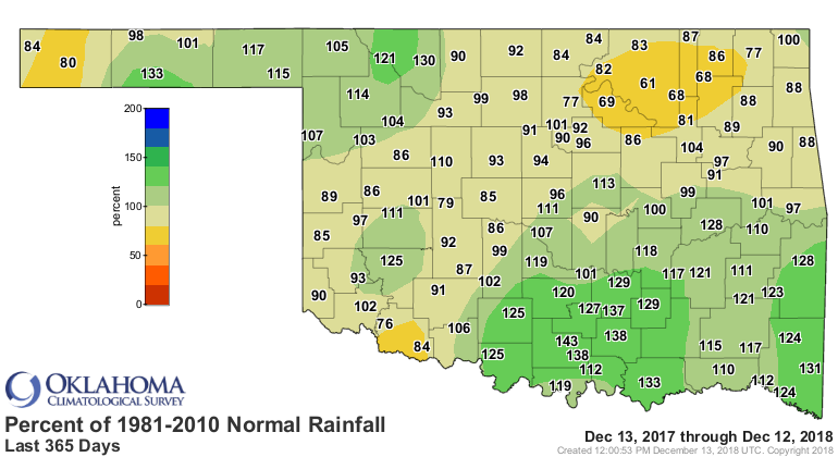
This is good for that area, because Oklahoma has been drying out. But northern
and especially northeastern Oklahoma has become aqua-challenged over the last
60+ days.
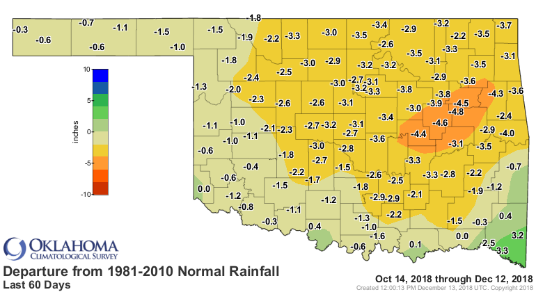

But the deficits across the northeast go back well over a year.
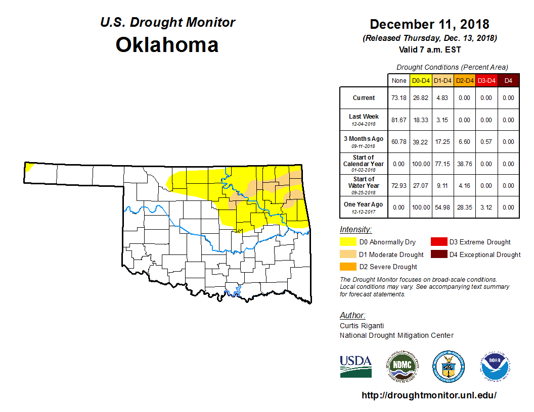
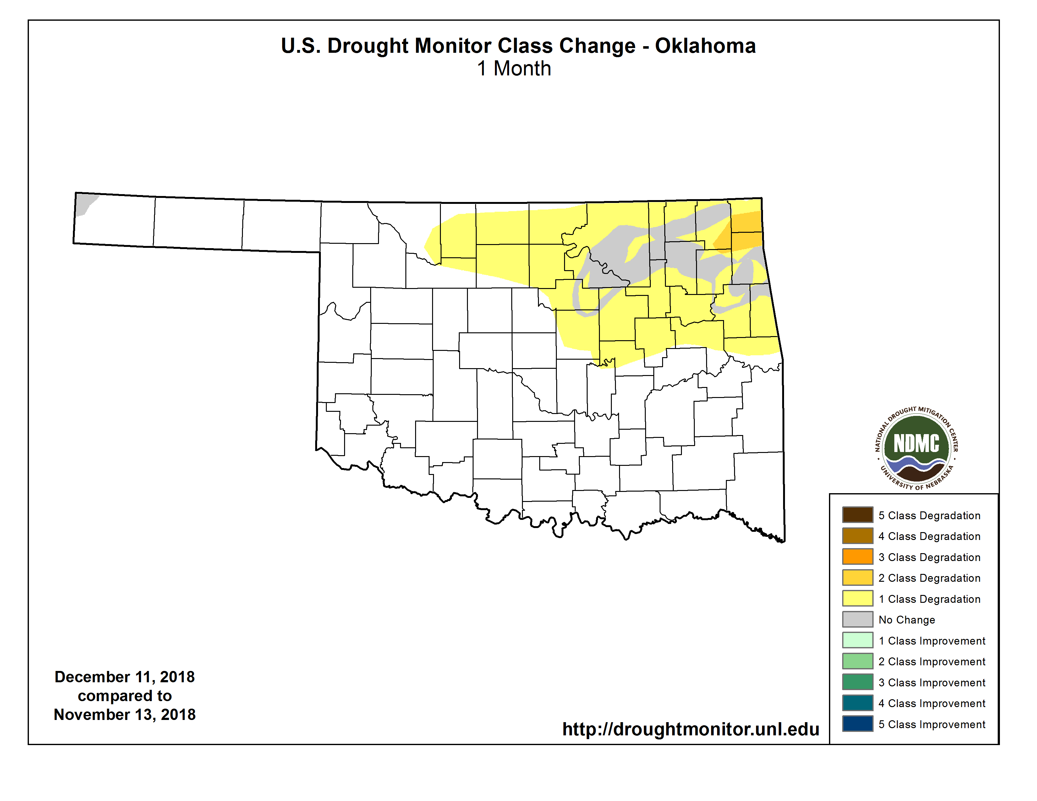
This has led to an expansion of Abnormally Dry (D0) and Moderate Drought (D1)
across the northeastern quarter of the state on the new U.S. Drought Monitor,
bleeding over into northwestern Oklahoma. The area in D0-D1 has increased
from 8% of the state a month ago to 27% today.
So we need rain, we DON'T need the wind, and I can't tell what we need for
temperatures. I know what temperatures I WANT, but I doubt we'll be seeing any
80s anytime soon. Wait, it is Oklahoma...
Oh yeah, hair elitists have more trouble with stocking caps too.
HAHAHAHAHAHAHA!!
HAHAHA!
HAHA
haha
ha
Oh.
Gary McManus
State Climatologist
Oklahoma Mesonet
Oklahoma Climatological Survey
(405) 325-2253
gmcmanus@mesonet.org
December 13 in Mesonet History
| Record | Value | Station | Year |
|---|---|---|---|
| Maximum Temperature | 76°F | SLAP | 2021 |
| Minimum Temperature | 3°F | MEDF | 2000 |
| Maximum Rainfall | 4.06 inches | BROK | 2015 |
Mesonet records begin in 1994.
Search by Date
If you're a bit off, don't worry, because just like horseshoes, “almost” counts on the Ticker website!