Ticker for December 7, 2018
MESONET TICKER ... MESONET TICKER ... MESONET TICKER ... MESONET TICKER ...
December 7, 2018 December 7, 2018 December 7, 2018 December 7, 2018
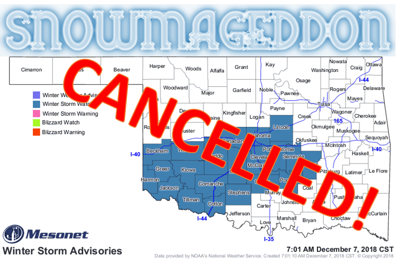
Anatomy of a bust
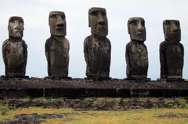
This may go down as one of the biggest busts since (CAREFUL!) those folks on
Easter Island said "hey, we ended up with more stone to work with than we
thought."
That's alright, we can take it. Much like our scalp, we've always tried to be as
transparent as possible here at the Ticker. Luckily, we have a "scalp"goat for
this one. It was the Warriors!! Whoops, bad 1970s movie reference. It was the
weather forecast models. Yeah, that's the ticket! When I typed this a couple of
days ago, I thought I was being overly cautious:
"Now for some GOOD news. This forecast can and probably will change as the storm
gets closer, the computer models get a better handle on it, and the forecasters
are able to pinpoint the impacts and their locations better. And that will
continue right up to and through the event. So maybe those impacts you're seeing
now will lessen over time."
Alas, I broke my own brass (can't afford golden) rules...don't trust the models
when the storm system is still over the ocean where it can't be sampled by our
dense observational network!
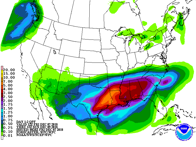
So the weather models gaveth, then the weather models tooketh away. Our winter
storm that looked so ominous throughout the week, as spit out by the suite of
computer forecast models available to forecasters, have thrown a great big wet
blanket on our winter weather excitement. The chance for wintry weather still
exists, but it's a shadow of its former self. Northern Oklahoma, once the
bullseye of the models with 8-12 inches of snow, now get nothing. GOOD DAY SIR!
More 1970s movie references? Really?
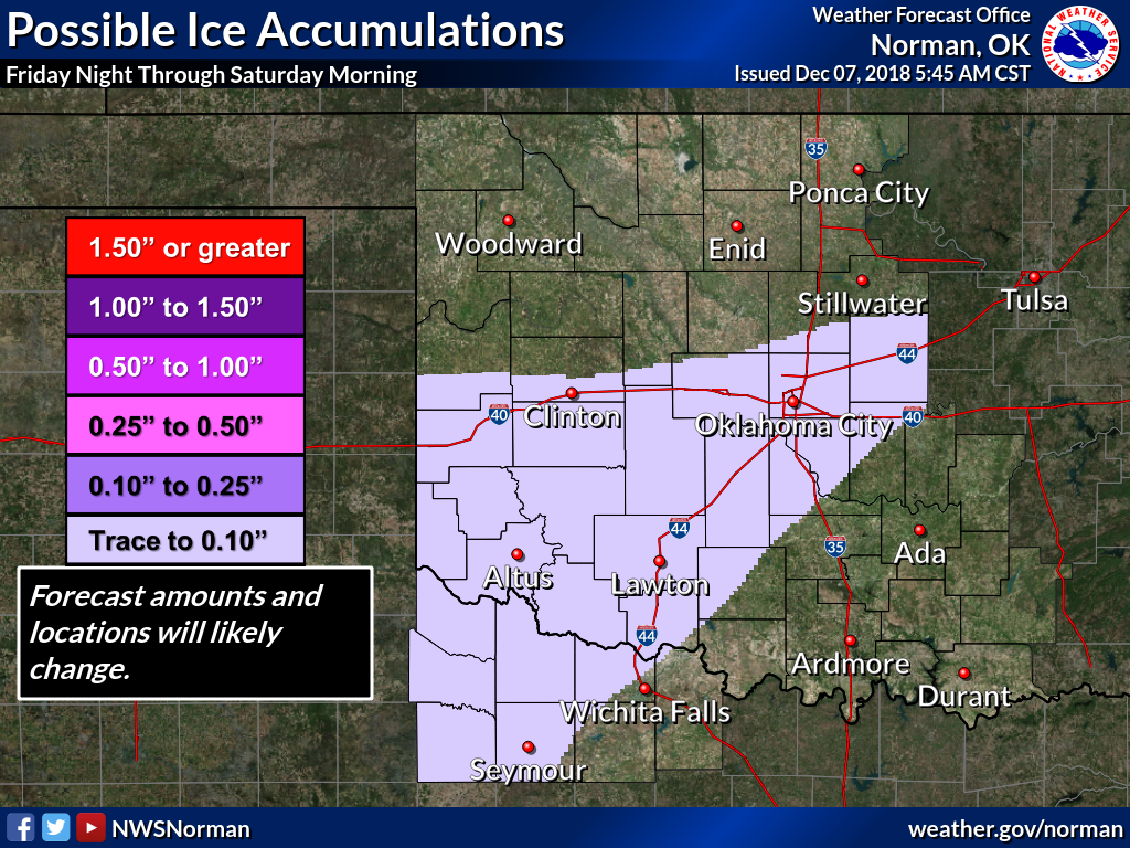
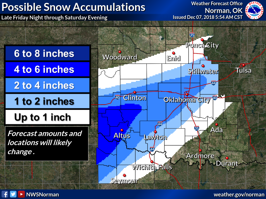
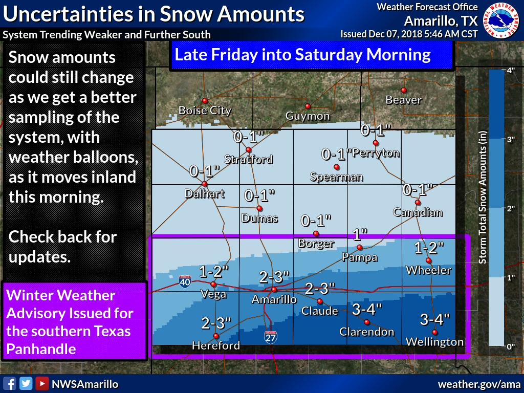
As it is now, there will still be some snow, mostly across SW through central
Oklahoma. A bit of ice. Enough to have that much smaller winter storm watch
in place (and frankly, I wouldn't be shocked if it gets dropped to a winter
weather advisory later).
The storm dove south, and the amount of moisture it had to work with also
diminished.
So we know two things for sure:
1. It's going to be cold...that hasn't changed.
2. Forecasting winter weather remains a challenge.
3. This is simply an extra line...I said two things, remember?
In actuality, this is a good thing. The amount of ice being forecast had bad
intentions as far as impacts go...power outages, dangerous travel, slips and
falls, etc. And 8-12" of snow does nobody any favors. I know it's fun to be
snowed in, but remember, not everybody gets the luxury of staying home during
that type of weather. There would have been accidents (some with injuries) and
many of the other types of bad outcomes dealing with bad winter weather.
Now I'm being a wet blanket. Let's just enjoy or dislike whatever we get and
await our next weather event down the road. And also remember this from a
couple of days ago as well:
"Now for some BAD news. This forecast can and probably will change as the storm
gets closer, the computer models get a better handle on it, and the forecasters
are able to pinpoint the impacts and their locations better. And that will
continue right up to and through the event. So maybe those impacts you're seeing
now will GET WORSE over time."
Gary McManus
State Climatologist
Oklahoma Mesonet
Oklahoma Climatological Survey
(405) 325-2253
gmcmanus@ou.edu
December 7 in Mesonet History
| Record | Value | Station | Year |
|---|---|---|---|
| Maximum Temperature | 80°F | BURN | 2007 |
| Minimum Temperature | -9°F | BOIS | 2005 |
| Maximum Rainfall | 1.27 inches | BBOW | 1997 |
Mesonet records begin in 1994.
Search by Date
If you're a bit off, don't worry, because just like horseshoes, “almost” counts on the Ticker website!