Ticker for November 15, 2018
MESONET TICKER ... MESONET TICKER ... MESONET TICKER ... MESONET TICKER ...
November 15, 2018 November 15, 2018 November 15, 2018 November 15, 2018
Out of the frozen pan
Hey, some places in Oklahoma forgot to freeze last night!
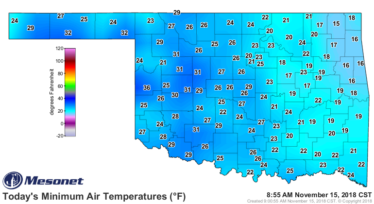
Okay, ONE place...Cheyenne way out in far western Oklahoma managed to stay above
freezing this morning with a low of 36 degrees. That's due to the Cheyenne Mesonet
site being a bit higher in the local terrain, so it pokes up above the shallow
layer of cold air (hence the term "inversion poking" to describe this
phenomenon...Medicine Park is another notorious inversion poker). At any rate,
our ride on the arctic express will stop for a few days, but let's take a look
back and the journey using the Mesonet's hours below freezing maps. I'll show ya
hours at or below 32, 28 and 24 degrees just for fun. The smaller grey (I prefer
the UK spelling of that color, Guvnor!) numbers show the lowest temperature
reached over the period of the last week or so.

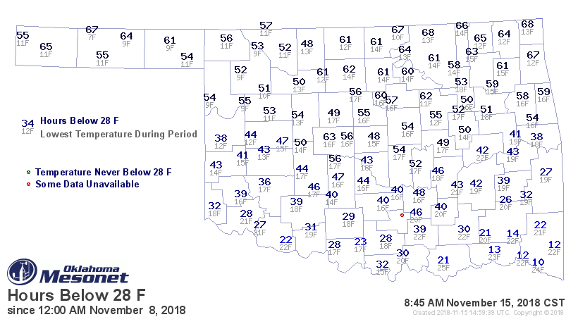

So the entire state has spent at least 24 hours below freezing at this point.
Allergy sufferers rejoice! Looks like Eva is the unsurprising winner of the
lowest temperature of 7 degrees, and Boise City gets the prize for longest
duration below freezing at 101 hours. Hours below 28 and 24 degrees diminish
accordingly, but are still unusually large for this time of year. This is more
January-ish than mid-November.
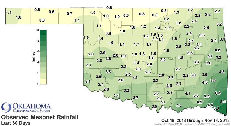
The snow (WHICH WAS NOT THE FIRST SNOWFALL OF THE SEASON FOR THE STATE...that
honor goes to the Panhandle back on Oct. 14, with more falling on Halloween)
that fell across northern Oklahoma didn't dent the current running deficits
much over the last 30 days.
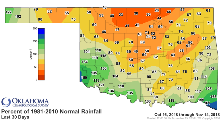

This is a dry time of the year, approaching the driest three months of the
year for Dec-Feb, so any deficits means it's REALLY dry, but not to alarming
related to normal. The problem is we already have a bit of drought and dry
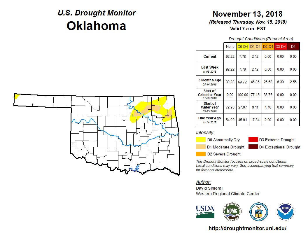
conditions plaguing northern Oklahoma, as evidenced by the latest Drought
Monitor map. Only 2% of the state is in drought, but that area has been in
drought for quite some time with little relief.
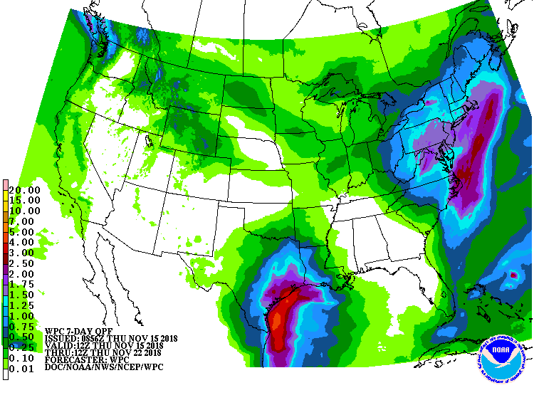
There's not much help on the horizon, if that horizon is limited to 7 days.
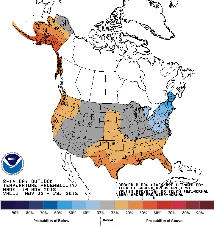
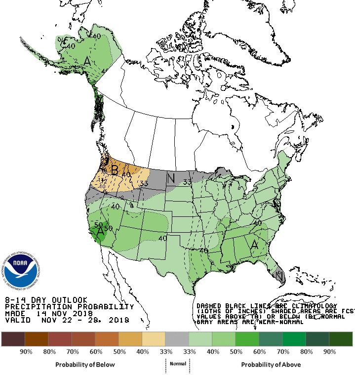
Maybe into next week, but that's iffy at best. The CPC outlook for next week
shows increased odds of above normal precip, but again, it's a dry time of the
year, so possibly nothing to get excited about. Possibly warm too. Possibly a
wet Thanksgiving, but not a frozen one.
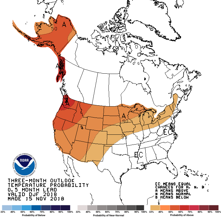
Let's look down the road at the CPC December and December-February outlooks.
Nothing earth-shattering here for Oklahoma. Warmth across the West possibly
bleeds into the Panhandle for both periods.
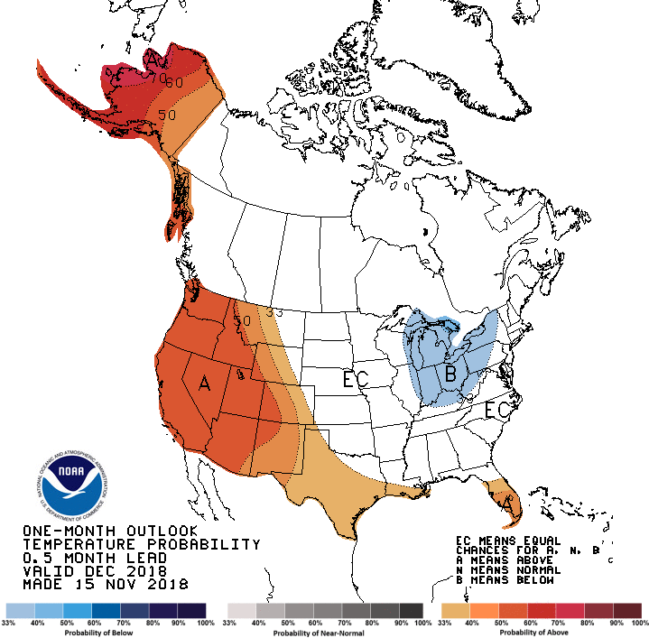
The moisture outlooks are mixed. For December, not much except for possibly
drier than normal across the eastern third of Oklahoma. Looking at the entire
winter period, they see increased odds for above normal precip across far
western Oklahoma, sort of a classical El Nino look to the map.

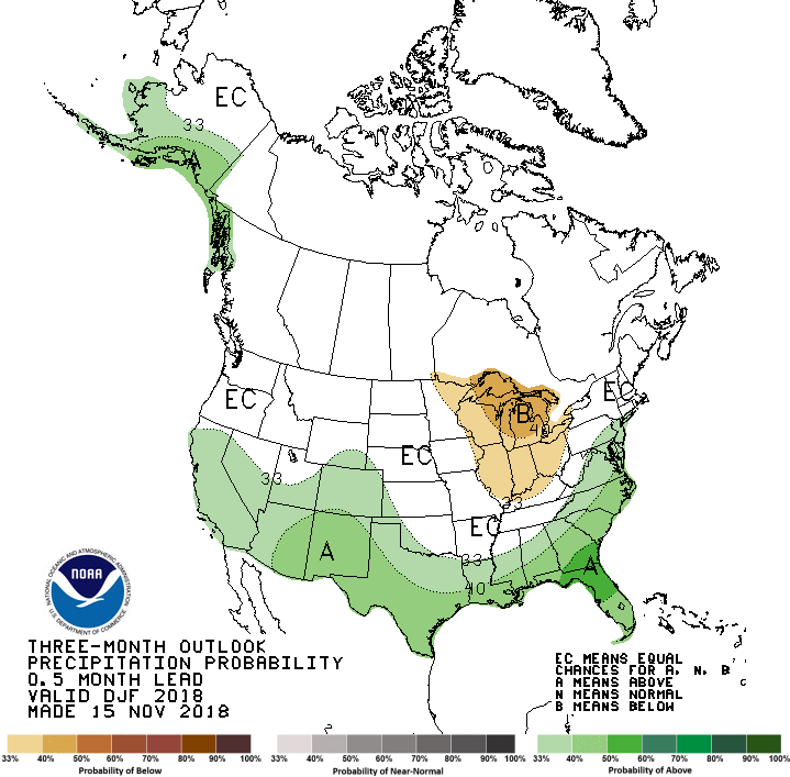
All the white "EC" areas are punts, meaning equal chances of above-, below-
or near-normal conditions. In other words, climatology.
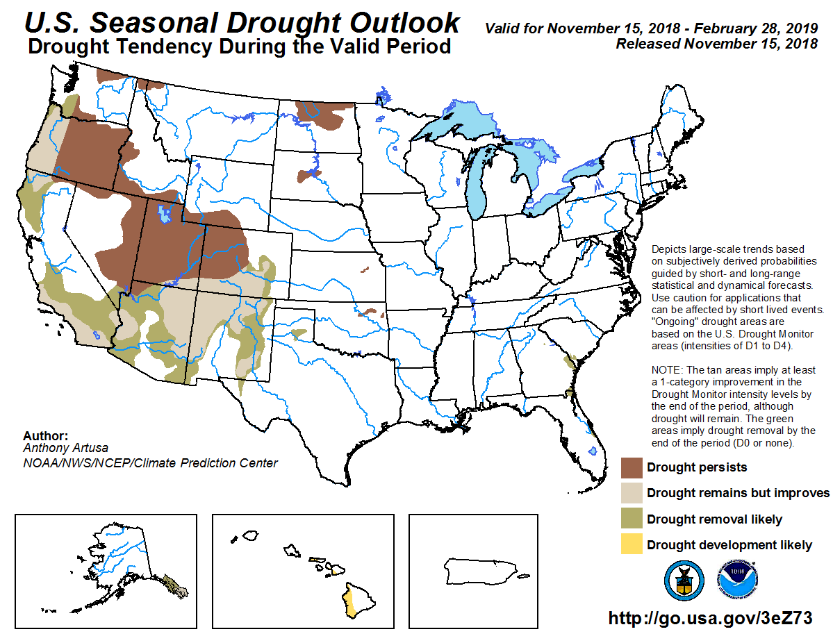
The seasonal drought outlook doesn't see drought developing in the state, which
is good. It does see persistence of that drought that exists in northeastern
Oklahoma, however.
With El Nino imminent (still waiting on the atmospheric response...the sea
surface temperatures are playing along already), we will have to wait and
see if it has greater influence on our weather. It's predicted to be a weak
El Nino (small chances it could reach moderate strength). Weak El Nino events
can sometimes bring us drier than normal weather, so that will bear watching.

We have a ton of overgrowth of vegetation thanks to our wet and mild fall, so
we don't want to have a mega-fire for the fourth year in a row. Another thing
that bears watching.
Gary McManus
State Climatologist
Oklahoma Mesonet
Oklahoma Climatological Survey
(405) 325-2253
gmcmanus@mesonet.org
November 15 in Mesonet History
| Record | Value | Station | Year |
|---|---|---|---|
| Maximum Temperature | 94°F | TIPT | 2025 |
| Minimum Temperature | 8°F | KENT | 1997 |
| Maximum Rainfall | 2.71 inches | BROK | 2011 |
Mesonet records begin in 1994.
Search by Date
If you're a bit off, don't worry, because just like horseshoes, “almost” counts on the Ticker website!