Ticker for October 30, 2018
MESONET TICKER ... MESONET TICKER ... MESONET TICKER ... MESONET TICKER ...
October 30, 2018 October 30, 2018 October 30, 2018 October 30, 2018
Happy Front Day!
Oh, there's a holiday tomorrow where you have to walk around at night in flimsy
costumes, exposed to the elements? That must mean Mother Nature will provide us
with our customary pre-Halloween cold front. Sure enough, right on schedule! Here
you can see the front's presence across northwestern Oklahoma on the Mesonet's
wind and wind chill temperature maps.

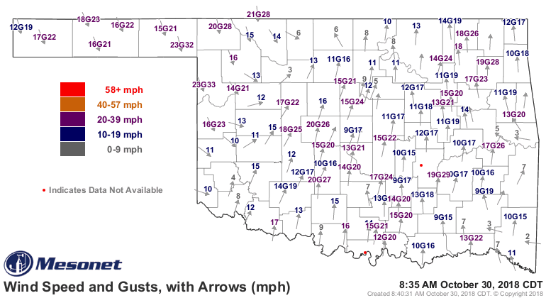
The areas with northwesterly winds and lower wind chills are BEHIND the cold
front, Valentine. Now, what are commodities? Commodities are agricultural
products... like coffee that you had for breakfast... wheat, which is used to
make bread... pork bellies, which is used to make bacon, which you might find in
a 'bacon, lettuce and tomato' sandwich.
Whoops, took that "Trading Places" shtick a little too far. Back on track. Oh
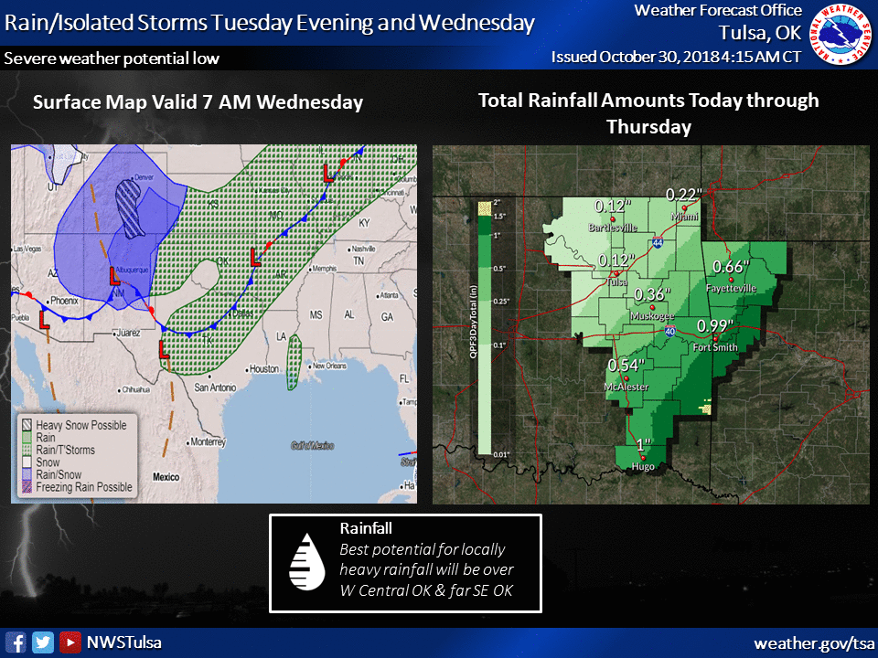
yes, Halloween misery. So the front will continue through the state today and
perhaps kick off a few showers (maybe some storms in the SE). Then we'll see
cooler weather tomorrow with some post-frontal showers possible earlier in the
day. By the time most of you trudge out with your kids tomorrow evening, most
of the rain should have pushed off to the SE, but don't be shocked by a bit
of mist here or there. Cloudy skies and just enough wind to give you a chill
will accompany temperatures in the 40s and low 50s.

Following that, just sort of BLAH November weather with a few minor cold
fronts here and there, some chances for a bit of rain, until maybe a better
chance of rain early next week with another front and stronger storm system.
Emphasis on *MAYBE*.
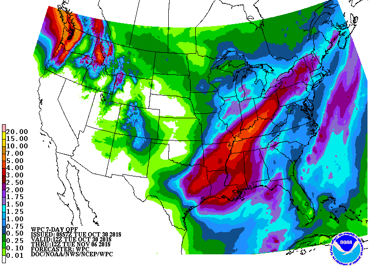
Tough to see any washouts for now, though. The 7-day rain forecast is not
exactly bullish on the moisture amounts for most of the state.
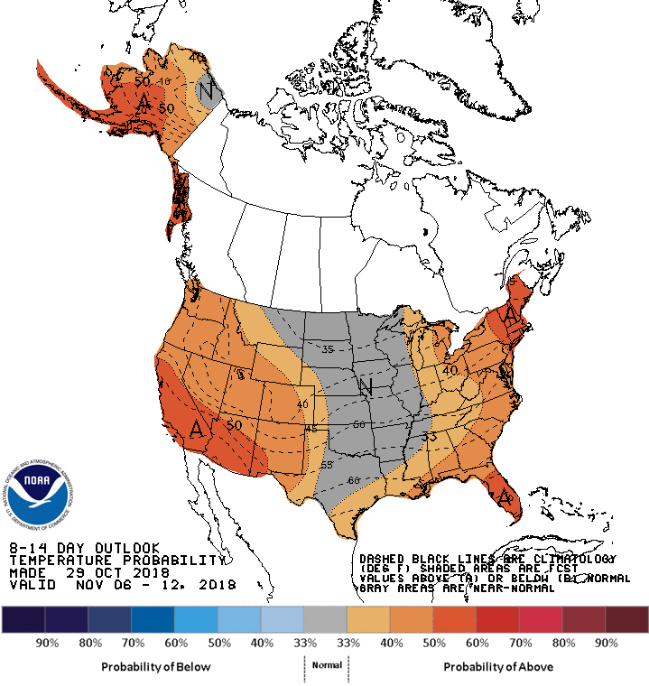
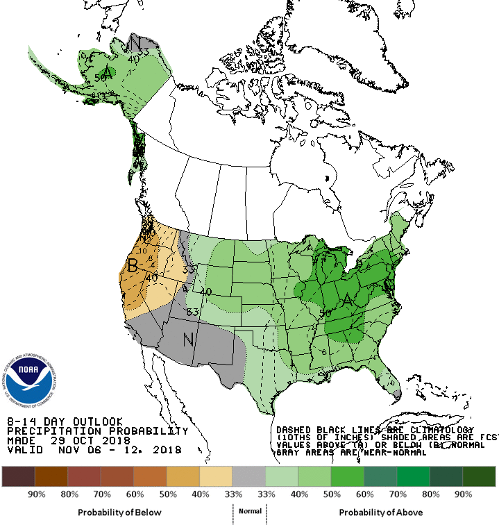
We are entering our dries time of the year and so even the hint of above normal
precip chances for the second week of November doesn't mean significant
precip is in the offing. Temperatures through that period appear to be tilted to
the "Normal" category.
Nothing really exciting showing up right now, seems like. Maybe that's a good
thing?
Gary McManus
State Climatologist
Oklahoma Mesonet
Oklahoma Climatological Survey
(405) 325-2253
gmcmanus@mesonet.org
October 30 in Mesonet History
| Record | Value | Station | Year |
|---|---|---|---|
| Maximum Temperature | 92°F | TIPT | 2003 |
| Minimum Temperature | 4°F | KENT | 2019 |
| Maximum Rainfall | 3.95 inches | PORT | 2013 |
Mesonet records begin in 1994.
Search by Date
If you're a bit off, don't worry, because just like horseshoes, “almost” counts on the Ticker website!