Ticker for September 18, 2018
MESONET TICKER ... MESONET TICKER ... MESONET TICKER ... MESONET TICKER ...
September 18, 2018 September 18, 2018 September 18, 2018 September 18, 2018
Goodrains
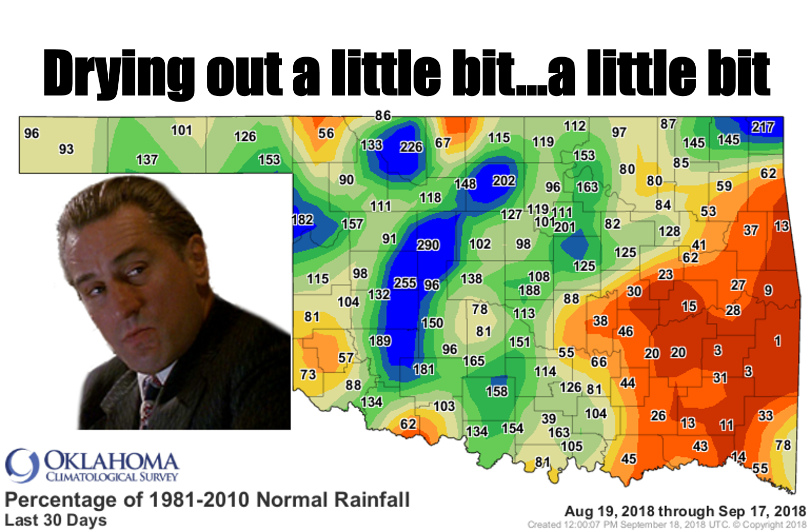
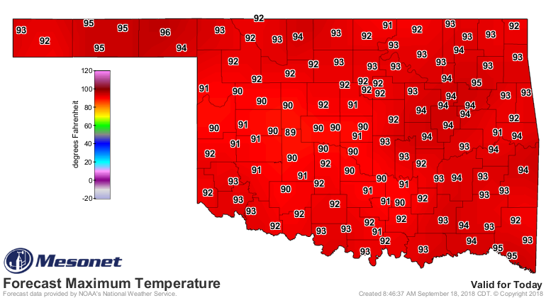
Don't look now, but it's gotten hot again, AND it has stopped raining in parts
of the state. What is this, like a slightly cooler August? I mean, the State
Fair is here...where's the rain? Well, it looks like it's coming, and boy do
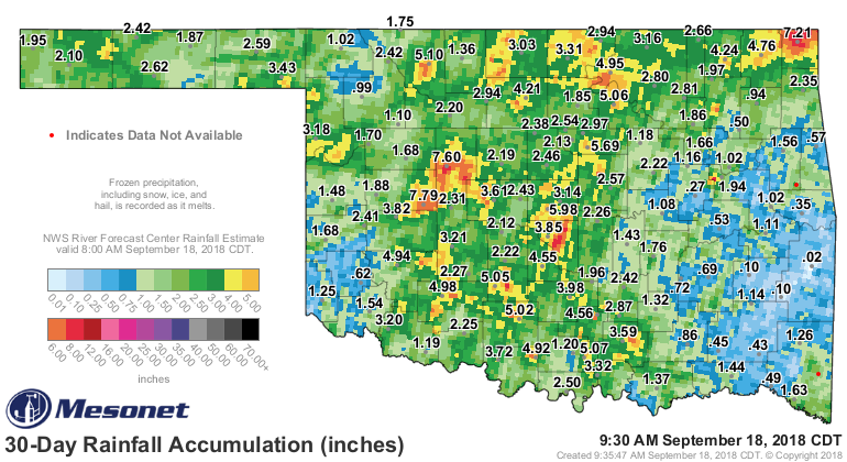
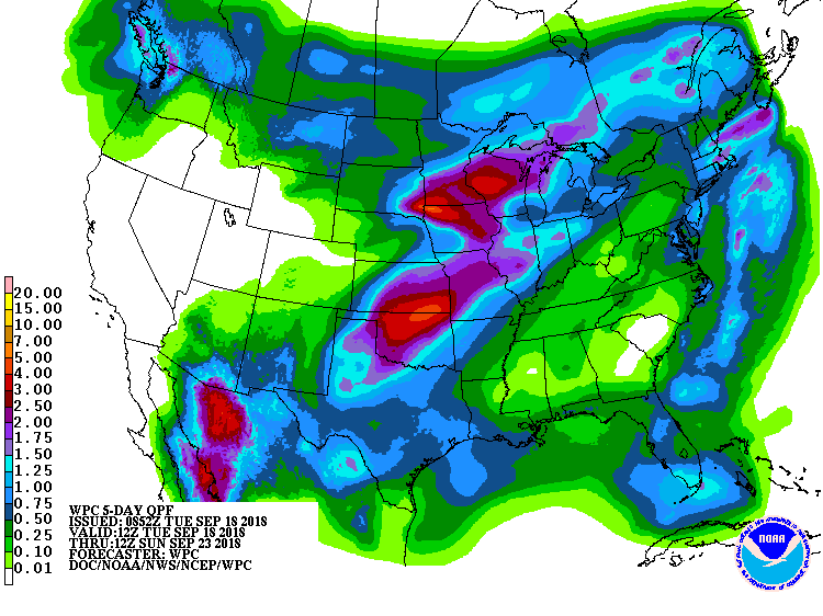
we need it. The picture above shows just how dry it has gotten over parts of the
state over the last month. Sure, we've had some heavy rains. REALLY heavy rains,
but a large part of SE up the EC OK has gone without, and add far SW OK to that
dilemma as well.
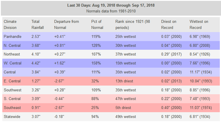
In fact, for SE OK, the last 30 days are the 5th driest since at least 1921, well
over 2.5 inches below normal.
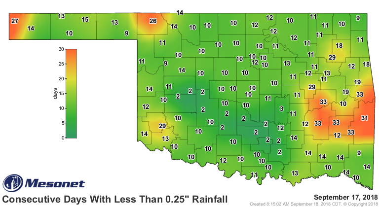
And it's been over a month since some of those places have seen a day with at
least a quarter-inch of rain.
Add to that the heat we've seen lately and you're looking at Flash Drought City.
We do have some rain chances coming up, but the good rains might be confined to
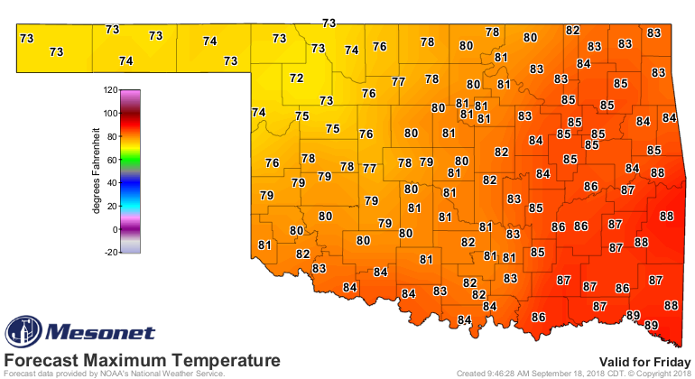
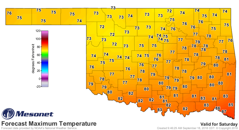
northern Oklahoma. The chances go up Thursday with Friday and Saturday looking
like the wettest days, but Sunday could see some lingering wetness as well.
Until then, heat heat heat until the rain arrives. Today through Thursday will
be downright hot, then if you are lucky enough to have clouds and/or rain on
Friday and Saturday...enjoy!
Gary McManus
State Climatologist
Oklahoma Mesonet
Oklahoma Climatological Survey
(405) 325-2253
gmcmanus@mesonet.org
September 18 in Mesonet History
| Record | Value | Station | Year |
|---|---|---|---|
| Maximum Temperature | 107°F | BUFF | 1997 |
| Minimum Temperature | 40°F | BOIS | 2012 |
| Maximum Rainfall | 3.61 inches | OILT | 2015 |
Mesonet records begin in 1994.
Search by Date
If you're a bit off, don't worry, because just like horseshoes, “almost” counts on the Ticker website!