Ticker for September 13, 2018
MESONET TICKER ... MESONET TICKER ... MESONET TICKER ... MESONET TICKER ...
September 13, 2018 September 13, 2018 September 13, 2018 September 13, 2018
Droughtless in Bugtussle
Hey, I tried for Gotebo, but they're still in drought! But they're close to the
transition to "abnormally dry" conditions on the newest Drought Monitor map.

And drought is trending downward, rapidly in some places and not so rapidly in
others. Obviously, the two areas in the worst shape remain across SW OK and then
another spot centered on Osage County in the northeast. We're working with some
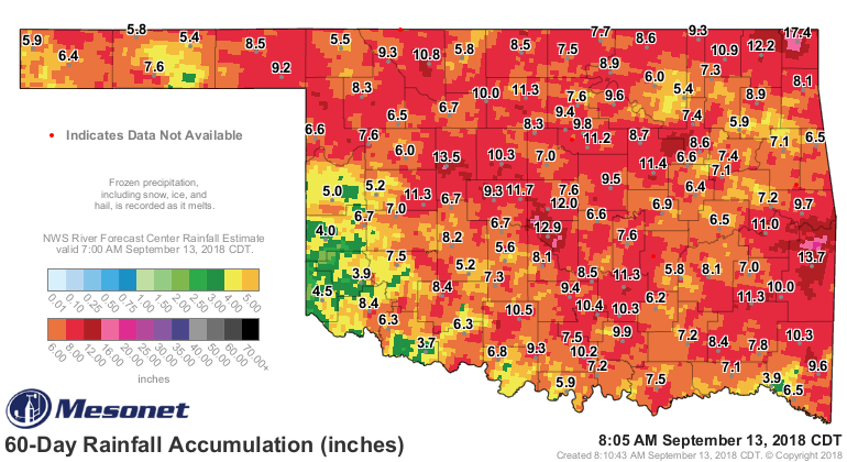
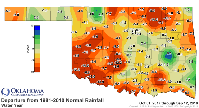
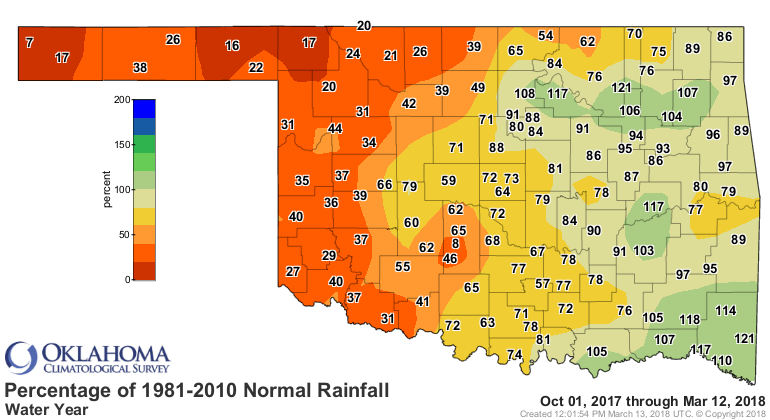
pretty hefty rains that have fallen over the last 45 days or so, and the 60-day
rain map reflects that along with some prior deficits.

So factoring in last week's rains, we had yet another downward turn in the
drought across most of those areas.

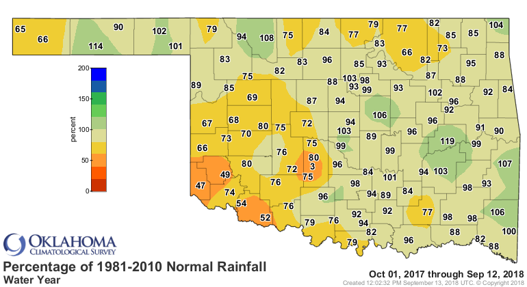
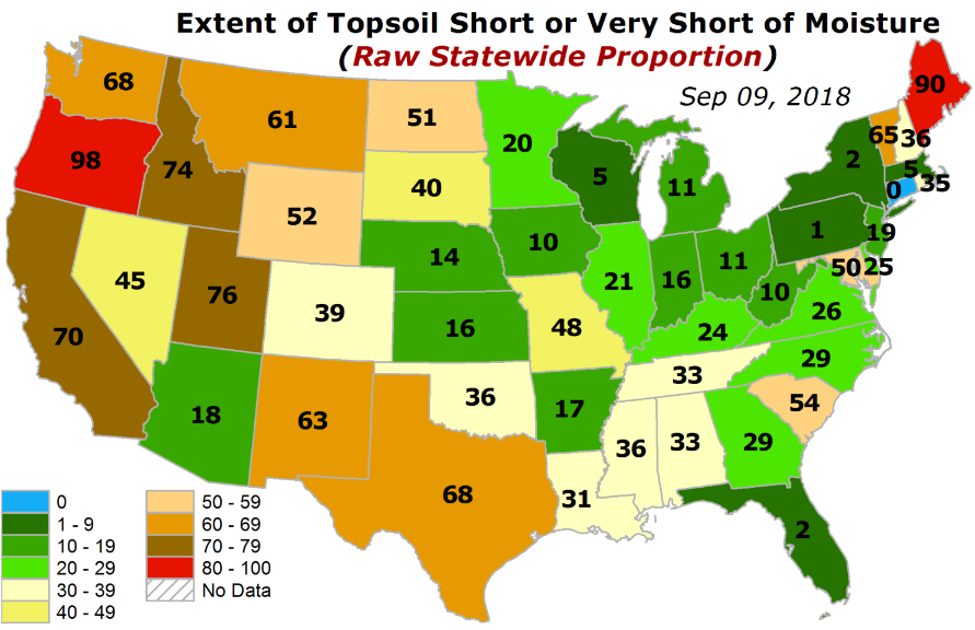
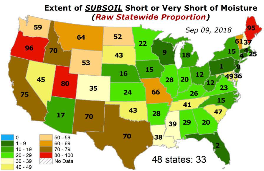
And so this drought, which began back in September-October'ish of 2017, now
covers a mere 17% of the state, it's lowest areal coverage since Nov. 14, 2017.
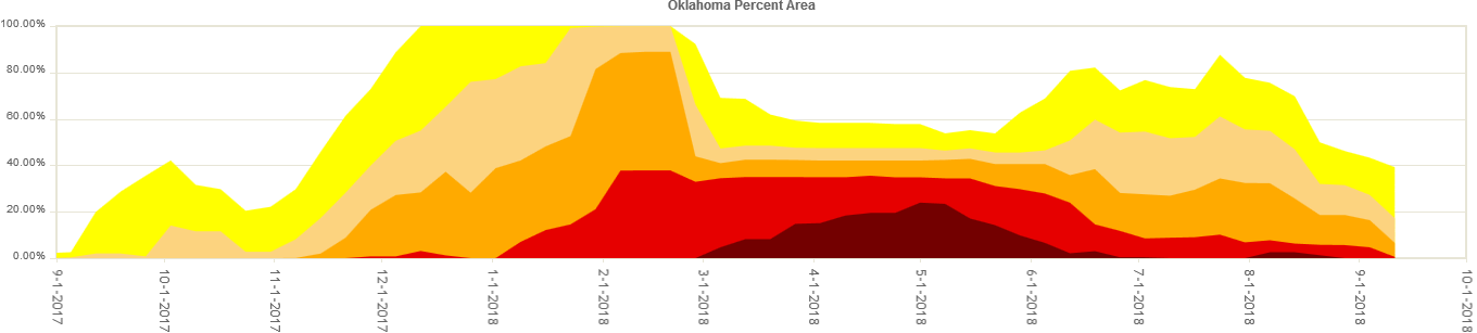
The kicker there is that the drought was just getting started, soon to be
amplified by lots of warmth and very little rainfall. Many of those localized
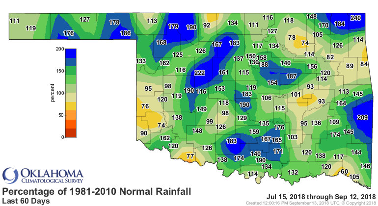
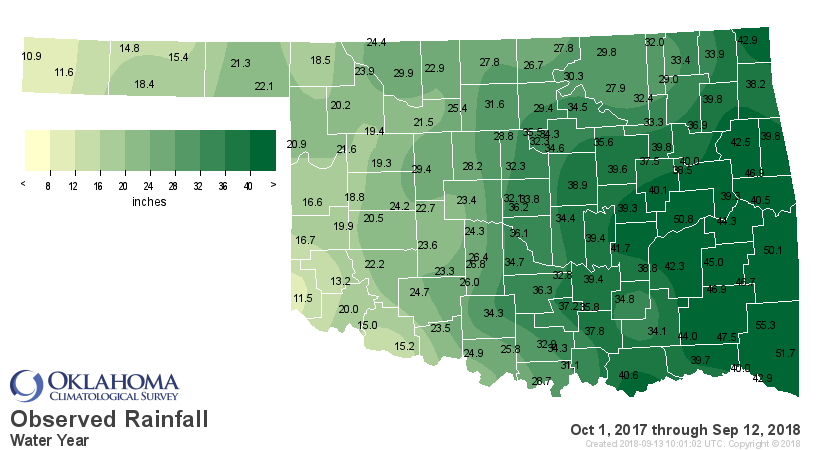
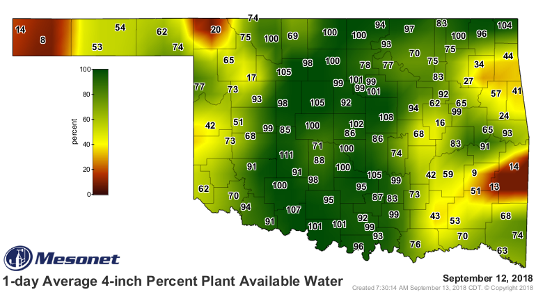
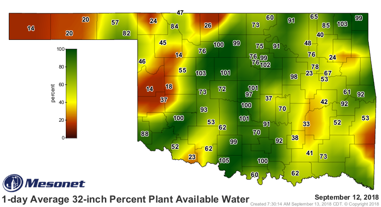
deficits are still quite clear on the water year-to-date rainfall maps.
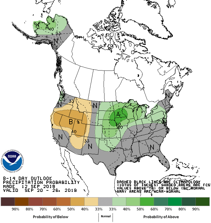
Now what we need for FURTHER drought reduction is pretty simple. Rain. We don't
see much of that in the next week or so...maybe a few chances here and there.
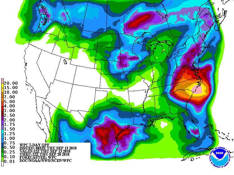
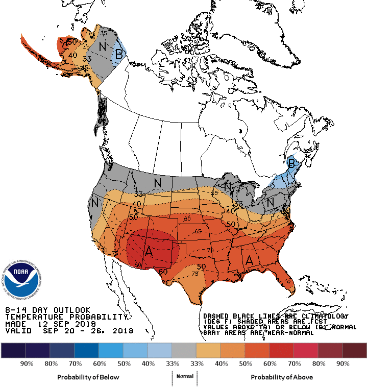
Even the State Fair can't help us there! Maybe after next week? It looks warm,
but some added moisture chances would be nice.
Impacts are still there...no doubt about that. But they are improving. Some of
that rain might have come too late for some areas, like rangeland and pasture,
but the planting conditions for this year's wheat crop have improved considerably.
Lots of topsoil moisture to work with, AND an improved subsoil moisture profile
as well.
Now you know I can't get through a post without being a Negative George (come
on, do I look like a Nancy??), but the scary part is we're actually worse than
where we were last year. So if we do enter another dry spell like last year's,
drought will accelerate rapidly, even as the cool season approaches.
The good news? We're "probably" going to have El Nino to work with this year
instead of La Nina. The former does tend to give us a wetter than normal cool
season, or at least tilts the odds in our favor. The latter...well, look to
last year's cool season as an example of its less-than-favorable work.
Right now, we're in a favorable spot, though. Let's stick with that!
Gary McManus
State Climatologist
Oklahoma Mesonet
Oklahoma Climatological Survey
(405) 325-2253
gmcmanus@mesonet.org
September 13 in Mesonet History
| Record | Value | Station | Year |
|---|---|---|---|
| Maximum Temperature | 109°F | WALT | 2011 |
| Minimum Temperature | 40°F | NEWK | 2014 |
| Maximum Rainfall | 5.53 inches | TULL | 1998 |
Mesonet records begin in 1994.
Search by Date
If you're a bit off, don't worry, because just like horseshoes, “almost” counts on the Ticker website!