Ticker for August 29, 2018
MESONET TICKER ... MESONET TICKER ... MESONET TICKER ... MESONET TICKER ...
August 29, 2018 August 29, 2018 August 29, 2018 August 29, 2018
COLD FRONT MAGIC!
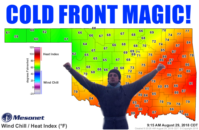
HURRAH, HURRAH, and SIS BOOM BAH! Salutations and tidings of good joy!
Merry Christmas?
Okay, a bit early on that one, but what a nice present to get here in late August
after a run of summery non-fun. Temperatures have cooled off nicely behind our
stalwart cold front, thanks to both a mound of cooler air AND a good layer of
clouds that also have a bit of water falling from them.

Not as impressive as last night's soakers across far western Oklahoma, but even
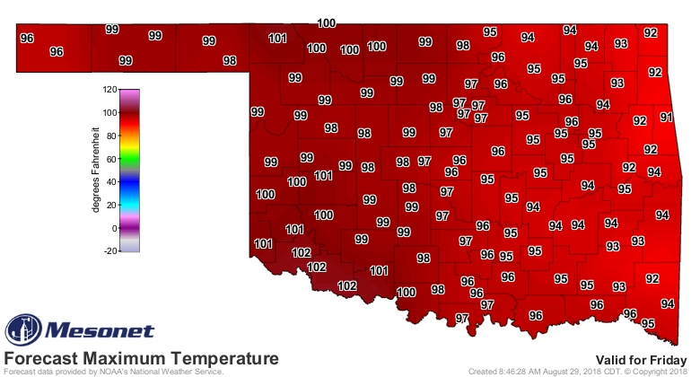
if it cools us down for a day, we'll take it, no? So we get to go from this
yesterday

to this today
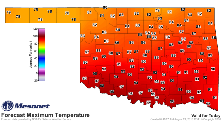
Sorry southern Oklahoma, but that's why, uh, you're southern Oklahoma. The rest
of us won't celebrate for too long, with highs on Friday soaring once again.
We *MIGHT* be in for another break later in the weekend and early next week,
but the forecast models are a bit at odds on what's going to happen, leaving
us humans a tad perplexed. Best right now to say a little cooler with possible
chances of rain.
Next week? Let's get through August first!
Yo Adrian...I DIDN'T FORECAST IT!
Gary McManus
State Climatologist
Oklahoma Mesonet
Oklahoma Climatological Survey
(405) 325-2253
gmcmanus@mesonet.org
August 29 in Mesonet History
| Record | Value | Station | Year |
|---|---|---|---|
| Maximum Temperature | 109°F | WAUR | 2011 |
| Minimum Temperature | 48°F | EVAX | 2017 |
| Maximum Rainfall | 5.06 inches | VINI | 2003 |
Mesonet records begin in 1994.
Search by Date
If you're a bit off, don't worry, because just like horseshoes, “almost” counts on the Ticker website!