Ticker for August 27, 2018
MESONET TICKER ... MESONET TICKER ... MESONET TICKER ... MESONET TICKER ...
August 27, 2018 August 27, 2018 August 27, 2018 August 27, 2018
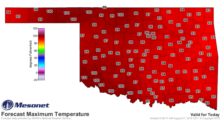
And the heat goes on
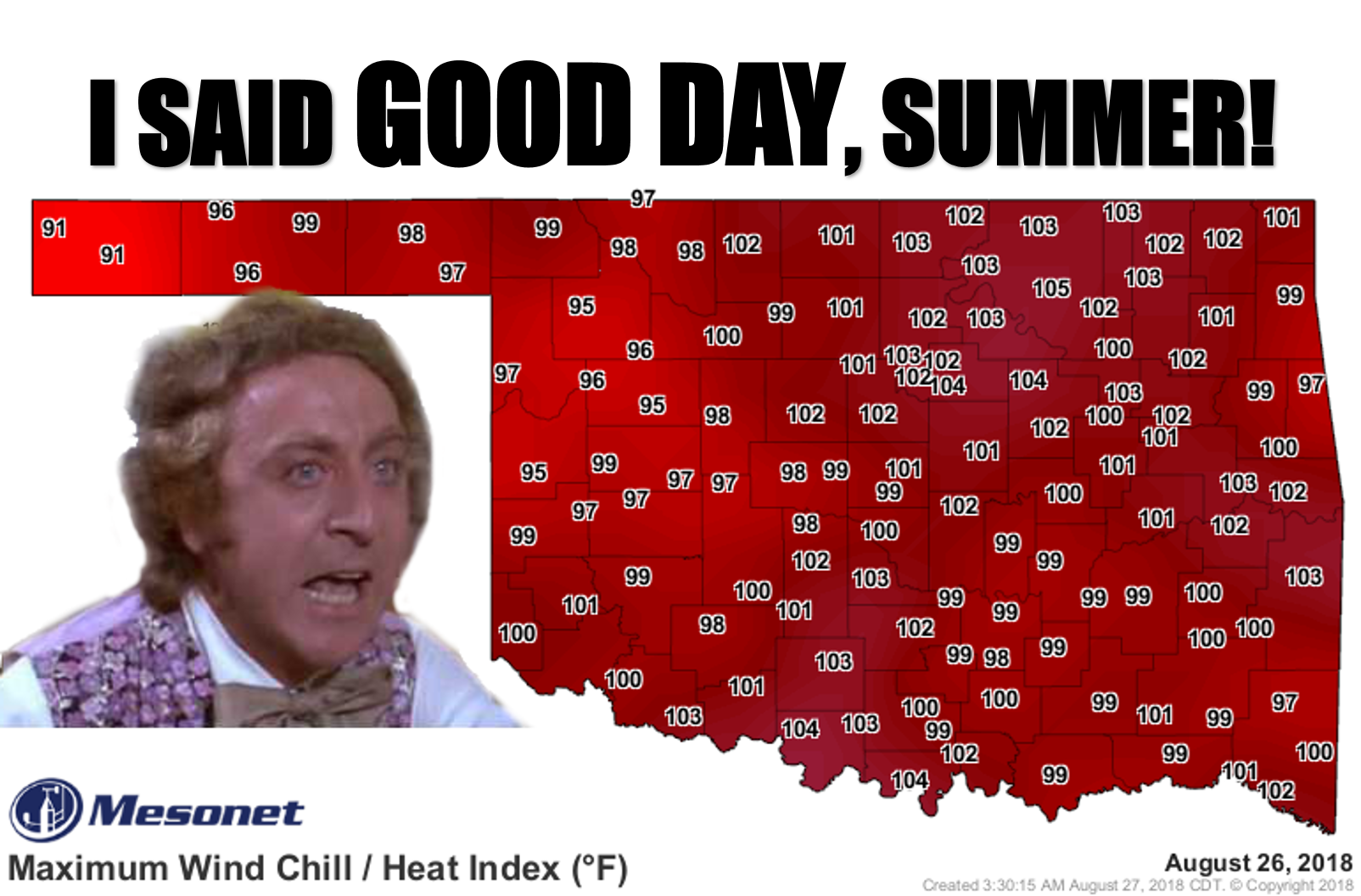
Okay, as an admitted summer-weather lover, I'm going to go ahead and commiserate
with those of you that hate the doldrums we're currently mired in. 'Twas a cruel
trick Mother Nature played on us this year, going from the fall preview for much
of August, only to turn around and plunge us back into summer. And really,
we're only experiencing "normal" summer heat right now, very seasonable.
Maybe a bit worse than normal thanks to the humidity after all that rain, but
it just feels worse because of the mild weeks previous to now. Heck, if you look
at the Mesonet's statewide average high temperatures vs. the long-term (2003-17)
average, we're still a bit below normal (remember, these are averaged across
the state...your local area might be a bit higher or lower than average,
depending on location.
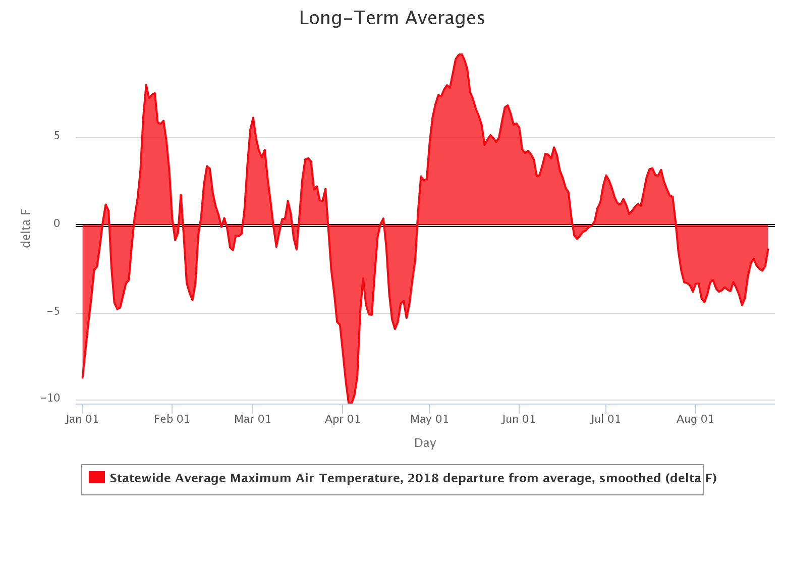
That's a cool graph if I do say so myself. Look at the warmth we had through
winter and early spring, then a COLD April followed immediately by the WARMEST
May in state history; heat which lasted through much of June as well. Then a hot
period during July, followed by our mild August that brought us lots of rain.
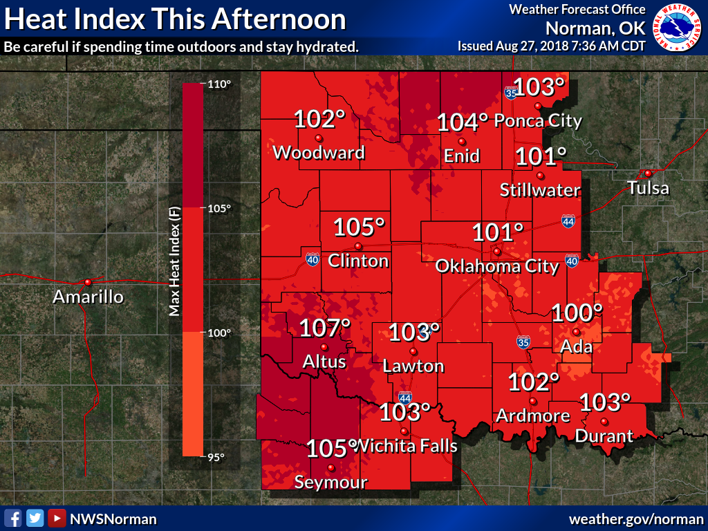
What about the impacts of that rain, moistening the soils only to be freed into
the atmosphere once again as it is evaporated by the sun, which in turn adds
fuel to the heat index? Here's the same graph from June onward, except this
time for the Mesonet's statewide average heat index.
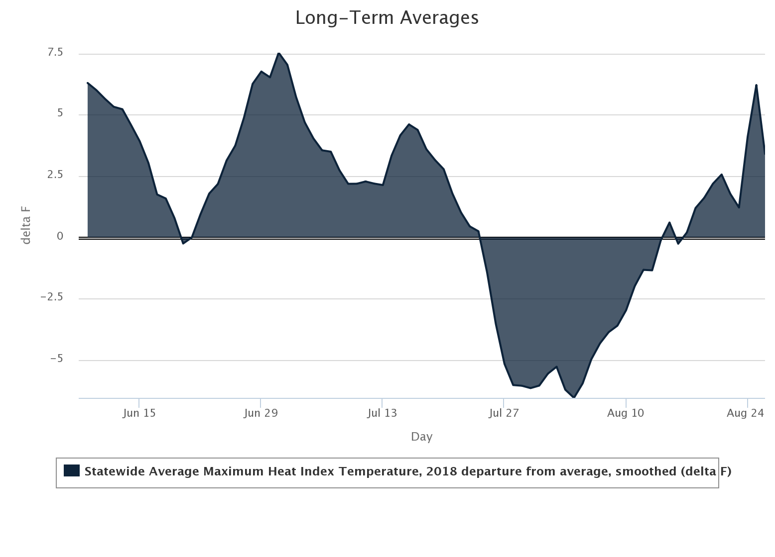
Verrrrry interesting indeed. We still see the heat of summer, the significant
cool-down from the end of July through the first three weeks of August, and
then a return to the lovely conditions we're seeing now. So at least for the
hottest part of the day, adding humidity to the mix, it feels a tad bit worse
than what we've seen from 2003-2017.
That's okay, we also have an equalizer working on our side...the wind! It's odd
to see wind like we've had lately this time of year. Sure, it's not unheard of,
but we're showing gusts on the Mesonet from 20-40 mph if not a bit higher in
some places. When that hits your skin and starts evaporating that sweat, it
can cool you down pretty effectively.
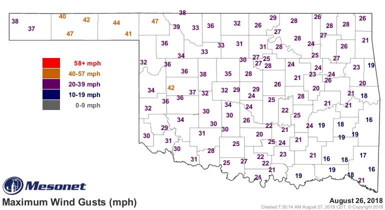
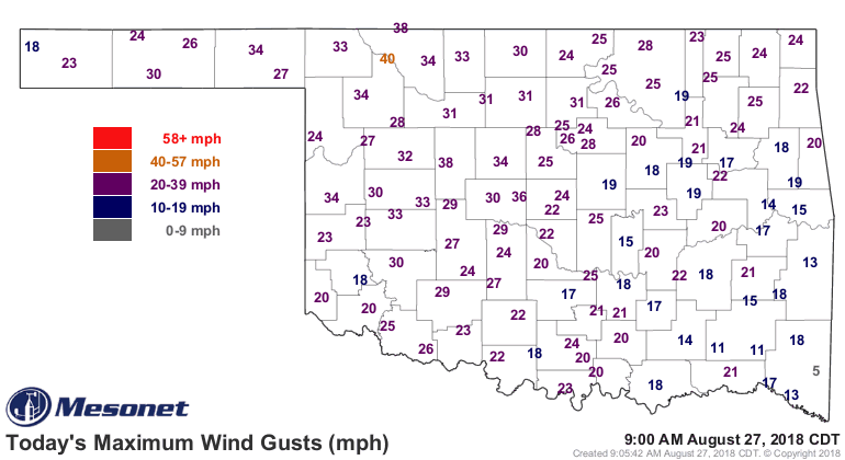
So again, looking at the Mesonet's statewide average mean wind speed vs. the
long-term average, the last few days of August show up pretty clearly as a
bit windier that what we're used to.

Another gentle reminder...these are all averages from across the state as a
whole. Your local area might be a bit higher, lower, or even on the dot compared
to these graphs.
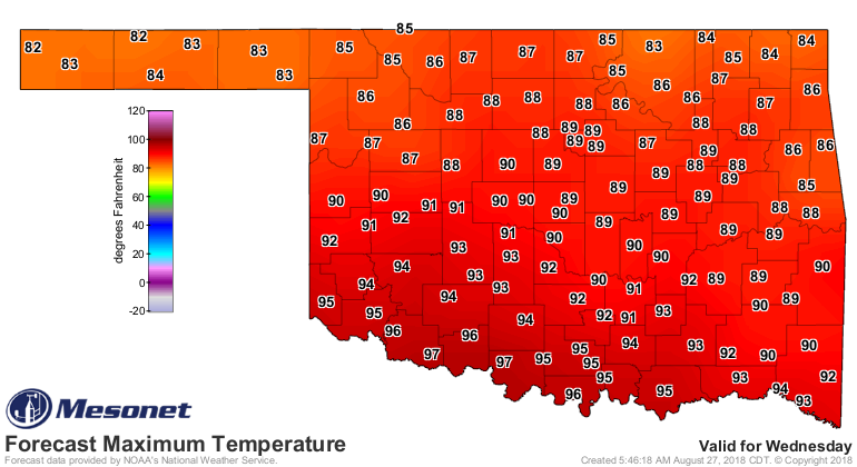
What's coming up? More of the same, with a brief respite late Tuesday into
Wednesday with a cool front of sorts and associated low wind chances.
Wednesday looks pretty pleasant, but we're back to the frying pan afterwards.
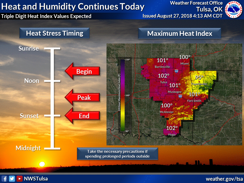
So for today, take all your heat safety precautions.
Not sure when the heat is going to break.
We get nothing! We lose!
Good day, Oklahoma.
Gary Wonka
State Chocolatier and Climatologist
Oklahoma Mesonet
Oklahoma Climatological Factory
(405) 325-2253
gmcmanus@mesonet.org
August 27 in Mesonet History
| Record | Value | Station | Year |
|---|---|---|---|
| Maximum Temperature | 109°F | GRA2 | 2011 |
| Minimum Temperature | 48°F | SEIL | 2010 |
| Maximum Rainfall | 3.95 inches | CLOU | 1996 |
Mesonet records begin in 1994.
Search by Date
If you're a bit off, don't worry, because just like horseshoes, “almost” counts on the Ticker website!