Ticker for August 2, 2018
MESONET TICKER ... MESONET TICKER ... MESONET TICKER ... MESONET TICKER ...
August 2, 2018 August 2, 2018 August 2, 2018 August 2, 2018
Goodbye JulTember
Sorry for the no Tick for awhile, we were too busy out and about giving drought
tocks. Get it? Tocks? Talks? Ahhhh, never mind. I guess we're all just cranky
since we're going from this

back to this
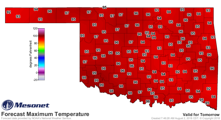
for awhile.
Oh well, it's August. We'll see fall back in a month (or 2? 3?). Now back to
July. Here's a little tale of our topsy-turvy seventh month of 2018.
-------------------------------------------------------------------------------
Mother Nature threw Oklahoma a Hail Mary during the final week of July, offering
drought-quenching rains and a glorious preview of fall. That brief seasonal
transformation followed a dose of brutal summer weather that saw highs soar above
110 degrees and the heat index hit 120. The middle two weeks were especially
fierce, culminating with record-breaking heat from the 19th through the 22nd.
Temperatures reached 113 degrees at the Grandfield and Tipton Mesonet sites on
both the 19th and 20th.
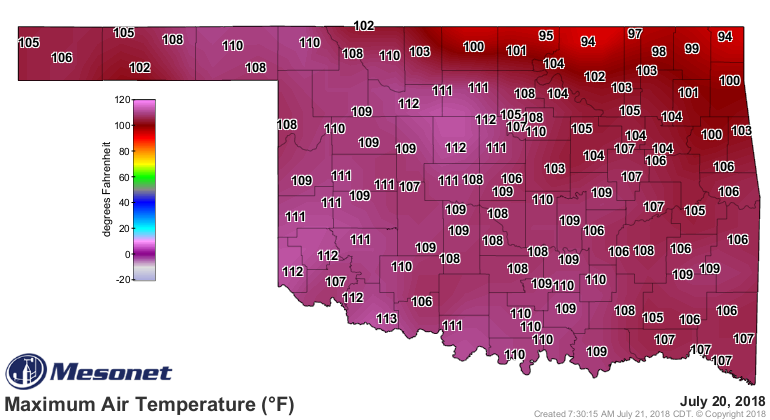
There were 35 instances of temperatures reaching at least 110 degrees at
Mesonet sites during the month, and highs reached 105 degrees 93 times.
Combined with the humidity, the heat became even more oppressive. The heat
index soared to 120 degrees at Pawnee on the 19th and again at Bristow the
following day.
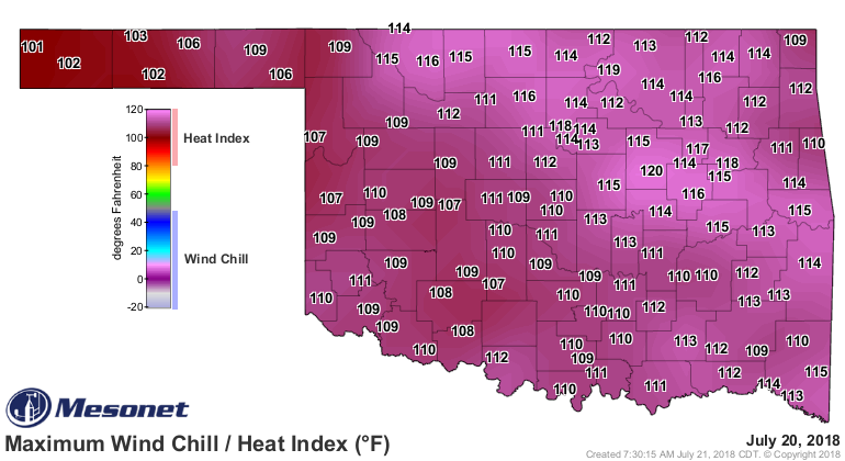
The Mesonet’s 120 sites recorded heat index values of at least 115 degrees 36
times during July. The cold front that visited the state during the month’s
final week was unusual in both its timing and strength, but provided a welcome
respite from Oklahoma’s normal July drudgery. Rainy weather, clouds and the
cooler air helped provide Oklahomans with a brief glimpse of fall. Highs
struggled to reach 90 degrees, and Boise City and Eva fell to a relatively
chilly 50 degrees on July’s final day. According to preliminary data from the
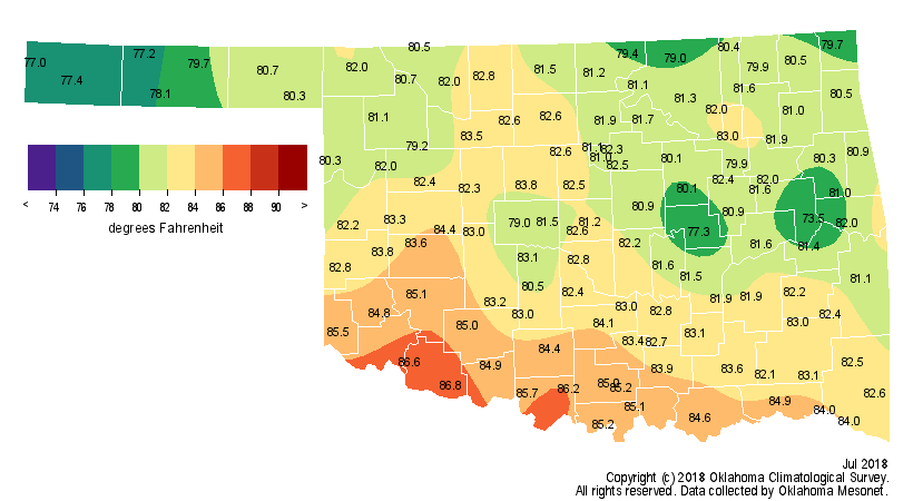
Oklahoma Mesonet, the statewide average temperature for July was 81.2 degrees,
0.3 degrees below normal and ranked as the 58th coolest since records began in
1895.
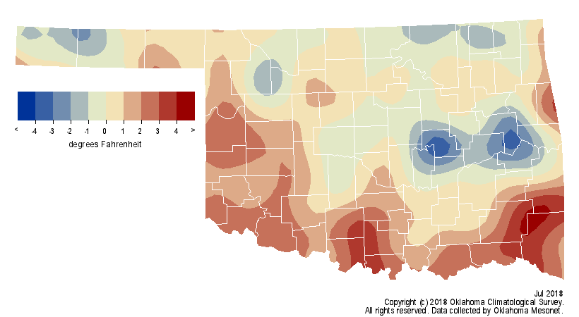
The year-to-date temperature through July was still very warm at 0.8 degrees
above normal, the 29th warmest January-July on record.
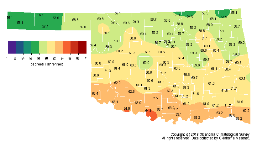
The real benefit of the late-month cold front was the moisture it brought to a
parched state. Through July 26, the statewide average rainfall total according
to the Oklahoma Mesonet was 1.28 inches, on pace for the 21st driest July on
record. That statewide average had more than doubled over the next five days to
2.93 inches, upping its ranking to the 57th wettest on record.
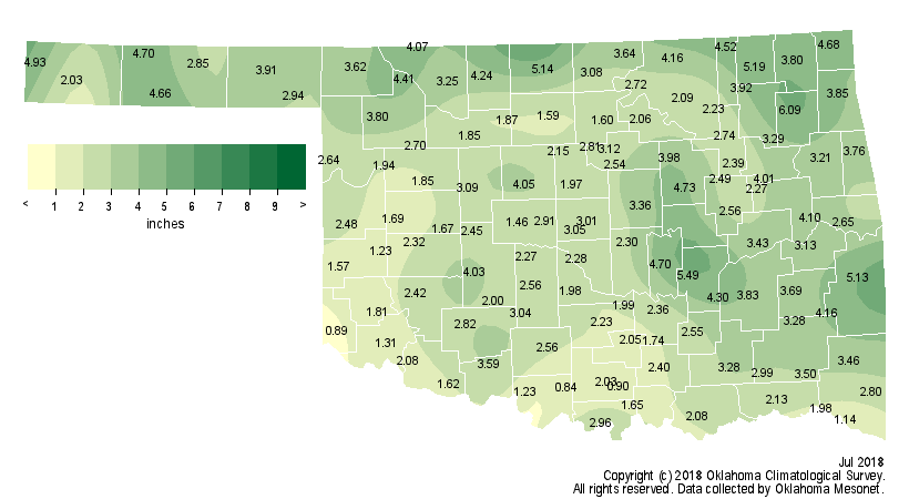
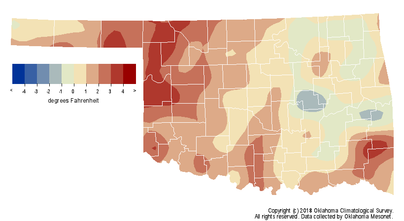
The heaviest rains fell across far northern Oklahoma and localized areas in the
east. Twenty-Two Mesonet sites reported at least 4 inches of rain, with Pryor
leading the state at 6.09 inches. Not all sections of the state were so
fortunate, however. Significant deficits remained along the Red River as well
as portions of north central Oklahoma. Ringling recorded 0.84 inches of rain
for the lowest July total, while another 27 Mesonet sites recorded 2 inches or
less. The first seven months of the year finished 2.53 inches below normal to
rank as the 51st driest January-July on record. As with the monthly totals, the
year-to-date totals were also highly variable. Southwestern Oklahoma was 6.23
inches below normal for their 18th direst such period, while east central
Oklahoma enjoyed its 43rd wettest at 1.25 inches above normal. Deficits of
nearly 10 inches existed over that period from southwestern through
northeastern Oklahoma.
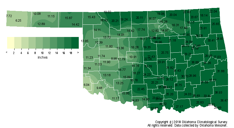
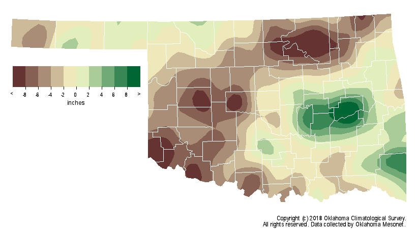
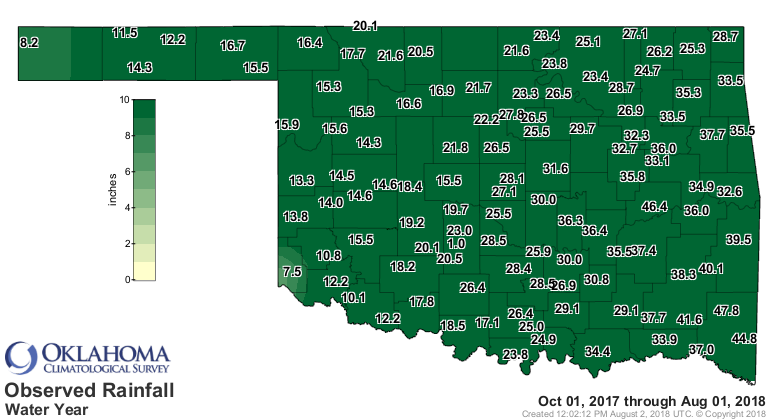
Hollis received 7.5 inches of rain since Oct. 1, 2017, a deficit of 13.2 inches.

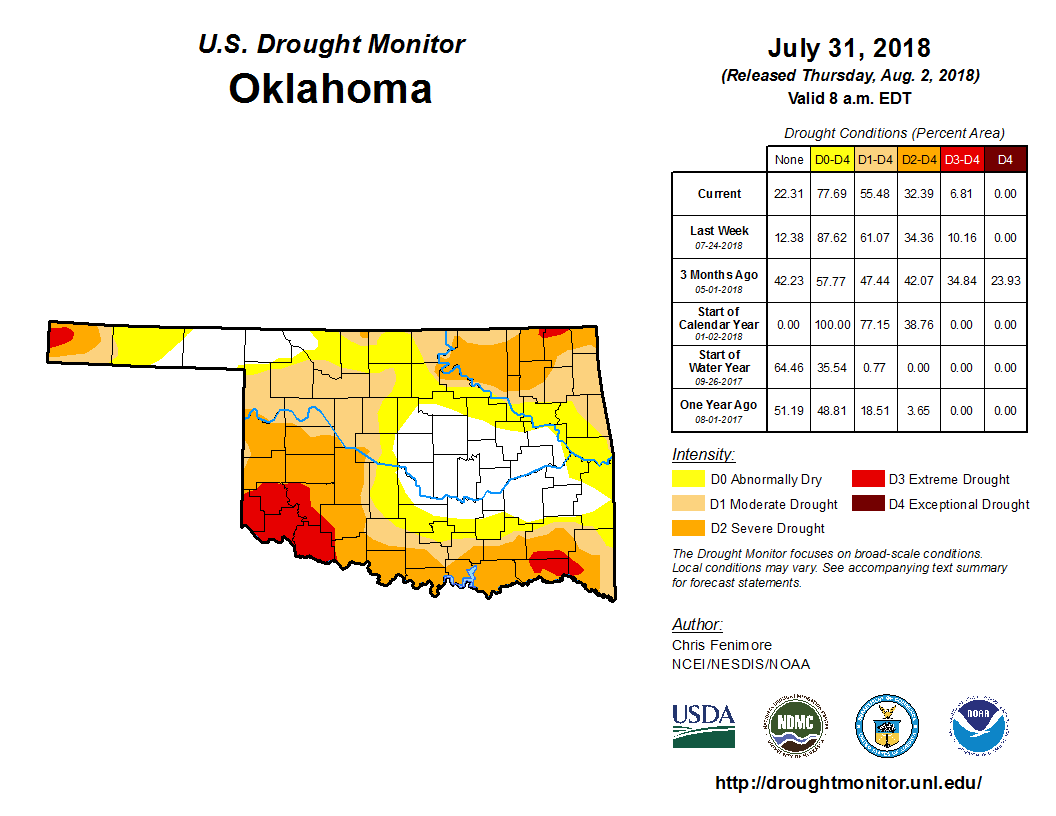
Despite the late relief during July, the U.S. Drought Monitor ended the month
with 55 percent of the state in drought, and another 12 percent considered
“abnormally dry,” a drought precursor. Thirty-Two percent of the state was in
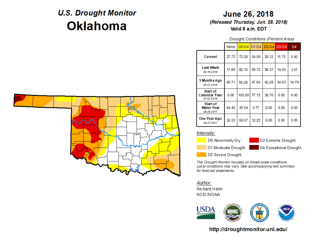
at least “severe” drought, and 7 percent was labeled “extreme.” Extreme drought
dropped 5 percent since the end of June, but severe drought increased 9 percent.
The Drought Monitor’s intensity scale slides from moderate-severe-extreme-
exceptional, with exceptional being the worst classification.
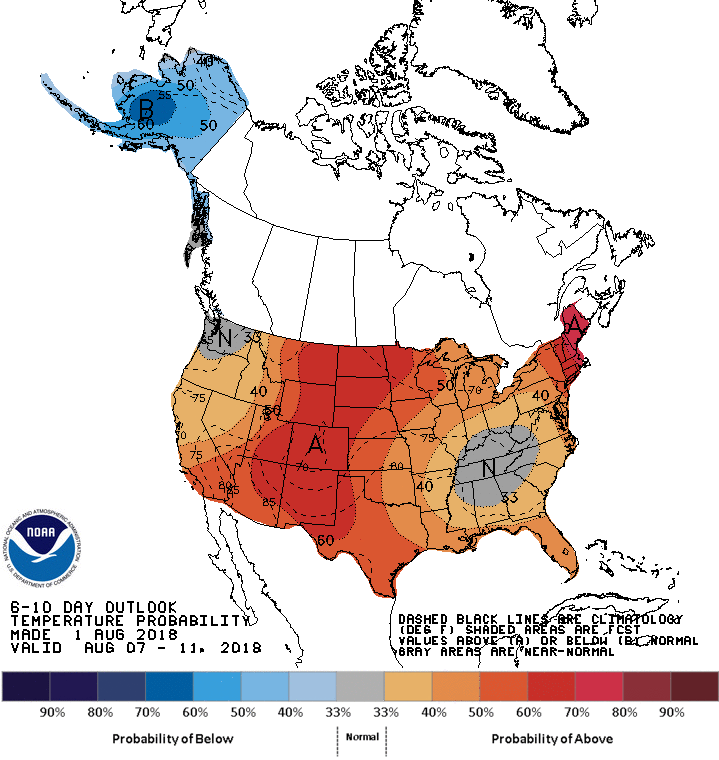
The August temperature outlook from the Climate Prediction Center (CPC)
indicated increased odds of above normal temperature for all but the extreme
northeast corner of the state. Those odds were greater along the Red River.
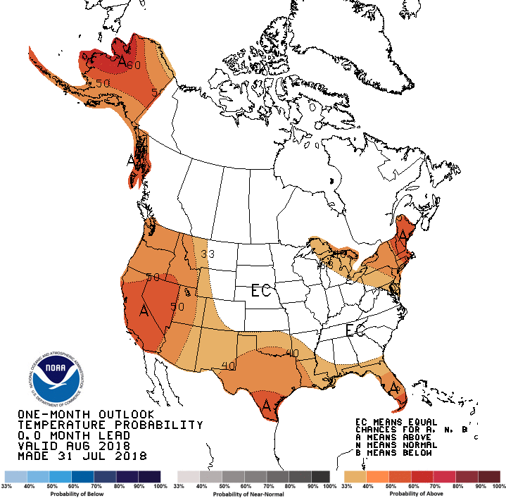
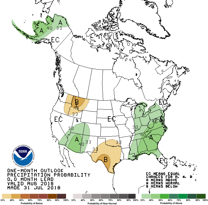
The precipitation outlook saw slightly increased odds for below normal
precipitation across the southern half of the state, but no clear signal in
the northern half.
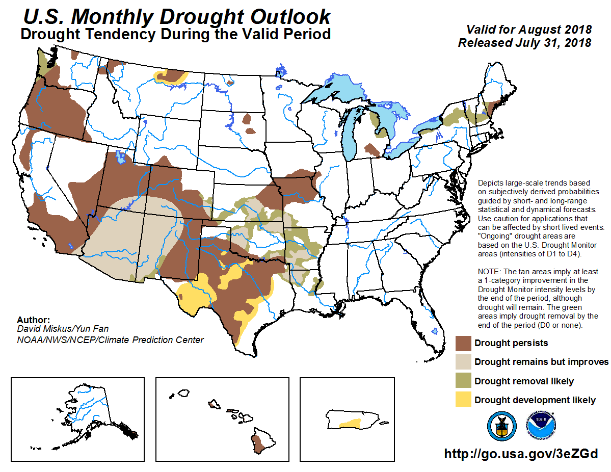
Drought is expected to persist or intensify along the Red River and in the far
western Panhandle during August, according to CPC’s Monthly Drought Outlook.
Other areas that were in drought at the end of July can expect improvement by
the end of August.
Gary McManus
State Climatologist
Oklahoma Mesonet
Oklahoma Climatological Survey
(405) 325-2253
gmcmanus@mesonet.org
August 2 in Mesonet History
| Record | Value | Station | Year |
|---|---|---|---|
| Maximum Temperature | 114°F | KIN2 | 2012 |
| Minimum Temperature | 51°F | BURB | 2009 |
| Maximum Rainfall | 6.63 inches | HOLL | 1995 |
Mesonet records begin in 1994.
Search by Date
If you're a bit off, don't worry, because just like horseshoes, “almost” counts on the Ticker website!