Ticker for July 12, 2018
MESONET TICKER ... MESONET TICKER ... MESONET TICKER ... MESONET TICKER ...
July 12, 2018 July 12, 2018 July 12, 2018 July 12, 2018
Flash drought?
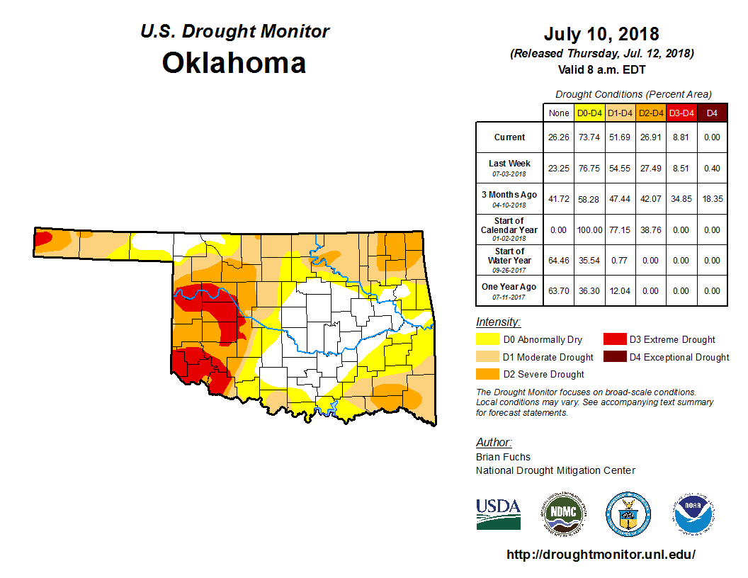
A re-evaluation of drought impacts across far northwestern Oklahoma have led to a
better drought monitor map this week. As we showed on Monday, there are some
fairly credible reasons for that, with rainfall totals in the last 30 days
approximately 200% or greater.
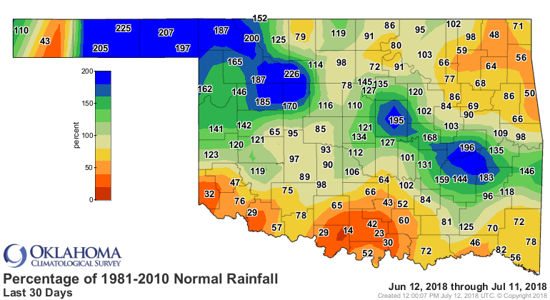
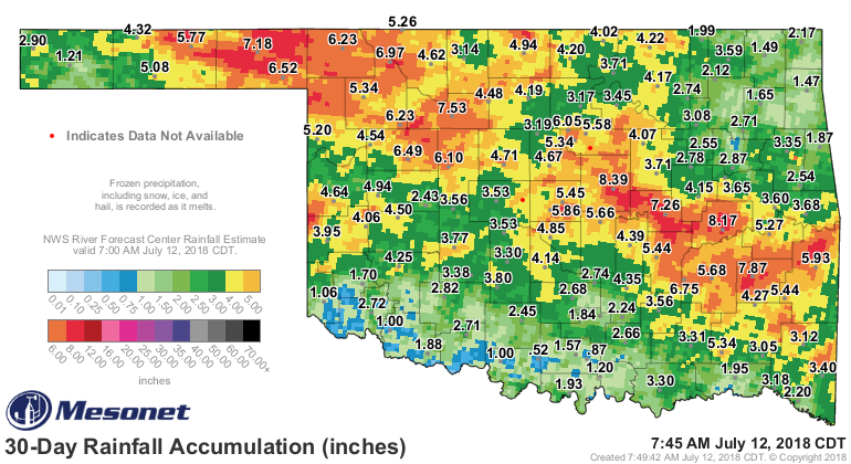
Even more impressive is the 13+ inches that fell in the last two months in Alva,
and 10+ inches in general across Woods and Alfalfa counties.

That has led to some downright wonderful changes across the far northwest corner
and into the Panhandle over the last month, and with the re-evaluation over the
last week.

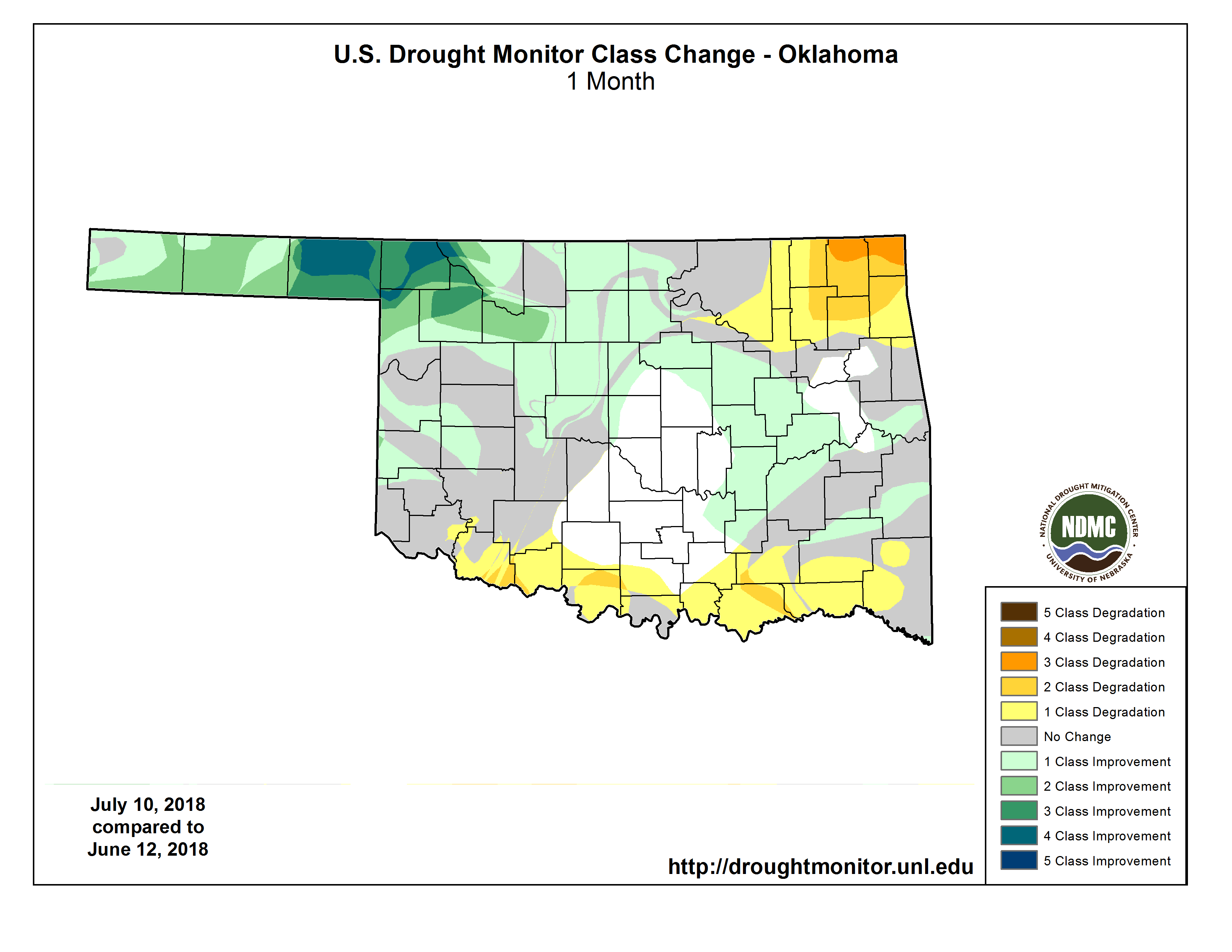
Now go back and look at all those maps. Sorry, I should have asked you to do
that earlier. Now look along the edge of the state...along the Red River, the
far northeast and southeast, and even the tip of the western Panhandle. Lots
of not-so-great colors in those areas. Those are the hotspots (pardon the pun)
that we're watching for rapid drought development as we bake under the summer
sun, even as Mother Nature shut off the spigots in those areas.
And it is really going to be a troubling time for those folks that have gone a
significant time without good rains, because the forecast for the next week is
DRY and HOT!
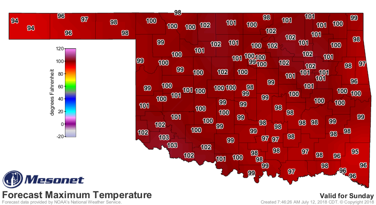
Just check out Sunday. It's gonna be a scorcher.
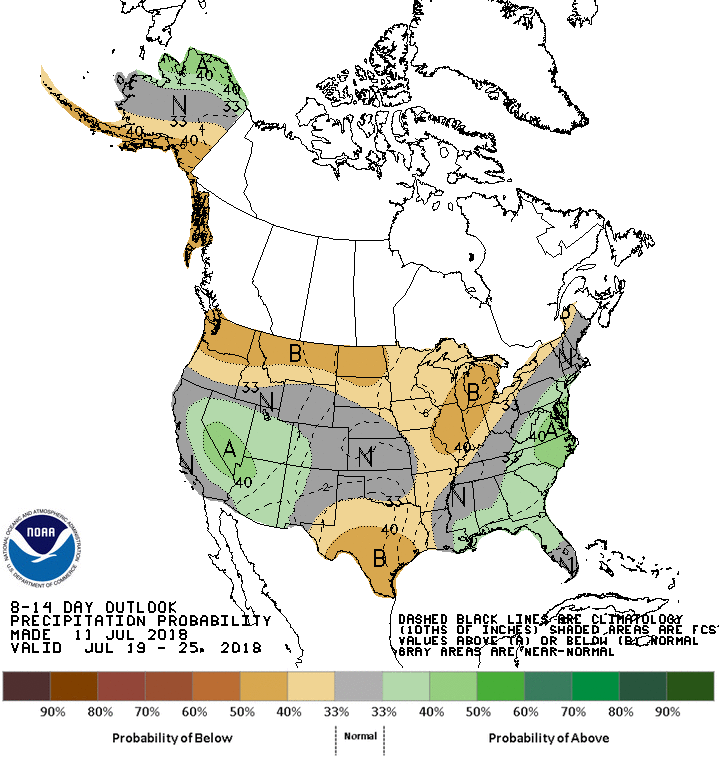
The preview for later next week doesn't look too bad on the CPC 8-14 day
outlooks, with a hint of above normal temps and near normal precip.
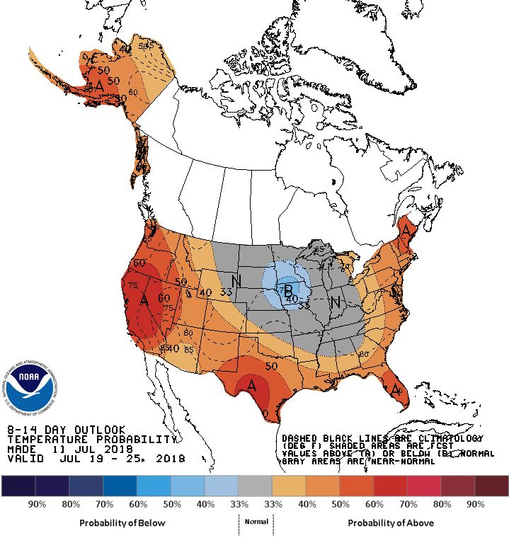
Here's the kicker, though...it's hotter 'n heck this time of year anyway, so
any hint of above normal temps doesn't help. And on the precip side, near
normal rainfall this time of year is not helpful since we're in the driest
stretch of the warm season. And when you combine the evaporative demands due
to just NORMAL summer heat, vs. normal summer rainfall, you're usually at a
deficit.
So flash drought is the name, and flash drought is the game. Normal relief would
come in September/October. Not-so-normal-but-not-out-of-the-question relief
can come during the height of summer, just don't count on it.
Gary McManus
State Climatologist
Oklahoma Mesonet
Oklahoma Climatological Survey
(405) 325-2253
gmcmanus@mesonet.org
July 12 in Mesonet History
| Record | Value | Station | Year |
|---|---|---|---|
| Maximum Temperature | 110°F | HOLL | 2001 |
| Minimum Temperature | 52°F | EVAX | 2021 |
| Maximum Rainfall | 4.44 inches | OKMU | 1996 |
Mesonet records begin in 1994.
Search by Date
If you're a bit off, don't worry, because just like horseshoes, “almost” counts on the Ticker website!