Ticker for July 9, 2018
MESONET TICKER ... MESONET TICKER ... MESONET TICKER ... MESONET TICKER ...
July 9, 2018 July 9, 2018 July 9, 2018 July 9, 2018
Boy Named Summer
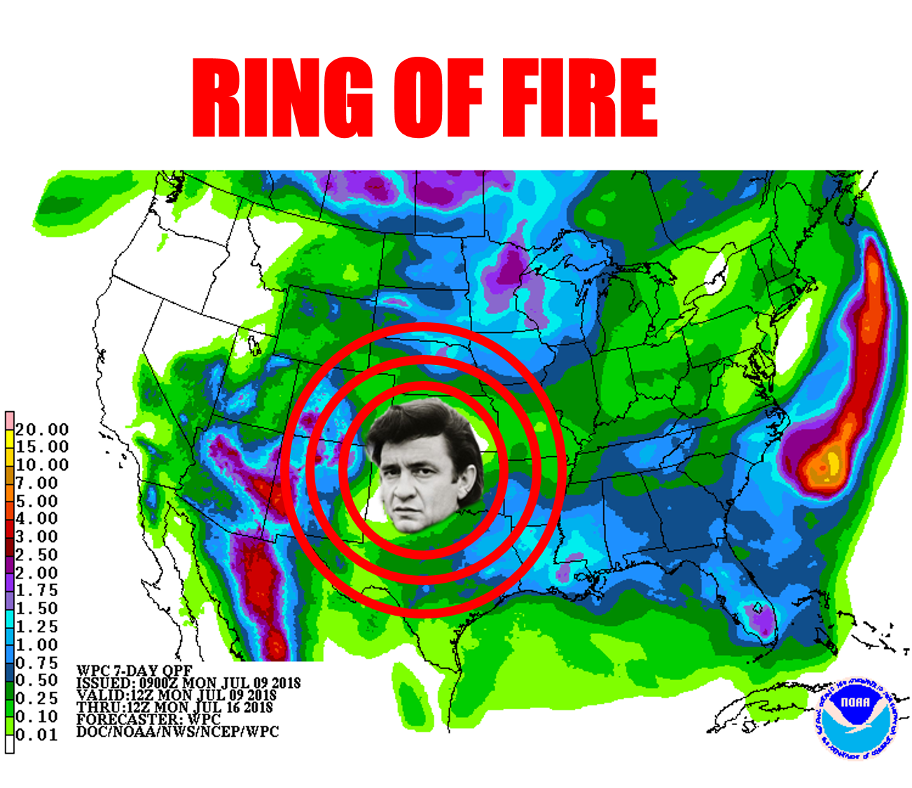
Ahhhh, July, when we become the heat dome's fool. As it meanders to the east and
west, those on the periphery of said torture dome get a chance of showers and
storms. The summer variety of storms, mind you...dump a ton of rain, then *POOF*!
That's what we see for the upcoming week as the heat dome once again build into
the Southern Plains and we're left holding a bag full of sultry. As we can see in
the unedited version of the 7-day forecast map, however, there are rain chances
around the edges of that heat dome, especially in the far southeastern parts of
the state.

They've gotten a bit down there, as well as other smaller areas scattered around
the state, as we went through last week's holiday.

Two inches in Cimarron County...that hits the spot! Other than that brief
flirtation with some rain, it's another steady march into triple-digit
territory through the week.
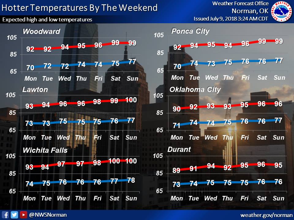
It's July, headed towards August.
BLAH!
Gary McManus
State Climatologist
Oklahoma Mesonet
Oklahoma Climatological Survey
(405) 325-2253
gmcmanus@mesonet.org
July 9 in Mesonet History
| Record | Value | Station | Year |
|---|---|---|---|
| Maximum Temperature | 115°F | BUFF | 2009 |
| Minimum Temperature | 55°F | KENT | 2015 |
| Maximum Rainfall | 3.91 inches | OKCE | 2014 |
Mesonet records begin in 1994.
Search by Date
If you're a bit off, don't worry, because just like horseshoes, “almost” counts on the Ticker website!