Ticker for May 24, 2018
MESONET TICKER ... MESONET TICKER ... MESONET TICKER ... MESONET TICKER ...
May 24, 2018 May 24, 2018 May 24, 2018 May 24, 2018
A little dab will do ya
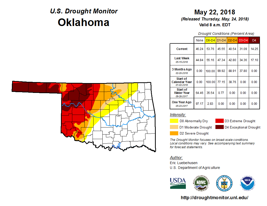
A bit of rain here, a bit of rain there...it does add up. If you look at the
rainfall over the last 30 days, it's easy to see where the improvement came in
the latest U.S. Drought Monitor.
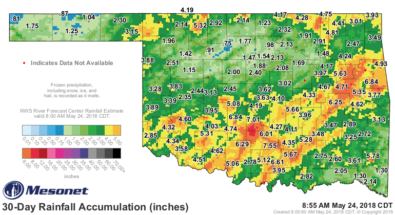
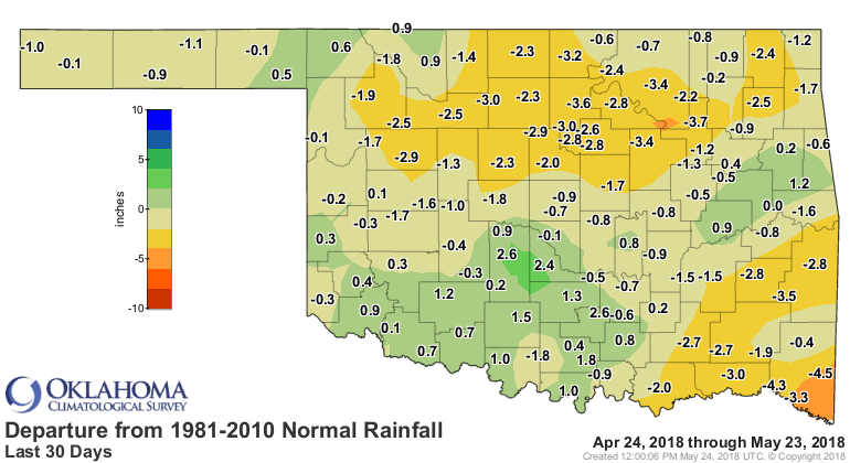
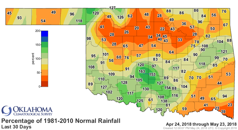
But you can also see where improvements WERE NOT warranted. Harper County fared
the best with a 2-category reduction over the last 2 weeks, and now much of
southwestern Oklahoma is also reduced from "Exceptional" to "Extreme" (or D4
to D3) drought. And the areas to the SE of I-44 got pounded with good rains.
There is some concern for far southeastern OK where the rains have been absent.
It doesn't seem possible to get good rains in the far corners of the state at the
same time. That's not exactly a shock. It is a big state, and the convective
systems will sometimes concentrate more fully on one part of the region.
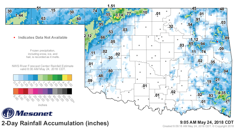
Heck, even Cimarron County, the driest spot in the state, has gotten into the
act over the last couple of days. Reports of a half-inch to over 2.5 inches
have come in from the folks out that way.
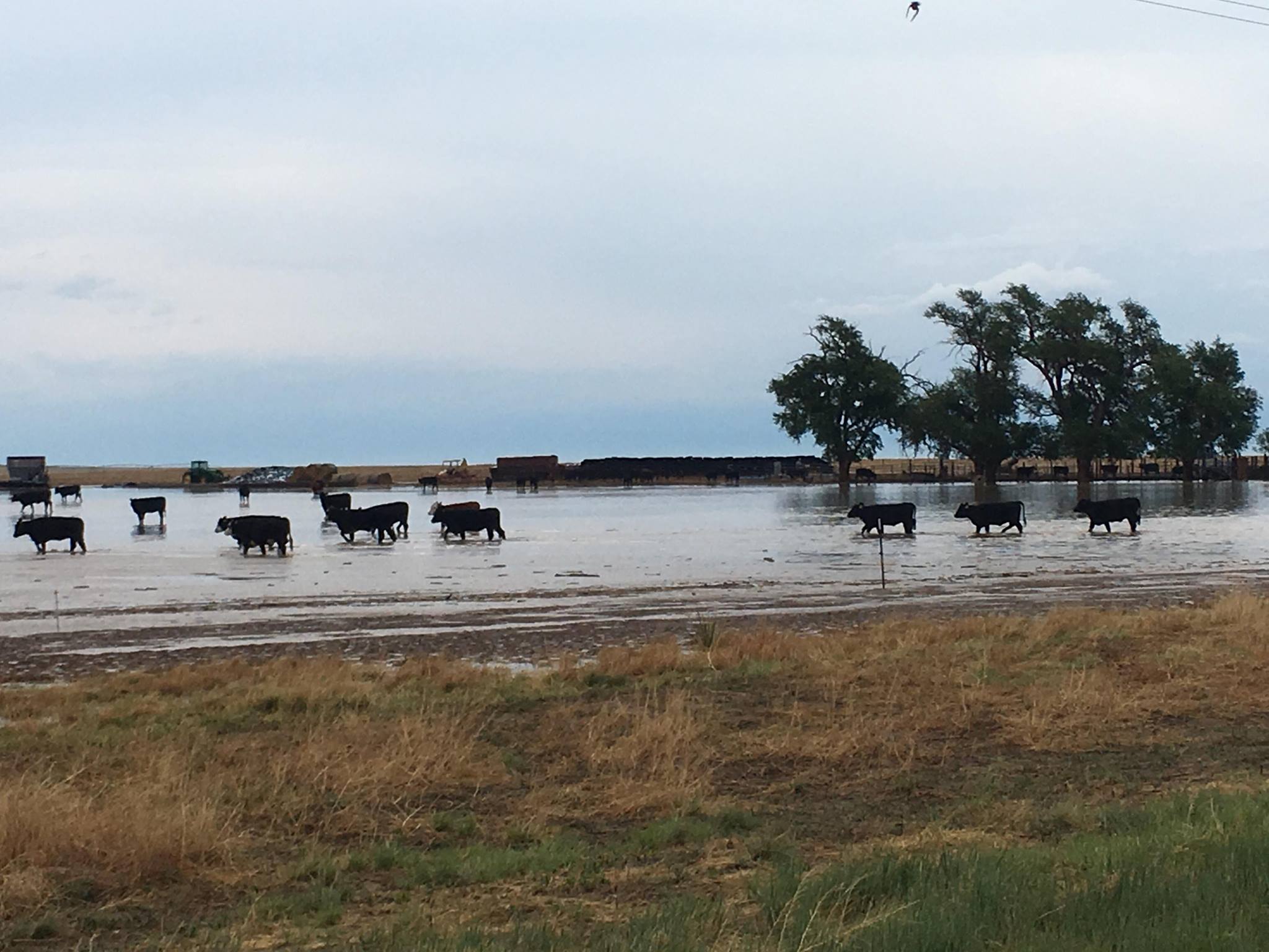
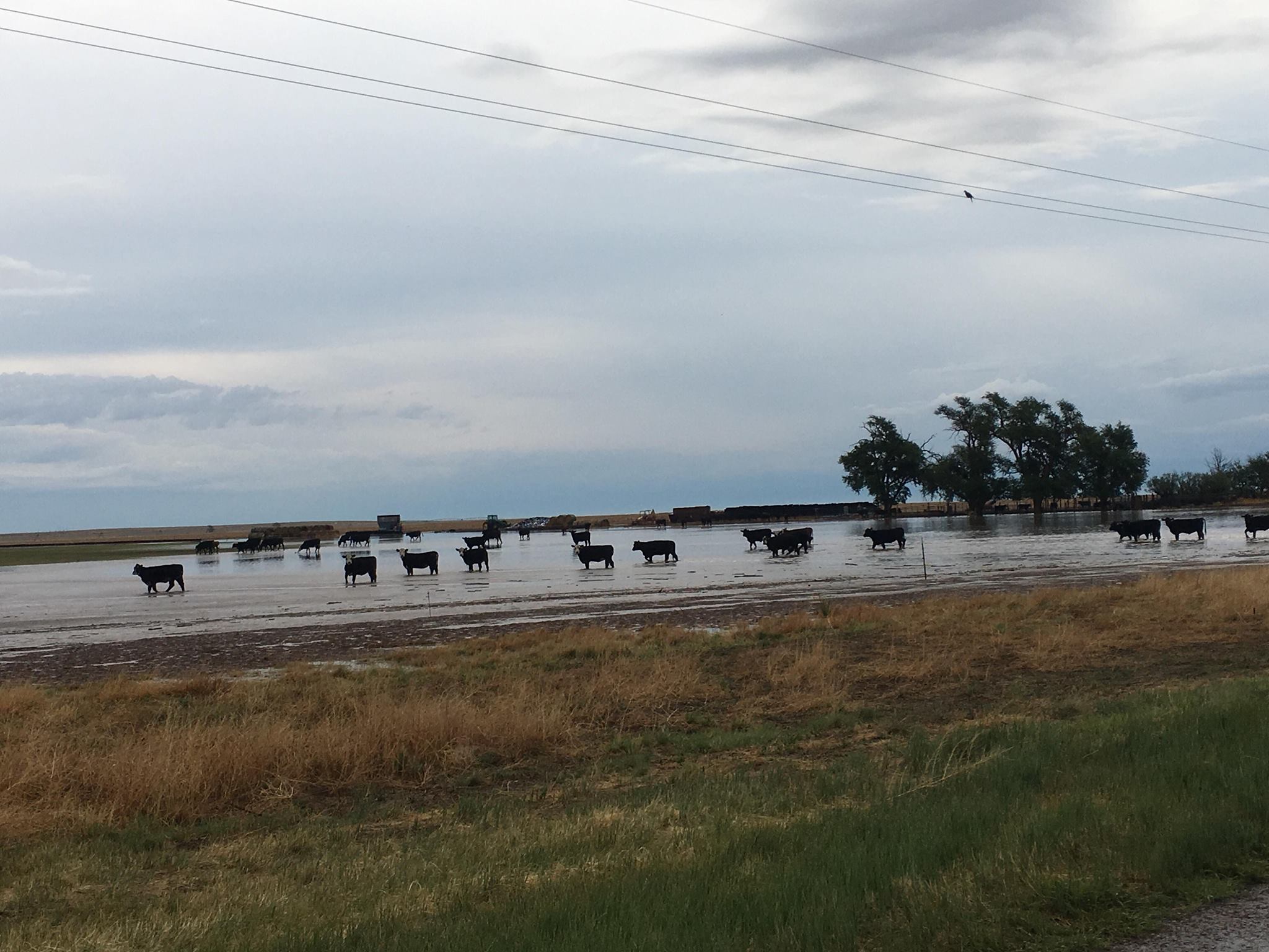
Here are a couple of pics from near Felt in the SE corner of the county of some
water-logged fields (and some happy cows) courtesy of Lori Balderas. These rains
would not be considered on the Drought Monitor until next week, of course.
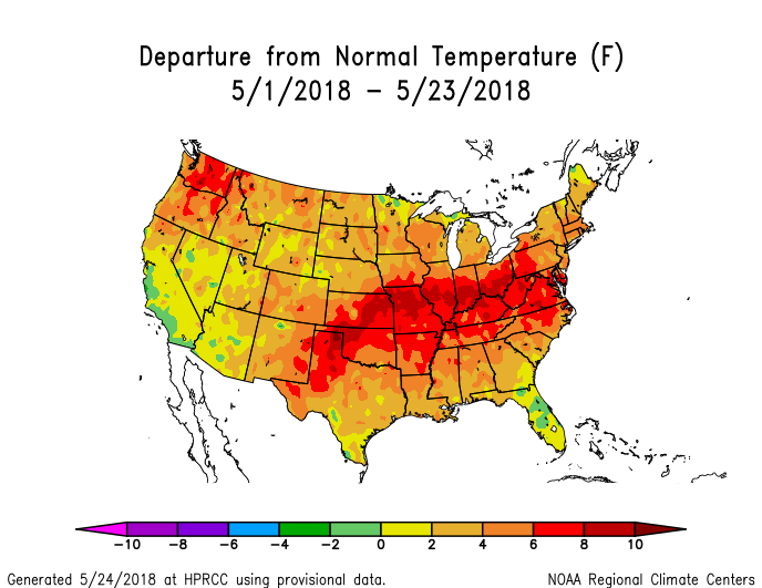
We're also dealing with extreme temperatures, unfortunately, which are drought's
best friend. We're still headed for one of, if not THE, warmest May on record
for the state. And probably for the country as a whole as well. Temperatures
across NW OK are running 6-10 degrees above normal.
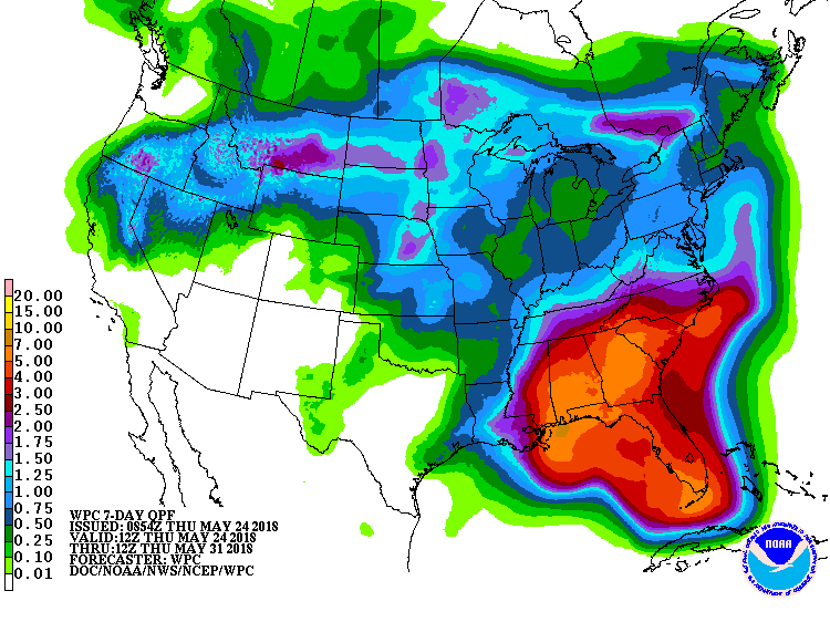
A smidgen of help over the next 7 days with a few chances of showers here and
there, but again the big rains will be across the Southeast U.S. as a tropical
disturbance from the Yucatan lifts north into the Gulf. For those that are
headed to the Gulf Coast over the holiday weekend...bring lots of umbrellas
and not as much sunscreen.
Gary McManus
State Climatologist
Oklahoma Mesonet
Oklahoma Climatological Survey
(405) 325-2253
gmcmanus@mesonet.org
May 24 in Mesonet History
| Record | Value | Station | Year |
|---|---|---|---|
| Maximum Temperature | 111°F | TIPT | 2000 |
| Minimum Temperature | 36°F | EVAX | 2017 |
| Maximum Rainfall | 6.54″ | MCAL | 2015 |
Mesonet records begin in 1994.
Search by Date
If you're a bit off, don't worry, because just like horseshoes, “almost” counts on the Ticker website!