Ticker for May 17, 2018
MESONET TICKER ... MESONET TICKER ... MESONET TICKER ... MESONET TICKER ...
May 17, 2018 May 17, 2018 May 17, 2018 May 17, 2018
Here comes summer!
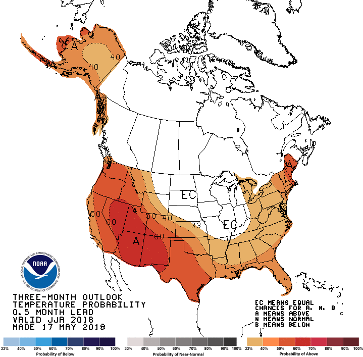
Ugh. I think summer is already here, as I've said before, and we skipped spring
thanks to the second coldest April on record. Well, the above temperature outlook
from the Climate Prediction Center doesn't give much hope for a mild summer like
last year's, I'm afraid, with increased odds of above normal temperatures across
the entire state. We're talking the climatological summer here...June-August.
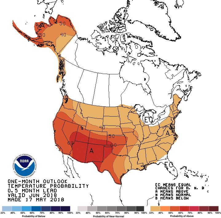
Speaking of June, its outlook isn't much better with increased odds of above
normal temperatures, especially in the Panhandle.
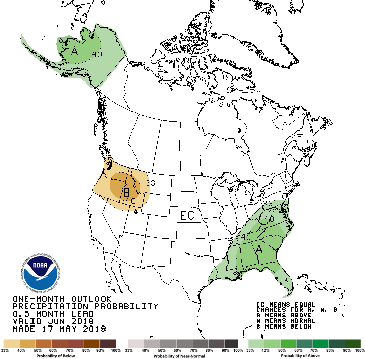
The precipitation outlooks for both periods hold no clues for Oklahoma, other
than to say we have equal chances for above-, below-, or near-normal temps.
PUNT!

A bit odd, but the seasonal drought outlook from CPC shows drought improving
(but remaining) across the entire state from where it stands now.
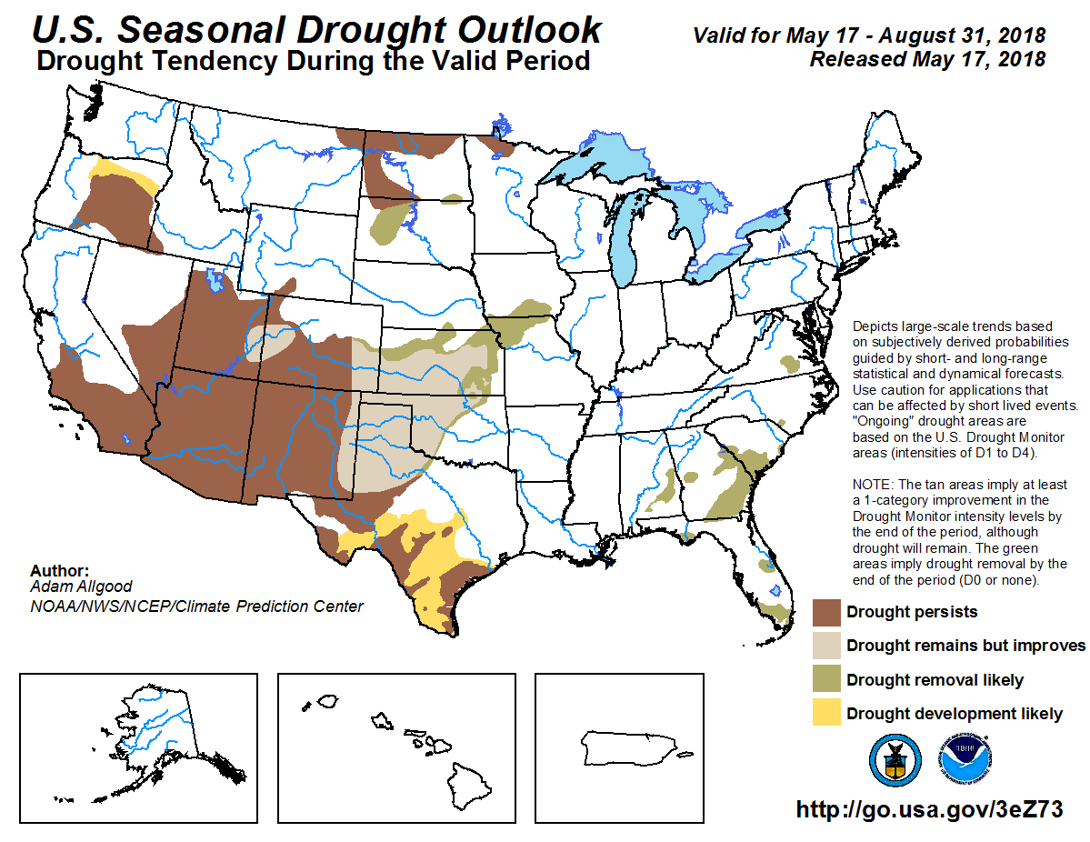
It is a bit of a conundrum, given the forecast for wet weather over the next
week or so, but facing a possible hot summer and all the drought-enhancing
things that comes with (e.g., higher temps = higher evaporation and
transpiration rates), but the outlook forecaster acknowledges this.
"Above-normal temperatures are favored during the monthly and
seasonal periods, which would promote high evapotranspiration
rates and reduce the opportunity for soil moisture recharge
during the period. Based on the short term forecast and a wet
climatology, improvement of the worst drought conditions is
favored for eastern New Mexico, North Texas, western Oklahoma,
Kansas, and eastern Colorado, but drought conditions are likely
to remain throughout the period."
We'll have to see how that works out if we do indeed tilt towards a hot summer.
As is usually the case in Oklahoma, how much rainfall we get during the summer
months will determine whether we're mild, hot, or REALLY hot.
Speaking of the drought, as if we could forget, we have seen some improvements
in the worst-hit areas in the state. Now keep in mind once again that we can't
consider any precip that occurred after Tuesday morning, and there was a good
deal of it. But still, the improvements across western Oklahoma are indeed
real, and probably will continue into next week.
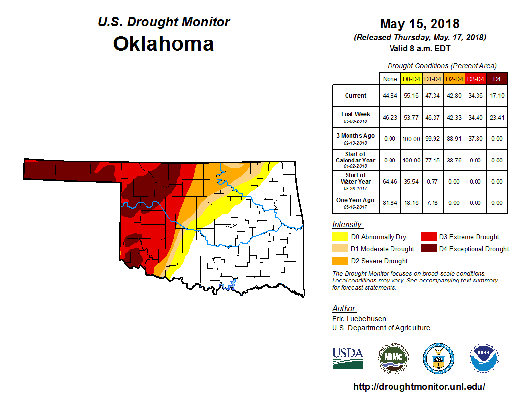
So improvements show up across far western Oklahoma, with Exceptional (D4)
drought being reduced from 23% of the state to 17%. The amount of drought
actually increased a tad from 46 to 47%, but we'll take it regardless. This is
all due to the substantial moisture that has fallen over the last 30 days.
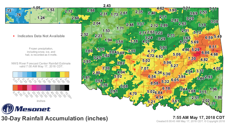

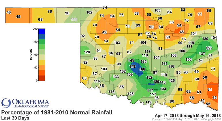
Looking at that rain map, it's obvious we still need much, much more across
western Oklahoma. But those pockets of above normal totals will help those
areas substantially, especially if we get reinforcing moisture. And it looks
like that might just be possible.
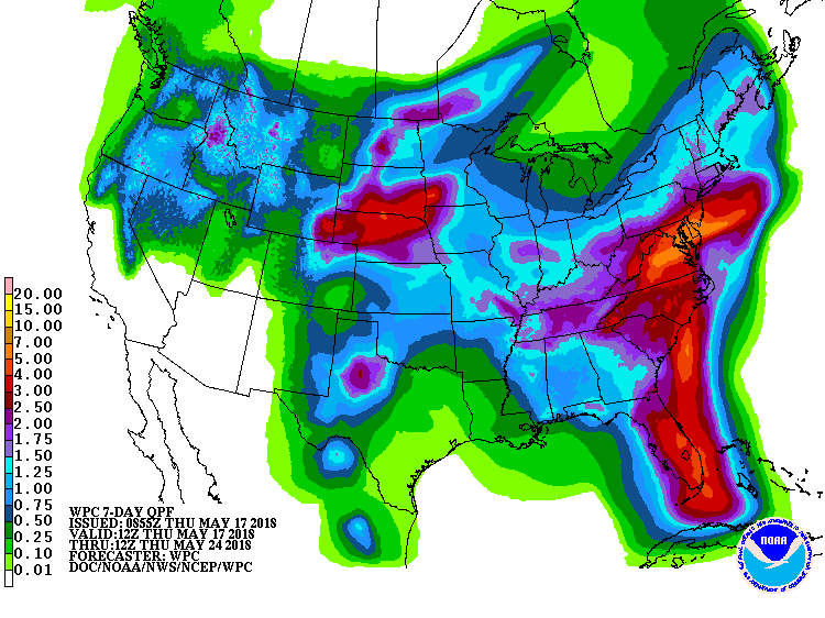
Those aren't drought-ending rains either, but the possibility for that to
change to an even more favorable look is there, at least.
We'll see. Sometimes these things pan out, and sometimes they don't. But
remember, it could "not pan out" in our favor. An inaccurate precipitation
forecast is just as wrong if its not wet enough than if its too wet.
Huh? Well, we'll figure all that out later. Enjoy summer for the next 6 months
until we jump right to winter.
Gary McManus
State Climatologist
Oklahoma Mesonet
Oklahoma Climatological Survey
(405) 325-2253
gmcmanus@mesonet.org
May 17 in Mesonet History
| Record | Value | Station | Year |
|---|---|---|---|
| Maximum Temperature | 101°F | HOLL | 2022 |
| Minimum Temperature | 37°F | CAMA | 2009 |
| Maximum Rainfall | 3.66 inches | PORT | 2002 |
Mesonet records begin in 1994.
Search by Date
If you're a bit off, don't worry, because just like horseshoes, “almost” counts on the Ticker website!